Spanning from Chicago to LA, the once-bustling Route 66 now symbolizes a nostalgic era of road trips and small-town charm.
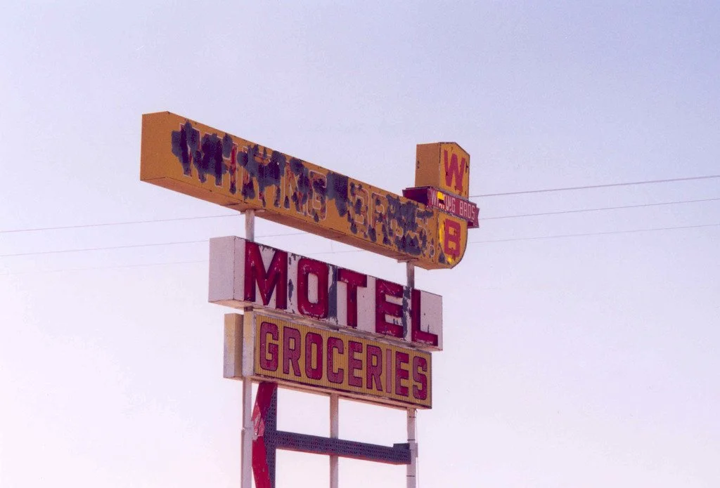
Whiting Brothers Motel and Grocery Sign. Kellie Thorne. PDM 1.0
Route 66, once hailed as the main street of America, has since gained a reputation for tackiness and kitsch, embodying a bygone era. Historic towns along Route 66, once associated with the American Dream, now stand as monuments to a fading past.
During the postwar 1950s, Route 66’s popularity soared among middle-class families, when there was a rise in car ownership. This era, known as the Golden Age of the American road trip, aligned with the expansion of highways in the 30s and 40s. The cultural significance of Route 66 diminished in the late 1950s, when it was replaced by the I-40. Part of the Interstate Highway System, the I-40 is a high-speed freeway that most cross-country travelers favor over the winding Route 66.
Once bustling towns along Route 66 have now faded near abandonment or become outright ghost towns. While remnants of the towns remain, they serve as a solemn reminder of the liminal, transient nature of American road trip culture. Pop culture celebrates and mourns small-town America; books like “On the Road” and “Travels with Charley,” movies like “Thelma and Louise” and “Cars,” and songs like “Take It Easy” and “Get Your Kicks” have shaped our understanding of Route 66 over the decades. Despite these cultural tributes, America's commitment to preserving the mother road's cultural integrity has waned, and as we approach the 100th anniversary of Route 66, its once vibrant spirit risks being relegated to memory. Here are four of Route 66’s ghost towns.
Texola, Oklahoma
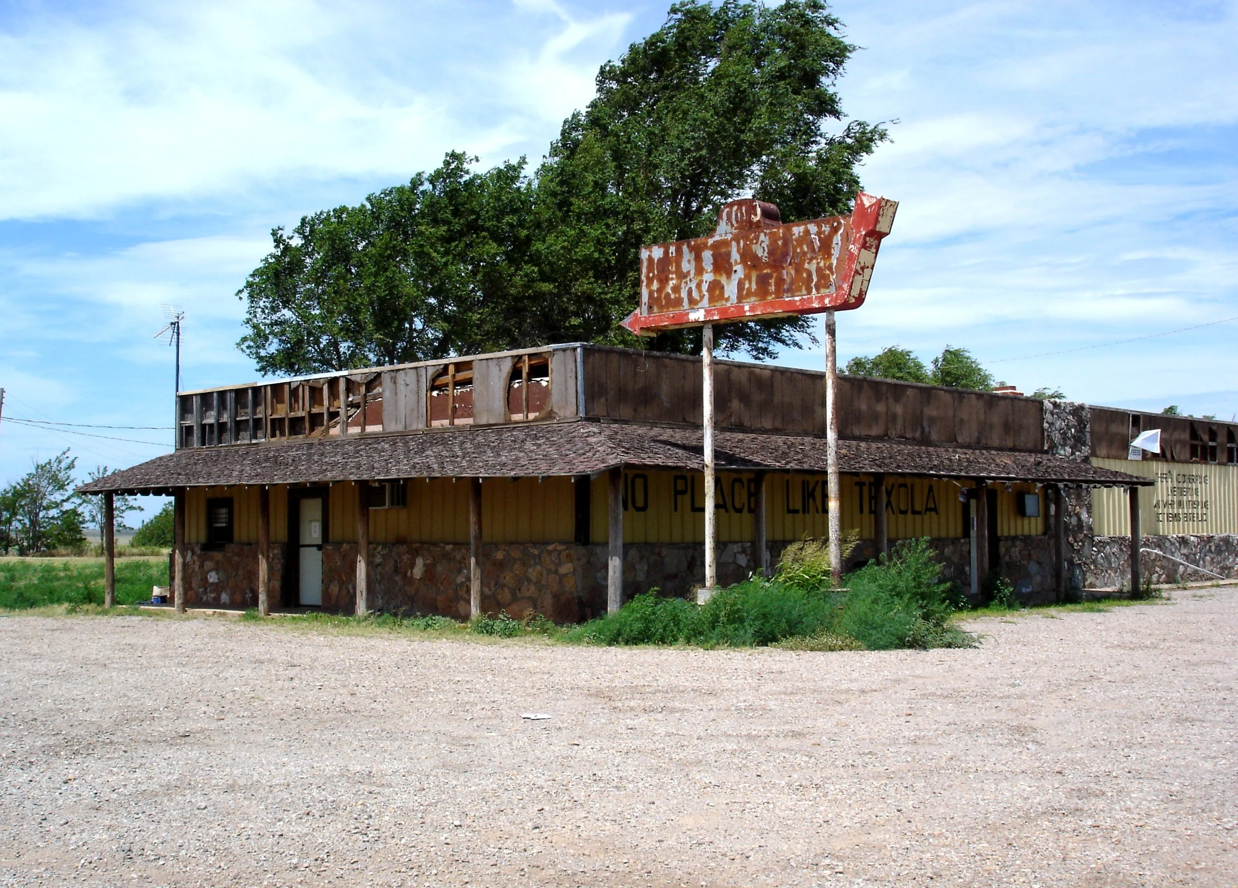
Old bar in Texola. CTLiotta. CC0 1.0
Texola, Oklahoma borders Texas and Oklahoma, and had a population of just 42 as of 2022. A product of westward expansion and the railroad, the town gained prominence for its cotton production. The economy thrived up until the 1930s, when the Great Depression and Dust Bowl displaced local farmers. By the 1970s, the I-40 had bypassed Texola, leading to a decrease in tourism. Today, the Magnolia Service Station and one-room jail are among the many abandoned buildings in the area.
Alanreed, Texas
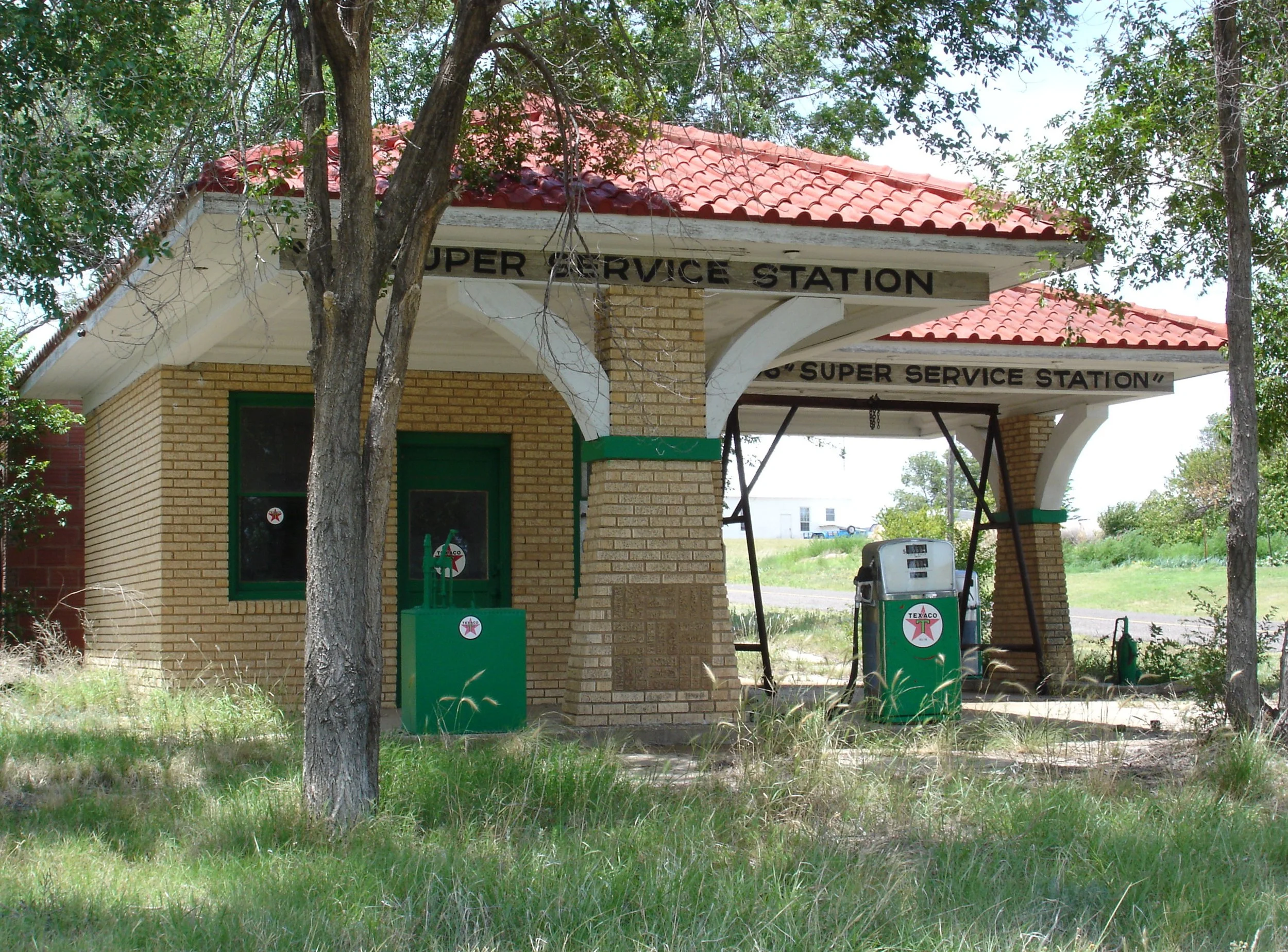
Super 66 Service Station in Alanreed. CTLiotta. CC0 1.0
Alanreed, Texas is roughly sixty-seven miles east of Amarillo (known for the Cadillac Ranch art installation), with a population of 23 as of 2020. The town experienced a population surge during the oil boom, but began to decline in the 1930s when the I-40 was constructed. Among its notable landmarks is the Super 66 Service Station, one of several restored gas stations along Route 66. Alanreed was even home to the Regal Reptile Ranch, which once housed over one-hundred live snakes. Alanreed is located along the Jericho Gap, an infamous stretch of highway notorious for bogging cars down in the mud. Locals from nearby towns even capitalized on stranded cars by offering to help travelers out of the mud, for a fee.
Two Guns, Arizona
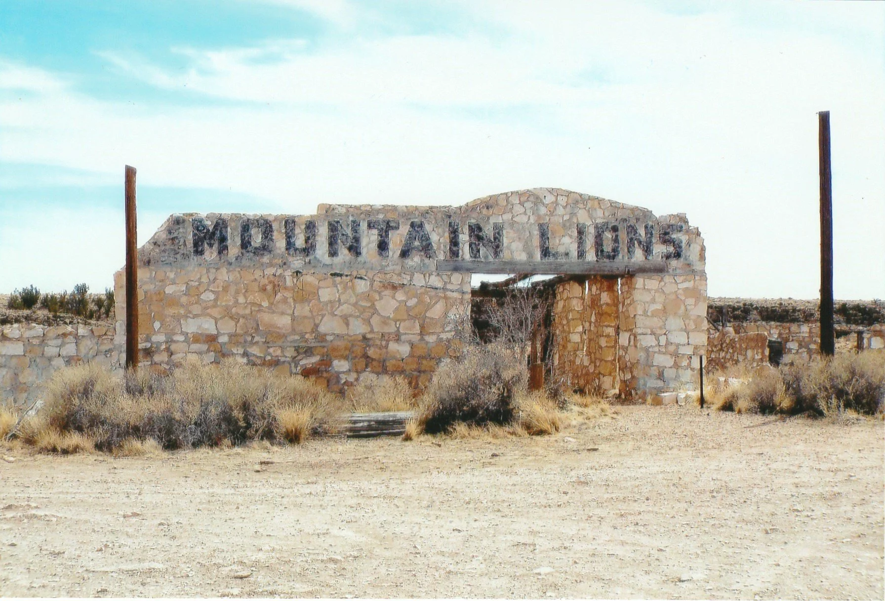
Ruins of Harry Miller’s zoo. Marine 69-71. CC BY-SA 4.0
Two Guns, Arizona is roughly forty miles east of Flagstaff, just outside of Winslow, and known as a “cursed” ghost town. In 1926, Harry Miller shot and killed his landlord, Earl Cundiff, over a contract dispute. Later on, a service station was destroyed by a fire. Two Guns is also home to the Apache Death Cave, the site of a mass murder in 1878, when the Navajo lit fires to smoke the Apache out of the cave, killing forty-two tribe members. Claiming Apache heritage, Miller opened a trading post and zoo in Two Guns, where he sold Apache skeletal remains to tourists. Miller's life took a grim turn when he was attacked by two mountain lions and bitten by a snake from his own zoo.
Amboy, California
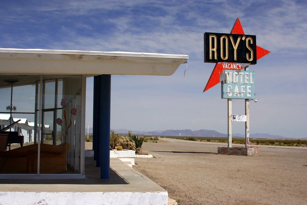
Roy’s in Amboy. Bruce Fingerhood. CC BY 2.0
Amboy, California is located in San Bernardino County in the Mojave Desert. It is the site of Roy’s Motel & Cafe, a Route 66 landmark known for its towering fifty-foot neon sign, an advertisement that has come to embody a slice of Americana. Tourism started to decline in the 1940s, and with the opening of I-40 in 1973, the once-thriving town was economically doomed. However, Roy’s remains open to Route 66 travelers, despite a further decline in tourism due to the pandemic.
Agnes Moser Volland
Agnes is a student at UC Berkeley majoring in Interdisciplinary Studies and minoring in Creative Writing, with a research focus on road trip culture in America. She currently writes for BARE Magazine and Caravan Travel & Style Magazine. She is working on a novel that follows two sisters as they road trip down Highway 40, from California to Oklahoma. In the future, she hopes to pursue a career in journalism, publishing, or research.

