Summer Road Trip to the Tetons and Yellowstone

From experiencing geysers, to hot springs to glacial lakes, this is an adventurous road trip that offers exceptional and unique camping lodging. 

Gros Ventre Road. Mike Goad. CC0 1.0

Grand Teton and Yellowstone are neighboring National Parks celebrated for their rich biodiversity, particularly vibrant during the summer months. A scenic drive through both parks typically spans about a week, allowing time to explore key attractions along the route. Yellowstone National Park is renowned for its geothermal vents, pine tree forests and grasslands, while Grand Teton National Park is known for its rugged landscape, including lush fields and U-shaped valleys. For those planning a summer road trip to Wyoming, here are the top attractions, hiking trails and campgrounds in the Tetons and Yellowstone.

Attractions

Norris Geyser Basin boardwalk. Yellowstone National Park. PDM 1.0

Norris Geyser Basin, the hottest geyser basin in Yellowstone, erupts every 20 to 80 minutes. A 1.8-mile loop trail, accessible via a boardwalk, offers views of steaming blue pools, and bison are sometimes spotted in the area. Notably, it features the Steamboat Geyser, the world's largest active geyser, known to reach heights of up to 380 feet. 

Side note: for visitors road tripping through the Tetons and Yellowstone, I recommend purchasing the $80 America the Beautiful pass, granting access to attractions in all National Parks.

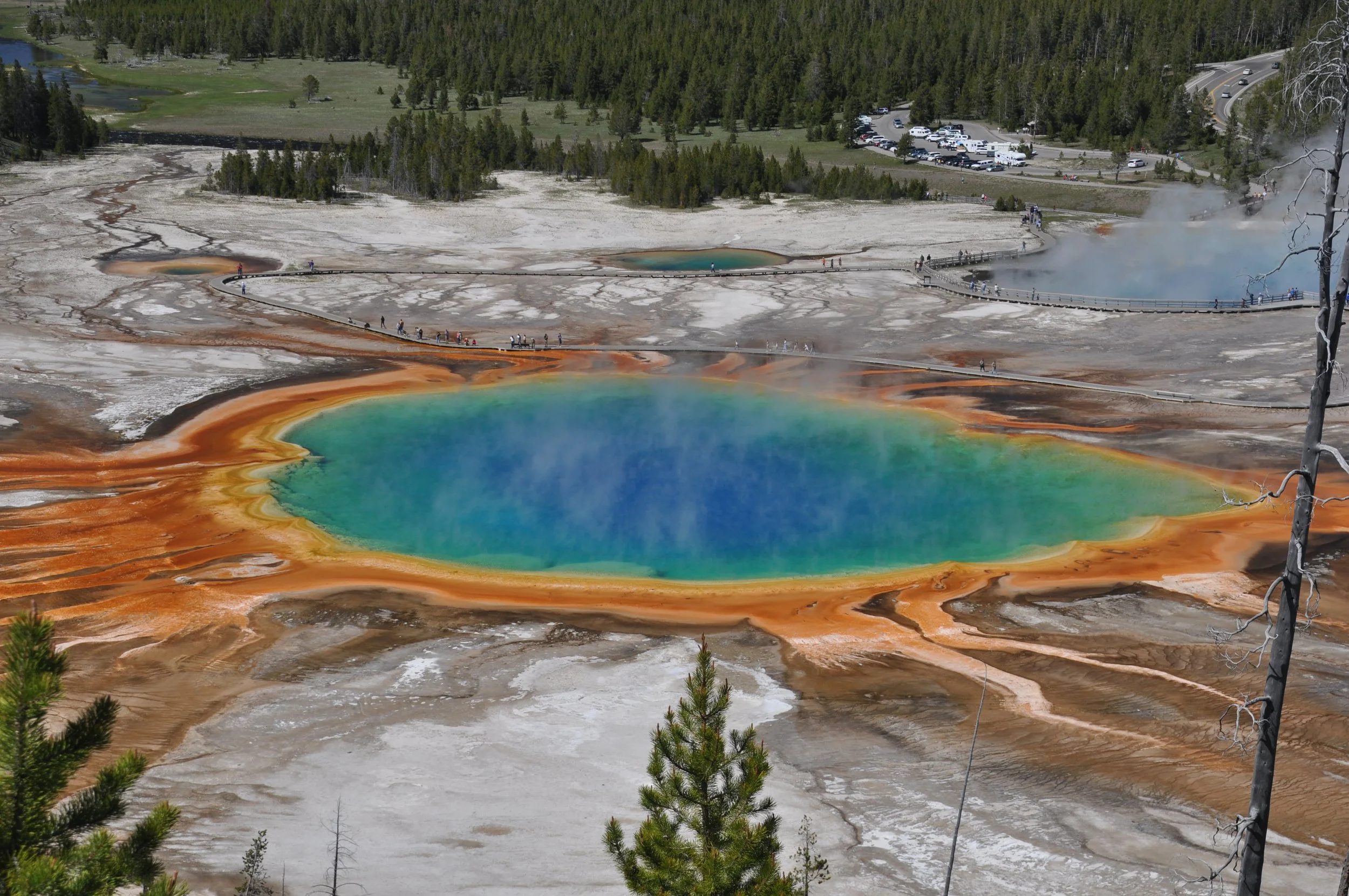
Grand Prismatic Spring. James St. John. CC BY 2.0

Yellowstone’s Grand Prismatic Spring, the largest hot spring in the United States, is celebrated for its vibrant colors—a teal blue pool with bands of orange and yellow. For a viewpoint overlooking the spring, follow the 0.5-mile Fairy Falls trail.

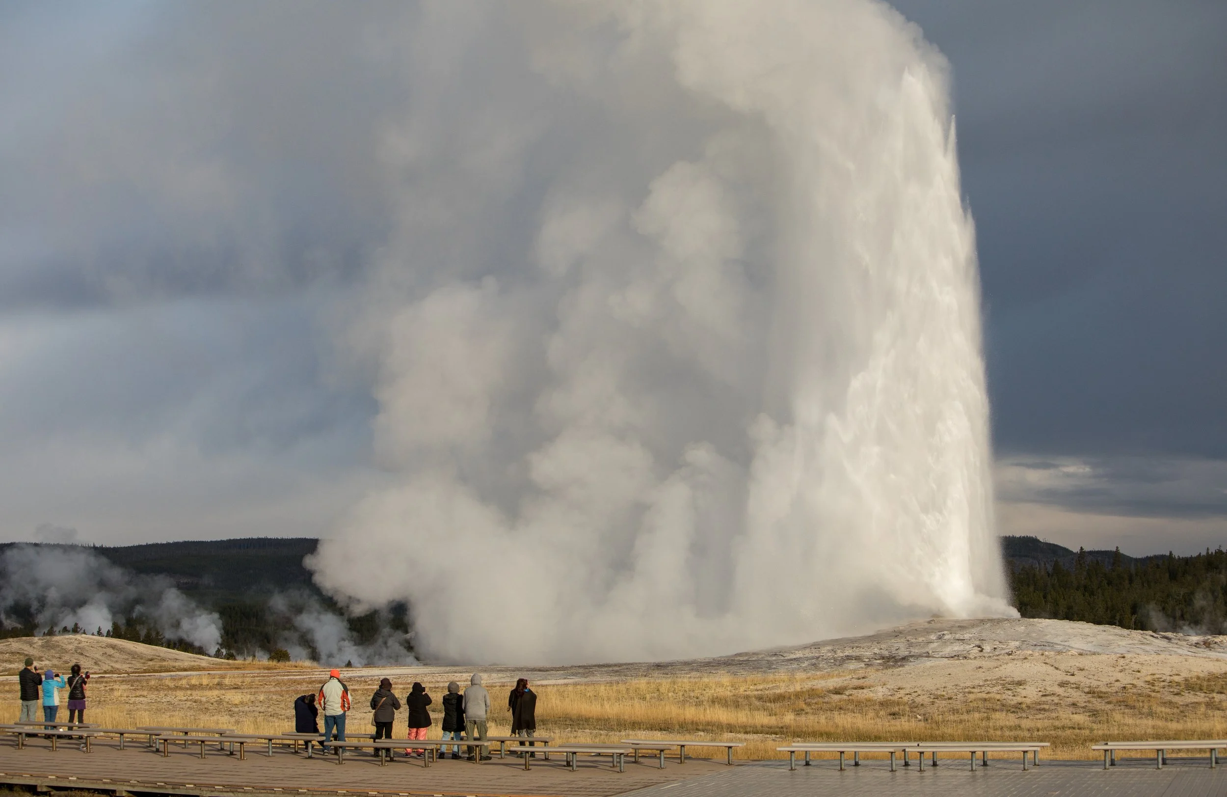
Old Faithful Geyser. National Parks Gallery. PDM 1.0

Old Faithful Geyser erupts regularly, every forty minutes to two hours. Located in West Yellowstone near the Old Faithful Inn, the 0.7-mile loop trail offers convenient access to the geyser.

Jackson Lake. Diana Robinson. CC BY-NC-ND 2.0

Jackson Lake is a glacial lake known for its clear, icy water, surrounded by snow-capped mountains. Colter Bay picnic area and beach provide opportunities for fishing, boating and polar plunging. The Colter Bay campground is convenient for water enthusiasts and is the largest campground in the Tetons.

Hikes

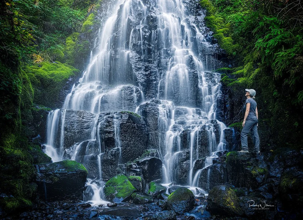
Fairy Falls. Rudy Wilms. CC BY-NC-ND 2.0

For outdoors lovers, there are can’t-miss hikes in both parks. In Yellowstone, the Fairy Falls trail is an easier, flatter route, a 1.6-mile hike to a waterfall surrounded by lush greenery. A little longer, Mystic Falls is a 2.4-mile hike to a cascade-type waterfall. Pelican Valley is a 6.2-mile hike, providing a quieter, less touristy experience through serene meadows. In the Tetons, Cascade Canyon is a 9.1-mile out-and-back trail to a glacier-formed canyon, with wildflowers that are most vibrant during spring and summer months. It’s a more strenuous hike, so less experienced trekkers may opt for the Cascade Canyon Express to experience panoramic views of the area.

Campgrounds

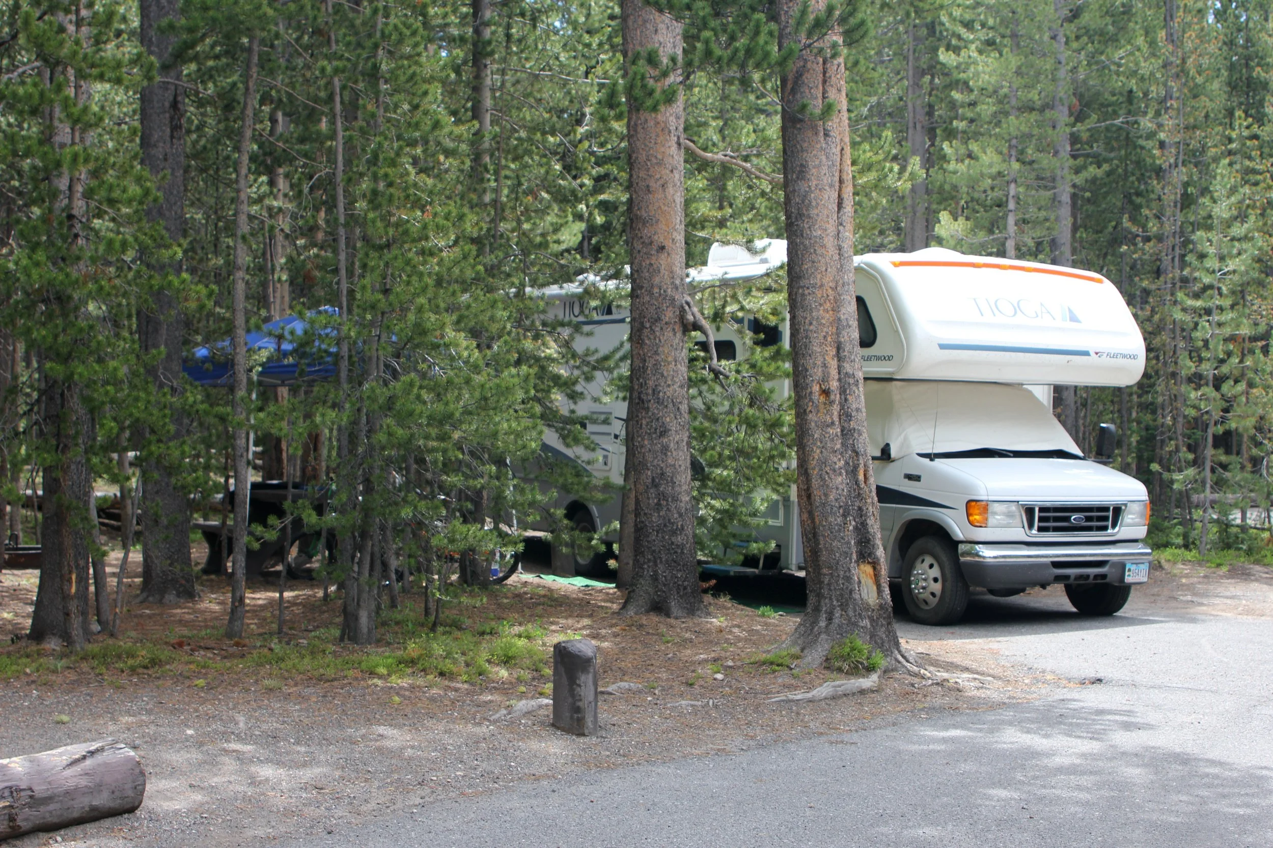
Canyon campground site. Yellowstone National Park. PDM 1.0

In Yellowstone, both Madison campground and Canyon campground are centrally located. Madison is close to the Old Faithful area and Madison River, while Canyon is near the Geyser Basins. Canyon campground arguably has more privacy, mostly due to the shade from pine trees.

In the Tetons, Jenny Lake campground is next to the scenic Jenny Lake, providing expansive views of snow-peaked mountains.

Yellowstone is recognized by the National Park Service as one of the planet's last and largest natural ecosystems. The Tetons, often overshadowed by Yellowstone, are just as worth visiting. Experience the unbeatable views, attractions and trails of Grand Teton and Yellowstone National Parks on a road trip this summer.


Agnes Volland

Agnes is a student at UC Berkeley majoring in Interdisciplinary Studies and minoring in Creative Writing, with a research focus on road trip culture in America. She currently writes for BARE Magazine and Caravan Travel & Style Magazine. She is working on a novel that follows two sisters as they road trip down Highway 40, from California to Oklahoma. In the future, she hopes to pursue a career in journalism, publishing, or research.

The Oregon Coast: An Underrated Road Trip

If you’re planning a road trip up the Oregon coast, here are the best pit stops for outdoors lovers.

Oregon coastline by Cannon Beach. Magnus Manske. CC BY 2.0

The Oregon coast is often overlooked, with west coast travelers often favoring SoCal’s bustling beaches and LA’s celebrity-fueled hotspots. Most road trippers don’t think to venture north past the Bay Area, unaware that there’s more to explore up Highway 101. For those seeking a summer road trip, consider escaping the crowds and finding solace amongst the Oregon coastline’s towering bluffs, colossal rock formations, seashell-studded beaches and historic lighthouses. After driving up the Oregon coast, from Harris Beach to Astoria, here are my recommended stops for outdoors lovers seeking a scenic getaway.

Haystack Rock. Dries Buytaert. CC BY-NC 4.0

Haystack Rock at Cannon Beach

Haystack Rock is one of the most famous landmarks in Oregon, featured in iconic movies like "The Goonies" and "Point Break." The rock formation is 235 feet tall and home to a diverse array of bird life, such as the tufted puffin and western gull. If you have time, be sure to explore the quaint coastal town of Cannon Beach, replete with art galleries, cafes and gift shops.

Devil’s Punchbowl at low tide. Flickr @liquidcrash. CC BY-SA 2.0

Devil’s Punchbowl State Natural Area

Devil’s Punchbowl is located in Otter Rock, a unique rock formation resembling a punch bowl that fills with water during high tide. Devils Punchbowl State Natural Area is a popular whale-watching site, especially during late summer and early fall.

Three Capes Scenic Loop at Cape Lookout. Flickr @Jasperdo. CC BY-NC-ND 2.0

Three Capes Scenic Loop

The Three Capes Scenic Loop is arguably the most scenic drive in Oregon, starting in Tillamook and ending in Pacific City. The drive takes roughly two hours without stopping, passing through idyllic towns, farms and forests. For scenic viewpoints, consider stopping at Cape Meares, Cape Lookout and Cape Kiwanda. It’s hard to find a better campground than the one at Cape Lookout State Beach, with its close proximity to the ocean and surrounding lush greenery. For other campgrounds along the Oregon coast, consider South Beach, Umpqua Lighthouse and Harris Beach.

Cobble Beach at Yaquina Head. Jeff Hollett. CC BY-SA 4.0

Cobble Beach

Cobble Beach is near the fishing town of Newport, and like its name suggests, is a beach made up of cobblestones. Cobble Beach is one of the most abundant tide pool zones along the Oregon Coast, and visitors can easily spot sea anemones, mussels and starfish. Be sure to check out the historic lighthouse at Yaquina Head, a short walk from the beach.

Person sliding down sand at Oregon Dunes National Recreation Area. Matt Kieffer. CC BY-SA 2.0

Oregon Dunes National Recreation Area

For those looking for an action-packed, adventurous getaway, consider visiting the Oregon Dunes National Recreation Area. The dunes are located in Reedsport, Oregon, spanning forty miles along the coastline, making them the largest coastal sand dunes in North America and among the largest globally. The area offers abundant opportunities for outdoor activities, including ATV riding, sandboarding and mountain biking.

Oregon’s beaches can not be underestimated, radiating an untouched beauty as if devoid of human life. While driving up the Oregon coast only takes eight hours, travelers might want to stretch out their road trip over four days, with just two hours of driving each day, to truly savor the wonders of the region. While the Oregon coast is worth visiting during any season, for minimal rain and maximum sunlight, I recommend planning a road trip during July or August. The Oregon coast is one of the best stretches of drive in the Pacific Northwest, and I highly recommend a trip up the 101 this summer.


Agnes Volland

Agnes is a student at UC Berkeley majoring in Interdisciplinary Studies and minoring in Creative Writing, with a research focus on road trip culture in America. She currently writes for BARE Magazine and Caravan Travel & Style Magazine. She is working on a novel that follows two sisters as they road trip down Highway 40, from California to Oklahoma. In the future, she hopes to pursue a career in journalism, publishing, or research.

The Cost of Climate Change: Forced Relocation in Panama’s San Blas Islands

Rising sea levels led to the evacuation of about 300 Indigenous Guna families from Gardi Sugdub Island off the coast of Panama on June 1, 2024.

Gardi Sugdub, Panama. Lee Bosher. ATTRIBUTION-NONCOMMERCIAL 2.0 GENERIC

Climate change poses a threat to coastal territories around the world, as warming global temperatures lead to rising sea levels and stronger storms. Gardi Sugdub is one of 365 islands in the San Blas archipelago, many of which are expected to be underwater by 2050. The rising waters along Panama’s Pacific and Caribbean coasts are expected to subject 63 communities to climate displacement throughout the coming decades as about 2% of Panama’s coastal territory becomes submerged. Although the relocation on June 1, 2024, was successful, the 300 Guna families are the first of an estimated 38,000 people in Panama who will require relocation in the short and medium term. 

The Guna people, the Indigenous inhabitants of about 50 of the 365 islands in the San Blas archipelago, are the first of these communities to relocate. Indigenous and other marginalized communities are disproportionately affected by climate displacement, where people are forced to move because of climate-related threats or disasters. Inequities resulting from the climate crisis disproportionately harm People of Color, particularly Women of Color. After decades of attempts by Guna community members to receive relocation support, the Panamanian government finally agreed.

The Guna people have inhabited Gardi Sugdub for generations. Theyarrived on the island about 150 years ago when they crossed the water from the Panamanian and Colombian mainlands. The move off of the island to a landlocked community surrounded by jungle is a challenge for many because over 200 years of Guna culture have been centered around the sea. While most of Gardi Sugdub’s inhabitants relocated, about 200 people chose to stay on the island.

The relocated Guna people have moved to a new community called Isberyala. Isberyala, a plot of 300 two bedroom houses situated in the forest, starkly contrasts with life on Gardi Sugdub, where houses were overcrowded and often homed by multiple families. Panama’s Ministry of Housing ensured that the Isberyala residential project includes infrastructure like electricity, playgrounds, cultural spaces and streets named after historic Guna leaders. The people in Isberyala can easily visit their old homes too, as Gardi Sugdub is only a 30-minute walk and a short boat ride away.

TO GET INVOLVED

Those looking to spread awareness and advocate against climate displacement and inequity can learn more and share knowledge with others. People can support mitigation and relief efforts by donating to organizations that support relocations like Swiss NGO Displacement Solutions and the UN Refugee Agency, which recently started a Climate Resilience Fund.


Madison Paulus

Madison is a student at George Washington University studying international affairs, journalism, mass communication, and Arabic. Born and raised in Seattle, Washington, Madison grew up in a creative, open-minded environment. With passions for human rights and social justice, Madison uses her writing skills to educate and advocate. In the future, Madison hopes to pursue a career in science communication or travel journalism.

Climate Change on Trial: Vermont Passes Climate Reparations Bill

After historic flooding, Vermont calls for “Big Oil” to pay its share of the damages.

The Great Vermont Flood of 2023 in Montpelier, Vermont. The National Guard, CC BY-SA 2.0

Climate change has become a serious issue across the globe. Freak weather events, increased global temperatures and glacial melt, among other crises, have made it almost impossible to ignore. And for residents in one state, climate change has come right to their doors for what lawmakers intend to make the last time.

Vermont suffered severe flooding during the summer of 2023—the water completely submerged parking meters in the capital city of Montpelier. Thousands of residents lost cars, homes and businesses. According to the National Weather Service, the damages from this event alone rivaled—and even exceeded—the damage caused by Hurricane Irene back in 2011.

Now, the state government has passed a bill forcing fossil fuel companies to pay for a portion of the damages caused by climate change. Vermont is now the first state in the Union to take these organizations to task for externalities caused by fossil fuel emissions. According to the bill, the Agency of Natural Resources will create a report by 2026 that estimates the cost of climate change-based damage since 1995. This will examine aspects such as public health, agriculture and economic development.

The bill has been lauded for its progressive approach to climate justice, as holding companies accountable for pollution is, perhaps unsurprisingly, very widely supported. However, several Vermont politicians have also expressed concern over what will surely turn into a knock-down, drag-out legal battle come the report’s publication.

This bill marks a huge turning point in the climate justice movement. Although the legal battle has yet to begin, the precedent set by this bill is groundbreaking. The federal government has taken little serious action toward climate change reparations, as they are a divisive issue on a national level. Some consider the process to have very little legal basis, which naturally spawns skepticism that the legislation can actually be enforced.

However, regardless of how the bill has been received, the progress here is undeniable. There’s something to be said for the power of precedent in legal situations. Reparations have been divisive in the court system on account of being largely untested in a legal setting. Most court cases on a federal level are decided largely based on the results of similar cases in the past. Much of the heel-dragging over climate change, then, can be explained by how new and untested many of these legal approaches are.

It’s far more difficult to pass a bill at the federal level than the state, especially when trying to attack such an inflammatory issue. That said, states taking action—successful or not—could begin to wear down that resistance. If Vermont manages to extract reparations from the targeted companies, other states may follow suit. With enough states unified towards climate reparations, the federal government may be forced to take a stance. It likely won’t be for some time, but Vermont’s actions now are potentially paving the way for a massive shift in the governmental response to climate change in future years.


Ryan Livingston

Ryan is a senior at The College of New Jersey, majoring in English and minoring in marketing. Since a young age, Ryan has been passionate about human rights and environmental action and uses his writing to educate wherever he can. He hopes to pursue a career in professional writing and spread his message even further.

Hiking in the Canadian Rockies: The Natural Magic of Waterton National Park

Find some of the best hikes in the world on the southern Canadian border.

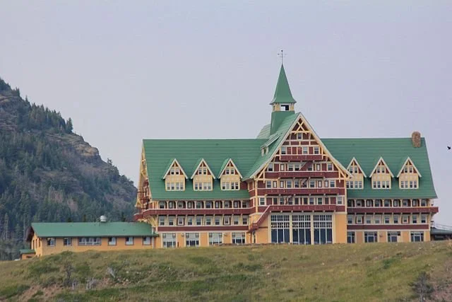
Waterton Lakes seen from the Prince of Wales. Sean Tseng, CC BY-SA 4.0

Uniquely positioned as the only national park in both the United States and Canada at the same time and known as an International Peace Park, and the first of its kind, Waterton is a once-in-a-lifetime experience. During my two weeks there, I discovered hidden waterfalls, hiked over miles of snow and ice, and took a step back into Canadian history.

Our first destination was the Prince of Wales Hotel. Positioned on top of a hill overlooking the beautiful Upper Waterton Lake, this building was constructed in 1927 and has remained one of the most recognizable landmarks in the entire park. The interior is a classic 20th-century hotel, complete with a manually-operated crank elevator. Niagara, the restaurant within the hotel, holds high tea in the drawing room in the afternoons, bringing guests back to Victorian England, complete with pastries and ornate British tea sets.

The Prince of Wales Hotel. Royalbroil, CC BY-SA 3.0

Heading down along the steep path on the hillside, we arrived in the small town of Waterton on the edge of the lake. The sleepy mountain village was a lovely experience; it felt like taking a trip back through Canadian history, complete with uniformed mounties patrolling the streets. The town opens up onto a variety of hiking trails into the surrounding mountains and along the shores of the lake.

Taking one of these mountain paths, we climbed up and around the foothills and into a gorgeous pine forest. Making our way along the rocky outcroppings and winding paths, we found ourselves facing a thundering waterfall only a few minutes after we started out. This would prove to be the standard for our trip; it seems like everywhere you look, there’s another beautiful vista or secret wonder waiting to be discovered.

Just a few minutes’ drive from the hotel, we arrived in Red Rock Canyon, a small but beautiful gap in the earth lined by small brush and occasionally frequented by coyotes. Thankfully, we didn’t run into any of them on our trail, but at the viewing spot at the end of the short hike we spotted one scampering along the bank of the small river far below us. This canyon is also a known visiting spot for both brown and grizzly bears; their presence in the park has led seasoned travelers to suggest carrying noisemakers or regularly shouting, “Hey, bear!” to avoid taking the huge animals by surprise and risking an attack.

After a few days enjoying the sights of Waterton, we made our way further west and crossed the border back into the US’s Glacier National Park to visit some of the last remaining glaciers in North America. One of these ancient ice giants, Jackson Glacier, is visible from the side of the famous Going-to-the-Sun Road. This winding path along the side of the Rocky Mountains sits at an elevation of around 6,000 feet and is lined with waterfalls and scenic vistas. If you’re lucky, you can spot herds of bighorn sheep climbing the hills alongside the road; with their unique hooves, they can cling to a sheer rock wall as if it was flat ground. And as long as the weather is good, you can clearly see the massive ice sheet that carved out the valleys below, suspended between two peaks in the far distance.

Jackson Glacier as seen from Going-to-the-Sun Road. MONGO, CC BY-SA 4.0

Further along the road, we came to our next stop; a trailhead that led out into a massive field of snow. With bandanas and wool hats to resist the biting cold, we started out across what looked like a scene straight out of a Hallmark movie. But after a few feet, we discovered that there was actually a wooden walkway—about three yards beneath us. This massive field of snow was in reality a mountain of its own; it was several yards deep and miles wide in all directions.

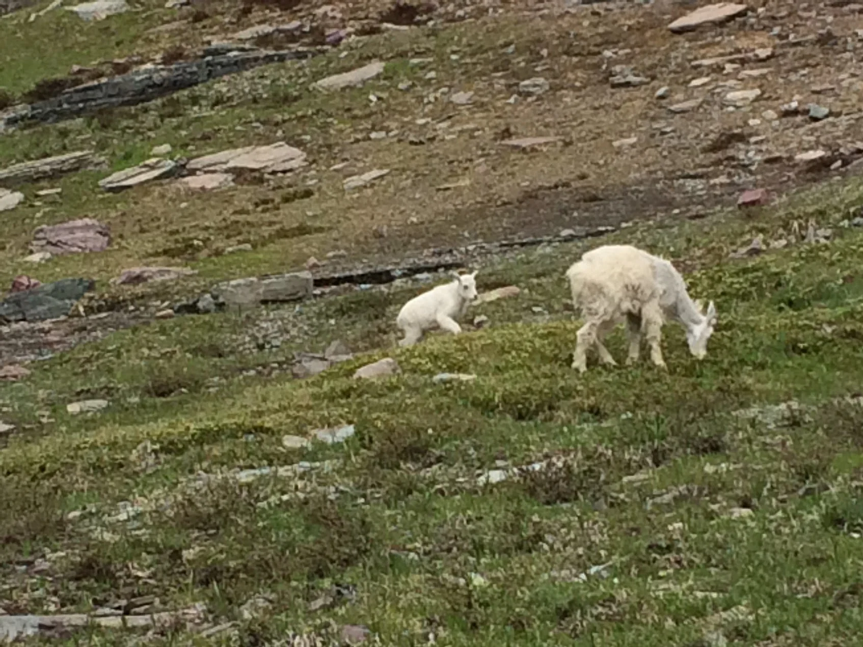
After picking our way along the often slippery surface of the snowy mountain, we found ourselves in another forest, this one populated by tons of wild mountain goats. Groups of hikers stood along the roped-off path, snapping photos of the adorable baby goats as they rooted through the snow and brush for food. We also spotted some wolverines, keeping their distance from us as they hunted for prey along the upper slopes of the mountain.

A mountain goat with its kid. Photo by author.

Once we had descended to our car again, we made our way back north to our last stop: Many Glacier Hotel, overlooking Swiftcurrent Lake. After dropping off our things, we hopped on board one of the boating tours. We were taken across the lake to the opposite shore, where we briefly hiked our way through the foothills before hopping on another boat and circling back around. During our cruise, we were given the history of the area, from the area’s original residents, the Cheyenne and Blackfoot tribes, to the park’s founding in 1910.

Waterton and Glacier are some of the most beautiful national parks in the world; despite being overshadowed by Yellowstone and the Grand Canyon, there is nothing quite like hiking across miles of snow and viewing the ancient glaciers that formed the landscape of America and Canada. The wildlife, the environment and even the towns of Waterton are steeped in natural beauty and wonder; anyone who enjoys hiking and loves a good view should make their way to Waterton once in their lives.

There are many ways to visit and stay in Waterton. The closest airport to the park is Kalispell (FCA), although for some Calgary International Airport (YYC) may be preferable. The Prince of Wales Hotel from this article is open for online bookings in the spring and summer at their website, and other lodgings are bookable here and on other sites you can find through Google Hotels. Prices in the area generally range from around $130 to $150 per night.


Ryan Livingston

Ryan is a senior at The College of New Jersey, majoring in English and minoring in marketing. Since a young age, Ryan has been passionate about human rights and environmental action and uses his writing to educate wherever he can. He hopes to pursue a career in professional writing and spread his message even further.

Uncontrolled Burn: Canada’s Devastating Wildfires

Thousands of wildfires, miles of scorched forests and colossal plumes of smoke are threatening Canada on all fronts.

Forest fire at night. U.S. Forest Service, public domain

Canada is no stranger to wildfires. According to the Canadian National Fire Database, over 8,000 fires occur every year, burning over 2 million hectares of land. The highest risk period for fires starts in April or May and lasts all the way through September or October, with hold-over fires potentially burning well into winter.

But recently, fires have become more and more frequent earlier in the year. These early fires have also been growing in severity and damage, which should only happen well into the summer. Canada has endured over a thousand fires in 2024 alone, with 104 currently raging as of late May. Most are relatively under control thanks to quick responses from fire teams, but about a seventh are registered as “uncontrolled.” Despite the best efforts of local fire companies and government action, these fires have devoured thousands of hectares of land and are currently threatening several cities across the country.

The Parker Lake fire, named for its apparent origin point, caused thousands of citizens of Fort Nelson in British Columbia to flee their homes. At that time the fire was already roughly 3 square miles in size; the long period of dry weather, coupled with strong winds, caused the fire to grow out of control, which prompted evacuation orders on May 11th. Parts of Alberta have also been given orders to prepare for evacuation as other fires steadily approach.

In addition to the threat posed by the blazes themselves, the smoke produced by the constant burning has blanketed most of Canada and is beginning to drift south into the midwestern United States. This smoke can cause serious reactions in those with existing respiratory illnesses and even be harmful to the lungs of healthy individuals. Given the severity of 2023’s wildfire season, we can expect a tremendous amount of smoke this year as well.

There are many possible causes for wildfires, ranging from the carelessness of individual hikers or campers to the climate itself. Higher global temperatures can cause more frequent flare-ups, long-lasting droughts can leave forest floors incredibly dry and flammable, and warmer winters leave less snow behind, resulting in even dryer conditions. Additionally, zombie fires—blazes that have smoldered underneath the snow over winter only to reemerge after the spring thaw—have increased the number of threatened communities.

How You Can Help

Fire season has only just begun in Canada and the nation is already being battered from all sides. Conditions are only expected to worsen as the temperatures rise and droughts linger; more evacuations are also expected as a result. However, several charities have already begun donating to the firefighters working to combat the blazes, as well as the many displaced citizens. Sites such as Global Giving and the Canadian Red Cross are excellent ways to help offset the devastation wreaked by the hundreds of wildfires.


Ryan Livingtston

Ryan is a senior at The College of New Jersey, majoring in English and minoring in marketing. Since a young age, Ryan has been passionate about human rights and environmental action and uses his writing to educate wherever he can. He hopes to pursue a career in professional writing and spread his message even further.

The Slow Rise of Gang Violence in Haiti

Haiti finds itself in a humanitarian crisis, with limited access to resources and police assistance amid widespread gang presence. 

UN officials try to aid the police force in Haiti as violence escalates, CC0 1.0.

Already in a long-term humanitarian crisis stemming from a 7.0 magnitude earthquake in 2010, Haiti has been in a vulnerable position for the last fourteen years. Until recently, the fate of Haiti rested with 10 remaining senators, all of whose terms expired two weeks into 2023. There are currently about 200 gangs in Haiti, half of which are residing in Port-au-Prince, Haiti’s capital. Among these are G9 and GPep; two rival gangs with the largest presence in the capital.

G9 Family and Allies (“G9”) was formerly associated with the dominating Haitian Tet Kale political party, rising via a relationship between Chérizier and the Moïse administration in 2020. The intention of this group was to maintain social order among civilians angry about lack of political assistance to their poor conditions. Over time, it strayed away from its initial goals and took up violence and kidnapping. 

The second politically relevant gang present in Port-au-Prince is GPep, less well known but equally dangerous. GPep, a gang alliance led by Gabriel Jean Pierre (“Ti Gabriel”), is the sworn enemy of G9.  Associated with Haitian opposition parties, GPep is responsible for high levels of violence, famines and the deaths of innocent civilians in its clashes with G9 for power. In September of 2023, the rivals made a public pact to “viv ansanm” (“live together”) to coordinate against shared political rivals. 

In February 2024, various Haitian gangs carried out a series of coordinated attacks throughout Port-au-Prince. Chérizier and the G9 Alliance ultimately claimed responsibility for the spike in violence. The gangs’ intentions were to reduce the power of the police force and prevent the return of the Prime Minister from Kenya, where he had previously been negotiating with the United Nations for protective measures. Since then, gang activity has seen a steady increase in Port-au-Prince, including the storming of two of the country’s largest prisons to free thousands of inmates and an attempted seizure of the national airport.  G9 also notably expanded its control and effectively blocked access to the country’s main oil storage facility, worsening the fuel shortage. On March 3, the Prime minister declared a state of emergency and enforced a nightly curfew.

The recent increase in gang presence has also limited citizens’ access to healthcare. As a result of a storm by the gangs in March, the State University of Haiti Hospital (HUEH) was forced to close and has not reopened since. TIME journalist Dánica Coto looks broadly at the impact gang violence has had on the medical system and explains that, “Even if a hospital is open, sometimes there is little or no medical staff because gang violence erupts daily in Port-au-Prince, forcing doctors and nurses to stay at home or turn around if they encounter blocked roads manned by heavily armed men.” The gangs therefore not only harm citizens directly, but medical restrain them by limiting access to cancer, asthma, diabetes and other medical condition treatments.

The rapid increase in gang violence is impacting more than just the capital, the displacement of people also posing a risk for the rest of Haiti. With a large population residing in Port-au-Prince, smaller cities outside the capital are too fragile to support people fleeing en masse. The United Nations International Organization for Migration raised their concerns in early April: “It should be emphasized that [these] provinces do not have sufficient infrastructure and host communities do not have sufficient resources that can enable them to cope with these massive displacement flows coming from the capital.” The insufficient resources of the regions surrounding Port-au-Prince continues to pose a risk for Haitains, their food security, health and safety still insecure even if they escape the capital. 

The United Nations is calling for more support for Haiti, with only 8% of the 2024 Humanitarian Needs and Response Plan for Haiti already funded. In a United Nations meeting, the Haiti delegate focuses on the importance of sending aid to the police force and emphasizes that, “We need to ring alarm bells. It is absolutely vital to act quickly to avoid the genocide being implemented in the country." Executive Director of the UN Office on Drugs and Crime Ghada Waly echoes the need for outside intervention; “In the absence of international action to improve Haiti’s security, through the deployment of the multinational security support mission […] alongside a long-term political solution, the circumstances will remain enormously challenging.” Haiti is in desperate need of outside assistance from the United Nations and other countries, its current support system too weak to protect and care for its people.

The Dominican Republic has deployed its own limited resources to stem the flow of arms into Haiti, although its Minister of Foreign Affairs emphasized the need for tougher sanctions and an arms embargo to help build a sustainable peace. United Nations delegates are also pushing for a rigorous implementation of the sanctions regime to hold financiers of the violence accountable, and thus reduce the damage being done to Haiti. In its current state, Haiti’s healthcare and political system are on the verge of collapse. It is only through external intervention and support that the country has a hope of making it through the crisis and starting, once again, on a path to reconstruction.

TO GET INVOLVED:

Save the Children has an ongoing campaign to help children and refugees in Haiti. Check out their website here to learn about the current state of Haiti and steps, both big and small, that can be taken to send humanitarian aid overseas. 

Christian humanitarian organization World Vision is working to help end the suffering in Haiti by sponsoring individual childrens’ wellbeing, as well as general crisis response efforts. Click here to learn more.


Aanya Panyadahundi

Aanya is a student at the University of Michigan studying sociology and journalism on a pre-law path. She loves to travel the world whenever she can, always eager to learn more about the different cultures and societies around her. In her free time, she likes to play the violin, ski, and listen to podcasts.

Whale Watching in Washington State in the San Juan Islands

Experience a beautiful archipelago off the coast of Washington State that’s bursting with natural splendor

The coast of Orca Island in the San Juan Islands. Bureau of Land Management, CC0

Only an hour and a half by ferry from the coast of Seattle, Washington, the San Juan Islands are an incredible destination for any wilderness-seeking wanderers. After only a week, I’d seen dozens of whales and porpoises, and explored miles of the main island both on foot and by bicycle. My friends and I still consider this one of our greatest trips! From whale watching and sea kayaking to hiking and ziplining, these islands provide the perfect “surf-and-turf” nature experience.

The small archipelago is by far most famous for its local orca pods. A rarity in American waters, the Northwest's Gulf of Georgia boasts three local pods that feed primarily on salmon, as well as a traveling pod from Canada that feeds on the local harbor seal population. In addition to the orcas, a wide variety of marine mammals can be spotted both along the shoreline and out in the heart of the Gulf. On our first whale watching tour from the main island my companions and I saw humpback whales, Steller sea lions and a variety of dolphins and porpoises keeping pace with our boat.

The archipelago is made up of four main bodies of land: San Juan, Orcas Island, Lopez Island, and Shaw Island. The first, San Juan, is the largest and most visited island in the chain, and is home to the beautiful town of Friday Harbor. In addition to being the ferry’s main landing point and the heart of the archipelago itself, Friday Harbor is the main hotspot for whale watching tours. The guides provide an excellent experience; ours taught us all about the native marine animals and the history of the islands. We spent most of our time on San Juan during our tour, hiking across the hilly terrain to the south for some amazing views.

A view of Friday Harbor from the balcony of a local restaurant. Image from author. Ryan Livingston

But perhaps the best thing about Friday Harbor is the locals. In particular a harbor seal named Popeye, who likes to spend her mornings floating outside of the dockside restaurants in the hopes of getting some handouts. She’s very friendly, and has become something of a mascot for Friday Harbor!

San Juan is also the site of Lime Kiln Point State Park, which is lauded as one of the best whale watching sites in the world. The park is also a hangout spot for the river otter population around the islands. Lime Kiln Point is also an excellent hiking spot, with a trail leading up to a vintage lighthouse that is the park’s main landmark. This lighthouse provides an excellent view of most of the Gulf.

On the latter half of our trip, my friends and I paid Orcas Island a visit. Known for its rich artistic history, it is known locally as the “Gem of the San Juans.” The coastal towns include a variety of sailing, fishing and whale watching charters, as well as a few sea kayaking companies that give tours of the island and its history. With their friendly and informative tour guides, you’ll wind up learning about everything from jellyfish to the islands’ border disputes back in 1949! Orcas Island is also the site of Moran State Park, an excellent site for hiking, biking, camping and boating on the small lakes situated across the landscape.

The other two islands are well worth visiting, although I wound up spending all of my time on San Juan and Orcas. Lopez Island is by far the least hilly of the four, and as a result has been adapted into a fantastic biking location. With trails all over the island and tons of rental shops to choose from, Lopez is the biker’s dream. In addition, for any eco-minded travelers, a visit to Lopez Island can include a variety of volunteer opportunities, including trash pickup, injured and beached animal rescue training and more.

Finally, we have Shaw, the smallest island in the archipelago and home to the one-of-a-kind Our Lady of the Rock Monastery. Built on living in the same traditional lifestyle as its founders, the nuns tend a sprawling farm that, like the monastery itself, is open to the public. Although it does offer worship sessions, the architecture and rich history are reason enough to visit.

Whether you’re looking for an escape into nature or searching for the elusive mammals of the sea, the San Juan Islands are a uniquely beautiful experience. The best times to visit are between May and August, when the salmon runs are at their highest and orca and porpoise sightings are the most common. Whale watching tours can be booked out of any of the four islands at places like San Juan Excursions, and hotel bookings can range from $157 to around $300 a night in the heart of Friday Harbor. Camping in the various state parks is also an excellent option.


Ryan Livingston

Ryan is a senior at The College of New Jersey, majoring in English and minoring in marketing. Since a young age, Ryan has been passionate about human rights and environmental action and uses his writing to educate wherever he can. He hopes to pursue a career in professional writing and spread his message even further.

The Ethics of Kelp Farming in Alaska

From food, medicine, climate mitigation and preserving Indigenous traditions, kelp is the shape shifting superhero a polluted world needs.

Kelp with sardines. National Ocean Service. CC By 2.0.

Ethereal and elusive, an unconventional forest grows in the ocean—not full of trees, but of kelp. These captivating, yet occasionally uninviting, greenish tendrils are classified as a type of brown algae that grow as coastal seaweeds; they are typically found in colder waters. In a way, the ethereal kelp borders on the mystical and magical. Kelp is a shapeshifter; a veritable phenomenon that can morph into a variety of forms. Kelp can be used as biofuel, an eco-friendly alternative to fossil fuels derived from renewable biological materials. This multi-talented algae can also be used to make utensils, soap and clothing as well as food—all manner of products people use in their daily lives. 
Beyond biofuel, food and everyday household items, the production and usage of kelp is a key debate amongst climate scientists and environmentalists alike. Farming kelp could be a solution in mitigating negative effects of climate change; it could also bolster coastal locations’ economies and positively affect the livelihoods of communities living in and around these shores. But, on the other hand, farming kelp is also fraught with bureaucratic convolutions and, in the long run, could potentially backfire and end up re-polluting oceans. In short, the implications of kelp farming are complex; they are enigmatic and double-edged, much like the kelp itself.

Alaskan Company Barnacle Foods’ Kelp Products. Josephine S. CC By 2.0.

The Eyak People of Alaska—and particularly one Dune Lankard—understand kelp farming. Lankard is the co-founder of The Eyak Preservation Council as well as the President and Founder of Native Conservancy, both of which are groups that support Alaska Native peoples’ efforts in preserving and conserving land and biodiversity on the Alaskan Coastline. People in Alaska and beyond have begun to farm kelp because of commercial, food security and climate change mitigation possibilities. And, because of its optimal climatic conditions, Alaska has become a hotspot for kelp farming.

But why is kelp—this mysterious, gangly sept of seaweed—so valuable and beneficial for the environment? For humans consuming kelp, the benefits lie within its nutritional content: kelp contains calcium, magnesium, iron, vitamin C and potassium. But, perhaps more importantly, people like Dune Lankard and fellow Alaskan kelp farmers are more concerned with kelp’s ability to mitigate climate change. Kelp’s primary ability to mitigate climate change comes from its ability to sequester carbon dioxide. You may have heard of carbon dioxide because it is a greenhouse gas. But, what you might not know, is that carbon dioxide from the atmosphere can also enter the ocean, resulting in a mechanism called ocean acidification.

pH reference scale — Ocean Acidification lowers pH. Heinrich-Böll-Stiftung. CC by 2.0.

As more carbon dioxide enters the ocean and gets absorbed, the pH of the ocean itself decreases, meaning the ocean becomes more acidic. But, this is where Kelp the superhero rushes in and saves the marine phyla. Kelp require carbon to grow because of photosynthesis—they absorb sunlight as well as carbon dioxide to produce the sugar and oxygen they need to live—and, through their uptake of carbon, they leave oceans less acidic and marine organisms more happy. Additionally, when kelp float out to sea and die, sinking deep beneath the surface of the water, their carbon sinks into the depths along with them
Perhaps it makes sense that kelp, with its bewitching appearance, could be responsible for such intricate—almost magical—climate processes. While there are over 500 species of seaweed in Alaska, the three most-commonly grown species are bull kelp, sugar kelp and ribbon kelp. Bull kelp is strong, almost proud-looking—its thick stalk beholds a sense of authority in the water. Sugar kelp, on the other hand, is more delicately enchanting—its slightly-curled, yellow blades are like rays of sunlight spattering the sea. Ribbon kelp, with its thick spine and greenish appearance, are more reminiscent of a looming forest, or the shifting of willows in the wind.

Bull kelp bulb. James St. John. CC By 2.0.

These kelp, however, represent more than just their life cycle, climate mitigation abilities and appearance. Historically, the Eyak people—located on the Copper River Delta near Cordova, Alaska—have long used kelp for food, medicine and even tools. But, through colonialism and imperialism, some of these traditions were disrupted over decades. Today, however, the Eyak and other Indigenous peoples’ kelp farming has allowed them to reclaim these traditions. Additionally, there are immense economic benefits for any employees involved in kelp farming. The fall-to-spring growth cycle of kelp, as well as the need for regular visitation and observation of kelp farms, offer both seasonal and year-round employment opportunities. The increasing amount of kelp farms subsequently increases the number of job opportunities in Alaska, bolstering the state’s economy. Although mariculture in Alaska is currently a $1.5 million dollar industry, newly awarded $45 million in grants could potentially grow it to more than $1.85 billion in 10 years. 

Kelp farming and consumption, however, is not all sunshine and rainbows. One of the most difficult aspects of kelp farming is getting started in the first place—a kelp farm requires a permit. Most states require multi-step permit application through boards of aquaculture as well as departments of fish, wildlife and game. Luckily, on average Alaska has a lower permit processing time than most states. Beyond the bureaucratic complexities of even getting started, there are also questions being raised by environmental and climate scientists about the future of kelp farming. Although—as is outlined above—kelp farming is believed to help ocean acidification through carbon sequestration, some scientists are questioning the ability for kelp to continue to sequester carbon as ocean temperatures warm as a result of climate change.
While people should be mindful of the ambiguous future of kelp farming, for now it is safe to say that the more immediate outcomes of farming are helping kelp maintain a positive reputation. Kelp—delicate and mysteriously distant—is, in actuality, an aid toward a variety of more tangible, positive outcomes. Kelp is food. Kelp is medicine. Kelp can even represent community and prosperity. Of course, kelp can also be a huge factor in sequestering carbon in a post-industrial society. But, for many people, these scientific processes can feel overwhelming or unimportant simply because they seem intangible. This is why the effects of kelp that people can really see and feel—the sense of community, the positive economic impacts and the reclamation of tradition—are something to celebrate. Despite its unconventionality and elusivity, kelp can be a superhero.


Carina Cole

Carina Cole is a Media Studies student with a Correlate in Creative Writing at Vassar College. She is an avid journalist and occasional flash fiction writer. Her passion for writing overlaps with environmentalism, feminism, social justice, and a desire to travel beyond the United States. When she’s not writing, you can find her meticulously curating playlists or picking up a paintbrush.

Oppenheimer’s Critical Omission: The Relocation of Hispanic and Indigenous Populations

Intricate but incomplete, Christopher Nolan’s Oppenheimer disregards the true history of Hispanic and Indigenous populations in New Mexico.

Trinity Nuclear Test. U.S. National Archives and Records Administration. CC0.

A picturesque aquamarine sky hangs lazily above a dusty, deserted New Mexico landscape. Through a tangle of brush, a lanky Robert Oppenheimer, played by Irish actor Cillian Murphy, emerges on horseback. His eyes feast on the remote plains and he declares that besides a local boys’ school and “Indian” burial grounds, Los Alamos will be the perfect site to construct the world’s first atomic weapons.

These momentous decisions and moral quandaries are explored in Christopher Nolan’s Oppenheimer. Grossing $450 million in its first fourteen days at the box office, the 1940s period piece has cemented itself as a somewhat unlikely cultural icon. Gone are the days of Nolan’s slightly fantastical films — notably Inception (2010) and Interstellar (2014). Recently, the Academy Award-nominated director has been dipping his toes in the realism of period pieces, beginning with Dunkirk (2017) and continuing with Oppenheimer.
Nolan’s portrayal of Oppenheimer — based on the biography American Prometheus: The Triumph and Tragedy of J. Robert Oppenheimer by Kai Bird and Martin J. Sherwin — is deliberately layered. The audience travels alongside Oppenheimer over the course of his life for three hours. On one hand, Oppenheimer’s humanity is a gut punch: viewers experience his mistress’s death, his tumultuous marriage, and his gradual realization of the death and destruction his scientific creation has wrought. On the other, viewers gaze upon the physicist with disgust: the man was, as he infamously declared himself, a destroyer of worlds.

J. Robert Oppenheimer. U.S. National Archives and Records Administration. CC0.

The use of the first atomic bomb by the United States to defeat Japan and win World War II is one of the signal events of the modern era, arguably helping to prevent a land invasion of Japan that could have killed millions. Despite the magnitude of this technical and geopolitical accomplishment, the legacy of the destruction of Hiroshima and Nagasaki will forever cast a negative light on the United States government and the team of nuclear physicists involved in the development of the atomic bomb. While Nolan acknowledges this complex legacy, his portrayal of key elements of the Manhattan Project and the Los Alamos Laboratory obscures another historical moral quandary. The remote sandy vistas in Nolan’s cinematography smother the true story of Los Alamos and the Trinity nuclear test.

The reality, omitted from Nolan’s film, is that during the Manhattan Project the U.S. Government forcibly relocated Indigenous and Hispanic populations that resided in Los Alamos, New Mexico. Contrary to the movie’s dialogue, there were two dozen homesteaders and a ranch occupying the land that was taken by the government for the project, in addition to the school mentioned by Oppenheimer. The government seized the land and offered the owners compensation based on an appraisal of the land — an amount of compensation that the government itself thought was fit. Some homesteaders, however, objected to the compensation offered by the government, considering it far too little. Many in the Federal Government would eventually come to agree with them; in 2004, decades after the original compensation, Congress established a $10 million fund to pay back the homesteaders. 
Moreover, it was difficult for the homesteaders to object in the first place due to the language barrier. Most homesteaders spoke Spanish, while government officials often only communicated in English. Some families were even held at gunpoint as they were forced to leave with no explanation, due to the project’s secrecy. Livestock and other animals on property were shot or let loose. Livelihoods were destroyed along with these animals.

Los Alamos Colloquium of Physicists. Los Alamos National Laboratory. CC0.

The element of secrecy surrounding the Manhattan Project and the Trinity nuclear test disrupted the lives of families living directly on Los Alamos land. But, for the 13,000 New Mexicans living within a fifty mile radius of the Trinity test (in Jornada del Muerto, New Mexico), the nuclear explosion truly seemed to be the end of the world. Because the mushroom cloud was visible from up to 200 miles away from the test site, and no civilians knew tests were being conducted, fear erupted in concert with the explosion. 

Nolan’s film not only fails to indicate that homesteaders on Los Alamos were forcibly relocated — it also fails to mention that civilians from northern to southern New Mexico were exposed to harmful radiation from the bomb. Radioactive fallout initially contaminated water and livestock, and in turn, civilians. There were no studies or treatment conducted on individuals exposed to radiation, which could have exposed the highly classified program. Those who were in the radius or downwind of the fallout became known as “downwinders,” and began to develop autoimmune diseases, chronic illness and cancer. 

Manhattan Project U.S. Map. Wikimedia Commons. CC by 3.0.

Eventually, the Hispanic American and Indigenous populations who lived in the area returned to Los Alamos to work for the project without knowing its true nature or extent. They returned as maids or as construction workers, often handling radioactive and contaminated materials without knowledge of the harm and risk of exposure. Many became economically dependent on a laboratory that posed environmental and health risks for the greater Los Alamos population. This led to struggles with physical and mental health that have continued to the present time. 

The legacy of the Manhattan Project, the Los Alamos Laboratory and the Trinity nuclear test hangs in a state of limbo. It transcends time — becoming the past, present and future for Hispanic and Indigenous populations in New Mexico. Nolan’s failure to acknowledge these populations’ displacement and unwitting contamination silences their narratives and obscures this unique patrimony. J. Robert Oppenheimer’s depiction as a thumbtack in sandy nothingness is historically inaccurate — Nolan’s cinematic depiction of desolation glosses over a more complex reality. Los Alamos was, and is, living and breathing.


Carina Cole

Carina Cole is a Media Studies student with a Correlate in Creative Writing at Vassar College. She is an avid journalist and occasional flash fiction writer. Her passion for writing overlaps with environmentalism, feminism, social justice, and a desire to travel beyond the United States. When she’s not writing, you can find her meticulously curating playlists or picking up a paintbrush.

Frozen Glory: Inside the Eskimo-Indian Olympics

From cultural preservation to sheer athletic spectacle, the World Eskimo-Indian Olympics are a highlight of the Native Alaskan calendar.

An athlete competes in the blanket toss event at the WEIO. KNOM Radio. CC BY-SA 2.0

In the early 1960s, two non-Indigenous pilots who regularly made trips over Alaska’s rural communities kept observing the celebration of an interesting cultural event. This sporting event, as they later came to realize it was, dated back far beyond living memory and honored strength, resilience and endurance through a series of events meant to test the skills necessary to live in such an unforgiving environment. Given that Alaska had just recently become an American state in 1959, the early 60s saw the gradual encroachment of mainstream American culture into its more remote outlying communities, posing a serious threat to local traditions and practices. After the pilots shared their concerns with various groups in Fairbanks, the World Eskimo-Indian Olympics (WEIO) was officially born in 1961 and drew Native participants and spectators from around the Fairbanks area to participate on the banks of the Chena River.

The WEIO has grown significantly since then, with thousands of people traveling to watch the best of Alaska’s Indigenous athletes compete in the Big Dipper Ice Arena for four days each July. Aside from a minimum age limit of 12 years, there are no age categories for any of the events, which means that several generations of the same family can be seen competing against each other. It is also common for older and more experienced competitors to coach and advise the younger athletes during the competition: rather than trying to beat one’s opponents, the larger goal is to compete against and better oneself.

Athletes Sean O’Brien (left) and Chris Kalmakoff (right) compete in the Eskimo stick pull event. Erich Engman. CC BY-NC-ND 2.0

Many of the events, however, are still extremely competitive, and involve intimate face-offs between athletes. The Indian Stick Pull, for example, calls for athletes to wrench a short greased stick from their opponent, an event meant to replicate the grip strength necessary when trying to keep hold of a freshly caught fish by its tail. The Ear Pull is a contest of stamina to demonstrate the athletes’ ability to withstand pain, a valued trait in the often cruel conditions of the Alaskan North. In this event, string is looped around the opposite ears of two athletes as they face each other as they pull away in a tug-of-war with their ears until one cedes the match.

Other events are competed individually, but with just as much rigor and excitement. The Greased Pole Walk, as its name suggests, tests the balance needed for crossing creeks on slippery logs by having contestants walk as far as they can barefoot along a greased wooden pole. A favorite among both competitors and spectators alike, the Two-Foot High Kick requires competitors to jump vertically and kick a suspended ball with both feet before landing and maintaining their balance. Hundreds of years ago, villages along the coast would perform these kicks as a way to communicate to the village that a whale or some other game had been caught, and to prepare themselves to assist the hunters upon their return.

Athlete Ezra Elissoff competes in the Two-Foot High Kick final at the 2021 WEIO. Jeff Chen. CC BY-SA 2.0

Despite the popularity of basketball and ice hockey, the traditional sports seem to be gaining popularity among young children and teenagers, and are also contributing to the difficult task of preserving and passing on Native Alaskan culture. Miley Kakaruk, a 15-year-old athlete of the Inupiaq tribe of Northwestern Alaska, says that she imagines her ancestors competing in the same events centuries ago, vying to be chosen for their village’s next hunting party. Because each event is so heavily rooted in their history, younger competitors are able to learn the customs and stories that so heavily influence the culture and lifestyle of their people.

Equally important is the power of these games to forge a connection between athletes and society. Historically, studies have shown that Native Alaskans suffer from some of the highest rates of alcoholism and drug abuse in the US. A number of the people that the WEIO Board works with and recruits are young adults who are at risk of or actively battling addiction. According to Gina Kalloch, a board member and ex-athlete, discovering their culture through such a fondly practiced social tradition has allowed many of these people to develop a sense of pride in themselves and their culture, and helped to reorient their lives.

Native Alaskan women compete in the Miss WEIO Cultural Pageant alongside the athletic events each year. Danny Martin. CC BY-SA 2.0

While this year’s edition of the Olympics already took place between July 12 and 15, highlights of both the sporting events and the accompanying Miss WEIO Cultural Pageant are freely available on the internet.


Tanaya Vohra

Tanaya is an undergraduate student pursuing a major in Public Health at the University of Chicago. She's lived in Asia, Europe and North America and wants to share her love of travel and exploring new cultures through her writing.

Why You Should Visit the Makah Tribe on the Coast of Washington State

Visiting this region offers a unique opportunity to immerse yourself in a rich Indigenous culture that dates back thousands of years. 

View from Cape Flattery Bluff. Manuel Bahamondez H. CC BY-NC-ND 2.0

The Makah Tribe's reservation, resting on the extreme northwest tip of Washington State, boasts an ethereal landscape and thriving cultural practices. The land and the Tribe's community inspire and nurture ongoing engagement with nature and rich family connections. Despite its remote location, accessible by a single, winding route, the rich culture and natural beauty of this community offer a magical experience for curious travelers. 

The reservation sits at the farthest point north and west in the continental United States, cradled between gentle hills covered by tall Douglas Fir, Sitka Spruce, and Western Red Cedar trees on one side and the rugged Pacific coastline on the other. In the wake of a century-long fight against colonization the Makah continue to protect their sovereignty through the teaching of their Indigenous language, the celebration of cultural rituals and artifacts in their local museum and schools, and the preservation of the tribe’s traditional and sustainable reliance on native plants and animal species. The Tribe welcomes visitors from near and far to reflect on the reservations’ deep culture and lush natural landscapes. Hiking, surfing, and other outdoor activities are easily accessible from this scenic location and cultural hub. Visiting the Makah Tribe offers a unique opportunity to immerse yourself in a rich Native American culture that dates back thousands of years. The stunning natural beauty surrounding the Makah Tribe, including picturesque beaches and rugged cliffs, provides a breathtaking backdrop for your visit.

Sunset on First Beach. Jaisril. CC-BY-NC-ND 2.0

Generation after generation, the fabric of the Tribe’s community is woven through its cultivation of the natural world and artistic endeavors. Today, a significant number of Makah individuals thrive as artists, making a living through the sale of intricately crafted goods which are sold to galleries, shops, and collectors across the globe. A major source of income comes from the exportation of these artistic goods and is a key element of the Tribe’s livelihood. Carvings and masks in particular are a distinct feature of Makah art and have garnered the attention of tourists and art sellers alike for generations. The pieces often feature animals that hold deep cultural importance to the Makah. Whales, salmon, halibut, ravens, eagles, otters, herons, and wolves are commonly depicted in these designs. Each carving tells a story, chronicling the rich narratives of the origins and struggles which are passed down through generations within the community and amongst families.

The Makah are highly skilled woodworkers, capable of fashioning a wide array of items from the trees that thrive in their surrounding forests. While western red cedar is most frequently used, you can also find artists working with alder, yew, and spruce. Carvings range in size, from intricate jewelry to grand ocean-worthy canoes and towering totems. The incorporation of nature imagery and the sourcing of natural materials reinforces and honors the Makah’s reverence for their lands and waters.
Example of Makah style art. A. Davey. CC-BY-NC-ND 2.0 

Long before the advent of written language, the tribe used dance, song, and storytelling to receive and retain intergenerational knowledge. These melodic traditions are shared and reinforced on various occasions, including weddings, naming ceremonies, memorials, and other family or community celebrations. The Makah reservation museum hosts a compelling collection of artifacts, information guides, as well as a garden with plants labeled with the native language and traditional uses. 

For instance, the tribe once maintained five, thriving and permanent villages: Waatch, Sooes, Deah, Ozette and Bahaada. Their ancient way of life began to shift in the late 1770s, when Spanish explorers first settled in and around Neah Bay in 1779. The Spanish and other European groups were eager to exploit the natural resources of the Makah's land and brought in non-Indigenous modes of technology, among the most important of which were guns. The exploitation of the land's natural resources resulted in extinction of native plants and animals (e.g., otters and whales). Not only did the Europeans bring new technologies, they brought diseases, such as smallpox and measles, which plagued the less resistant indigenous communities. The Tribe's traditional ways of life were disrupted, and its inter-generational familial and domestic structures were gravely impacted as a result of death and the loss of land ownership. In the winter of 1855, Makah leaders and the American government signed theTreaty of Neah Bay, which stipulated that the Tribe give up ownership of much of its land, with the exception of rights for certain Indigenous practices, such as whaling, seal hunting, and fishing. The Makah were forced to cope with changes and shift to a more European lifestyle. In exchange, the United States government promised to provide public education and health care. To this day much of the tribe’s coastlines and forests are still under shared jurisdiction with the National Parks Service and the United States Government. 

Makah Whale Hunting Ceremony. U.S. Forest Service- Pacific Northwest Region. CC0

As with so many Indigenous tribes across the country, the Makah have resisted the pull of corporate behemoths endeavoring to exploit the natural resources and cultural traditions that rightfully belong to the tribes. These tribes have fought to ensure their histories are not just archived but are alive and flourishing. One of the best ways to protect the ongoing strength of these communities is to visit these places and engage respectfully with the work and lifestyles of the Indigenous peoples, and to listen to and learn their histories. 


Avery Patterson

A rising junior at Vassar College in New York State, Avery is a Media Studies and French double major. She is an avid reader, writer, and traveler. She loves to immerse herself in new cultures and is an avid explorer who loves being in nature. She is passionate about climate and social justice and hopes to use her love of writing as a catalyst for positive change.

How Malaria Might Make a Comeback in the US

In order to prevent another pandemic so soon after the last one, US authorities need to stop this new malaria outbreak in its tracks.

The female Anopheles mosquito plays host to the disease’s parasite. CC BY-SA 2.0

Over the past two months, seven cases of locally acquired malaria have been identified in the US. These cases, six of which appeared in Florida and one in Texas, have drawn significant attention as the first time in 20 years the disease has been transmitted domestically. At present, the Center for Disease Control and Prevention (CDC) has reported that all five patients have received medical treatment and are recovering positively, and that the risk of malaria reappearing in a more widespread epidemic across the U.S. is extremely low. That being said, this is a good reminder for those in charge of American public health infrastructure to reflect on how best to shore up national defenses, especially in the wake of the recent Covid-19 pandemic.

Malaria is caused by parasites, which commonly infect Anopheles mosquitoes, and who in turn transfer the disease to humans when they inject their proboscises into our bloodstreams. There are several species of the malaria parasite, collectively known as Plasmodium, some of which cause more serious cases than others, but all of which require tropical climates to thrive. Regardless of the species, malaria is still extremely serious and symptoms such as high fevers, chills, and nausea begin to manifest in a few weeks. Most worryingly is that malaria, if left untreated, is fatal. As of 2021, the World Health Organization (WHO) believed that a grand total of 247 million cases of malaria occurred around the world, of which 619,000 were fatal. The majority of these deaths were children in various countries in Africa, where malaria is a constant present threat and contributes to a vicious cycle of social and economic poverty, taking a massive toll on countries in already precarious situations.

Malaria awareness in the US during the 1950s. Library of Congress. CC BY-NC-ND 2.0

At the beginning of the 20th century, malaria was considered an extremely serious issue in the US; the CDC was actually founded in 1946 to eliminate the disease. Over the next six years, various public health measures such as insecticide use and window screens were implemented to reduce the 15,000 cases reported in 1947, and in 1951, the CDC finally announced that malaria was in the US no longer. This remained the case for decades, until an incident in 2003 when eight locally acquired cases in Palm Beach, Florida were identified. Fortunately, the outbreak was quickly quashed thanks to an immediate response campaign that completely rid the area of mosquitoes to prevent transmission. Since then, malaria has remained fairly absent from the American healthcare landscape.

It is important to note, however, that malaria has never been completely extinct in the US; prior to the recent COVID-19 pandemic, roughly 2,000 cases of the disease were identified and reported annually in patients who had traveled to countries with high incidences of malaria in Southeast Asia and Africa. Additionally, once infected individuals return to the US, local mosquitos who feed on them can pick up the parasite and spread it further. Every so often, this may result in a small reintroduction of the disease and potentially even some limited transmission, but there has never been any worry of it resulting in a much widespread epidemic.

The malaria parasite pictured under a microscope. Joseph Takahashi Lab. CC BY-NC-ND 2.0

The reason these recent cases received so much attention were that all five were acquired locally within the US, which likely indicates that the parasitic mosquito population has made a resurgence as well. Thankfully, the species of parasite identified to have caused this small outbreak is known to transmit one of the milder forms of the disease, but that in no way detracts from the gravity of the situation. Matters of public health have become much more salient in regular discourse since the COVID-19 pandemic, and with it, some extreme opinions about containing and treating transmissible diseases. While America’s healthcare infrastructure continues to operate in largely the same way as it did during the 2003 outbreak, experts have agreed that public cooperation is now more important than ever if this re-appearance is to be nipped in the bud.

The RTS,S malaria vaccine. TheScientist. CC BY-SA 2.0

One particular area in which this agreement would go a long way, is that surrounding the efficacy of vaccines. In October of 2021, the WHO officially recommended the use of the RTS,S malaria vaccine developed by GlaxoSmithKline to prevent transmission in regions with high incidences of the disease. In addition to being logistically simple to store and administer, trials proved that the vaccine was beneficial to 90% of those treated, a staggering figure in the world of pharmaceutical development. Introducing the vaccine to the U.S. seems like an obvious step to take in the wake of these recent malaria cases, especially given the low price of a single dose at $9.30.

Vaccines have been a hotspot of controversy over the past few years, with many people denouncing both their safety and efficacy as a preventative treatment. Government authorities and healthcare professionals and academics around the world continue to release studies and evidence to show that vaccines are essential to build up individual and population-wide resistance  to a variety of diseases, but large groups of the public still remain unconvinced. Among the many lessons and important takeaways from the COVID-19 pandemic, the importance of vaccinations is among the most important, especially in the face of a potential re-emergence of a disease as deadly as malaria.


Tanaya Vohra

Tanaya is an undergraduate student pursuing a major in Public Health at the University of Chicago. She's lived in Asia, Europe and North America and wants to share her love of travel and exploring new cultures through her writing.

A Sustainable Guide to the U.S. Virgin Islands

The U.S. Virgin Islands offer a gateway into a world of rich marine life, lush vegetation, and a complicated global history.

Trunk Bay Overlook in St. John, U.S. Virgin Islands. Blake Carroll. CC0 1.0

Nestled in the northeastern area of the Caribbean Sea, some forty miles east of Puerto Rico, the U.S. Virgin Islands are characterized by their tropical beauty and rich coastal life. The U.S. territory consists of a bevy of small, minor islands and three large, more significant ones: St. Croix, St. John and St. Thomas, the latter of which hosts the capital, Charlotte Amalie. 

Following a struggle over control of the islands between European powers, Denmark claimed St. Thomas in 1666 and St. John in 1684, and eventually St. Croix in 1733. Under Danish control the islands became a center for sugarcane production, and a major player in the African slave trade until slavery was abolished in 1848.

The United States purchased the Danish West Indies in 1917 for $25 million dollars, acquiring what are now the U.S. Virgin Islands. Tourism boomed after World War II to become the islands’’ primary economic activity, with nearly 3 million people visiting the islands every year.

St. Croix 

Christiansted, St. Croix. Crystal Forest. CC BY 2.0

Known for its world class scuba diving and rum making, St. Croix offers opportunities for travelers to explore its environmental wonders and colonial history. One popular destination is the old town of Christiansted, which served as a mercantile center to support the island’s sugar-based economy in the 1700s. Travelers can explore the old Danish colonial architecture, including Fort Christiansted, which was built in the 18th century to ward off pirates. Alexander Hamilton spent his adolescence on St. Croix, and guided tours allow travelers to explore the island’s history while mapping out Hamilton’s early life. Popular sites on the tours include Christiansted Wharf, the international trade post where Hamilton arrived on the island as a child, and St. John’s Anglican Church, where Hamilton’s mother was buried.  

Camping offers travelers a great opportunity to explore a new environment in a low-impact and environmentally conscious way. Mount Victory Camp on St. Croix is one such site working to create a sustainable option for travelers to enjoy St. Croix. The camp includes eco-lodges built from storm-felled tropical hardwoods and powered by renewable energy. Workshops are also on offer for visitors to learn more about the natural environment, with activities ranging from bow-making and wild food preparation to shelter building and naturalist studies.

On St. Croix, travelers can take advantage of activities offered through the St. Croix Environmental Association. The Association supports environmental advocacy, conservation and educational programs that help the public to learn more about the island’s natural resources. It also provides educational opportunities for kids, where they can engage directly with nature through snorkeling clinics, eco fairs, and forest field days.  

The Buck Island Reef National Monument was established in 1961 and lies off the northern coast of St. Croix. The Monument covers some 30 square miles, including the entirety of Buck Island and surrounding barrier reefs. It is a popular snorkeling spot, and visitors can catch a glimpse of the rich marine life supported by the reefs, the likes of which include butterfly fish, barracuda, and reef sharks. Travelers can end their Buck Island adventure at Turtle Beach. The beach’s soft currents allow for easy swimming and, true to its name, an opportunity to glimpse sea turtles. 

St. John

Virgin Islands National Park. Larry Syverson. CC BY-SA 2.0

Home to 20 square miles of protected national park land, the island of St. John is a paradise of tropical vegetation. Established in 1956, the Virgin Islands National Park covers approximately three-fifths of St. John’s mainland and includes waters surrounding the island, as well as parts of Hassel Island and the harbor of Charlotte Amalie on St. Thomas. The park, which was named a UNESCO World Network Biosphere Reserve in 1983, is home to some 800 different species of plants, ranging from cactus and agave to mangrove swamps and bay rum plants. In addition to its vegetation, the park also hosts more than 20 species of tropical birds as well as dozens of migrating species.

Off the coast of St. John, the Virgin Islands Coral Reef National Monument includes roughly 22 square miles of protected coral reefs and marine life. The monument, which was created in 2001, is a “no-take” zone, which effectively bans fishing in the area in an attempt to protect damaged reefs and overfished species. 

With its extensive area of protected national parkland, St. John offers numerous camping sites for travelers. Along with those provided through the National Park, Maho Bay Camp is another popular site in which visitors can take advantage of eco-friendly lodgings. The camp began as 18 tent cottages in the heart of the National Park in 1976, and is now made up of 114 hand built tents. The lodgings are built on raised wooden pilings in order to prevent erosion of the forest floor and reduce runoff that can feed into and harm coral reefs. The camp provides visitors opportunities to further explore the island by offering activities such as sailing excursions, scuba diving, snorkeling and boat tours. 

Maho Bay Beach is also one of the most popular places on the island for travelers to glimpse sea turtles. Sea turtles are a protected species, and it's important that travelers in no way touch or disturb the animals. Visitors can, however, marvel at the turtles underwater from a safe distance at Maho Bay Beach, with snorkeling gear rented by nearby stores such as Reef2Peek

St. Thomas

Charlotte Amalie. Wayne Hsieh. CC BY-NC 2.0

First established as a Danish colony in 1672, St. Thomas serves as a gateway to the rest of the Virgin Islands and home to the territory’s capital city, Charlotte Amalie. Slavery was first introduced to St. Thomas in 1673, and Denmark’s use of the island to export sugarcane, along with its neutral status during the Napoleonic Wars, made it a prominent trading center and the largest slaving port in the Western Hemisphere.

The impacts of slavery in the Virgin Islands are still felt by local communities today. Emancipation Day is celebrated on July 3rd to commemorate the abolition of slavery on the island in 1848. The holiday is a moment of celebration, memorialization, and reflection on the islands’ history of slavery. On St. Thomas, Emancipation Day activities are hosted by The Pan African Support Group, which creates programs to generate education around the islands’ history while supporting their continuous social and political growth. The group is also working to create a genealogy project to help islanders trace back their familial roots and origins, dating all the way back to1838. 

Walking tours in Charlotte Amalie give travelers the opportunity to learn about St. Thomas’ history. A self-guided tour includes sites such as Fort Chirstian, which was built by the Danish in 1680 to protect against invasion, and the Emancipation Gardens, which commemorate the 1848 emancipation of slaves by Governor Peter von Scholten.

Another popular spot for travelers are the 99 Steps. The staircase was built using bricks brought over from Denmark on sailing ships to make the island’s hilly terrain more accessible. Climbing the steps leads travelers to another important site on the island: Blackbeard’s Castle. Now a National Historic Landmark, the structure was originally built to provide a vantage point from which to spot enemy pirate ships. The castle is currently under renovation following damage from Hurricane Irma.

As one of the most developed and frequently visited of the Virgin islands, St. Thomas faces greater challenges of creating sustainable travel options.

One of the most popular ways to explore St. Thomas is through Virgin Islands EcoTours, which offer travelers opportunities to learn more about the island from professional naturalists through kayaking, snorkeling and hiking trips.

While exploring the Virgin Islands’ beaches and marine life, travelers should be aware of their choice of sunscreen and the effects it has on the environment. Sunscreens that contain oxybenzone, octinoxate and octocrylene can prove toxic to the oceans and are prohibited on the islands. Travelers should opt for non-nano mineral sunscreens containing zinc oxide and titanium dioxide, which have been deemed environmentally safe. 

Making environmentally conscious food choices at restaurants can help lower human impact on St. Thomas’ environment. With local species such as Caribbean lobster and conch, as well as reef fish such as grouper, snapper and grunt under threat from overfishing, it is more sustainable for travelers to opt for open water alternatives such as dorado, wahoo and barracuda.

Every May, AgriFest offers an opportunity to learn about the island’s local food production and farming community. The  agriculture and food fair uplifts local vendors while celebrating Caribbean culture and cooking traditions.


Jessica Blatt

Jessica Blatt graduated from Barnard College with a degree in English. Along with journalism, she is passionate about creative writing and storytelling that inspires readers to engage with the world around them. She hopes to share her love for travel and learning about new cultures through her work.

An Ethiopian’s Path to From Refugee Camp to College Campus

How a refugee survived genocide and rebuilt a life in the United States.

Omot retelling his journey coming to the U.S. during our interview. Image courtesy of Ojullu Omit.

This semester, I had the privilege of connecting with Ojullu Omot, whose life was forever altered by tragedy. On December 13, 2003, when he was just 14 years old, Omot experienced a massacre at his hometown in south-west Ethiopia. As part of a Wake Forest University project to raise awareness about the challenges faced by refugees, a team made up of me and my classmates produced a 10-minute advocacy film that aims to shed light on the often-overlooked struggles refugees encounter while adapting to life in the United States. Omot’s story is a testament to the blend of heartbreak and perseverance that characterizes the ongoing global refugee crisis, capturing the resilience and fortitude of those seeking haven away from home.

Omot’s story began with displacement, as he fled the 2003 massacre in the remote Gambella region of southwestern Ethiopia. From December 13-15, in a reprisal against a small ambush against Ethiopian federal government officials, ethnically Amhara, Oromo, and Tigrayan soldiers and rioters murdered hundreds of minority Anuak civilians. Human Rights Watch’s report suggests that these atrocities should be considered crimes against humanity. . The Ethiopian government claimed that only 57 were killed and that the violence resulted from ethnic tensions between rival Anuak and Nuer groups, in contrast to the claims of international human rights groups and the Anuak themselves.  Human rights NGOs have called for a thorough investigation into the incident, with concerns that others like it could occur. Despite facing deadly tragedy along with the immense challenges of settling into a new society as a refugee, Omot has found a new home in the United States, where he serves as a living witness to the egregious human rights abuses of his homeland. He remains committed to starting a new chapter in life.

By now Omot has gotten used to retelling the story of how he left his home in Ethiopia in the midst of genocidal violence, and his journey  from there to become an international politics student in the United States. The three-day-long massacre in Gambella town of southwestern Ethiopia was an outburst of ethnic conflict between the indigenous Anuak group and members of the Ethiopian military. As the situation in Ethiopia deteriorated, Omot moved to Sudan when he was a teenager, with the hope that things would get better in a year or two.

But they didn’t. The military confrontation neither started, nor ended with the massacre.  More than 10,000 Anuak people were forced to leave Ethiopia in 2004, the year after the massacre took place.

Omot left Sudan for Kenya after two years of waiting. The unrest had separated him from his family, and he lacked many colorful memories about his childhood in Ethiopia, Sudan and Kenya. What he remembered is playing football with his friends in refugee camps everyday; many of those eventually being sent to Canada, Australia and other developed nations. Omot remembers planes from the United Nation hovered above their heads in refugee camps, dropping food and supplies and people hurrying to grab them. “We were dependent on the refugee program,” Omot said, “Resettlement in the United States was not a typical solution for refugees living in the United Nations High Commissioner for Refugees(UNHCR) camp.”

Omot never dreamed about coming to the United States then. He was invested in the idea that everything will go back to normal in Ethiopia, and that he could then return home. Yet Omot’s life took a major turn in the year 2016. He was called for an interview, which he later found out was part of the application process by U.S. Citizenship and Immigration Services employees concerning whether he is eligible for resettlement in the United States as a refugee. The approval rate for a refugee status in the United States is 27%, according to World Data.  

Omot waited for roughly six months until he was called for a series of security checks, examinations and orientation. In February 2016, International Organization for Migration contacted Omot, telling him that his case is ready. He then boarded a plane to the United States on April 4th, 2016, his first ever flight. When he landed in Miami, Florida, it was like landing on a new planet- the shock of the novel language and lifestyle almost dazzled the then 28 year old. 

“There was something change, [such as] the day became longer, I was not even comfortable, and I cannot see where I come from, ” Omot recalled his initial exposure to the United States, “The first question I asked myself [was], is this the U.S. [as] I expected it?”

And the first few months continued to affirm to him that starting anew wasn’t easy. Omot often found himself alone in his house assigned by the government, since his roommates busied themselves working in the daytime, and went straight to sleep not long after walking in the door at night. Comparing the situation to the community life in Ethiopia, where everyone would sit down and share stories after a day’s work, filled Omot with homesickness at night. 

Language is also a major challenge to Omot. Going to a university was at the top of his wish list when he came to the United States, but he couldn’t even understand people’s accents when he asked for directions on his way to school. He had no idea how to open emails during his first semester at a community college. When one of his classmates finally taught him how to view the inbox, he found emails from professors flooded in there. In winter, the temperature dropped so low that Omot, who used to live near the equator, had to drop his English as Second language (ESL) classes to avoid traveling in freezing weather.

But Omot is determined to realize his dream. Instead of “wasting time” in ESL classes, he decided to push himself, taking the General Educational Development (GED) tests directly.  He works as a hospital janitor in the daytime for living; in the evening and before dawn, he dives into his study. Whenever he had free time, Omot would peruse his textbooks, went up to the library of the community college he attended everyday, asking every librarian what GED looks like, and tips and tricks to score higher. 

The global refugee population has reached crisis proportions, with more than 30 million refugees displaced in 2022, signaling a significant surge from the previous year's level. The United Nations High Commissioner for Refugees (UNHCR) has reported a staggering total of 103 million people forcibly displaced as of mid-2022. In response, President Joe Biden has committed to revamping America’s current “inhumane” immigration policy. However, the administration's effort to admit refugees has fallen significantly short of its goal, with only 25,465 individuals granted admission by the end of the previous fiscal year on September 30, 2022, a mere 20% of the objective. The number of refugees received by the United States still remains one of the lowest among all nations, and the number continues to decrease.

Refugees face a plethora of challenges when they resettle in a foreign country, with attaining secure housing among the most pressing. Asylum seekers in particular struggle to obtain temporary housing due to a lack of government support and unfamiliarity with the US housing system. Non-profit organizations and shelters provide vital assistance to these individuals. Despite this aid, refugee and asylum seekers are disproportionately at risk for health problems, both physical and mental. They are more susceptible to severe mental health conditions like PTSD and depression, while chronic illnesses like diabetes, hypertension, and cardiovascular disease exacerbate their already challenging circumstances.

In 2017, Omot took the GED for the first time. And hard work pays off — he passed the test.

“It [passing the test] gives me hope that I could continue to do all of them,” said Omot, breaking into a smile. And he did. After he finished with GED, Omot is currently pursuing a bachelor degree in international politics at University of North Carolina Greensboro. When asked why he could recall his story in astonishingly clear detail, Omot answered, “I think my story is important because if other people, other refugees heard about it, they would think, oh, this guy did that and starting his new life. Maybe I could do the same.”

To Get Involved:

While Omot is navigating through his new life in the United States, it is not without support from various refugee organizations, such as Every Campus a Refugee (ECAR), an organization aiming to mobilize colleges and universities to host refugees on campus grounds and support them in their resettlement. ECAR provided nearly 4 years free housing and accessories to Omot, and provides several other services to refugees in the North Carolina region. Learn more about ECAR here.


Hope Zhu

Hope is a Chinese international student at Wake Forest University in North Carolina studying sociology, statistics, and journalism. She dreams of traveling around the globe as a freelance reporter while touching on a wide range of social issues from education inequality to cultural diversity. Passionate about environmental issues and learning about other cultures, she is eager to explore the globe. In her free time, she enjoys cooking Asian cuisine, reading, and theater.