
Have a passion for hiking, here’s your chance to embark on a whole new experience. Travel to Guatemala to follow a guide, either by horseback or foot, to climb Volcan Pacaya.
Read MoreTrekking the W Circuit in Patagonia's Torres Del Paine
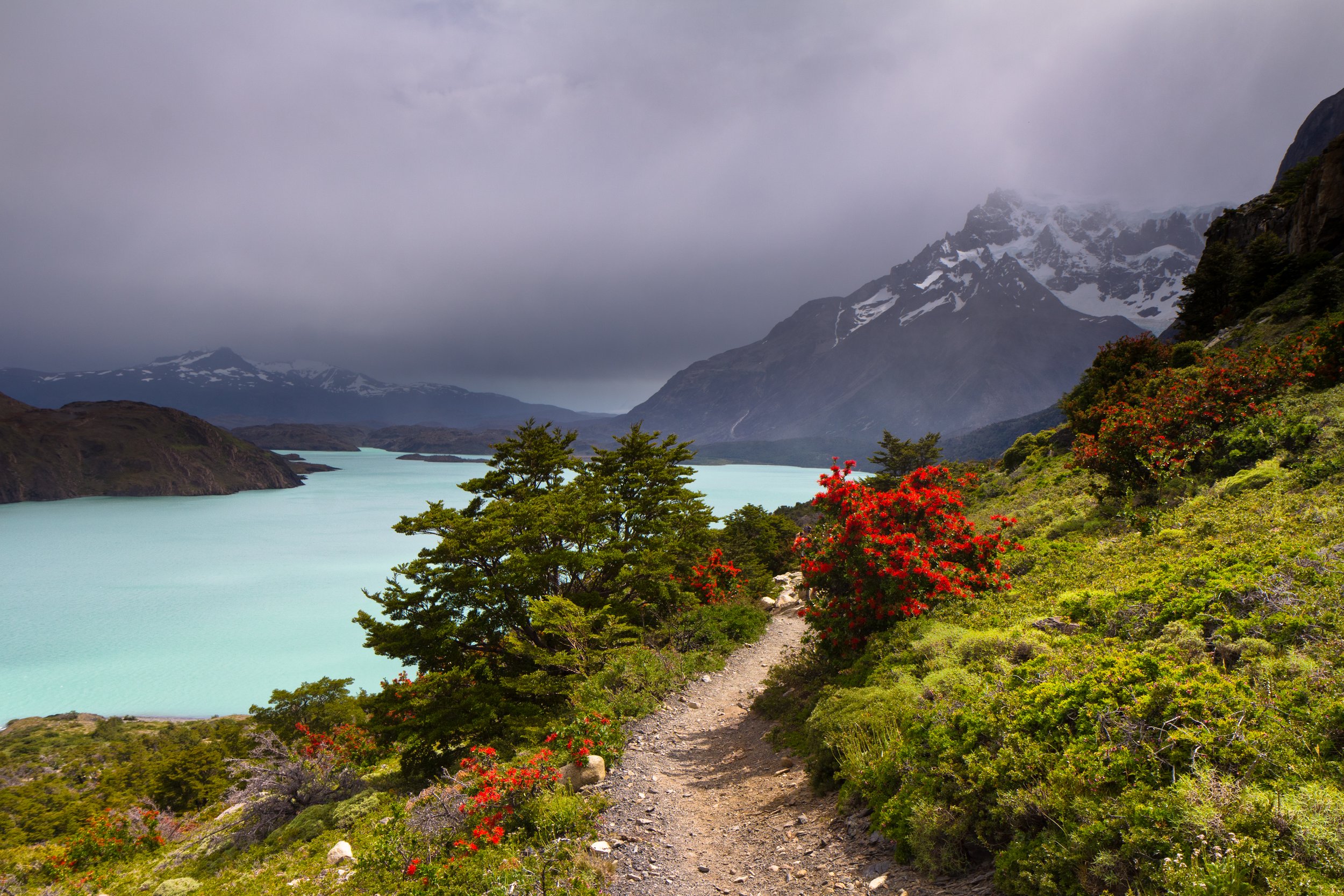
The W Circuit draws international hikers year round, giving travelers the chance to backpack through Chile’s famous national park.

The Torres Del Paine national park was first established in 1959. By 1978 the park was designated a world Biosphere reserve by UNESCO. The W Circuit, located in the park, is a multi-day trek providing experienced hikers a taste of backpacking in the southern Chilean region of Patagonia.
The trek is well known for its scenery and the relatively accessible altitude. The lack of technical skills required to hike this circuit draws in people from around the world. The W Circuit is 43 miles long, and typically takes hikers five days to complete.
The W Circuit not only shows travelers the famous scenery of the national park, but it is home to diverse landscapes that draw in hikers from around the world. Granite spires loom over a glacial lake at the base of the Torres, making the landmark an iconic stop along the hike. The east end of the hike passes by Lake Nordenskjold, a site that impresses hikers with its bright blue color surrounded by forests and peaks. Another notable portion of the hike is the French Valley. Set between mountains, the valley is situated below a glacier with a river running through it.
Getting to the national park itself can be difficult, as the nearest airport is in Punta Arenas — roughly a three hour drive from the national park. International travelers will most likely have to take more than one flight to reach the park. After reaching the W circuit, however, traveling becomes more accessible for hikers because of the refugios along the route. Refugios are essentially small lodges that hikers can stay in after a day of hiking. There are also campsites that hikers can use, although reserving a spot in advance is recommended.
Travelers set out to complete the W Circuit year round. The weather is unpredictable in general, and while there are peak seasons (typically December through February), hikers are still able to complete the circuit even during the off season. The circuit is the least accessible during the southern hemisphere winter (June, July and August in Chile), as there are often few hikers and accommodations are less readily available, but a prepared hiker can still make the trip.
The trails are consistently marked, and during peak season there are often many hikers on the trails. This makes it possible for hikers to complete the trek without a guide, as it is typically easy to follow the trail and the presence of lodges and other hikers adds an additional level of safety.

Dana Flynn
Dana is a recent graduate from Tufts University with a degree in English. While at Tufts she enjoyed working on a campus literary magazine and reading as much as possible. Originally from the Pacific Northwest, she loves to explore and learn new things.
Hut-to-Hut: Hiking in the Italian Dolomites
Mountain Huts, called Rifugios, make multiple day treks through the Italian Alps accessible to hikers.

Puez-Geisler nature park in the Dolomites. Dmitry Djouce. CC BY 2.0
The mountain range located in northern Italy has 18 major peaks and uniquely diverse mountain landscapes. The Dolomites have sharp peaks in varying shapes, along with alpine meadows and valleys that have drawn hikers for years. Mountain huts, also known as rifugios, are placed throughout the Italian mountain range, all within a day’s hike of the next hut. The trek to visit each hut is a total of 75 miles, and typically takes hikers ten days to complete. The huts are stocked with food, and offer basic bedding for travelers. While not every rifugio offers places for hikers to stay overnight, many only serve food, so travelers can stop for lunch before continuing to the next hut. The huts allow hikers to do multiple day-treks without having to pack much. All they will need is personal items and sleeping bag linings. The rifugios are open starting in June and often draw travelers of varying hiking experience.
The Dolomites first started attracting hikers during the ‘golden age of mountaineering’ in the late 19th century. Many mountaineers who first summited the peaks wrote early travel guides for the region, drawing more explorers. Then, in World War One, the Dolomites became the front line for the Italian and Austro-Hungarian armies to pass through. As a result, there are still visible remnants of the war, one being an open-air museum of Mt. Lagazuoi. The ‘castle of rock’ has complex systems of tunnels dug into the mountainside during the war. The tunnels are open for people to walk through and learn more about World War One’s impact on the region.
Additionally,a museum is dedicated to World War One on the range’s highest peak, Marmolada. The summit stands at over 10,000 feet, making the museum the highest in Europe. The locals of the region often speak Italian, German and Ladin, a Rhaeto-Romaniclanguage that is recognized as an official language of the region. Roughly 30,000 people speak Ladin, and there are considerable efforts to preserve the region’s language and the culture.
RELATED CONTENT:

Dana Flynn
Dana is a recent graduate from Tufts University with a degree in English. While at Tufts she enjoyed working on a campus literary magazine and reading as much as possible. Originally from the Pacific Northwest, she loves to explore and learn new things.
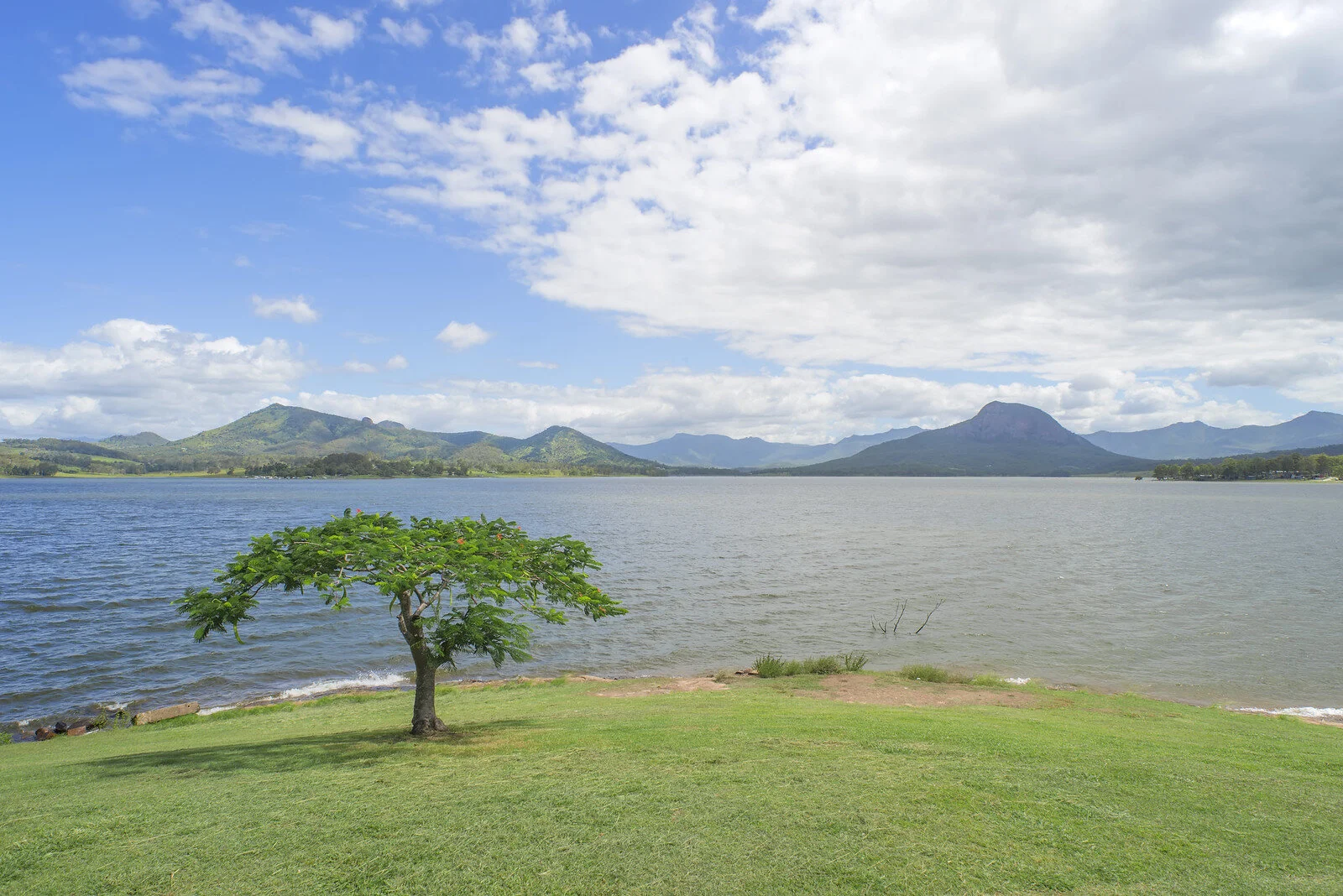
Lake Moogerah in Queensland, Australia. Lenny K Photography. CC BY 2.0.
Australia’s National Parks are Natural Wonders of the World
Australia has long been an escape for those who are seeking to get in touch with nature. While the country is most famous for its semiarid and desert regions, Australia is one of the few countries in the world which can boast a majority of the Earth’s 14 ecoregions—the continent is home to eight.
While Australia is the sixth-largest country in the world, it is one of the most sparsely populated. According to the 2016 census, 23.4 million people call Australia home, with 80% living less than 60 miles from the coast, yielding a population density of 9 people per square mile. This has left the vast majority of Australia’s ecoregions untouched by human development.
Australia’s eight ecoregions range from the very wet tropical and subtropical moist broadleaf forests—found exclusively on the northeast coast of Queensland—to the deserts and xeric shrublands which comprise a majority of the country’s landmass.
This vast diversity in natural habitats makes Australia one of the most biodiverse places in the world. According to the 2009 Numbers of Living Species in Australia and the World report, 147,579 described species had been confirmed, with the estimate for the total number of species which call the continent home at 566,398. A majority of these species are endemic to Australia, ranging from platypi to emus to kangaroos to koalas.
The National Reserve System, Australia’s counterpart to the United States’ National Park Service, is a largely new system of protected areas with the goal of preserving Australia’s vast biodiversity and ecoregions. While the first national park in the country, the Royal National Park in New South Wales, was established in 1879, the National Reserve System did not come into existence until 1992 with the ratification of the Convention on Biological Diversity.
Since then, the National Reserve System has gone on to become a vast network of over 13,000 commonwealth, state and territory protected areas, with a combined landmass of 370 million acres—about 19.75% of the country’s total landmass. Ranging from the expansive Kosciuszko National Park in New South Wales, which includes high summits which regularly see snowfall, to the famous Uluru-Kata Tjuta National Park in the Simpson Desert, Australia’s National Reserve System truly offers something for everyone.
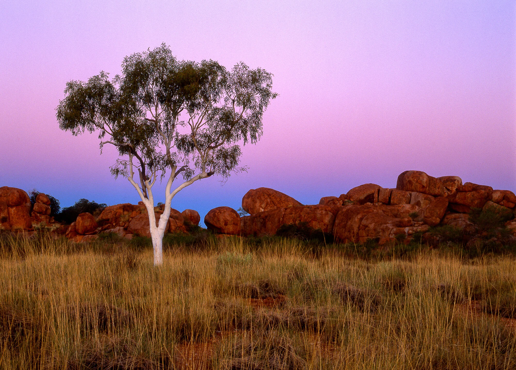
The Devil’s Marbles, a natural rock formation in the Northern Territory. Mark Wassell. CC BY-NC-ND 2.0.
For travelers who are looking to explore the desert and see some unique rock formations, Western Australia’s Nambung National Park cannot be beaten. Located in the Pinnacles Desert, Nambung offers picturesque desert views, beautiful beaches at Kangaroo Point and Hangover Bay, and the aforementioned rock formations called stromatolites. The park can be enjoyed year-round, but the most popular time to visit is in September and October, when its wildflowers are in full bloom.
Located on the southwestern coast of Victoria, Port Campbell National Park is home to breathtaking cliffs which overlook the Southern Ocean and a variety of natural islets, gorges and arches. One of the most famous, the London Bridge, provides the perfect spot to view a population of little penguins come ashore, as well as whale watching in the winter months. Port Campbell can be enjoyed year-round, with different flora and fauna prevalent throughout the various seasons of the year.
For those who can’t get enough of the rainforest, Daintree National Park in Queensland is a popular park for camping and hiking. A part of the Wet Tropics of Queensland, which were designated as a UNESCO World Heritage Site in 1988, the park is home to a variety of unique species, including 430 birds, 23 reptiles and 13 amphibians. While the park is open year-round, the best time to visit is during the drier, cooler months from May to September.

Jacob Sutherland
Jacob is a recent graduate from the University of California San Diego where he majored in Political Science and minored in Spanish Language Studies. He previously served as the News Editor for The UCSD Guardian, and hopes to shed light on social justice issues in his work.
South Korea Loves Its Mountains
Climbing the country’s many mountains is a national pastime. South Korea’s tranquil scenery allows hikers of all skill levels to escape the worries of the modern world.

Two hikers at Seoraksan. Tasmanian.Kris. CC BY-NC-SA 2.0.
If you go to South Korea, bring hiking gear. Lots of it. More so than in the United States, hiking is a communal exercise and a great to-do. A pair of sneakers and a water bottle won’t cut it when trekking up Seoraksan, a mountain located three hours from Seoul. Hikers, whether amateur or professional, purchase a catalog’s worth of clothing for even a short afternoon hike. In addition to the equipment, bring an appetite. Food, along with a little rice wine, will be served once—at the very least.
Hiking is less of a hobby and more of a national pastime for South Korea. Two-thirds of South Koreans climb a mountain at least once a year, and almost a third go once a month. Companies that make hiking equipment find a lucrative market in the country, since retailers have estimated that the average hiker wears $1,000 worth of gear for each trek. South Korea’s 22 national parks see roughly 45 million visitors a year.
There are many reasons why climbing mountains is such a widely enjoyed pastime. For one, they’re everywhere. Most people live within an hour or two of a hiking trail. Subways and buses provide easy transport, not to mention that multiple hiking groups offer group expeditions. Beginning in 1967, South Korea began setting aside its many mountains as national parks. By the end of the 1980s, over 2,000 square miles had been designated as national parks. This amounts to 6% of South Korea’s landmass.

The sun shines on Dobongsan. Giuseppe Milo. CC BY 2.0.
Mountains figure prominently in national myths as well. Dangun, the mythical founder of Korea, is said to have been born on Mount Paektu, along the border between China and North Korea. The mountain is mentioned in the national anthems of both North and South Korea. Additionally, South Korean culture values “pungsu,” a practice similar to feng shui, that emphasizes harmony with nature. With mountains located so close to big cities like Seoul, they provide a picturesque respite for hard workers.

South Korea’s fall foliage. Brandon HM Oh. CC BY-NC-ND 2.0.
However, only recently did the mountains attract as many mountaineers as they do now. Park Chung-hee, president in the 1960s and ‘70s, encouraged businesses to lead employees on group hikes as a community-building tool. The residual effects of this policy are still widely felt. A long lunch break often provides enough time for a quick trek. Many trails shoot straight to the peak before climbing down, allowing for brisk and efficient exercise. This may be annoying for many enthusiasts who want to savor the panoramic views the mountains offer.

A hike through Bukhansan. golbenge. CC BY-SA 2.0.
Citizens have plenty of mountains to choose from, such as those in the Taebaek and Sobaek ranges. Seoraksan, South Korea’s third-tallest peak at 5,600 feet, takes only three hours to climb, and fiery fall foliage attracts many to this mountain in particular. However, its beauty is nearly matched by other peaks. For example, Bukhansan gives urbanites in Seoul a chance to unwind in the great outdoors. Located just outside the city, it is affectionately called the “lungs of Seoul.”

The Taebaek Mountains in winter. mariusz kluzniak. CC BY-NC-ND 2.0.
South Korea’s hiking culture is visible even among those who emigrate. In Southern California, South Korean immigrants often don the same gear for hiking Runyon Canyon in Los Angeles that they would for Seoraksan. Backpacks bulge with Tupperware stuffed with South Korean delicacies for a midday picnic. For these hikers, traveling the trails is more than a hobby. It’s a way of keeping a precious national tradition alive.

Michael McCarthy
Michael is an undergraduate student at Haverford College, dodging the pandemic by taking a gap year. He writes in a variety of genres, and his time in high school debate renders political writing an inevitable fascination. Writing at Catalyst and the Bi-Co News, a student-run newspaper, provides an outlet for this passion. In the future, he intends to keep writing in mediums both informative and creative.

The confluence of two arms of the Kaskawulsh Glacier in the Yukon. Richard Droker. CC BY-NC-ND 2.0.
Glacier Hunting in the Pacific Northwest
Glaciers have long been an object of fascination for many curious travelers and scientists. These frozen rivers, slowly ebbing and flowing past mountains for thousands of years, have become synonymous with Antarctica, Greenland, Patagonia and the Arctic.
One other region which is home to a number of glaciers is Upper Cascadia, an area encompassing British Columbia, the Canadian Rockies in Alberta, the Yukon and southeast Alaska. Given their proximity to the cities of Anchorage, Calgary, Juneau and Whitehorse, many of these glaciers are accessible to curious travelers who do not want to break the bank on a global expedition into an unknown icy world.
While many of these glaciers remain intact, all have been subjected to warm temperatures as a result of climate change, which has caused dramatic melting of ice and changes to the region’s biodiversity.
Regardless, these icy wonders continue to wow and inspire hundreds of thousands annually. For those interested in taking a glimpse into the frozen world, below is a list of some of the most popular glaciers in the Pacific Northwest.
Mendenhall Glacier — Juneau, Alaska
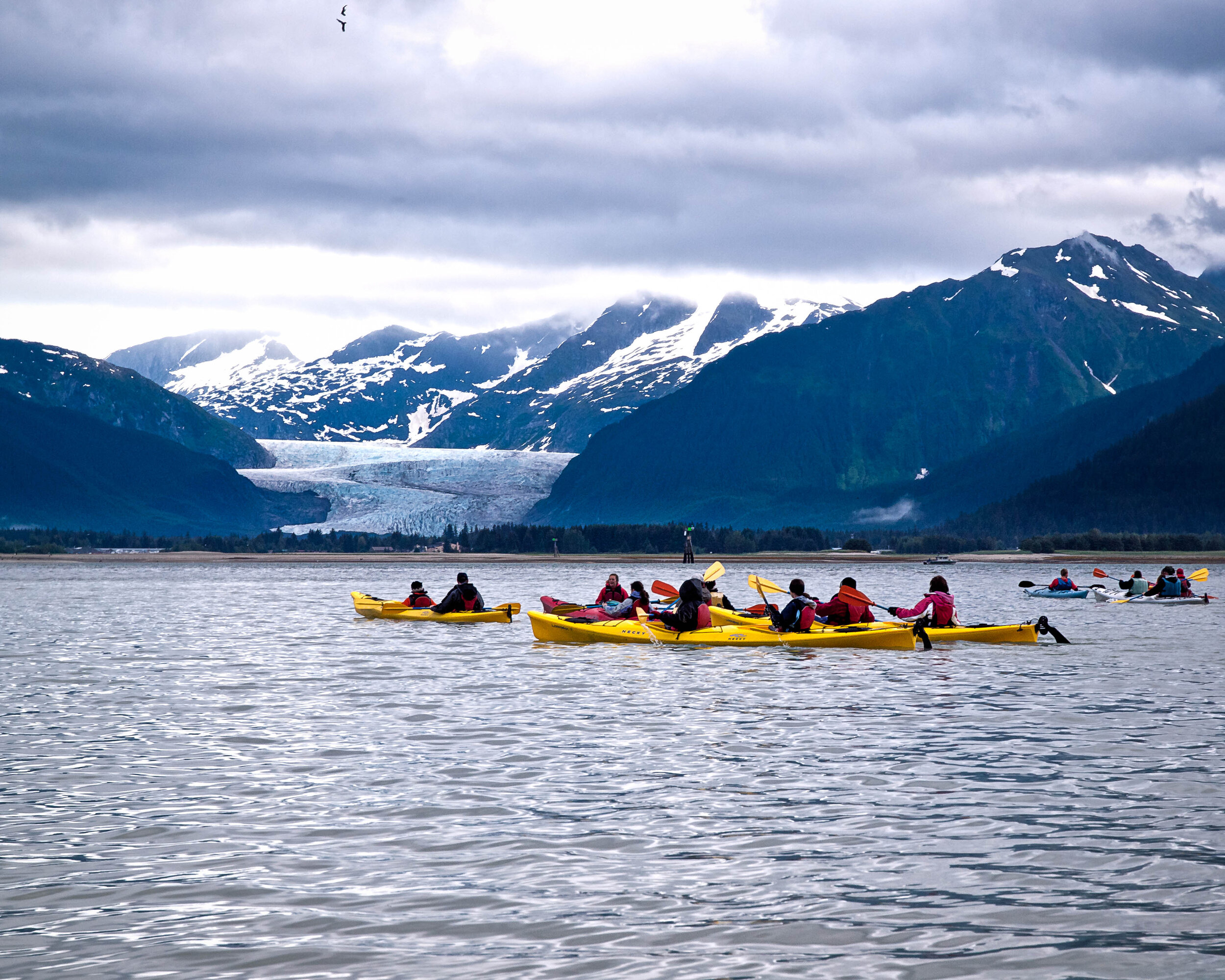
Kayakers in Mendenhall Lake, with the mouth of the Mendenhall Glacier in the background. Peter Lee. CC BY-NC 2.0.
One of the most accessible glaciers in North America, the Mendenhall Glacier is located just12 miles outside of downtown Juneau, Alaska. The glacier is a defining feature of the Tongass National Forest and draws around 500,000 visitors annually.
While visitors to the park cannot walk on the glacier itself, the forest is home to a number of activities and viewing areas which allow for a more personalized viewing experience. Kayaks, telescopes, ranger talks and a movie are available at the visitor center. Likewise, those interested in hiking can take one of five trails around the forest, with the Photo Point Trail offering the best views.
Given its proximity to Juneau International Airport, many glacier hunters visit Mendenhall before hopping on a seaplane or helicopter to head to the nearby Herbert and Taku glaciers in addition to Glacier Bay National Park.
Kaskawulsh Glacier — Kluane National Park, Yukon
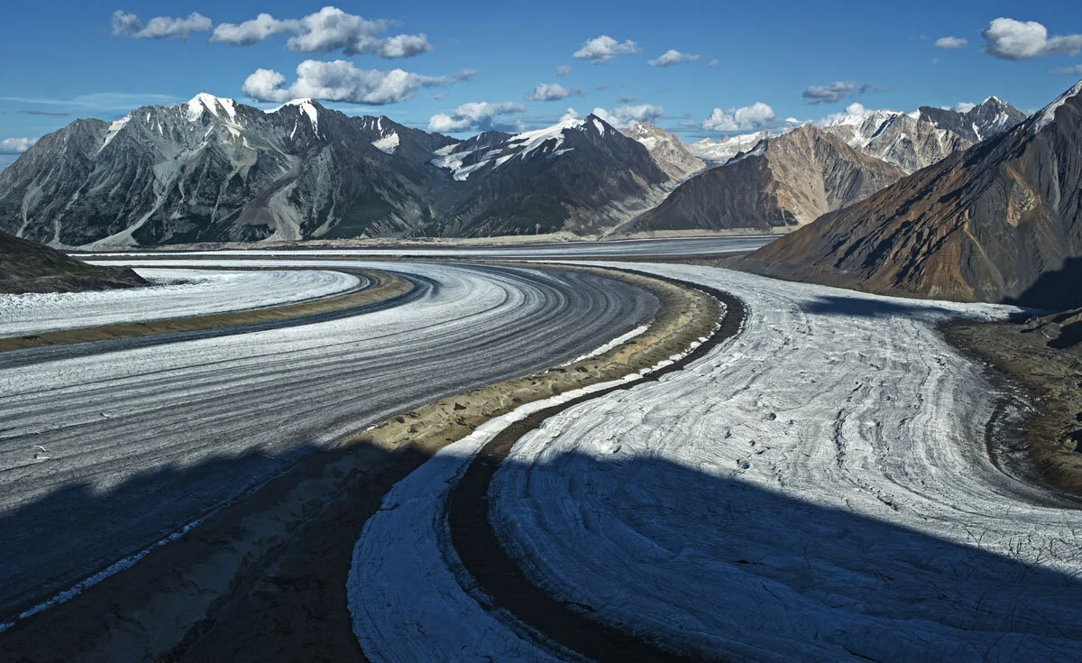
The confluence of the south arm of the Kaskawulsh Glacier. Richard Droker. CC BY-NC-ND 2.0.
Located in the St. Elias Mountains in Kluane National Park, the Kaskawulsh Glacier is one of the largest and most visited glaciers in the Yukon. While this glacier is a bit more remote—the national park is about 100 miles away from Whitehorse, capital of the Yukon and the nearest city with an international airport—many glacier hunters undertake the long trek to enjoy hiking, skiing and snowshoeing.
The Kaskawulsh Glacier in recent years has begun to retreat due to rising temperatures as a result of climate change. The St. Elias Mountains lost 22% of their ice cover between 1957 and 2007, and the Kaskawulsh Glacier specifically lost 6.6 square miles of ice between 1977 and 2007. While the region has not met the same fate as has Glacier National Park in Montana, which lost the majority of its glaciers over the past 50 years, visitors interested in visiting Kaskawulsh are encouraged to do so sooner rather than later.
Kenai Fjords National Park — Alaska
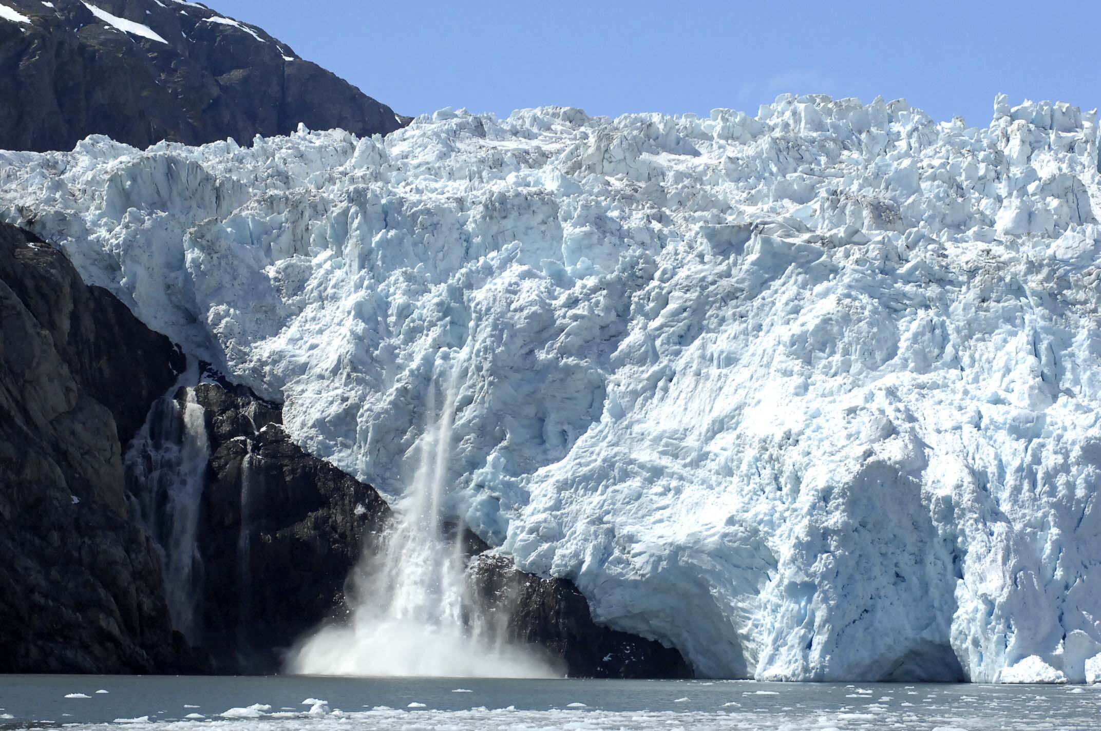
The Holgate Glacier in Kenai Fjords National Park. National Parks Service of Alaska. CC BY 2.0.
Kenai Fjords National Park, which is situated 130 miles south of Anchorage near Seward, Alaska, is home to a quarter of the state’s glaciers. While the park’s icefields have receded due to climate change, many glaciers are still intact, drawing in hundreds of thousands of visitors annually. Popular glaciers in the icefield include Bear Glacier, which is the longest in the park, and Exit Glacier, the only one accessible by road.
Visitors to the park can hike the Harding Icefield Trail, which is an intense 8.2 mile round trip trail that showcases the park’s glaciers, fauna and vegetation. Those interested in visiting the park should opt to take the Alaska Railroad, which runs daily between Anchorage and Seward and offers immaculate views of the surrounding fjords, forests and mountain ranges which lie between the two cities.
Ha-Iltzuk Icefield — British Columbia

Icefields in British Columbia as seen from the International Space Station. NASA’s Marshall Space Flight Center. CC BY-NC 2.0.
The Ha-Iltzuk Icefield is the largest icefield in the Coast Mountains of British Columbia. The region is home to a number of glaciers, lakes, rivers, mountains and volcanoes. Given that the field is in a remote part of the province and is not accessible by road, most visitors opt to charter a helicopter for excursions.
While camping in the park, many choose to visit the Silverthrone and Klinaklini glaciers, both of which flow toward the south, as well Mount Silverthrone, which is surrounded by a number of smaller, unnamed valley glaciers.
Athabasca Glacier — Alberta

The Athabasca Glacier in the Columbia Icefield. Lord Lucan Lives. CC BY-ND 2.0.
The Athabasca Glacier is one of the six principal toes of the Columbia Icefield in Alberta’s Jasper National Park. The most visited glacier in North America, Athabasca’s four-mile length is home to some rare species of animals including flying insects which can survive in minus 30 degrees Celsius.
The glacier has receded due to climate change, losing 0.9 miles of length over the past 150 years, when markings of glacial retreat first began to be measured. The glacier currently loses an estimated 16 feet each year, and is expected to disappear near the end of the century. Visitors to the park are encouraged to be mindful of the flora and fauna and must take efforts to ensure that none of the biodiversity is disturbed by their excursions.

Jacob Sutherland
is a recent graduate from the University of California San Diego where he majored in Political Science and minored in Spanish Language Studies. He previously served as the News Editor for The UCSD Guardian, and hopes to shed light on social justice issues in his work.
10 Isolated Travel Destinations in the US
Thinking about your next trip once the pandemic eases? This year, try one of these remote spots where isolation will be the theme. From Maine to Montana, explore nature free from crowds.
Read More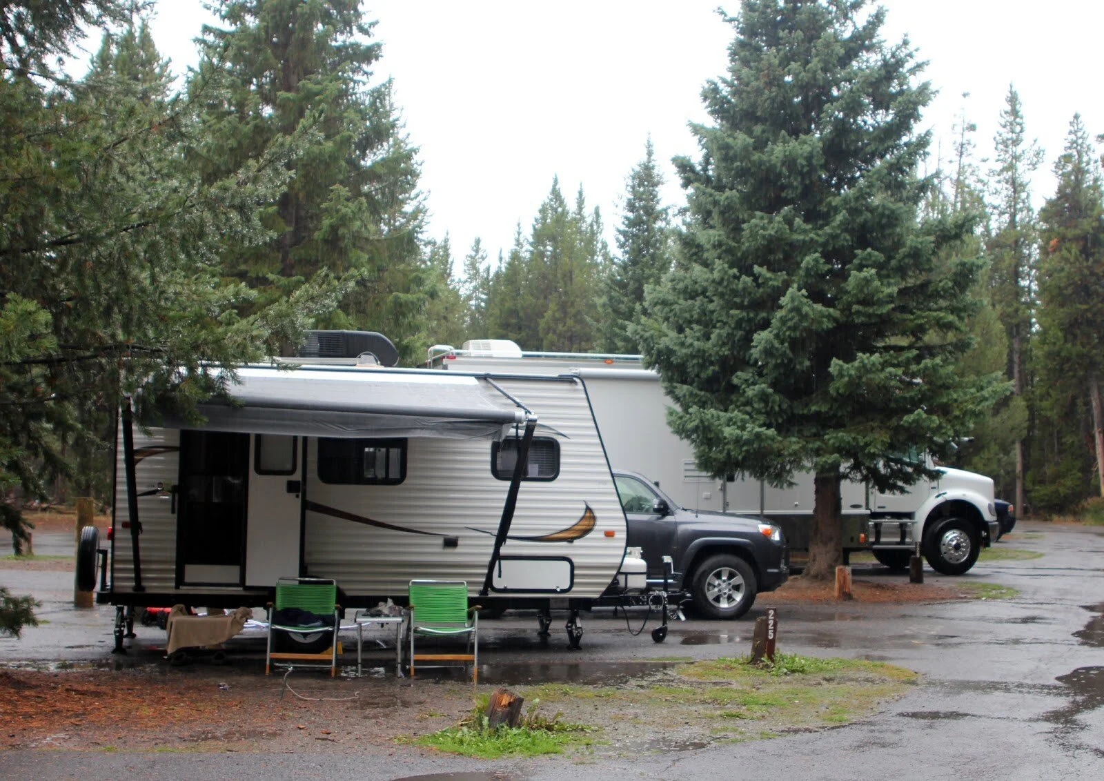
RVs at Fishing Bridge RV Park in Yellowstone. Yellowstone National Park. CC0.
RV There Yet? 8 Great RV Adventures for a Socially Distanced Summer
As COVID-19 changes the way we can travel or feel comfortable traveling, people are considering renting RVs to take on road trips as an alternative summer adventure. State parks and campgrounds are beginning to reopen across the U.S., but have restrictions in place in order to balance public safety with the enjoyment of being outdoors. Some major national parks like Death Valley do not yet have plans to reopen for the summer. For the parks that do open, it is inevitable that the limited spaces will fill up quickly, so you might want to plan to visit less popular scenic destinations. And with many visitor centers and hotels remaining closed, renting an RV might be the best way to have a safe, fun summer. Be sure to check local regulations often as closures and travel restrictions change quickly.

A beautiful sunset over Sebago Lake in Maine. Paul VanDerWerf. CC BY 2.0.
New England – Sebago Lake, Maine
Nestled in southern Maine is the deepest and second largest lake in the state—Sebago Lake. Visitors can fish for Atlantic salmon, lake trout and large and smallmouth bass, among others. Locals advise anglers to use live or realistic bait when fishing because of Sebago Lake’s crystal-clear water. Visitors interested in swimming can head to any of the many sandy beaches on the shores of the lake, but should keep in mind that some of the beaches do not have lifeguard supervision. If you are more interested in hiking and biking, the nearby White Mountains provide the perfect opportunity to explore marked trails. While Sebago Lake also offers activities such as an amusement park and golf courses, they may likely be closed for summer 2020. RVs can be parked at any campground on the lake’s shores.

A beautiful view of the Loyalsock Valley in Worlds End State Park. Nicholas Tonelli. CC BY 2.0.
Mid-Atlantic – Worlds End State Park, Pennsylvania
One of the best places for a socially distanced outdoor adventure is Worlds End State Park in Sullivan County, Pennsylvania. The popular 59.2-mile backpacking trail—the Loyalsock Trail—plays host to a multitude of waterfalls and impressive views. For those who are not interested in hiking but still want to see what the region has to offer, Dry Run Falls is easily accessible in the neighboring Loyalsock State Forest and is located close to a parking area. Splashing in Loyalsock Creek’s ice-cold water is sure to be refreshing as the summer sun turns up the heat. Keep in mind that swimming is prohibited in any other water source at the park, and lifeguards are not on duty. Worlds End offers 70 camping sites, half with electric hookups.

Big Sable Point Lighthouse in Ludington State Park. Rachel Kramer. CC BY 2.0.
Midwest – Ludington State Park, Michigan
If you are most interested in fishing, Ludington State Park offers an abundance of bass, northern pike, bluegill, perch and walleye. A favorite hiking destination is the 112-foot Big Sable Point Lighthouse on the shores of Lake Michigan. Visitors can choose from any of the eight marked hiking trails or can head to the picturesque canoe pathway that is sure to attract avid canoers and kayakers, along with novices. The park offers plenty of RV parks and campgrounds, some with free Wi-Fi, showers and restrooms. Visitors should keep in mind that the Michigan State Park Recreation Passport, which costs Michigan residents $12 and nonresidents $34 per vehicle, is required to enter Ludington State Park.

View of the Cherohala Skyway with the fall canopy of the adjacent northern hardwood stands, in Graham County, North Carolina. Brian Stansberry. CC BY 3.0.
South Atlantic – Cherohala Skyway, North Carolina to Tennessee
The 43-mile Cherohala Skyway is the perfect ride for those looking for vistas of forested mountainside, hiking trails, waterfalls and unobstructed scenic overlooks. The National Scenic Byway climbs up mountains for 18 miles in North Carolina and winds down the Appalachian mountainsides for another 23 miles into the deep forests of Tennessee. The Cherohala Skyway, named after the Cherokee and Nantahala National Forests that it crosses through, is free from crowds—making it a perfect destination for this summer. Along the scenic highway is Indian Boundary Lake, the Tellico River and Bald River Falls, and of course, many beautiful spots for long or short hikes. There are plenty of campgrounds along the scenic route, some more popular than others, so choose according to your comfort levels and COVID-19 regulations.

Southeast – Jekyll Island, Georgia
For a truly unique RV destination, Jekyll Island is a great choice. Bird-watching, biking, swimming and kayaking are only some of the activities you can choose from. One of the most interesting sites to see on Jekyll Island is Driftwood Beach, which transports visitors to a surreal world. The bleached and preserved oak trees appear as though they are growing out of the sand, like a spooky, living boneyard. The Georgia Sea Turtle Center is beginning to reopen and is currently limiting admissions to 50 people at a time. Some activities at the rehabilitation center have been canceled for the time being, but keep it in mind for any future trips to Jekyll Island. The Jekyll Island Campground is available for parking an RV this summer, but reservations should be made to ensure your spot is secured.

Paluxy River in Dinosaur Valley State Park. Russ. CC BY-SA 2.0.
Southwest – Dinosaur Valley State Park, Texas
Dinosaur Valley State Park earned its name from the fossilized dinosaur tracks left in the mud along the edges of the Paluxy River in Glen Rose, Texas. The park has over 20 miles of trails to explore and hike. Visitors can book a horseback riding lesson from the Eagle Eye Ranch Carriage Company or go geocaching if they are not interested in visiting the Paluxy River to swim, kayak or fish. Park your RV in any of the 41 fully-electric campsites. Advance reservations are required.
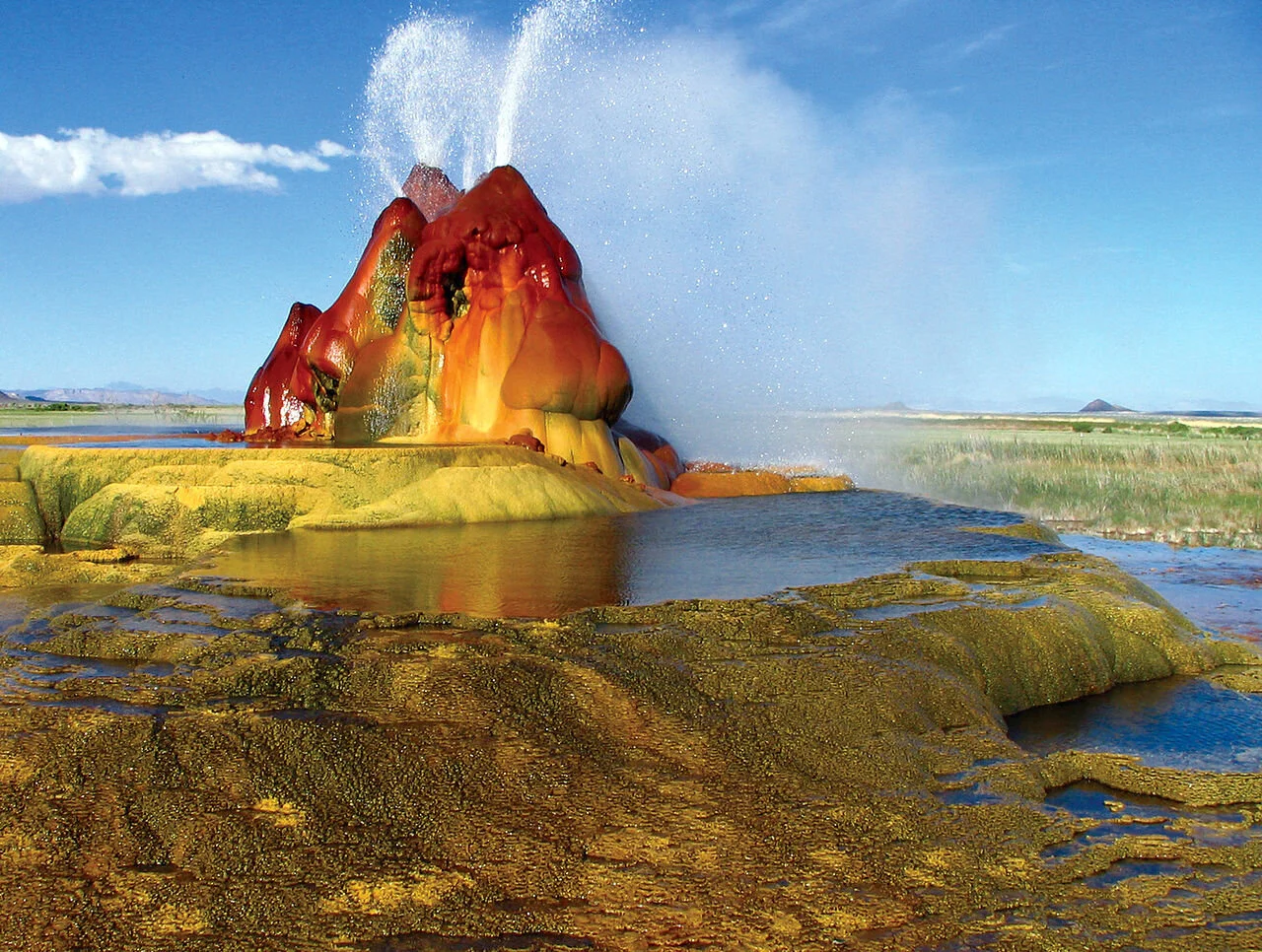
The Fly Geyser in the Black Rock Desert Wilderness. Jeremy C. Munns. CC0.
Mountain West – Black Rock Desert Wilderness, Nevada
The enchanting Black Rock Desert Wilderness is made up of lava beds and various playas, including the dry lakebed of the prehistoric Lake Lahontan. It is home to the annual Burning Man festival, which will take place virtually this year. Visitors can hike any of the 180 miles of nearly-unexplored trails that wind through the area. One of the most exciting sites is the rainbow-colored Fly Geyser. The geyser is the man-made result of a 1964 drilling accident by a geothermal power company that was drilling a test well. Over the years, calcium carbonate deposits have formed over three large mounds that have grown to almost 6 feet tall. Artificial or not, the Fly Geyser is truly a captivating, colorful sight. RV campgrounds do not have any amenities, so keep that in mind when deciding whether to stay at the Black Rock Desert or a private campground in bordering towns.

Colorful beach glass on Glass Beach in Fort Bragg. Gustavo Gerdel. CC BY-SA 4.0.
Pacific West – Fort Bragg, California
For a beachier RV destination, the coastal city of Fort Bragg in Northern California is a great choice for its charming views. Glass Beach at the southern end of MacKerricher State Park offers an interesting alternative to plain sand beaches with its countless beads of naturally polished sea glass. Don’t miss out on Van Damme State Park’s miniature Mendocino cypress forest and be sure to visit the Mendocino Coast Botanical Gardens, most known for their rhododendrons that thrive in the humid, coastal climate. The Mendocino Coast Botanical Gardens are not yet open to the general public, but are gradually lifting COVID-19 restrictions so it’s worth it to keep checking when they’ll be open to all visitors. Some RV parks and campgrounds in and around Fort Bragg (in particular the campgrounds in the California State Park System) are temporarily closed, while others are slowly reopening for business. Be sure to call and reserve a spot before you go.

Asiya Haouchine
is an Algerian-American writer who graduated from the University of Connecticut in May 2016, earning a BA in journalism and English. She was an editorial intern and contributing writer for Warscapes magazine and the online/blog editor for Long River Review. She is currently studying for her Master’s in Library and Information Science. @AsiyaHaou
Wanderlust: Plose in South Tyrol, Italy
Film makers Peter Jablonowski, Thomas Pöcksteiner, Maximilian Lang and Lorenz Pritz share with viewers their hiking exploration of Plose, a mountain in South Tyrol, Italy. Here, we can see that the possibilities for mountain sport activities, cultural visits, outings, and undertakings are boundless. In addition, the area is known for drawing in culinary fans with its hearty cuisine, which is loved far beyond the borders of South Tyrol. Many travelers enjoy the exceptional wines, chestnut treats, apple creations, and farm specialties too.
Exploring California's Montana de Oro State Park
With its rugged cliffs, secluded sandy beaches, coastal plains, streams, canyons, and hills (including 1,347-foot Valencia Peak!), naturalists and backpackers can experience the solitude and freedom found along Montana de Oro’s trails in California.
Hiking the "Deadly" Kalalau Trail
Ryan J. Harris and his travel mates attempt to hike up the dangerous Kalalau Trail in Hawaii in pursuit of the best pizza in the world. Usually you just pick up the phone and call Dominos but sometimes to get a good slice you got to put in work. They hiked the Kalalau Trail in search of a mystical pizza maker they had gotten word of.
CHINA: The Longest Way
Christopher Rehange walked through China for one year, 4500 km. He let his hair grow and had many adventures along the way.
Read More