
At more than 10,000 feet, Fansipan Mountain in Vietnam is the tallest mountain in SE Asia. Hikers traverse clouds and thick forests to get to the top. Cable cars ascend to the peak for those who don’t want to make the trek.
Read MoreTrekking Up Le Morne Brabant Mountain in Mauritius
This mountain, which serves as a symbol of hope, offers hikers a breathtaking view of Le Morne beach and remains a meaningful part of local Mauritian culture.

Le Morne beach in Mauritius. Colours of Mauritius. Unsplash.
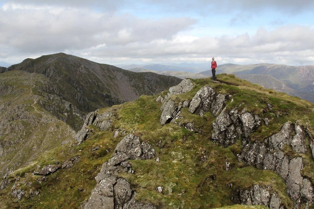
Tucked away in Mauritius lies Le Morne Brabant mountain, a site known for its beautiful hiking path and bird’s-eye views of the surrounding beach.
With the mountain sitting at 1,824 feet above sea level, the hike to the top takes around three to four hours depending on the speed and size of the group. This hike is no easy feat, as special equipment is required to actually reach the summit due to the steepness of the climb. The trail measures over two miles and is shrouded in greenery and vegetation. Since Le Morne Brabant is situated on private land, it is notably one of the most well preserved and wildest mountains on the island.
The mountain was made a UNESCO World Heritage Site back in 2008, and was closed to the public shortly after. It was not until 2016 that the site reopened to visitors. This was a rather controversial decision, as many believed that reopening the site would contribute to its destruction. Because of this, there are several restrictions in place for visitors to ensure that this doesn’t happen. For example, most hikers need to be accompanied by a professional guide with EFR/WFA certification, and hikers need a further specialized guide to access the second area of the trail.
The site also has a rich historical significance. Back in the 1600s, the Dutch East India Company first took slaves to Mauritius to work on sugarcane and tobacco plantations, and by the late 1700s, many more slaves were brought over from other places in Africa and India. Before slavery was later abolished under British rule, Le Morne Brabant was used as a makeshift refuge shelter for runaway slaves. Due to Le Morne’s steep cliffs and isolated location, the escaped slaves were able to easily hide there . They eventually created small settlements on the summit and in the caves along the mountain, where they were able to remain safe.
Today, the community continues to honor the meaningful history of the mountain, which is viewed as a beacon of hope. Every year on February 1, the community celebrates the commemoration of the abolition of slavery at the International Slave Route monument, which is situated at the foot of the mountain.

Zara Irshad
Zara Irshad is a third year Communication student at the University of California, San Diego. Her passion for journalism comes from her love of storytelling and desire to learn about others. In addition to writing at CATALYST, she is an Opinion Writer for the UCSD Guardian, which allows her to incorporate various perspectives into her work.
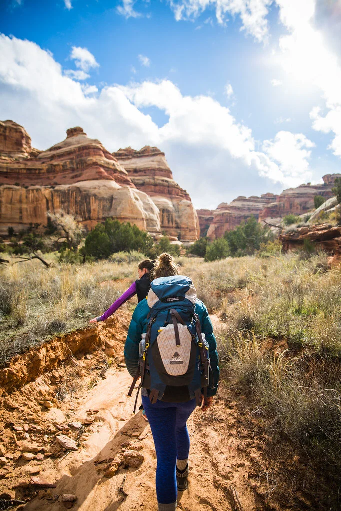
5 of the World’s Most Dangerous Hiking Trails
Everyone loves a good hike, but some trails around the globe stand out due to the intense challenges that they provide. The following five hikes should not be attempted by novice hikers.
Aonach Eagach, Scotland. Andrew Marshall. CC BY-NC-SA 2.0.
Hiking can test our physical and mental limits, and is a powerful cardio workout that is proven to boost your mood. While it can be fun to test yourself and get your adrenaline flowing and blood pumping, there are some hikes around the world that can cause serious injuries if you are not careful.
These five hiking trails are not for the faint-hearted and should not be attempted by novice hikers.
El Caminito del Rey, Spain. Arthur Harrow. CC BY-NC-ND 2.0.
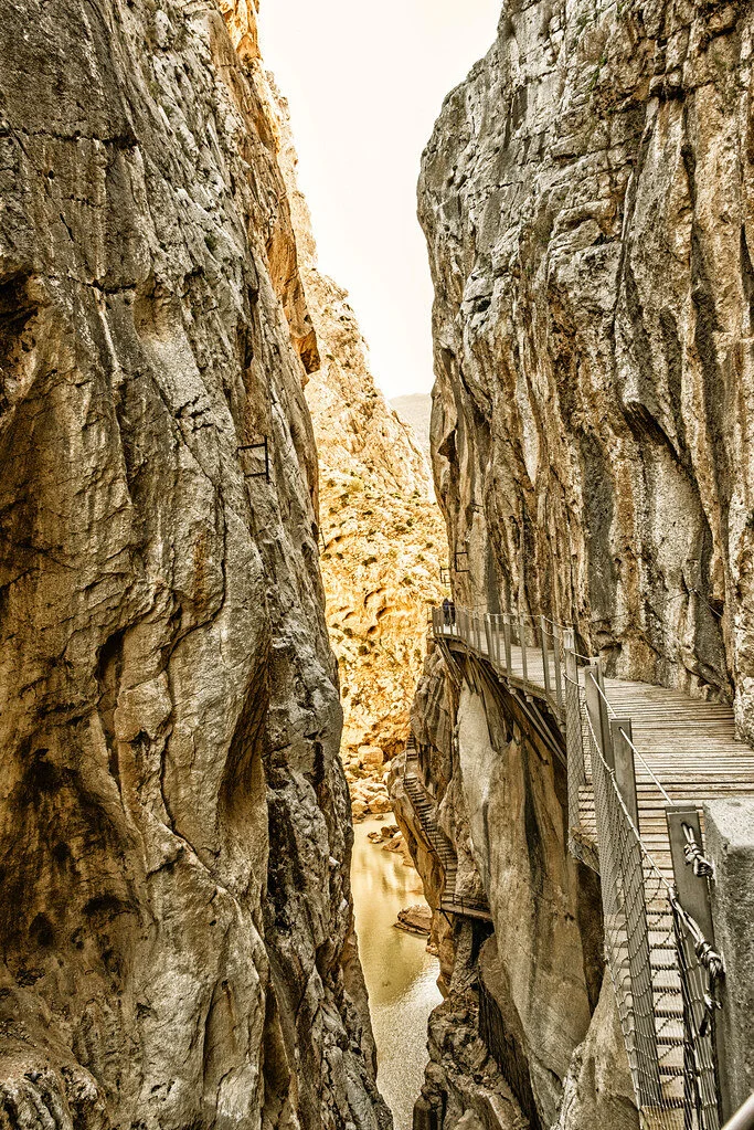
1. El Caminito del Rey, Spain — 4.8 miles
The name of this hike translates to “The King’s Little Pathway,” and it once was one of the world’s most hazardous footpaths. This aerial path is suspended 100 meters high against the walls of a gorge,. It was originally built from 1901 to 1905 between the waterfalls of Gaitanejo and El Chorro to move materials and workers to the local hydroelectric dam. The trail is named “The King’s Little Pathway” because, in 1921, King Alfonso XIII opened it to visitors and traveled along the walkway to the Conde de Guadalhorce dam.
The Caminito del Rey route runs through cliffs, canyons and large valleys. The area is inhabited by a wide variety of plant and animal species, such as Egyptian vultures, griffon vultures, golden eagles and wild boar. The path takes about three to four hours to walk, starting in the town of Ardales and ending in Álora.
The path closed to hikers in 2001 when five people fell to their demise into the river below. Fences were since built into the renovated path and it reopened in 2015.
Cascade Saddle. Tom@Where. CC BY-NC 2.0.
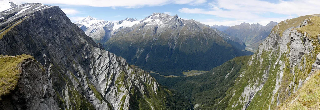
2. Cascade Saddle Route, New Zealand — 29.9 miles
This trek takes almost two days, or four to five days if you choose the expert route. Built in 1939 and located in the Matukituki Valley area and Mount Aspiring National Park in the Otago region, the route travels through scenery featured in the Lord of the Rings films, so many visitors flock to this route for photo opportunities.
The Cascade Saddle route is an alpine crossing recommended for experienced trampers. It is also recommended to hike it only in good weather during the summer. The Department of Conservation advises hikers to begin from the Matukituki side of the route, since ascending is much safer than descending. There are various different routes to take from there.
However, this route can be very dangerous in some parts, where the ground is slippery and unstable—especially when it is raining. Furthermore, there is danger of avalanches from June to November. Check the New Zealand Avalanche Advisory website before you go.
Several hikers have been injured on this trek, and some have even died. If you go, be sure to have the right skills and experience to make the decisions best for you along the trek—you must also bring the proper equipment.
Aonach Eagach ridge. mr__fox. CC BY-NC-ND 2.0.
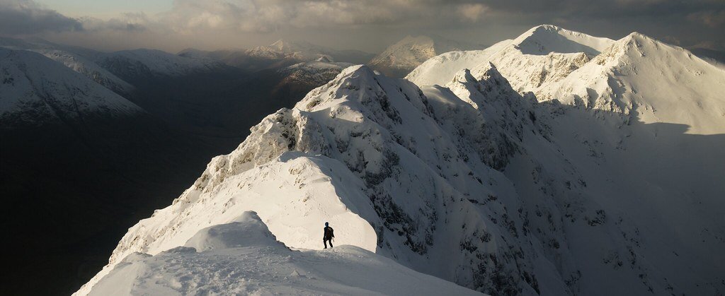
3. Aonach Eagach, Scotland — 6 miles
Located near Kinlochleven in the Scottish Highlands, the Aonach Eagach trail features beautiful wildflowers and mountainous scenery. However, it is also a hard, exposed scrambling ridge between Am Bodach and Stob Coire Lèith. Getting to the summit requires endurance, hard work and lots of climbing. The ridge is 3,126 feet high, making this trail one of the U.K.’s toughest ridge walks.
The trail is only recommended for very experienced hikers in good weather conditions. The rocks can get very slippery in rainy conditions, and side paths are often extremely hazardous and difficult to return from. Over the last 10 years, there have unfortunately been many deaths on the trail, the most recent being in 2017.
The trail is best done east to west, and those who push through the experience are rewarded with the view of a lifetime.
Backpacking in Utah. Zach Dischner. CC BY 2.0.
4. The Maze, Utah, USA — 2.9 miles
Although short, trails in the Maze are ancient and lead into various different canyons. Located near Gunlock, Utah, the Maze Overlook Trail requires basic climbing skills in order to navigate steep portions of rock. A 25-foot length of rope also comes in handy to raise or lower packs in difficult spots.
The Maze sees only 2,000 hikers per year since it is so remote and is the least accessible hike in the Canyonlands. The best time to go is in the spring, when temperatures are lower.
The Maze is quite literally a maze of intertwined canyons and dead-ends. The routes do not have beaten trails and they often weave up and over canyons, which are extremely difficult to traverse. Water sources in the Maze are also very limited. Part of the danger comes from how it can take rescuers up to three days to reach hikers because the path is so remote.
The highlight of this difficult and remote path is the view. Hikers will be able to see the Colorado River and Green River converge from atop a massive desert rock in a breathtaking view. Visitors can also see petroglyphs (prehistoric rock carvings) from ancient human history.
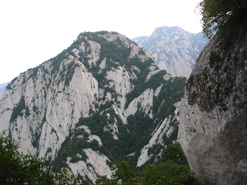
Mount Huashan. Jinjian Liang. CC BY-NC-ND 2.0.
5.Mount Huashan, China — 12.2 miles
Located near Huayin in the Shaanxi province of China, Mount Huashan trails are not very trafficked due to their narrow peaks and dangerous, steep paths. However, the trails feature beautiful wildflowers and scenery, as well as built-in steps and light poles.
Mount Huashan is known to be one of China’s five sacred mountains and one of the most popular pilgrimage sites for Chinese people. It is also considered by many to be the original place of Chinese civilization and is praised as the “Root of Huaxia (China).” The famous plank walk is 7,070 feet high and located on the mountain’s highest peak. There are many different trails to follow in the mountain, but the Changkong Plank Trail is the most dangerous and thrilling. The 700-year-old trail is only 12 inches wide.
The first few miles of the trail are a gradual ascent until Thousand Foot Narrow, and then the trail becomes narrow and steep toward the North Peak. There are many places to stop to experience breathtaking sunrises or sunsets and mountainous scenery. This trail is meant for only very experienced hikers.

Isabelle Durso
Isabelle is an undergraduate student at Boston University currently on campus in Boston. She is double majoring in Journalism and Film & Television, and she is interested in being a travel writer and writing human-interest stories around the world. Isabelle loves to explore and experience new cultures, and she hopes to share other people's stories through her writing. In the future, she intends to keep writing journalistic articles as well as creative screenplays.

A view of Nevado Sajama in Bolivia. Pierre Doyen. CC BY-NC-ND 2.0.
6 Mountains to Hike that You May Have Never Heard of
Our guide to 6 lesser-known mountains for your next hiking adventure, for all hiking levels, from California to Bolivia.
Read More
The departures board at the TWA Flight Center in New York. Wally Gobetz. CC BY-NC-ND 2.0.
Stuck at Home? Try These 5 Virtual Travel Experiences
With uncertainty surrounding the pandemic’s end, many sustainable travelers are unsure of when they will be able to venture back out into the world. Sustainable travel is rooted in the idea that one’s trip leaves a positive impact on the community visited, and the risk of spreading COVID-19 to remote communities around the globe directly interferes with this principle.
However, many sustainability and social action travel companies have pivoted from in-person travel to offer a variety of virtual experiences which connect travelers with communities they would otherwise be unable to visit. Likewise, a number of tourism organizations, tech developers and travel lovers have created their own virtual travel offerings. This allows communities around the globe which have traditionally been reliant on tourism to maintain economic sustainability during this period of uncertainty. Here is our guide to five organized virtual travel experiences that you can do from the comfort of your home.
1. Learn to Prepare Mexican Salsas with ExplorEquity

A variety of salsas. Chasing Donguri. CC BY-NC-SA 2.0.
Salsa is synonymous with Mexican cuisine. The delicious topping for chips, tortillas, tacos, burritos and enchiladas can trace its origins back to the Aztec, Mayan and Incan empires. Later popularized in Mexico and the United States throughout the 20th century, the salsa we know today can be made from combining an endless variety of ingredients. Given the regionality of Mexico’s cuisine, the country continues to innovate the popular dish in local restaurants, cafes, bars and homes.
With this unique virtual experience from ExplorEquity, travelers will learn to make a green creamy salsa, a red molcajete salsa and salsa macha. Led by chef Natalia from Mexico City, this virtual experience is perfect for salsa amateurs and connoisseurs alike. Each of the three recipes yields two servings, making this the perfect class to take with friends and family. ExploreEquity’s “Learn to Cook Mexican Salsa” class costs $39 per person and is generally offered every few weeks.
2. Practice Yoga in Sri Lanka, India and Portugal with Soul & Surf

A person practicing yoga on a beach in India. Dennis Yang. CC BY 2.0.
The origins of yoga date back thousands of years, but the practice is most commonly associated with Hinduism as one of its six orthodox philosophical systems. While still commonly associated with India, which is home to the world’s largest Hindu population, yoga over the past few decades has gained worldwide popularity for its physical benefits and meditative and spiritual components.
Soul & Surf, a wellness travel company operating in India, Sri Lanka and Portugal, offers travelers at home a unique opportunity to practice yoga with teachers from around the globe. Unlike other virtual yoga opportunities which generally consist of an archive of prerecorded sessions, Soul & Surf’s at-home yoga experience involves videos that are created and uploaded on a weekly basis, allowing travelers at home to connect with their teachers and destinations around the globe. Soul & Surf’s at-home offerings are continuous, and are sold as subscriptions for around $33 a month.
3. Break Bread with a Faraway Family Through Two Point Four

A family sharing a meal in Mozambique. WorldFish. CC BY-NC-ND 2.0.
One of the biggest casualties of sustainable travel throughout the pandemic has been the ability to connect with communities around the globe on a one-on-one basis. These intimate connections help to build lasting relationships, provide an opportunity for a mutual sharing of cultures, and foster a greater understanding and appreciation for the depth and complexity of the global community.
Two Point Four, a family-focused experiential travel company, has created a solution to allow intimate global connections to be made without risk of the virus’s spread. Through a free survey, the company will connect family travelers with others around the globe to facilitate community-building. Using a series of group calls, travelers will be able to learn from local guides and travel experts, break bread with other families, and allow folks to support one another on the issues of travel, sustainability and curiosity as the pandemic continues. What you do on the call is entirely up to you and the folks on the other end of the line—feel free to share favorite travel stories, have a meal together or discuss your lived experiences. The calls are free and vary in length based on the availability of the traveler and the other family or travel expert.
4. Explore the Natural Beauty of Chile with Chile 360

Amalia Glacier, Chile. Phil Parsons. CC BY-NC-SA 2.0.
Chile is one of the most beautiful countries in the world. The 2,653 mile ribbon-shaped country, which hugs the western edge of Argentina, is home to countless climates and cultures, offering travelers to the country a unique experience. Visitors can wander the Atacama in the north, the world’s driest desert, or the fjords and glaciers common throughout Chile’s southernmost regions. Santiago, the nation’s capital, is a cosmopolitan metropolis offering a wide variety of experiences, cuisines and cultural attractions.
While travel to the country may not be possible for most due to the pandemic, the Image of Chile Foundation, a private nonprofit which works closely with the Chilean government to promote tourism in the country, has released an app called Chile 360 which provides users with the opportunity to explore Chile’s vast natural and cultural heritage. Travelers stuck at home can visit the turquoise waters of Patagonia’s Torres del Paine, explore the Rano Kau volcano on Easter Island, and get up close with the Cathedral of Santiago de Compostela, a famous national landmark in the nation’s capital. The app is free and currently available on the Apple and Google app stores.
5. Visit Kyoto’s Historic Geisha District with Ken’s Tours Kyoto

Cherry blossoms in the Gion neighborhood of Kyoto, Japan. Trevor Dobson. CC BY-NC-ND 2.0.
Geishas, a class of Japanese women who are traditional performance artists and entertainers, have continued to maintain 17th-century Japanese traditions into the modern era. Common throughout the country, but most prevalent in Tokyo and Kyoto, geishas continue to captivate local and international audiences alike with their unique art, performances, makeup and dress. Many in Japan today regard geishas as some of the most successful Japanese businesswomen ever.
Ken’s Tours Kyoto, a small group of travel experts who normally lead guided tours throughout the city, offers travelers the opportunity to virtually explore Gion, Kyoto’s historic geisha district. Through 40-minute guided sessions, travelers from home will visit some of the most famous landmarks in the neighborhood, listen as guides share childhood stories from growing up in Kyoto and learn various Shinto rituals and traditions. This unique experience is offered for $39 a session through Amazon on a rolling basis.

Jacob Sutherland
Jacob is a recent graduate from the University of California San Diego where he majored in Political Science and minored in Spanish Language Studies. He previously served as the News Editor for The UCSD Guardian, and hopes to shed light on social justice issues in his work.
From Everest to Kathmandu: The Wonders of Nepal
Nepal is most famous for being the home of Mount Everest, one of the 7 natural wonders of the world. However, you don’t have to be a mountaineer to appreciate the beauty of this remote country, which boasts much more than its high peaks and rocky slopes. The monasteries of Nepal demonstrate the deep spirituality of many of its people and their decision to live in harmony with the natural world. Nepal’s main religions are Hinduism and Buddhism, and it has historical significance for both of these faiths. As the world’s only Hindu kingdom, as well as the birthplace of Buddha, Nepal’s religious history is rich and vibrant. This can be seen today in its people, architecture, and majesty of the natural world.
8 Surprisingly Vibrant Desert Destinations
Deserts are much more than the beating sun and rolling sand dunes we often picture. These eight destinations showcase the incredible natural beauty of the desert, from salt flats and chalk formations to mountains and glaciers.

Though deserts are often thought of as just hot, dry expanses of sand, they come in a variety of climates and landscapes and hold some of the world’s most fascinating natural formations. Deserts “are areas that receive very little precipitation,” making them arid but not necessarily hot and sandy. Many deserts are mountainous, and others are large expanses of rock or salt flats. Though their arid environment makes water in deserts scarce, they are far from lifeless. Plants and animals, including humans, have adapted to desert life. One-sixth of the Earth’s population lives in deserts, which are found on every continent.
These eight desert destinations range from freezing to boiling in temperature and are all unique, with their own attractions and plant and animal life. Each of these stunning deserts is worth a visit, and they may change your opinion of the desert as a stark, lonely place to one of beautiful landscapes blooming with culture, history and life.

White and Black Deserts, Egypt
Located just a few hours from Cairo, Egypt’s White and Black deserts are two stunning and underappreciated visitor attractions. The White Desert is located in the Farafra Depression, a section of Egypt’s Western Desert, and boasts some of the most unique geological landscapes in the country. Incredible wind-carved white chalk formations rise from the sand in the shapes of towering mushrooms and pebbles, giving the White Desert its name. The White Desert stretches over 30 miles, and the most visited area is the southern portion closest to Farafra. To the north of the White Desert is the Black Desert, where volcanic mountains have eroded to coat the sand dunes with a layer of black powder and rocks. In the Black Desert, visitors can climb up English Mountain and look out over the landscape. The Egyptian Tourism Authority recommends booking a tour to explore the deserts in depth, and travelers can even stay in the White Desert overnight.
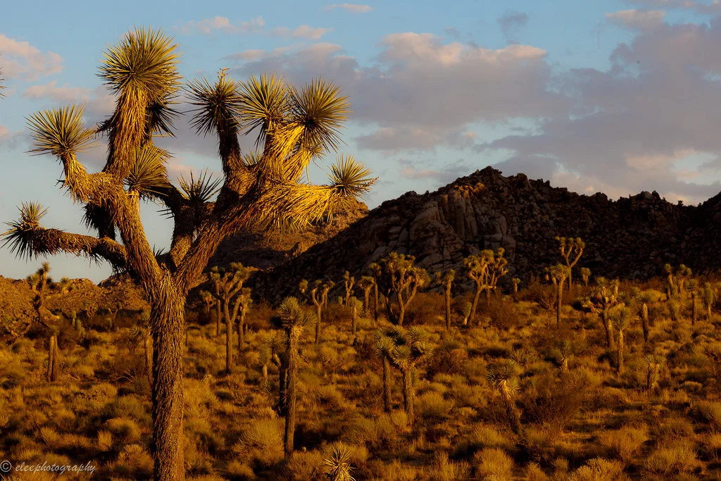
Joshua Tree National Park, California
Joshua Tree National Park in Southern California is where two different desert ecosystems meet. Parts of the Mojave and the Colorado deserts are both found in Joshua Tree, along with a distinctive variety of plant and animal life. The Joshua tree, the park’s namesake, is the most identifiable of the plants, with its twisted, spindly branches and spiky clusters of greenery. Some of the park’s most popular attractions are Skull Rock; Keys View, a lookout with views of the Coachella Valley and the San Andreas Fault; and Cottonwood Spring Oasis, which was a water stop for prospectors and miners in the late 1800s. Joshua Tree National Park has roughly 300 miles of hiking trails for visitors to explore. The park is open 24 hours and can be visited at any time of the year, but visitation rises during the fall due to the cool weather and is at its height during the wildflower bloom in the spring.

Atacama Desert, Chile
Trips to the Atacama Desert in northern Chile are likened to visiting Mars on Earth. The dry, rocky terrain is so similar to that of Mars that NASA tests its Mars-bound rovers here. The Atacama Desert, the driest desert on Earth, spans over 600 miles between the Andes and the Chilean Coastal Range. Some weather stations set up in the Atacama have never seen rain. Despite its dryness, the desert is home to thousands of people, as well as plants and animals. People have been living in the Atacama Desert for centuries; mummies were discovered in the Atacama dating back to 7020 B.C., even before the oldest known Egyptian mummies. Attractions in the Atacama Desert include El Tatio geyser field, the Chaxa Lagoon, the Atacama salt flats, and sand dunes over 300 feet tall. The Atacama Desert is also said to have some of the clearest night skies in the world, making it perfect for stargazing. It is best to avoid a trip to the Atacama during the summer months, as the high temperatures make for a sweltering visit.

Salar de Uyuni, Bolivia
The world’s largest salt flat, Salar de Uyuni, covers 3,900 square miles in the southwestern corner of Bolivia. Salar de Uyuni is so large it can be seen from space and holds an estimated 10 billion tons of salt. Beneath the salt flat is approximately 70% of the world’s lithium reserves. This lithium is carefully extracted and used for powering laptops, electric cars and smartphones. Salar de Uyuni is surrounded by scenic lakes, geysers and rock formations, and is one of the world’s most beautiful and untouched natural landscapes. Tours of Salar de Uyuni take visitors to the Valley of Rocks; Morning Sun, which is home to geysers and mud pots; Colchani, a salt-processing village; and the Polques Hot Springs, where travelers can soak in warm thermal water. The landscape of Salar de Uyuni changes based on the seasons, so travelers should plan their visits around what they want to see. From July to October, access to all sites of Salar de Uyuni is unrestricted, but during the rainy season from December to April, visitors may be able to witness the salt flat’s famous mirror effect, where a thin layer of water over the salt transforms the land into the world’s largest mirror.

Tanque Verde Ranch, Arizona
Located just outside of Tucson, Arizona, near Saguaro National Park and the Rincon Mountains, Tanque Verde Ranch gives visitors “the ultimate dude ranch experience.” The ranch sprawls over 640 acres and stocks over 150 horses. Visitors to the ranch can get a real-life cowboy experience, including horseback riding and team penning. Riders of all experience levels will find something to do at Tanque Verde, where visitors can take beginning, intermediate and advanced lessons and then go on a sunrise or sunset trail ride through the Arizona desert. Tanque Verde Ranch offers kids’ riding activities too, as well as activities for non-riders such as yoga, mountain biking, fishing, swimming and pickleball. Visitors should pack long pants and closed-toe shoes if they plan to ride, and casual wear is appropriate for all non-riding times. Trips to the ranch usually last around four days, and visitors stay on the property. Tanque Verde Ranch is open to visitors year-round.
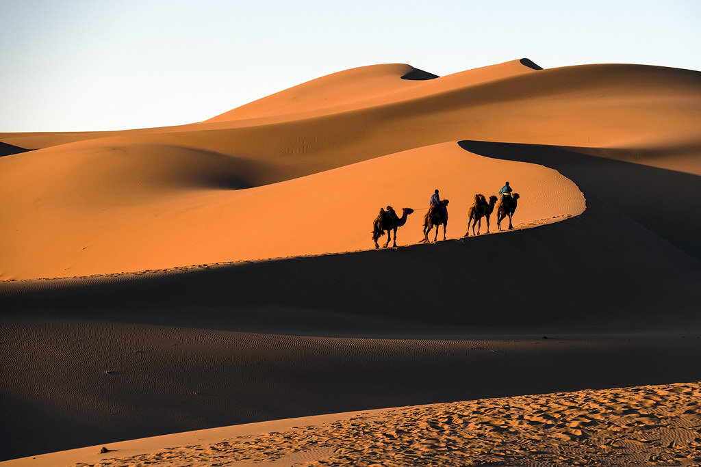
Gobi Desert, Mongolia
Spanning most of southern Mongolia and its border with China, the Gobi Desert contains stunning views and years of history. The region was once populated by dinosaurs, and some of the best-preserved fossils in the world were found near the Flaming Cliffs of Bayanzag. The Gobi Desert showcases a variety of natural beauty, from towering sand dunes to incredible white granite formations. Dry desert plants that come to life after rain make the Gobi unique, as well as ”saxaul forests” made up of sand-colored shrubbery. Visitors to the Gobi Desert should explore the Khongor Sand Dunes, an area that offers rocky and mountainous terrain in the south, dry and barren terrain in the center, and several oases in the north. Other major attractions are the Flaming Cliffs of Bayanzag, where red clay seems to glow in the sun, and the Gobi Waterfall, which looks like a city in ruins but is a completely natural formation. The best time to visit the Gobi Desert is either in late spring or in autumn, when the weather is neither too hot nor too cold.
Nk’Mip Desert, Canada
Also called the Okanagan Desert, Canada’s Nk’Mip Desert contains the most endangered landscape in Canada. Located in Osoyoos in British Columbia, the Nk’Mip Desert Cultural Center is a 1,600-acre area of the Okanagan Desert managed by the Osoyoos Indian Band, and is the only fully intact area of desert in Canada. The desert is situated in a semiarid microclimate. The cultural center was designed to be eco-friendly and resembles the traditional winter homes of the Osoyoos Indian Band. Visitors can explore the desert on walking trails, which are surrounded by sage, prickly pear cactuses and antelope brush, as well as sculptures of desert creatures and native peoples by Smoker Marchand. The trails take visitors through a traditional Osoyoos village, where they will find a traditional sweat lodge and pit house. Many visitors prefer to explore Nk’Mip Desert in the summer due to the region’s relatively cold winters.

Patagonian Desert, Argentina and Chile
The Patagonian Desert is South America’s largest desert and the seventh-largest in the world. It covers parts of southern Argentina and Chile, and is a cold desert, sometimes reaching a high temperature of 68 degrees Fahrenheit. The Patagonian Desert is home to two national parks: Torres del Paine National Park in Chile and Los Glaciares National Park in Argentina. Torres del Paine and Los Glaciares aren’t typical desert environments, but since the Patagonian is a cold desert, its landscape is different from that of most deserts. Before the Andes were formed, the Patagonian Desert was likely covered by temperate forests, so the region containing the desert, Patagonia, is extremely ecologically and geographically diverse. Torres del Paine National Park is known for its towering granite structures, which were shaped by glaciers. Los Glaciares is home to large glaciers, as well as scenic mountains, lakes and woods. The Cueva de las Manos, or “Cave of Hands,” is a series of caves in Argentinian Patagonia which are filled with paintings of hands dating back to 700 A.D., likely made by ancestors of the Tehuelche people. Tehuelche people live in Patagonia today, some still following a nomadic lifestyle. The best time to visit Patagonia is generally said to be in the summer (December to February), when the days are warm and the fauna is in full bloom, but there are merits to exploring the area at all times of year.

Rachel Lynch
Rachel is a student at Sarah Lawrence College in Bronxville, NY currently taking a semester off. She plans to study Writing and Child Development. Rachel loves to travel and is inspired by the places she’s been and everywhere she wants to go. She hopes to educate people on social justice issues and the history and culture of travel destinations through her writing.
ICELAND: Vindur Means Wind in Icelandic
The word Vindur means ”wind” in Icelandic which is relevant to the way this video was captured. For 3 minutes you will get to enjoy amazing drone footage portraying Iceland’s unbelievable landscapes. From beautiful waterfalls to endless valleys, with its unusual mountain ranges and out of this world landscapes, oceanic cliffs, old glacier, fantastic canyons and many other wonders, take look at what make Iceland so unique.