The Most Endangered Species of Penguin

The yellow-eyed penguins of New Zealand are the rarest species of penguins in the world.

Group of Yellow-Eyed Penguins. Chris Gin. CC BY-NC-ND 2.0

Known as hoiho penguins in the Māori language of New Zealand, yellow-eyed penguins are the most endangered penguin species. There are estimates of fewer than 3000 of them left in the wild. In the past 30 years alone, the population has decreased by 50-75%. 
Yellow-eyed penguins are easily identifiable, as they have yellow feathers around their eyes. It is a unique trait they have, along with the band of yellow that extends around their heads. Like other penguins, yellow-eyed penguins are predators, eating mostly fish and crustaceans. Adult birds generally have no land predators, but the chicks and eggs are in danger from animals like cats, dogs, ferrets and stoats. This is also common in Antarctica, where penguin chicks and eggs are vulnerable to other Antarctic birds, but the adults have almost nothing to fear from the other animals. In the water, however, yellow-eyed penguins are in danger from large marine predators, such as sharks and seals. Penguins have no defense mechanisms, so they mostly rely on their speed and maneuverability in the water to survive. Yellow-eyed penguins can swim up to 12.4 miles per hour. In comparison, the average human can swim around 2 miles per hour. If necessary, penguins also avoid ocean predators by jumping up on land. Like every other species, yellow-eyed penguins have a black back and white stomach to camouflage underwater. Their backs blend in with the dark depths for creatures above looking down on them, and their stomachs blend in with the surface for creatures looking up at them. 

Yellow-Eyed Penguin. Bernard Spragg. CC0 1.0.

Yellow-eyed penguins mate for life and breed two eggs a year. Their average lifespan is 23 years, and these penguins start breeding at different times. They reach sexual maturity around two years of age, and most females begin breeding then. With males, however, it is more common to start breeding at three. The parents will incubate the eggs until they hatch, and then raise the chicks for around twelve months. Their nesting sites are in the bushes and shrubs along New Zealand’s coast, though deforestation has become a major threat to them. Humans have been clearing out land to make room for new houses or grazing fields for their animals, so the penguins have been forced to find new homes. The loss of their natural nesting habitat and the introduction of predators such as dogs and cats have contributed a lot towards why yellow-eyed penguins are endangered. There is also a high chick mortality rate, and some penguins get caught in gillnets, which lead to their deaths. The other major contribution to their decline is the food shortage due to global warming. 
There are two main yellow-eyed penguin populations: the northern and southern ones. The size of each population is determined by how many breeding pairs there are, and in 1991, the northern population had 741 pairs. By 2020, it has decreased into a population of 233 breeding pairs. This decline has been mostly due to lack of food, diseases and predators. The northern population is spread out over ​​South Island, Stewart Island and various other ones near to them.
The southern population, on the other hand, has been doing much better. In 1992, the estimated number of breeding pairs was 400, and in 2017, the number increased to 570. The southern population is divided into two colonies, one on Auckland Island and the other on Campbell Island. Though the penguins on these islands are doing much better than their northern counterparts, the overall population of yellow-eyed penguins is still decreasing. 

Solitary Yellow-Eyed Penguin. Ben. CC BY-ND 2.0

To Get Involved:

There are multiple conservation organizations that exist in order to protect these penguins. One such organization is The Yellow-Eyed Penguin Trust, specifically focused on protecting the habitats and livelihoods of these birds. The easiest way to help them is by donating to them through their website, but it is possible to volunteer for them, if you live in New Zealand. Their office is based in Dunedin, but there are penguin preserves in other parts of the country. To learn more about the Yellow-Eyed Penguin Trust, click here
Penguin Place is another organization dedicated to helping yellow-eyed penguins. They are the first conservation program funded entirely by tourism. They do take donations on their website, but most of their funds come from tours. Their funding comes from guided tours on penguin reserves and the money goes to preserving their habitats, helping sick or wounded penguins and controlling predators. To learn more about Penguin Place, click here.


Katherine Lim

Katherine Lim is an undergraduate student at Vassar College studying English literature and Italian. She loves both reading and writing, and she hopes to pursue both in the future. With a passion for travel and nature, she wants to experience more of the world and everything it has to offer.

Macaque Monkeys Attack in Yamaguchi, Japan

Macaque monkeys, previously peaceful residents of Yamaguchi, Japan, began targeted attacks in July. 

Japanese macaque. Zweer de Bruin. CC BY-NC-ND 2.0. 

The city of Yamaguchi, Japan boasts historic temples, invaluable art, stunning gardens and macaque monkeys. Macaque monkeys have lived in highly populated areas of Japan since as early as the 1600’s, and up until recently, Japanese macaques have had very few concerning interactions with people.

However, since July 8th, more than fifty people in Yamaguchi have been attacked by the monkeys. City officials and experts say nothing like this has ever happened, and they even initially thought it was only one crazed monkey committing all of the attacks. But even after the monkey in question was euthanized, the attacks continued, leading the city to realize that an entire band of monkeys had inexplicably started attacking humans after years of peaceful  coexisting. Fortunately, as of late July, no serious injuries have occured, but city officials have taken to tranquilizing threatening macaques, as they are not deterred by food or traps. 

What makes these unprecedented attacks even more puzzling is the fact that they seem very coordinated, with an explicit goal, even if that goal is unclear to the people of Yamaguchi. While minor injuries have resulted from the attacks, some of the attacks appear to be attempted kidnappings. Additionally, the monkeys began by targeting primarily young children and older women. While over the past few weeks they have begun attacking adult men as well, these demographics are so specific that it begs the question: what is their intent? Unfortunately, no one knows yet. 

A mother in Yamaguchi recalls a monkey having broken into her home, and attempting to drag her child away. She noted that the monkey tried to take the child with it. The monkeys have been entering homes, and even lurking outside of nursery schools. While there have been occasional macaque attacks in the past, they primarily live in harmony with humans, and a planned effort like this is unprecedented. 

Two Japanese macaques. Etsuko Naka. CC BY 2.0. 

In terms of the history of Japanese macaques, as noted they have lived in Japan since as early as the 17th century. They are also incredibly intelligent animals, making the decision of the Yamaguchi officials to euthanize one a difficult call. Macaques have opposable thumbs and even sometimes walk on two legs. They are known for doing very human-like activities, such as bathing and relaxing in groups in hot springs in Japan. This habit, as well as the habit of washing their food in the ocean, was learned behaviors within the group, and previously, scientists thought only humans passed traditions and behaviors through generations. 

Despite the monkey attacks, which will hopefully come to an end soon, Yamaguchi has many sites to visit and a fascinating history. It is known for its temples, such as the Rurikoji Temple and Joeiji Temple. It is also a coastal town known for having high quality seafood and sake, which is perfect for travelers interested in food. Additionally, Yamaguchi is a very historic area, as the city contributed to the overthrow of the feudal era in Japan in the late 1800’s

Tokoji Temple in Yamaguchi, Japan. Yoshitaka Ando. CC BY-NC-ND 2.0. 

Ultimately, Yamaguchi, Japan is a beautiful and historic city which is currently experiencing turmoil at the hands of macaque monkeys. Officials hope that the situation will be resolved soon, and once it is, consider adding Yamaguchi to your travel list.


Calliana Leff

Calliana is currently an undergraduate student at Boston University majoring in English and minoring in psychology. She is passionate about sustainability and traveling in an ethical and respectful way. She hopes to continue her writing career and see more of the world after she graduates. 

7 Historical Sites That Could Be Underwater by 2050

Climate change is threatening these beautiful archaeological sites, and at this rate, it may not be long before they are completely submerged under water.
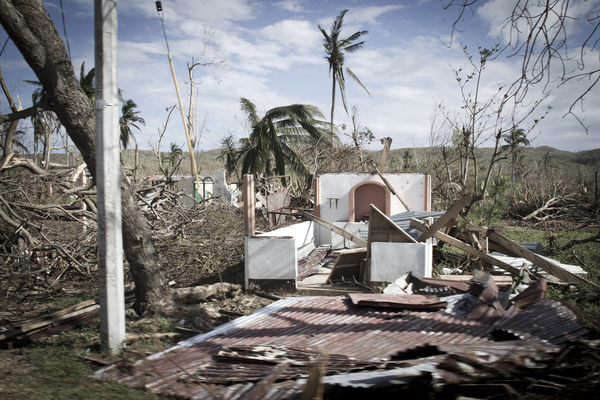
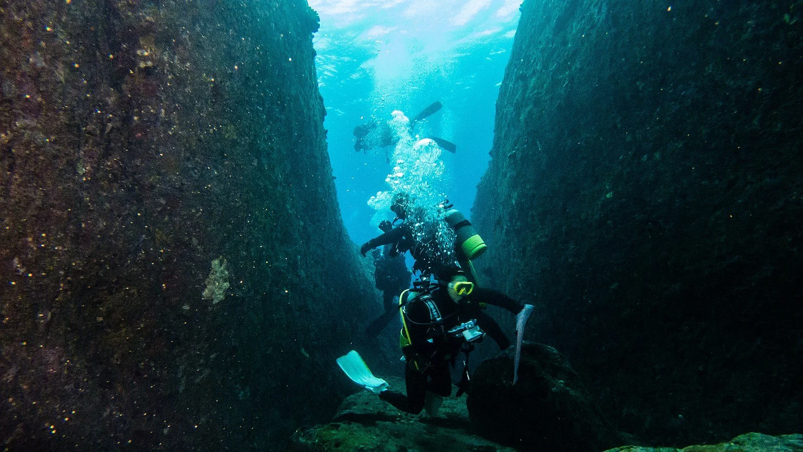
The Yonaguni Monument is submerged off the coast of Japan. Danapit. CC BY 2.0.

One of the most immediate consequences of global warming is the rise in sea levels that is threatening to turn many cities into a modern day Atlantis. However, it is not just the common tourist destinations of Venice and Bali that are at risk—there are a number of breathtaking historical sites that could also disappear under the tides. Many of these destinations are located at or below sea level and are also near bodies of water, which makes them extremely vulnerable to flooding and water damage.

1. Elephanta Caves – Gharapuri, India

Elephanta Caves. Ashwin Kumar. CC BY-SA 2.0.
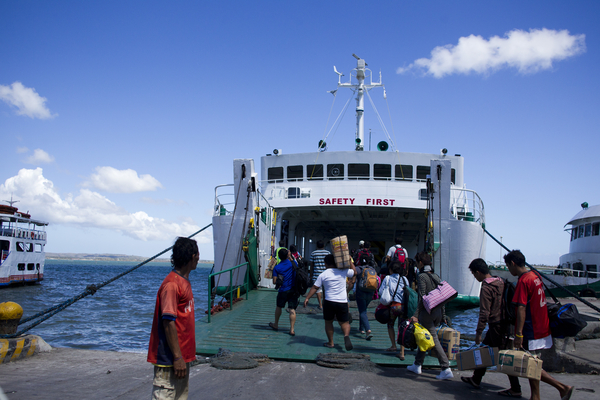
In 2014, the Elephanta Caves were identified as being at long-term risk from rising sea levels in the Indian Ocean in a study conducted by researchers at the University of Innsbruck. Located on Elephantine Island in Mumbai Harbor, the caves include a number of man-made excavations and carvings into the various rock faces of the island in honor of the Hindu god Shiva. These archaeological remains date back to the mid-fifth century, making the site almost 1,500 years old. Many of the cave entrances are adorned with detailed sculptures of Shiva, the most famous being “Sadashiva,” a bust of the god carved into the side of the mountain measuring seven meters in height. Every year, the few hundred islanders and a large tribe of monkeys welcome over a million tourists, despite local protests about how the visitors are endangering their way of life.

2. Great Mosque – Kilwa Kisiwani, Tanzania

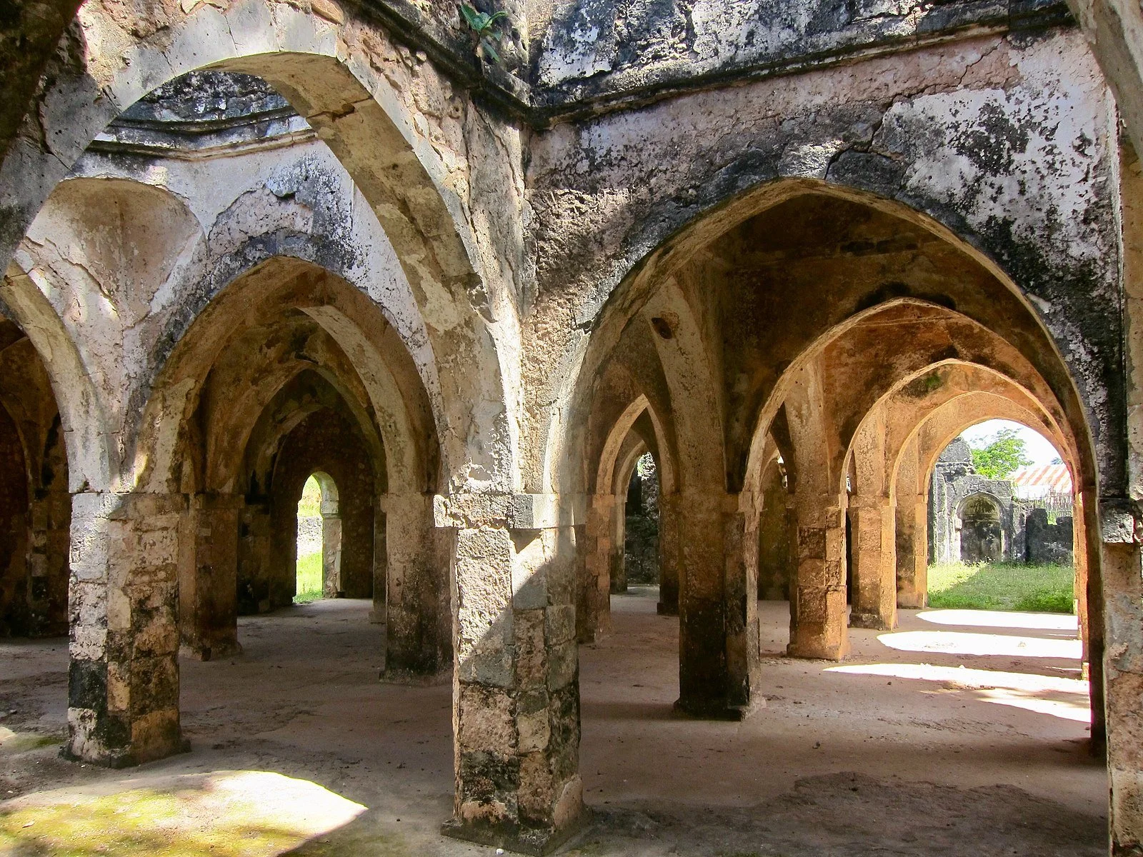
Inside the Great Mosque of Kilwa. Lazy-papaya. CC BY-SA 2.0.

As the oldest standing mosque on the east coast of Africa, the Great Mosque of Kilwa Kisiwani has been around since the 14th century. The island on which it is located was a key trading port in the Indian Ocean and saw shipments of ivory and gold as well as upwards of 20,000 African slaves pass through on their way to Europe and North America. Sailors stopping by on their journeys could enter the halls and worship under the 16 coral and timber domes, built specifically with such materials to withstand the elements. The local sultan added an extension to the south side of the mosque in the 14th century, including the “Great Dome” which also boasts an inscription by Ibn Battuta, an explorer known commonly as the Islamic Marco Polo.

Because Kilwa Kisiwani is a coastal city, local experts have long been expressing concerns about the dangers of coastal erosion to the integrity of the historical ruins. Rising water levels in the Indian Ocean are threatening the UNESCO heritage site as well as disrupt the locals’ way of life. 

3. Comalcalco – Tabasco, Mexico

Mayan ruins at Comalcalco, Tabasco. Dennis Jarvis. CC BY-SA 2.0.

The Mexican state of Tabasco sits on the coast of the Gulf of Mexico and experiences regular flooding. If sea levels continue to rise, the region and its incredible Mayan ruins could be completely submerged.

Aside from the temples, monuments and palaces typical of ancient Mayan ruins, the historical city of Comalcalco in Tabasco is also home to ancient cocoa farms and chocolate factories. Given its strategic location between the lush greenery that borders the Rio Seco, Comalcalco was an important trade center between the ports on the nearby coast and communities inland to the east. The city is also unique in that many of its buildings were constructed using kiln-fired bricks, which is why its name translates to “place of the clay griddles'' in Nahuatl. Many of these bricks are adorned with various glyphs and carvings of Mayan religious figures, making the site extremely valuable for archaeologists and a favorite of visiting tourists.

4. Gran Teatro Falla – Cadíz, Spain

The Gran Teatro Falla in the Old City of Cadíz, Spain. RG2. CC BY-SA 2.0.

The Gran Teatro Falla has stood as a prime example of neo-Mudejar architecture in the southwestern Spanish city of Cadíz since 1905. Named after famous Spanish composer Manuel de Falla, the red-brick building is affectionately known by locals as the “House of Colored Bricks” for its striking facade. The ceiling of the great hall is decorated with artist Felipe Abarzuza’s fresco of “El Paraíso” or Paradise, which was a new addition after the original Gran Teatro de Cádiz was destroyed in a fire in 1881. It took 21 years and three different architects for the new theater to be rebuilt, but it is still used to this day by various local groups throughout the year for theater, dance, music and film.

Unfortunately, Cadíz has also been identified as one of the Spanish cities that will be most negatively impacted by rising sea levels in the Mediterranean. This places the Gran Teatro, along with many other museums and historical monuments in the city, at risk of sinking.

5. Wat Mahathat – Ayutthaya, Thailand

Buddha statue at Wat Mahathat in Ayutthaya, Thailand. Uwe Schwarzbach. CC BY-NC-SA 2.0.

Thailand is among the many Southeast Asian countries that experiences a heavy monsoon season. Locals are used to seeing city streets completely submerged underwater between July and October every year. In 2011, the Buddhist University located at Wat Mahathat in the city of Ayutthaya experienced severe flooding as a result of the rains, and climate change’s effects on weather patterns continue to threaten the site.

This royal temple is believed to be one of the first built during the reign of the Ayutthaya Kingdom and includes various pagodas, a royal hall, numerous smaller temples for worship and a large sandstone bust of Buddha. It is a beautiful example of traditional Khmer architecture and also features ancient murals that extend across through the courtyards and chambers under groves of bodhi trees. The site is a popular destination for a large number of Buddhist pilgrims who journey across Southeast Asia each year to visit the oldest bell-shaped relic in the world, located in the center of the compound. At present, Wat Mahathat serves as the headquarters for Thailand’s largest monastic order, the Mahanikai school of Buddhism.

6. Roman Ruins – Tipaza, Algeria

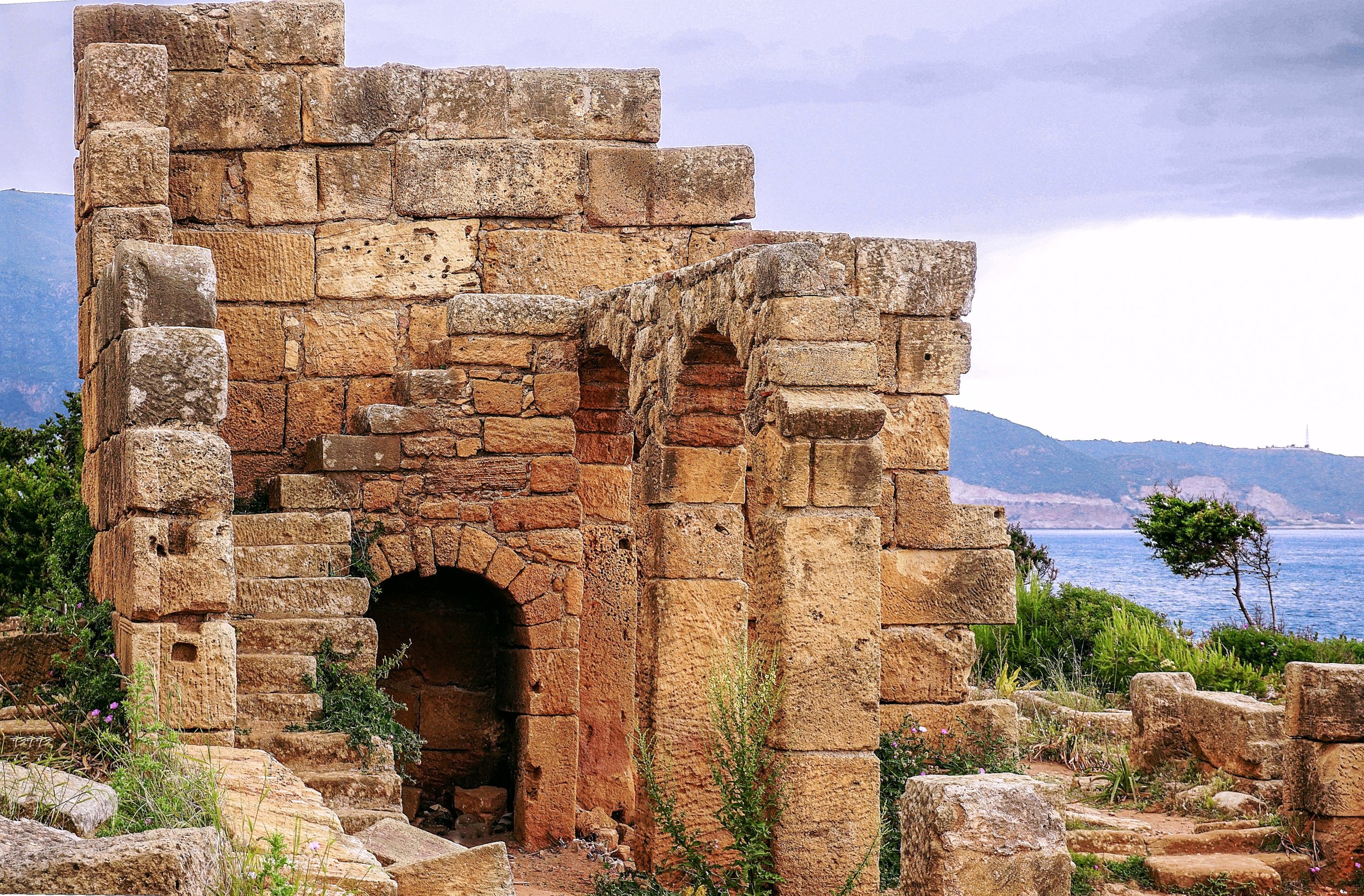
The remains of a Roman temple at Tipaza. Rachid Benabdellah. CC BY-SA 2.0.

The northern Algerian village of Tipaza is known for its scattering of Roman, Byzantine, Phoenician and early Christian ruins. Given its coastal location, it was prone to conquest by various sea-faring groups as early as the 6th century BCE. Nestled among golden beaches and pine tree forests, there are still remnants of a Punic necropolis, a Roman amphitheater once used for gladiator fights, various religious complexes and even thermal baths. The most notable monument is a royal mausoleum where the sole daughter of Cleopatra and Mark Antony is buried with her husband. The ancient town center was also surrounded by a defensive wall constructed by the Romans, most of which was deconstructed so that its materials could be reused for building Algiers.

UNESCO has already identified the ruins at Tipaza as being at heightened risk from flooding and erosion. The probability it estimated is also supposed to triple by 2050 if water levels in the Mediterranean continue to rise at present rates.

7. Iglesia Santo Domingo – Panama City, Panama

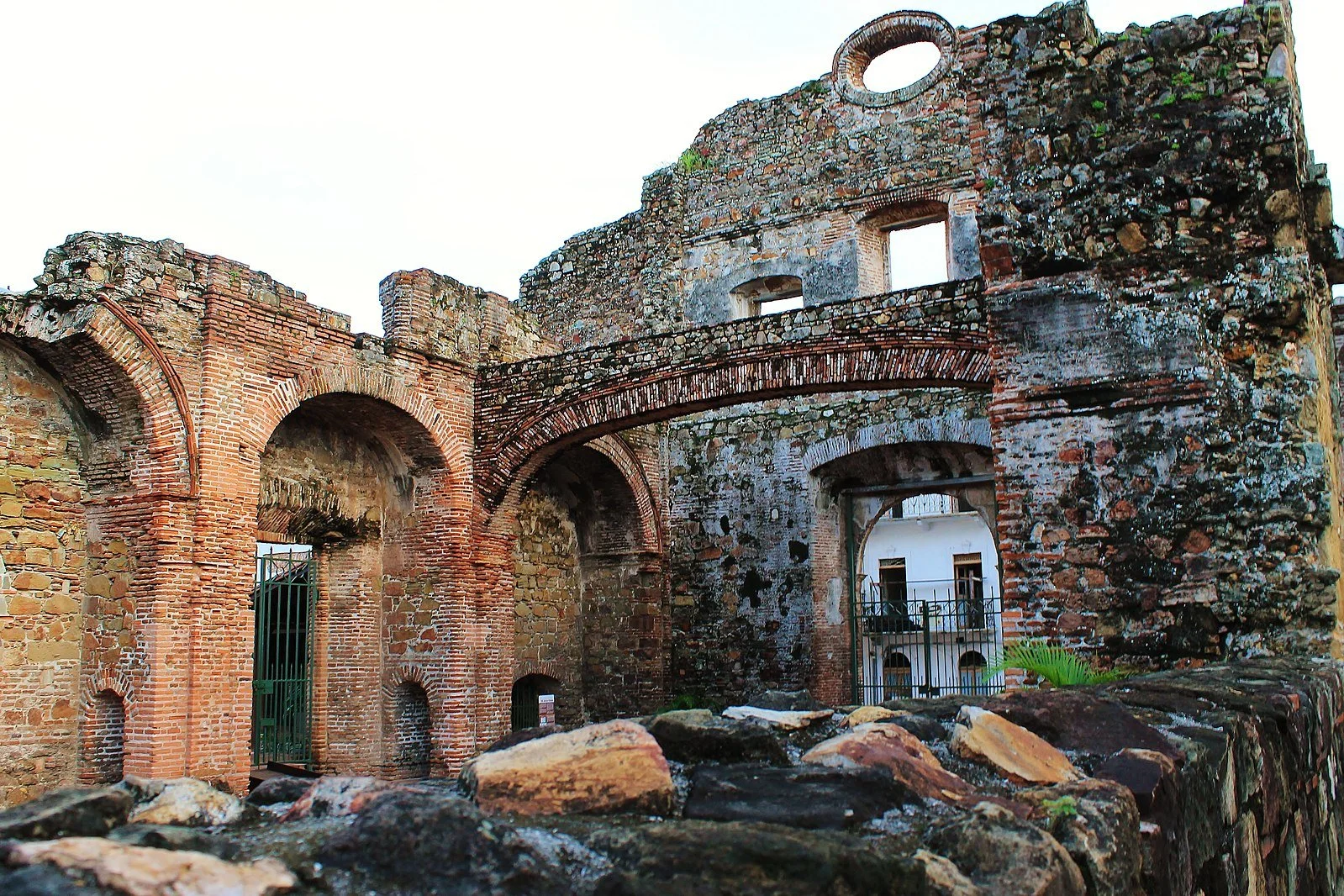
The Arco Chato in the Church of Santo Domingo. Darena. CC BY-SA 2.0.

Rising water levels in the South Pacific, in addition to the heavy rains experienced by Panama during their annual wet season, are threatening many older neighborhoods and the historical buildings within. This will only worsen as climate change continues.

The Iglesia Santo Domingo is one of the most iconic buildings in the Casco Viejo neighborhood of Panama City. The church is most well known for the flat arch—“Arco Chato”—that stretched across its interior courtyard with no support from its construction from 1678-2003 when it finally fell but was soon rebuilt. Because the arch was able to withstand two centuries worth of earthquakes, Governor Antonio Fernández de Córdoba selected Panama over Nicaragua to be the site of the interoceanic canal—the famous Panama Canal. Ravaged by fire in 1756, the church has stood as an empty brick shell ever since. It now houses the Museum of Religious Colonial Art, which exhibits various Panamanian artifacts from the 16th century onwards.


Tanaya Vohra

Tanaya is an undergraduate student pursuing a major in Public Health at the University of Chicago. She's lived in Asia, Europe and North America and wants to share her love of travel and exploring new cultures through her writing.

Dying By Fire: Wynn Bruce’s Environmental Protest

This past Earth Day, climate activist Wynn Bruce lit himself on fire on the steps of the Supreme Court, dying the following day. Set on demonstrating the importance of global warming, Bruce chose the world’s most radical form of protest to emphasize his commitment to martyrdom.

Steps of the Supreme Court. Dbking. CC BY 2.0.

On April 22, 2022, Wynn Bruce, a climate activist from Colorado, made a fateful and radical decision: he would go to the front of the Supreme Court and, using self-immolation, become a martyr for the fight for global-warming-related policy change. Fed up with the lack of commitment to the issue of climate change, Bruce seemed to feel this was the only way he could get United States policy makers to listen—by lighting himself on fire and dying for his cause.

Self-immolation is the most radical and rarest form of nonviolent protest. It is said by ABC to have “the ability to harness both the morality of nonviolent action with the visceral nature of violent action.” By Merriam-Webster's definition, it is the “deliberate and willing sacrifice of oneself often by fire.” Typically, protestors who choose this form of action will use flammable substances such as petrol and lighter fluid to make sure flames catch and spread across the body. The goal of this form of protest is not to live to see its impact, it's to sacrifice oneself as a martyr for a cause in order to stress the dire importance of certain issues.

Used now for decades to protest a variety of social issues, self-immolation has continued its way into the practices of the modern day protest. Wynn Bruce is just one example; a civil rights lawyer named David Buckle burned himself to death in 2018, also protesting climate change. Wynn Bruce, alongside being a son, climate activist and citizen of the world, was a Buddhist, which is the religion credited by many to have started the practice of self-immolation.

Self-immolation has been used across the globe and did not necessarily start as a form of active protest. Buddhists are commonly credited not only with self-immolation’s creation but also with the practice’s infamy. ABC explains that many Buddhists believed that the ability to renounce the body and “transcend[ing] it’s limitations” was when “perfection is reached.” In Buddhism, to transcend is to reach enlightenment—a state of compassion and one that also ends the cycle of rebirth—so often, self-immolation was done as a religious act and not as a form of protest. 

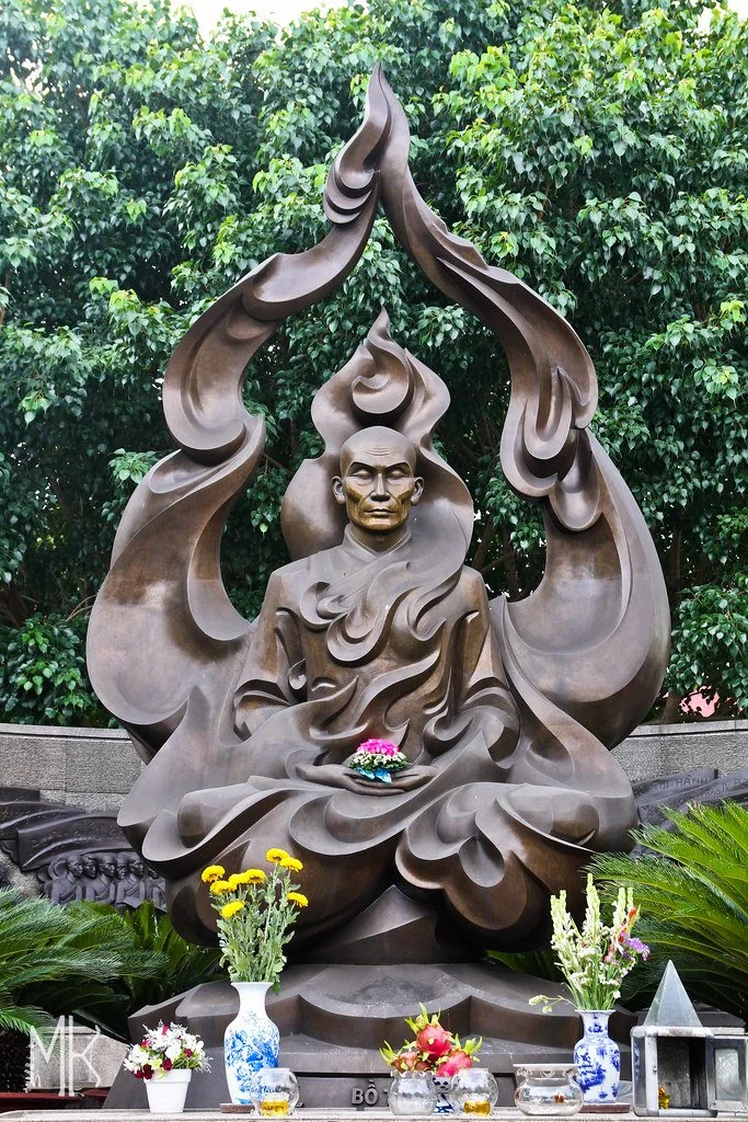
Buddhists used self-immolation first as a form of religious ceremony, but then turned to its more aggressive usages during the Vietnam War. Thich Quang Duc, known as The Burning Monk, used self immolation to protest a massacre that was allowed by the Vietnamese government. The president of Vietnam at the time had laws in place that restricted religious practices of faiths other than Catholicism, which eventually led to the. In response to this outrage, Thich Quang Duc made an ultimate sacrifice; gathering nearly 350 monks and nuns, Thich Quang Duc sat cross legged in the lotus position as a peer poured petrol over his body and lit a flame. Thich Quang Duc remained perfectly still as his body caught fire. This was an act of protest heard around the world, and the imagery from the day was quickly iconized in canonical protest media.

Thich Quang Duc being covered in petrol. Manhhai. CC BY 2.0.

Because self-immolation has the power to so strongly influence those who hear of it, it is not surprising how fast the news of Thich Quang Duc’s sacrifice reached all areas of the globe. Published in magazines such as TIME and the Associated Press, the image circulated the globe and continues to be brought up in tribute articles and memorial pieces by publications.

The act of self-immolation hurts no one except the martyr involved. It attracts all the right media attention, and it emphasizes the threat of pressing social issues in such an extreme way that the world is forced to listen. Wynn Bruce seemed to know this, and his peers claimed to understand his motivations. Dr. Kritee Kanko, a Buddhist priest took to Twitter to write, “This act is not suicide. This is a deeply fearless act of compassion to bring attention to climate crisis.”

A statue of The Burning Monk. MK Photography. CC BY-NC-ND-2.0.

To Get Involved

MCE Cares is an organization designed to help people learn about how to become a climate activist. To learn more about the ways in which you can support the fight for policy change and climate activism, click here.


Ava Mamary

Ava is an undergraduate student at the University of Illinois, double majoring in English and Communications. At school, she Web Writes about music for a student-run radio station. She is also an avid backpacker, which is where her passion for travel and the outdoors comes from. She is very passionate about social justice issues, specifically those involving women’s rights, and is excited to write content about social action across the globe.

How Much Water Does A Pair of Jeans Cost?

Has the commercial giant finally found the key to environmentally sustainable denim production? Or is this just another temporary measure to keep their customers happy?

H&M outlet store in Germany. Marco Verch. CC-BY 2.0.

Over the past few years, the fashion industry has come under major public scrutiny for its general lack of concern for the environment. Every single step of the clothing manufacturing process—growing cotton, dyeing fabric, washing clothes—uses inordinate amounts of water while also producing between 4 and 10% of global carbon emissions every year. Fast fashion giant H&M produced almost 3 billion garments and earned just under $22.5 billion in revenue in 2020, making it the second largest clothing retailer in the world. The company also consumed about 85 liters of water per kilogram of dyed fabric they produced, totaling around 225 billion liters of water for that year alone.

Despite having been the target of widespread concern over the negative environmental consequences of fast fashion practices, the Swedish retailer claims to be working towards a more sustainable future. H&M publicly announced its goal to reduce greenhouse gas emissions by 56% by 2030, but many are doubtful it will be successful. Some of its current strategies include cutting ties with suppliers who still use coal boilers, enforcing carbon pricing systems within the company and establishing a green investment team to support environmental projects.

Promotional material for H&M’s Less Water denim capsule collection. H&M. CC-BY-ND 2.0.

H&M’s most recent project is its new “Less Water” capsule collection, which claims to have a focus on cutting water usage in the production process. The line includes various denim garments that are supposedly the product of new dyeing and printing technologies that reduce both the amount of water used and the amount of chemicals released. The company has already reached its previous goal of having 15% recycled water reused in the production of new clothing by 2020. This was largely the result of targeted rainwater harvesting and wastewater recycling initiatives in Bangladesh and India, where the company’s largest treatment and manufacturing plants are located.

While these are all steps in the right direction, they are decidedly small ones. The majority of H&M’s garments are still made using materials that are not harvested in an eco-friendly manner. Most importantly, it continues to operate using the fast fashion business model of providing trendy clothes for cheap, most often at the expense of the quality of the clothing, the environment and the labor conditions of the workers. Despite scoring 68% on the Fashion Transparency Index in 2021 (an annual report that reviews and ranks retailers based on their social and environmental policies) the company has failed to release any information about whether or not they are on track for their 2030 goals.

PicknWeight vintage kilo store. Lordship100. CC-BY 2.0.

The Less Water collection follows in a long line of recent attempts by various brands to improve their public image by becoming more socially responsible. Whether or not they will continue in the long run is yet to be seen, but if you are really looking to be more environmentally conscious, try your local thrift or vintage store instead. Not only can the items be equally as affordable as fast fashion brands like H&M, but giving clothes a second life saves them from the landfill, which is a much more immediate way to make a positive difference.


Tanaya Vohra

Tanaya is an undergraduate student pursuing a major in Public Health at the University of Chicago. She's lived in Asia, Europe and North America and wants to share her love of travel and exploring new cultures through her writing.

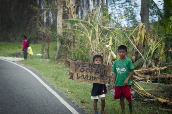
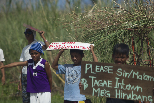
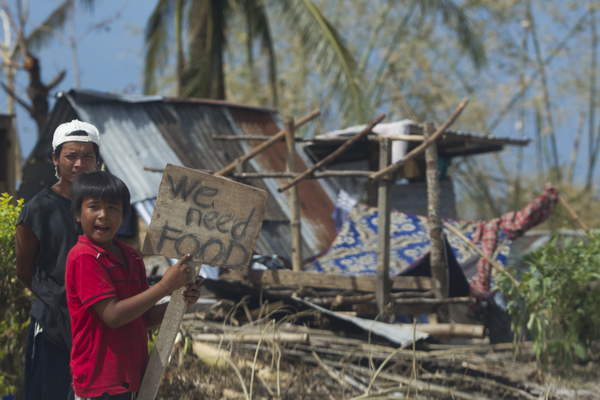
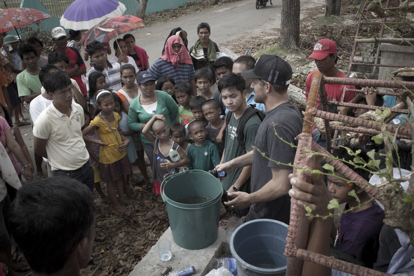
Photo Essay: On the Ground with Waves For Water in the Philippines

While the Philippine Islands were being struck by Super Typhoon Haiyan’s wrath, Jon Rose, Founder of Waves For Water, was already hatching his plan to help.

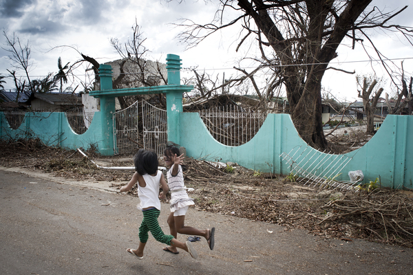
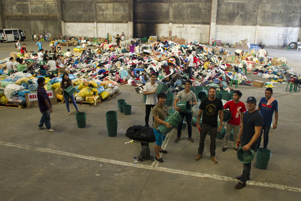
W4W began work in the Philippines in response to Typhoon Haiyan and continues to support areas with water shortages. 

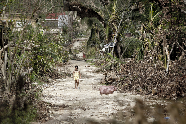
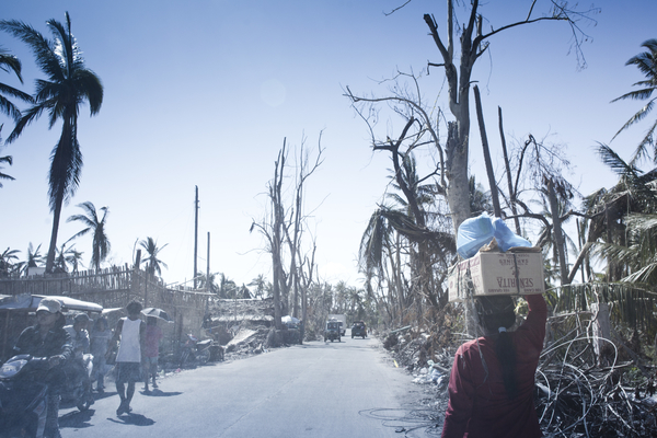
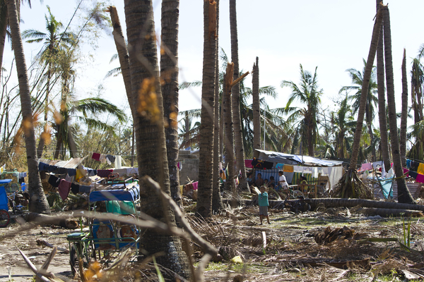
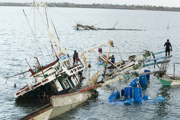
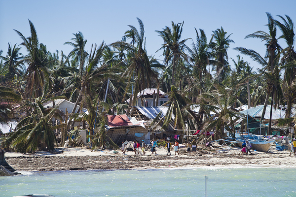
In 2013, the Philippines was hit by one of the most devastating typhoons ever recorded: Typhoon Haiyan. The natural disaster affected people throughout Southeast Asia and killed 6,300 people in the Philippines alone. Throughout the country, over 4.3 million people were affected. One major impact of the typhoon was its obstruction of access to clean water. 

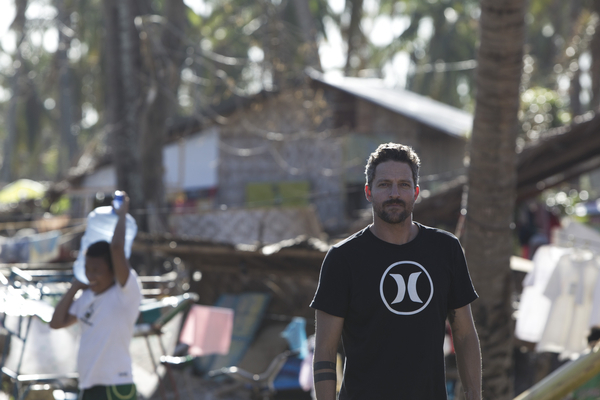
To address this problem, Jon Rose, founder of Waves for Water (W4W), arrived in the Philippines ready to distribute his organization’s water filters among “forgotten pockets,” communities that were not “the focal point of major relief efforts.” His method of distribution and relief relied on the “train-the trainer, local-based model” in which W4W organizers “empower” and “facilitate” for local people rather than decide “who gets what, when, where and how.” Two years after the typhoon, W4W established an office in the Philippines, where it is currently registered as a non-profit organization. Since 2015, W4W has built 66 rainwater catchment systems and provided over a million Filipinos with access to clean water. In December of 2021, the organization helped to address the devastation caused by Hurricane Odette in Siargao, Philippines through a partnership with Billabong. Currently, W4W is providing aid for those impacted by Tropical Depression Agaton, which has displaced 1.9 million people in Visayas and Mindanao, Philippines. You can contribute to this specific effort here

W4W’s humanitarian efforts are not limited to the Philippines. Since its inception in 2009, the organization has made an impact in 44 countries, including Mozambique, Ecuador, Sierra Leone and Chile, and has helped 3.75 million people gain reliable access to clean drinking water. W4W currently has 24r active programs helping to address water access issues. These programs seek to provide aid to citizens of Ukraine, Australia, Haiti and Guatemala. You can learn more and help out here.


Jon Rose

As a pro surfer of 13 years, Jon Rose traveled the world in pursuit of perfect waves. It was this passion that led him to development of Waves for Water in 2009. He hopes to see W4W enlist and empower travers to help solve the world water crisis.

Floods, Drought, and Famine: The Story of Climate Refugees

Due to the climate crisis, millions will be forced to migrate to escape natural disasters. However, the current legal framework surrounding refugees does not account for these climate refugees, raising questions about the future.

Flood Emergency Response in Pakistan. Asian Development Bank. CC 2.0

Kiribati is sinking. Due to rising sea levels exacerbated by climate change, it is estimated that the small Pacific island nation will be underwater by 2100. This poses an immense threat to Kiribati’s 114,189 citizens, many of whom are at the risk of losing their homes and livelihoods to the rapidly rising seas. 

Kiribati is not alone; many countries across the world are facing climate-related hardships such as drought, flooding, rising seas and increased hurricane frequency. The Institute for Economics and Peace estimates climate change may displace 1.2 billion people by 2050, mostly in developing nations ill-equipped to deal with natural disasters. This issue of climate change-induced displacement has led to the creation of a new type of refugee: the climate refugee.  

The term “refugee” typically conjures up an image of someone fleeing sudden violence or persecution, not comparatively gradual changes in the climate. This is reflected in the language of the UN’s 1951 Refugee Convention, which defines a refugee as “someone who is unable or unwilling to return to their country of origin owing to a well-founded fear of being persecuted for reasons of race, religion, nationality, membership of a particular social group, or political opinion.” Climate refugees are currently not afforded any legal protections by the United Nations, and the agency argues the current definition of refugee is sufficient. However, the dramatic rise in the number of people displaced due to environmental reasons has led to calls for climate refugees to be afforded full refugee status under international law. 

In 2015, Kiribati citizen Ioane Teitiota sued the government of New Zealand to become the first climate refugee. Teitiota argued he had lost his house to the sea, salt water had flooded his lands, and therefore by deporting him back to Kiribati, the New Zealand government was effectively dooming his family to poverty and instability. Teitiota’s argument was rejected on the grounds that he did not fit the criteria of a refugee under the 1951 Convention, and that changes in the climate did not pose an imminent danger. 

The case of Ioane Teitiota and Kiribati raises questions that wealthy countries such as New Zealand will increasingly be forced to deal with. One question is that of equity; what does the Global North, responsible for 72% of historical emissions, owe to the people of the Global South who will bear the brunt of climate change related displacement? Extreme heat waves in India, flooding in Senegal and drought in Guatemala have already sent waves of migrants searching for a more hospitable environment. However, since current international law lacks a sufficient mechanism to support climate refugees, many will be turned away as Teitiota was. 

To Get Involved 

As climate patterns continue to become more extreme, millions will be displaced from their homes and forced to change their way of life. Climate Refugees is an organization that seeks to support climate refugees through advocacy aimed at shaping policy. The Environmental Justice Foundation fights for legal protections for climate refugees while also pressuring governments to reduce their emissions. The International Organization for Migration seeks to provide humanitarian aid to refugees while working with governments to facilitate cooperation on climate-related issues. 


Ronan Morrill

Ronan is a sophomore at the University of California Berkeley studying history. He is an associate editor of Clio's Scroll, Berkeley's undergraduate history journal, and rows for the Cal Lightweight Crew team. He loves hiking and exploring the outdoors and is passionate about protecting the environment and preserving outdoor spaces. In his spare time he enjoys reading, running, and hanging out with his dogs.

Sand Mining Threatens Coastline as Sierra Leone Rebuilds

Within a few miles of Sierra Leone’s capital, sand mining is having a devastating effect. As beaches slowly disappear, so do the country’s hopes of post-war revival. 

Freetown Beach in Sierra Leone, Erik Cleves Kristensen, CC BY 2.0

Twenty years after Sierra Leone's 11-year civil war, the economic promises of sand mining prove to be costly. The war, which took thousands of lives and led nearly half the country's population into poverty, destroyed most of the country. What followed was a construction boom made possible by an essential ingredient of modern civilization: sand. However, as Sierra Leone’s 300 miles of glorious beaches slowly disappear, so does the revival of tourism and the protection of 55% of the population who live along the country’s coast from the dangers of rising sea levels due to climate change. 

As part of a post-civil war move to help communities benefit from local resources, Sierra Leone’s central government gave regulation of sand mining to local councils. Under the 2004 Local Government Act, local committees operate the trucks and strictly hire local people to mine the sand. After a long day of mining, the sand is dried and sold to developers to pave and extend roads as new homes, hotels and restaurants go up across the country. 

Government officials defend sand mining as an essential source of jobs and a necessary component in rebuilding Sierra Leone. Kasho Cole, chairman of the Western Area Rural District Council, told the Los Angeles Times that his council is “sensitive to environmental concerns, having banned sand mining on certain beaches because of the devastation it has already caused.”

Cole also acknowledged that assessments had not been carried out anywhere in the district to determine sand mining’s environmental impact. Due to large-scale illegal sand mining operations, Cole could not provide a definite amount of sand extracted from the beaches. 

Sand theft, the unauthorized and illegal form of sand mining, has led to a worldwide non-renewable resource depletion issue, causing the permanent loss of sand and significant habitat destruction. Sand mining has already made a significant environmental impact in North Stradbroke Island and Kurnell in Australia; the Indian states of Maharashtra, Madhya Pradesh, Andhra Pradesh, Tamil Nadu, and Goa; and the Red River in Yunnan, China. 

In the United States, the sand mining market generates slightly over $1 billion per year. The industry continues to grow annually by nearly 10% because of its use in hydrocarbon extraction. Globally, sand mining is a $70 billion industry, with sand selling for up to $90 per cubic yard. 

In Sierra Leone, sand mining operations are regulated on John Obey Beach, a village 20 miles south of the Western Area (Freetown Peninsula.) According to the Environmental Protection Agency, sand mining should be banned on all beaches apart from John Obey. However, when the police leave the beaches at 5 p.m., the mining continues after dark. 

Efforts to address the issue are hampered by conflicts of interest from those involved: miners who need the work, construction companies who need the supply and investors who are getting rich taxing the sand. Last year, a press statement from the local police force confirmed “certain service personnel appear to be aiding and abetting this illegal act.” 

As dump trucks continue to haul sand away and tides push further inland, John Obey Beach is slowly disappearing—taking trees, businesses, homes and dry land with it as far down the coast as Bureh, a surf town two miles south. While the activity contributes to Sierra Leone's coastal erosion, which is proceeding at up to 6 meters a year, the removal of sand also changes wave patterns that move sand along the coast, altering the quality of surf that Bureh, a renowned surf spot in Africa, is known for. 

Prior to the war, Sierra Leone’s beaches were packed with adventurous travelers from around the world. Kolleh Bangura, the director of Sierra Leone’s Environmental Protection Agency, told The New Humanitarian that “sand-mining is a calamity for the tourism industry… Anywhere in the world, sand is the resource of tourism, but now our beaches are being degraded.”

Lakka, a coastal town located 10 miles from Freetown, was once known for its large beaches and seaside resorts, offering a glimpse of the future if actions are not taken. Sand mining on Lakka Beach is illegal now, but the ban came too late—leaving a thin wedge of sand lined by crumbling buildings, many of which have been left abandoned. 

Even the miners themselves recognize sand mining is not sustainable; however, with a youth unemployment rate of 70%, the pressure falls on the government to provide alternative jobs. “In time, they need to ban it, as we want to bring tourism here,” Abu Bakarr, a sand miner, told The New Humanitarian. “But we need sand-mining to sustain our lives…The government needs to give us jobs. If there are no jobs, the youths will mine the sand.”

Papanie Bai-Sessay, the biodiversity officer at Conservation Society of Sierra Leone, told the Los Angeles Times that “the sand has been a buffer… we are destroying our first line of defense. If we don’t stop, it will be a disaster for millions.”


Claire Redden is a freelance journalist from Chicago, where she received her Bachelor’s of Communications from the University of Illinois. While living and studying in Paris, Claire wrote for the magazine, Toute La Culture. As a freelancer she contributes to travel guides for the up and coming brand, Thalby. She plans to take her skills to London, where she’ll pursue her Master’s of Arts and Lifestyle Journalism at the University of Arts, London College of Communication.

Saving More Elephants with Honey than with Vinegar

The vast majority of people around the world have only seen African elephants from a television screen, from behind fences in zoos, or- if they’re lucky- from a safe seat in a safari car as it bounces past the grazing giants of the Serengeti. From those vantage points, it’s impossible to look at the massive bodies, dexterous trunks, and intelligent eyes of the elephant and not feel a keen sense of wonder and awe. Elephants are some of those ‘charismatic megafauna’ that capture the hearts of people worldwide, making conservation efforts seem like a no-brainer. Who wouldn’t want to protect and save these wise, complicated, prehistoric-seeming creatures?

The people who share a homeland with elephants might be in that category. 

Elephants are herbivores, and must eat almost constantly to maintain enough calories to support their gargantuan bodies- individual adults can consume between 200 and 600 pounds of food per day. Traveling in family groups that can consist of 10-20 elephants or more, that’s an incredible amount of vegetation needed to sustain a herd. 

In addition to the grasses, roots, fruit, and bark found in the wild, elephants have quickly learned that their human neighbors can provide a tasty supplement to their diet- fields of carefully tended yams, cassava, corn, plantains, and grains. A herd of elephants can destroy a subsistence farmer’s means of food and income for the whole year in just a single night.

These episodes of crop raiding have created dangerous situations for people living in sub-Saharan Africa. Desperate to protect their livelihood, farmers may try to stay awake all night, ready to yell and bang pots in an effort to frighten away any pachyderm pilferers. However, elephants are not so easily startled by humans, and have been known to attack and kill would-be crop defenders. In anger and frustration, a group of villagers may then retaliate and try to kill the next group of elephants they see. These was creating a vicious cycle of animosity on both sides; elephants are intelligent creatures, and once they began associating humans with pain and disruption, there was evidence that they became more violent to humans in future encounters.

The heightened tensions were disastrous for both humans and elephants, and a solution was desperately needed to protect both vulnerable groups.

There had been local rumors buzzing around for a while that claimed elephants were afraid of bees, but it wasn’t until researchers Fritz Vollrath, Dr. Iain Douglas-Hamilton, and Dr. Lucy King investigated that those results were confirmed to the rest of the world. When confronted with the sound of bees buzzing, the elephants would immediately retreat and send out a rumbling call that would warn other elephants of danger in the area. Additionally, the elephants would begin shaking their heads and dusting themselves, suggesting that their skin was sensitive to bee stings and that they knew to associate the sound with potential pain.  

Armed with this knowledge, researchers, nonprofits, and government groups set out to make affordable beehive fences that could protect precious crops from marauding elephants and protect elephants from learning dangerous behaviors that would bring them into conflicts with humans. 

In the last few years, as the success of the beehive fences has been proven time and again, they are gaining in popularity throughout Africa. The fences are genius in their simplicity; a hanging box hive is hung from a fence every ten meters, all connected by wire. This way, if an elephant brushes against the fence or wire, the hives will swing and rock and the bees will swarm out to get away from the disturbance. Nearly 100% of the time, the elephant will turn tail and run, warning its family members to stay away. Thanks to their famous memories, the elephants won’t soon forget that lesson.

Not only do the fences allow farmers to harvest their full crop without any losses to elephants, but the honey produced in the hives has also found a niche market. “Elephant-Friendly Honey,” as it’s called, has been a huge hit with globally conscious consumers who increasingly want to know that the products they are buying support a good cause. 

African elephant populations have slowly been increasing since the poaching crisis that decimated their numbers in the 1970’s and 1980’s. While the rest of the world celebrated that fact, many African people living in close proximity to elephants couldn’t see why people around the world were so eager to save the creatures that were plaguing their lives and livelihoods. Now, thanks to an increased effort to help protect people along with ivory-tipped neighbors, more and more people are able to view their globally treasured wildlife with a sense of pride instead of fear. 


Katharine Rose Feildling

Katharine Rose was born in Maryland and is currently working for the Condor Recovery Project in California. She studied wildlife management in East Africa, and gained a deep passion for wildlife conservation, social activism, and travel while there. Since then, she has traveled and worked throughout the United States, South America, and Asia, and hopes to continue learning about global conservation and inspiring others to do the same. 

The World’s Electronic Waste is Ending Up in Ghana’s Landfill

While new tech gadgets launch every few months, the buildup of electronic waste is being sent to Ghana and damaging the citizens’ health. 

Location, Ghana. Fairphone. CC BY-NC 2.0

The capital city of Accra in Ghana is home to the largest e-waste landfill, Agbogbloshie. Electronic waste or e-waste is waste material with any battery or power cable. It ranges from everyday appliances to laptops, circuit boards, lamps, phones, etc. If these items are not disposed of properly, they can become harmful to the environment and people. An estimated 250,000 tons of electronics are sent every year to the dumpsite. The site not only houses e-waste, but about 40,000 Ghanaians inhabit the area alongside livestock. 

The e-waste arrives in Ghana through the Port of Tema, about 20 miles east of Agbogloshie. Most of the items in the container ships are from the United States or Western Europe. The electronics are secondhand and sent to Ghana with the idea of being refurbished then sold.  The majority of the items cannot be fixed and become e-waste, which is then taken to Agbogbloshie. Once the electronics arrive at the dumpsite, there is an entire process the electronics go through. First, small collectors sell the items to scrap dealers known as “masters.” The scrap dealers then have their workers, known as “boys,” use their bare hands, hammers and other tools to break apart the valuable metals inside. At times insulated wires are bundled together and taken to the “burner boys” they’re in charge of burning the plastic off of the wires. In doing so, they’re able to retrieve valuable metals. The metals include copper, aluminum, zinc, silver and others. Once the metals are recovered, they are weighed and sold for instant cash. 

PCBs Used to Extract Metals. Fairphone. CC BY-NC 2.0

The supply and demand is what fuels the toxic pollution in Agbogbloshie. As soon as the bulk of metals and wires are sold, they are exported out of Ghana and reused to produce new devices. The men and young boys who do this harmful labor are usually from rural northern cities searching for work to provide for their families back home. A “burner boy” will make about $40-50 Ghanaian cedis a day (US$6-8). Living in extreme poverty and barely making enough to move further up the chain, along with paying the ultimate price with their lives. They work arduously with no protective gear and no government regulations. At times, these young men and children have multiple health issues due to the toxic fumes and chemicals that leak from the electric waste. They face chronic nausea, debilitating headaches, skin diseases, burns, respiratory problems, infected wounds and cancer among others. All these issues are brought on by the toxic work environment, pollution and lack of regulations. Most people know that this line of work is debilitating to their health. However, the desperation for survival is the driving force. 

The people who work and live in Agbogbloshie are not the only ones suffering; the livestock is, too. The toxins are entering the food chain as cattle roam and graze the dumpsite freely. This is concerning as the Agbogbloshie area is home to one of the largest food markets in Accra. Most of the cows and chickens are slaughtered and eaten by the residents, which then ingest the high-level toxins. In addition, the water is also being contaminated as Agbogbloshie is situated on the Korle Lagoon. This lagoon is filled with piled-up waste of all sorts and links to the Gulf of Guinea, the Northeastern part of the Atlantic Ocean. 

Goat Freely Roaming. Fairphone. CC BY-NC 2.0 

Agbogbloshie is known to many of the locals as Sodom and Gomorrah. These biblical cities are synonymous with Agbogbloshie’s difficult living conditions. Although harsh, the people of this slum depend heavily on electrical waste in order to make a living. The Ghanian government has condemned the activity that’s taking place here. However, it has not lessened. As of now, change might be taking place in the near future. The German agency, GIZ, is in the middle of delivering a $5.5 million project for the people of Agbogbloshie. The plan is to build a sustainable recycling system and a health clinic and football pitch for workers. Much more will need to be done to keep the people’s health intact and away from this harmful environment. However, this is a start in bettering the status quo.


Jennifer Sung

Jennifer is a Communications Studies graduate based in Los Angeles. She grew up traveling with her dad and that is where her love for travel stems from. You can find her serving the community at her church, Fearless LA or planning her next trip overseas. She hopes to be involved in international humanitarian work one day.

Hidden Afghanistan

From the apricot and walnut groves of the beautiful Panjshir valley, to the strips of cultivated green set against the dry pink and tan of the mountains in Bamyan, to the glittering sapphire blue lakes of Band-e Amir, I went in search of the real Afghanistan.

The country’s rich cultural history, rugged landscape, and the legendary generosity of Afghan people, have long been a draw for adventurers and travellers alike, but for now, still struggling with deep-rooted insurgency, Afghanistan remains firmly off the radar for most. Plagued by terrorism and war, the most recent cycle of bloodshed and instability has left the country with a reputation for violence and little good ever makes our TV screens in the West. For too many, our narrative around countries like Afghanistan has been reduced to a single story.

As part of my work on a book called Life in the Himalayas — looking at people’s everyday working lives throughout this diverse and magnificent mountain range, from the high plateau of Tibet to the foothills of Myanmar — I spent three weeks documenting the lives of agropastoralists in Afghanistan, and exploring this battered but beautiful country. I set out to focus on rural areas, everyday life and culture, going in search of the real Afghanistan, away from the vestiges of war and terror.

Kabul

I started off in the bustling markets in the country’s capital, Kabul, a chaotic little jungle of trinket shops, carpet sellers and giant chunks of Lapis filling windows. Occasionally I felt uneasy under the stares of watchful eyes as I poked my way through the dusty streets. Mostly it felt like any other vibrant bazaar in Asia, people going about their busy day.
 

I ate in smoke filled restaurants sitting cross-legged on cushions. Whole sheep carcasses are hung directly above the stove and the cook simply butchers off the bits he needs and throws them into a big black pot, along with fistfuls of fresh herbs and spices. Huge roundels of hot naan breads are piled high on the tables and you pay for what you eat. There is a genuine old-world feeling in Kabul that is rare to find these days.
 

Panjshir Valley

From Kabul I travelled to Istalif, a district famous for its distinctive blue pottery, and then by road to the stunning Panjshir Valley, one of the most celebrated places in Afghanistan, located in the heart of the Hindu Kush mountains. Its name means ‘Valley of the Five Lions,’ which according to local legend refers to five spiritual protectors or ‘wali’ who built a dam here during the early 11th century AD for Sultan Mahmud of Ghazni.
 

The Panjshir river starts from a narrow gorge where snowmelt turn the river into a torrent, rich with fish. It gradually widens into the valley to reveal carefully irrigated fields of wheat and maize dotted with walnut, apricot and mulberry groves. 90 percent of farmers in Panjshir Province practice subsistence agriculture, and the war has destroyed irrigation canals and orchards, making many aspects of farmers’ lives a challenge.
 

In recent years, however, international initiatives have assisted local and regional government leaders to introduce improved varieties of wheat and educate farmers on methods for improving yields and irrigation.
 

Bamiyan

In the heart of the Hazarajat, Bamiyan is surely one of the most beautiful parts of the whole country. It was a popular tourist destination during the 1970s, but a decade later became a symbol of resistance to the Soviets. Today, although the valley is still dominated by the gaping cavities in the cliff face, and the rubble is a constant reminder of the Taliban’s rage and destruction of the two ancient Buddha, there is far more to Bamiyan.
 

Guarding the entrance to Bamiyan valley, the ruins of Shahr-e Zohak form a dramatic citadel — perched high on the cliffs at the confluence of the Bamiyan and Kalu rivers. The towers here are some of the most imposing in all of Afghanistan, and are made of mud-brick on stone foundations, with intricate geometric patterns built into their walls. With no doors, they were accessed by ladders that the defenders pulled up behind them.
 

Looking down from the citadel, the views are incredible, with the thin strips of cultivated green in neighbouring valleys like Fulladi providing a striking contrast to the dry pink and tan of the Koh-i Baba mountains.
 

At first glance, the barren hills of the Bamiyan valley appear to promise little, but the snowmelt that issues from them each spring allows the farmers here to irrigate the valley floor and grow crops like potatoes.
 

Donkeys are still the main source of transport in this rural province, and shepherds and their flocks are often compelled to walk long distances.
 

Band-e Amir

Meanwhile, the glittering sapphire blue lakes of Band-e Amir are one of Afghanistan’s most astounding natural sights. In April 2009, Band-e Amir was named the country’s first national park, 36 years after a previous attempt to do so was interrupted by decades of political strife and war.

Formed by the mineral-rich water that seeps out of faults and cracks in the rocky landscape, the six linked lakes of Band-e Amir sparkle like jewels against the dusty mountains that surround them.

Over time layers of hardened mineral deposits called travertine have built up on the shores, to create the dramatic sheer sides that now hold the lakes in place. Local lore tells a different story, asserting that these natural dams were thrown into place by Hazrat Ali, the prophet Muhammad’s son-in-law, during the reign of the infidel king Barbar.

Before gaining its status as a national park this region experienced significant habitat destruction for firewood and farmland, overgrazing and overhunting — the snow leopard has now vanished here — and also damaging fishing practices that involved using hand grenades. Today Band-e-Amir is protected by a small group of park rangers, and is still home to ibex (wild goats), urials (wild sheep), and wolves. Although numbers of visitors to the park remain small, it is hoped that in time, this region will become an important area for tourism in Afghanistan.
 

Herat

Finally in Herat, the country’s old cultural heart, I felt more welcome than anywhere else in the country. Chatting to passing nomads on the outskirts of the city, inside its little bazaars, visiting the Friday Mosque — one of Islam’s great buildings — I spoke openly with burqa sellers about the state of the country. Here I discovered an Afghanistan most people simply don’t know exists. Afghans are proud of their culture, they are welcoming, generous and have a sharp sense of humour.

On my last day, insurgents attacked one of the big hotels in Kabul. I could hear helicopters and sirens all day and was advised that it was best not to leave the house. The next morning a gunfight broke out beside the road on the way to the airport. Sand bags and gun turrets occupy every corner and the frequent security checks are a sobering reminder of how unstable and precarious daily life is for the people of Afghanistan, whose resilience remains under great strain in these troubled times.

Let us hope that one day, a lasting peace will come to this battered, but proud and ancient country, allowing travellers to experience its beauty and welcome, and to step onto the fabled silk route once more.
 

THIS ARTICLE WAS ORIGINALLY PUBLISHED ON MAPTIA.


Driven by his passion for travel, the environment and remote cultures, Alex Treadway has travelled to dozens of countries around the world on assignment.

COVID-19 Slows Africa’s Progress Against Poaching

Poaching is a last resort for villagers who lost their jobs due to COVID-19 lockdowns. Conservationists now struggle to preserve endangered species. 

A valuable commodity. valentinastorti. CC BY-NC 2.0.

They march through the field with chainsaws, the rhinos sedated. What follows is no gruesome act of poaching. It’s the exact opposite. Workers at the Spioenkop Nature Reserve in South Africa’s KwaZulu-Natal province rev their chainsaws and go to work sawing off the rhino horns. “It has a face mask put on it to cover its vision, it has earplugs put into its ears [...] so that reduces trauma to the animal,” says Mark Gerrard of Wildlife ACT, a nonprofit that protects African wildlife. “We’ve got to remind ourselves that this [a rhino’s horn] is just keratin—this is really just fingernails.” 

These rhinos’ horns will grow back in 18 to 24 months, but in the meantime, poachers won’t hunt them for the priceless commodity. Armed with only chainsaws and sedatives, the conservationists at the reserve are combating Africa’s interminable poaching problem. If a rhino has no horns, poachers have no reason to kill it. This fact doesn’t make the job any easier. “It is a traumatic experience for us,” Gerrard says, “not for the rhino.”

Spioenkop Nature Reserve has fared unusually well in its fight against poaching. Out of 15,600 rhinos in South Africa, 1,175 were killed by poachers in 2014. In 2015, the country began dehorning rhinos to considerable success. By 2019, the number of dead rhinos had fallen to 594. By 2020, it was 394. Nevertheless, Gerrard defines a truly successful dehorning effort as “zero animals poached.”

Two big cats, two big trophies. DappleRose. CC BY-NC-ND 2.0.

It will be a hard goal to reach. After COVID-19 effectively shut down international travel, tourism revenue in Africa plummeted, leaving conservationists cash-strapped in their anti-poaching campaigns. Spioenkop Nature Reserve has struggled to patrol its vast territory, but the issue goes beyond just South Africa. Wildlife tourism generates $29 billion each year and employs 3.6 million workers across Africa. The lack of sufficient funds for anti-poaching efforts is a continent-wide problem.

In Zambia’s Kafue National Park, poaching takes place at the edges of the park, where patrols have been cut back. In 2020, the park reported a 170% increase in snares, which snag wild cats. That same year, two lions were killed while none had been slain the year before. More disconcerting, patrollers increasingly find poached animals gored for “buck meat.” Poor local villagers, desperate from COVID-19 lockdowns, have joined poachers in the hunt to earn a living and put food on the table.

By and large, however, poaching is the work of international crime syndicates working in the black market. Some conservationists advocate legalizing the sale of poached items such as rhino horns and ivory to lower the market value, reducing profits for poachers. In Kenya, courts have buffed up their prosecution efforts, leading to a precipitous drop in poaching. Dedicated legal teams actively pursue convictions for poaching, and those caught red-handed face long prison sentences and fines of up to $200,000. Still, the black market provides lucrative opportunities for locals willing to break the law in hopes of amassing a fortune. A 35-pound black rhino horn can be worth up to $2 million. For poor Africans, the opportunity is often irresistible. 

Confiscated rhino horns. USFWS Headquarters. CC BY 2.0.

At Mpala, a research center in central Kenya, patrols have adopted a digital approach to combat rampant poaching. They use the SMART app (spatial monitoring and reporting tool) to track every animal a patrol encounters—alive or dead. It also allows them to track people seen infiltrating the parks. Conservationists are attempting to make up in brainpower what they lack in manpower; less tourism revenue led to slashed budgets, which meant fewer patrols. However, park managers agree that addressing the root cause of poaching, poverty, is the best solution to the problem. In this regard, nobody seems to have an answer.

So the traumatic work of sawing off rhino horns in Spioenkop continues. “We cannot let our guard down,” says Elise Serfontein of the organization Stop Rhino Poaching. “The kingpins and illicit markets are still out there, and even losing one rhino a day means that they are chipping away at what’s left of our national herd.” With one rhino’s horn sheared to a nub, the team moves on to the next. The rhino sleeps in the field as they approach. One member revs the chainsaw and begins cutting. White flakes flutter through the air like dust. 


Michael McCarthy

Michael is an undergraduate student at Haverford College, dodging the pandemic by taking a gap year. He writes in a variety of genres, and his time in high school debate renders political writing an inevitable fascination. Writing at Catalyst and the Bi-Co News, a student-run newspaper, provides an outlet for this passion. In the future, he intends to keep writing in mediums both informative and creative.

As Glaciers Disappear, Scientists Struggle to Preserve the Ice

By the second half of the 21st century, there may not be any glaciers left. Despite this grim prospect, scientists are working to preserve what they can of glaciers around the world.

Ice breaking off from a glacier in Alaska. Schmid Reportagen. CC BY 2.0. 

Around the world, glaciers are disappearing at unprecedented rates. In the past five years, Swiss glaciers have shrunk more than 10%. In the Himalayas, glaciers are melting at a rate double that of the last century. If current estimates are accurate, most glaciers around the world will be completely gone by the second half of the 21st century. As indicators of global warming, melting glaciers illustrate the catastrophic effects of climate change. Scientists are working to preserve glaciers in a multitude of ways before the last of the glaciers vanish. 

Ice core drilling. Helle Astrid Kjaær. CC BY 2.0. 

Ice Memory 

Headed by the French and Italian National Commissions of UNESCO, the Ice Memory project aims to preserve and archive glacier ice. Mountain glaciers are phenomenal natural records and contain a physical history of atmospheric composition. Preserving these records of the climate and environment is the goal of this project, which aims to collect ice core samples from 20 of the world’s most prolific glaciers before they disappear. The Ice Memory project plans to maintain an archive of ice cores in a repository in Antarctica to ensure the long-term preservation of the heritage of ice. 

Hellisheidi geothermal power plant, the site of the original Carbfix project. Sigrg. CC BY 2.0. 

Carbfix

Icelandic glaciologist Oddur Sigurdsson has predicted that Iceland’s 300 or so glaciers will be gone within 200 years. However, Icelandic environmental engineers are working on a promising new method called Carbfix which captures atmospheric carbon dioxide and pumps the greenhouse gas underground, where the gas mineralizes in less than two years in an effort to capture carbon emissions. The relocation of carbon emissions below ground helps to mitigate climate change, which in turn prevents glacial melt. The goal of the project is to transform CO2 into something that “stays buried underground as rock forever,” says Edda Arradóttir, Carbfix’s project manager. 

The Rhone Glacier in the Swiss Alps. Jam Cib. CC BY 2.0. 

Glacier Blankets 

Each winter for the past decade, Swiss residents near the Rhone Glacier have covered their neighboring glacier in white canvas blankets that reflect sunlight away from the ice. While over 131 feet of this glacier has disappeared in the past 10 years, Swiss glaciologist David Volken believes that this preservation technique is working. The blankets, as he told Agence France-Presse, have reduced the ice melt by almost 70%. While this technique is not a long-term solution, scientists are researching how to further utilize the sunlight-reflection technique in protecting glaciers across the Alps. 


Sarah Leidich

Sarah is currently an English and Film major at Barnard College of Columbia University. Sarah is inspired by global art in every form, and hopes to explore the intersection of activism, art, and storytelling through her writing.

The Eerie History and Uncertain Future of Japan’s Rabbit Island

Ōkunoshima and its imperiled bunny population remind us that wildlife and tourism don’t always mix.

A cluster of bunnies on Rabbit Island. Cindy Pepper. CC BY-NC-ND 2.0

From its many “cat islands,” which boast more feline than human residents, to Jigokudani Monkey Park, where visitors can observe macaques bathing in the naturally occurring hot springs, Japan seems to overflow with fantastical wildlife enclaves. Perhaps the most adorable of all is Ōkunoshima, or “Rabbit Island”—but the cotton-tailed denizens for which this island is known belie its sinister past and ambiguous future.

While Ōkunoshima, located in the Hiroshima Prefecture, is a popular tourist destination for those looking to get their kawaii fix, it was once hidden from maps due to its clandestine status as a World War II military location. Production of chemical weapons in the island’s poison gas factory began in 1929, and apart from factory workers and army higher-ups, few citizens were aware of its existence.

Ōkunoshima was chosen for its location: discreet enough for goings-on there to remain under the radar, and far enough from densely populated cities like Tokyo to prevent mass casualties in case of an accident. The factory there eventually produced more than 6,000 tons of gas—primarily mustard gas and the irritant lewisite—before its closure at the end of the war. Chemicals wereould be shipped to Kitakyushu in the Fukuoka Prefecture to be weaponized, eventually resulting in more than 80,000 casualties (including and more than 6,000 deaths) among Chinese soldiers and civilians.

Despite the fact that Japan was a signatory to the 1929 Geneva Convention banning the use of chemical weapons, none of the country’s citizens were prosecuted for employing poison gas. After Japan’s defeat in the war, most of the Ōkunoshima factory was destroyed, but laboratory buildings, the shell of a power plant, an army barracks, and a few other edifices remain. In 1988, local governmental entities and citizens opened the Poison Gas Museum to pay tribute to this dark and little-known facet of Japanese history. Displays include the ineffective protective gear worn by workers at the factory, which left them vulnerable to exposure and subsequent illness, as well as equipment used to manufacture the gases.

So where did the bunnies enter the equation? We know that a colony of rabbits was brought to the factory during its operational years to test the effects of poisons, but beyond that, theories diverge. Some suggest that the original crop of rabbits was destroyed along with the factory, while others claim that workers set the bunnies free after the war. Another theory asserts that schoolchildren brought eight rabbits to the island in 1971, where they bred until they reached their current population of approximately 1,000.

Tadanoumi Port viewed from the ferry to Ōkunoshima. Brian Shamblen. CC 2.0

Today, Ōkunoshima is easily accessible via a 15-minute ferry, and embodies peace, rest, and relaxation for tourists and locals alike. Visitors can easily explore it on foot (the island is less than 2.5 miles in circumference), collect souvenirs, dine, play tennis, swim in the ocean, and bathe in the hot spring—apart from communing with the wildlife, of course. Rabbit Island’s website describes it as a place to seek good fortune for your own family’s fertility, and advertises whipped ice cream and “original rabbit items” for sale, as well as octopus kelp rolls, a local delicacy known to pair well with sake.

Yet even the island’s thriving tourist industry and booming bunny population has a more sinister flip side. The wild rabbits depend on visitors for their food and water, but tourists often come bearing snacks that are harmful to the creatures’ delicate digestive systems—such as cabbage or vegetable peelings, which can cause fatal bloating. And while visitors are keen to share photos of their new fluffy friends online, social media has played a key role in destabilizing the rabbit population: Viral videos and articles have led to a vast influx of tourists in the past decade, and the resultant avalanche of snacks and treats has contributed to a breeding boom that the island’s ecosystem is unable to handle. These factors have combined to lower the bunnies’ life expectancy to only two years, compared to the three-to-five-year lifespan of the average wild rabbit.

The plight of the Ōkunoshima rabbits is just one example of the widespread harm social media has inflicted on wildlife populations across the globe: For instance, viral YouTube videos of slow lorises, wide-eyed nocturnal primates native to Southeast Asia, have led to people taking home lorises from the wild to keep as their own. Unfortunately, captivity is unhealthy for the animals, and they often end up relegated to props in tourist photos—or worse, sold into the illegal pet trade, and possibly slaughtered for use in cuisine or medicinals.

A curious bunny on Ōkunoshima seems to have mistaken the camera for a snack. Brian Shamblen. CC 2.0

Ultimately, bunny lovers need not be deterred from visiting Ōkunoshima, but following the rules is essential in order to treat the creatures kindly and foster their health and wellness. The Rabbit Island website lays out guidelines for responsible rabbit enthusiasts—including “refill water pans” and “check under your car,” as curious bunnies might hide underneath to escape the hot sun—and travelers can use their visit as an opportunity to educate friends and family about the unique perils posed to wildlife in the digital age. Approaching this mystical island mindfully is a small yet important step in helping the myriad diverse populations of the animal kingdom survive and thrive for many years to come.


TALYA PHELPS hails from the wilds of upstate New York, but dreams of exploring the globe. As former editor-in-chief at the student newspaper of her alma mater, Vassar College, and the daughter of a journalist, she hopes to follow her passion for writing and editing for many years to come. Contact her if you're looking for a spirited debate on the merits of the em dash vs. the hyphen.