Traveling Along the Western Coast of Turkey

Exploring the places where I feel most connected to my Turkish heritage.

Cesme. CharlesFred. CC BY-NC-SA 2.0.

The First Steps: Traveling to Turkey

An ocean view near my grandparent’s house in Cesme. Su Ertekin-Taner.

Today, my mom, younger sister, and I begin the first leg of our family’s annual trip to Turkey. Usually, we visit my Turkish parents’ childhood homes on these yearly trips, learning personal and national history that is too distant in the United States, where few close relatives live. I am a U.S. citizen with a Turkish identity. These trips help parse out parts of me, aid in my understanding of who I am — with, of course, a bit of leisure and excitement. Soon we will be partaking in this tradition. We will arrive at Cesme, where my mom’s side of the extended family waits for us. Cesme, one of the most popular vacation spots in Turkey, fills up this time of year. Located on the country’s western coast, this small town attracts many visitors from nearby Izmir, who eagerly travel an hour by car, and even some from Istanbul, who may not so eagerly await their six hour ride to the resort town. 

Regardless, they all flock to Cesme. The town’s name means “fountain” in Turkish; accordingly, many come for the beaches and the water of the Aegean Sea — the fountain of the earth — but Cesme has much more to offer than that: resorts, day hikes, the Cesme castle, artisan shops, seafood restaurants, and orbiting small towns like Dalyan and Alacati.

Now, I’m getting eager and I know my extended family is too. A year has been too long for them. A year has been too long for me. 

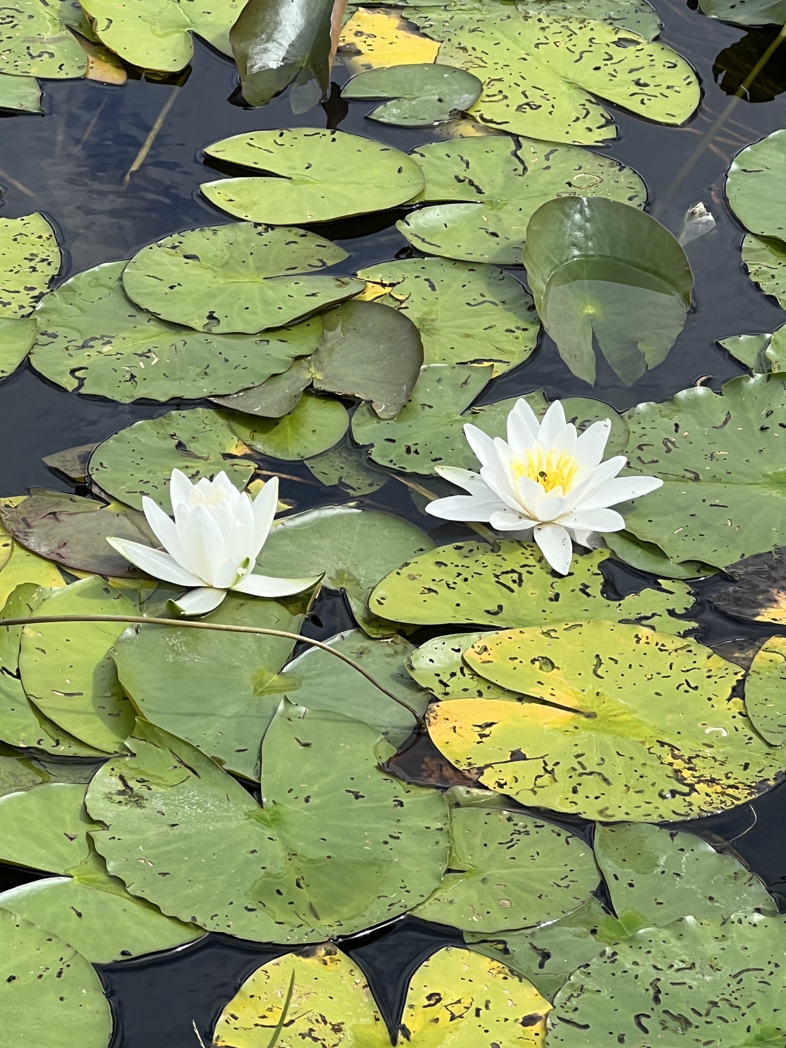
The ten hour flight doesn’t fly by. Instead, the minutes pass begrudgingly. I pass them thinking of the waves, the harbor, my grandparents’ Cesme house. Soon, but not soon enough, we arrive at a familiar small house pushed claustrophobically against its neighbors. Flowers and vines grow everywhere, and a bird or two coo. Across from my mom’s childhood home, the bright blue Aegean stretches out for miles. My eyes barely acclimate to this sort of paradise on Earth before I fall asleep.

Dalyan Harbor

Cesme. CharlesFred. CC BY-NC-SA 2.0.

A view of the Dalyan harbor. Su Ertekin-Taner.

Plate of lokma on a dinner table.

A bite of lokma. Su Ertekin-Taner.

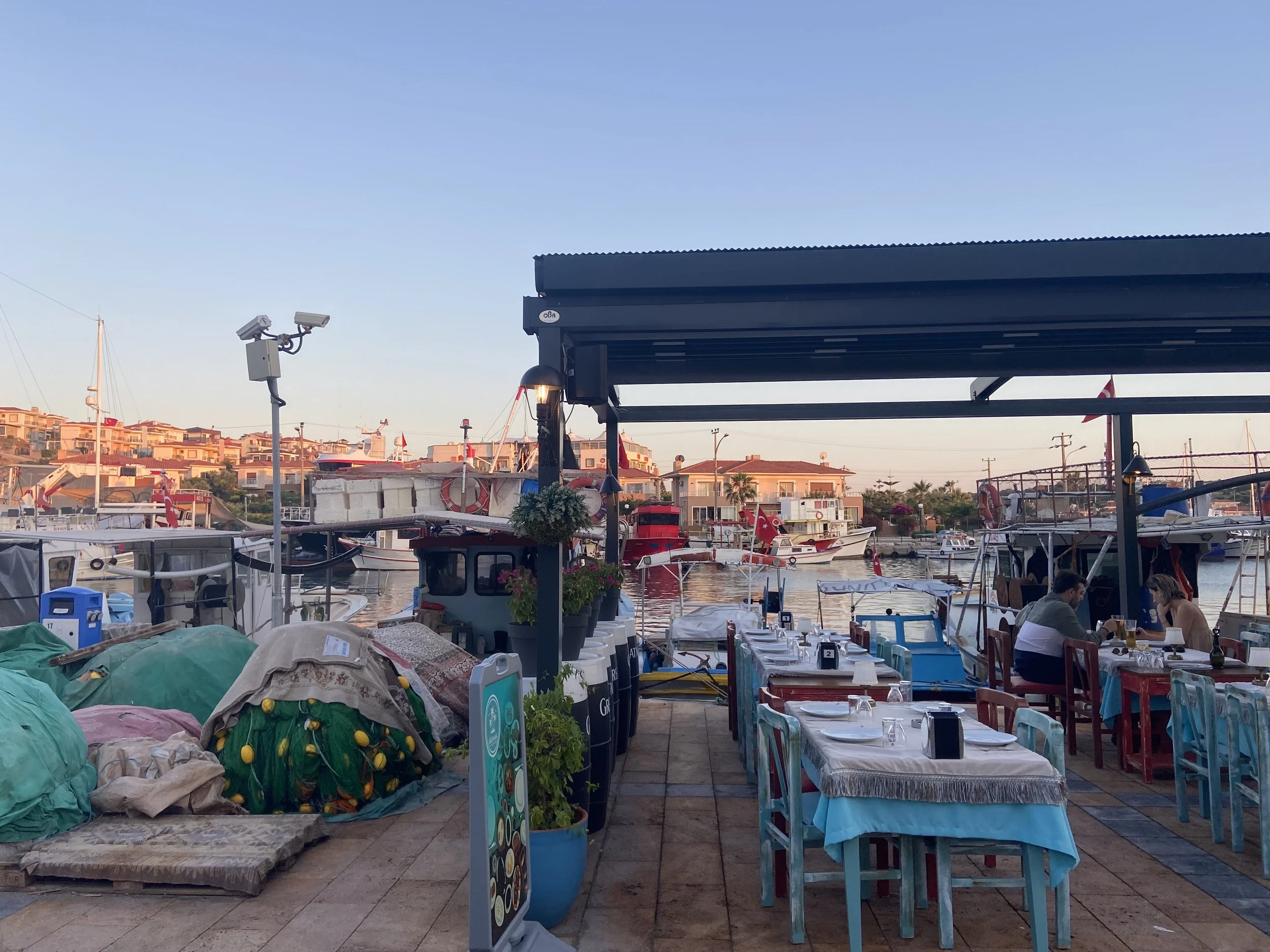
My mom takes me down to Dalyan via a cheap but reliable minibus. Dalyan is another small harbor town just an hour outside of the main Cesme gathering grounds, between the Fethiye and Marmaris districts. While our minibus trip takes thirty minutes, the town is an hour and a half drive from the Izmir airport.

Dalyan, though small and with a population of a little more than a couple thousand, offers many nautical traditions. The riverside dining experience is famed not only for its gastronomy (the fish), but also the riverside aspect; day-long boat tours float along the coast of the town, stopping in the odd Dalyan mud bath; and oh, the beaches. The finest salt water, found for example at Iztuzu Beach, cleanses and captivates swimmers and paddlers.

But now, it is night. We might engage in those activities later. For now, we’re walking through a quiet town. Although this town isn’t loud, its colors are: they shout their pride willingly. The green fishnets, the red-mauve roofs of houses, the turquoise pots of green leaves, the constant blue of the Aegean sea. There are too many hues to count, or rather identify. 

We greedily walk near the harbor first, our eyes hungering for the myriad colors. Fish restaurants — typical of Dalyan — line the scenery, some more crowded than others, some more touristy than others. The diners have just started their mezzes, a kind of Turkish tapas, or they’re readily consuming their main course, of which sea bass is the most popular. A small band plays outside one of the restaurants, trying to attract visitors, but the restaurants are relatively overpriced for Turkey and we’re unwilling to invest; instead, we will order from a more reasonably priced seafood restaurant in the coming days. In between restaurants are boats, small and little, with or sans people. Some boat goers sing to a radio, others drink Turkish tea (cay), reminiscing on some memory or another. 

Then we travel the inner street, more dangerously paved this time. The colors are still exciting here. We walk alongside apartments, markets, pharmacies, and small shops. Some boys play soccer near a tea shop, a couple struts hand in hand. This is a familial sort of place, a close neighborhood — almost. The cobblestone path we walk on eventually takes us to a lokma maker. Lokma is a traditional Turkish dessert of fried dough glistening with a sweet sugar syrup; lokma feels quite traditional, actually, to my stomach. It’s been a year since I’ve eaten my favorite dessert, and my mouth is watering. 

The lokma-makers have prepared the dough and fried it in front of visitors. When the lokma arrives, I’m salivating and finally, the syrup infused dough cuts through the saliva; this is fine enough dining for me. My mom opts for a Turkish coffee which, for many, is quite bitter. I’m fine with my lokma. and I go to bed full.

A Night in Cesme

Cesme Kale. Spiterman. CC BY-ND 2.0

Restaurants line Cesme harbor. Su Ertekin-Taner.

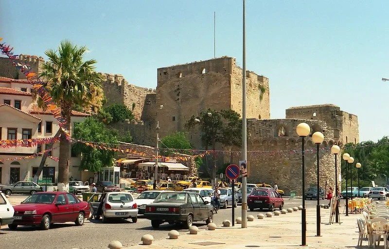
Today, the family travels to the epicenter of Cesme — about 52 miles outside of Izmir — which is not quite accurately described as Downtown Cesme because of its lack of imposing buildings. This is the most heavily populated town we’ll be visiting, with over 30,000 residents, and in some ways, the surroundings reflect this fact. We’re in a developed area, away from the sailing villages, the resorts like Altin Yunus (gold dolphin), Ilica Plaj (Ilica Beach) and Ephesus. We’re near the Cesme Marina, the shopping centers, and the Cesme castle, built to protect the town from the attacking Venetians.

The same minibus leaves us at the top, or start, of a crowded street, but one entirely without cars — it’s only people swarming here. A wide street is host to visitors and locals alike, trotting alongside jewelry stores, shoe stores, bookstores, restaurants and the most common business, gum-infused ice cream. Cesme’s gum trees are as famous as the ice cream they help produce. In the battle for most authentic gum ice cream billboards are used as ammunition, but taste is the final deciding factor in any stalemate. 

Rumeli Dondurma (ice cream) wins the taste, and therefore authenticity, battle by far. Ice cream flavors like banana, melon, pistachio and chocolate are infused with some of the gum from Cesme’s gum trees to create a chewy, stretchy consistency. The ice cream is not only flavorful, but fun to eat. 

With my banana ice cream in hand, we walk along the Cesme harbor now far from the streets teeming with people. Again, boats like the coast along with restaurants, but high end Turkish clothing shops also appear near the water. We practice some visual retail by gazing at the bright colors of clothing in store windows like those of Ipekyol and Yargici. Our feet have been reduced to automated machines by the time we’ve reached the end of the harbor strip and we soon find our way back to our grandparents’ home — by minibus, of course.

Exploring in Alacati

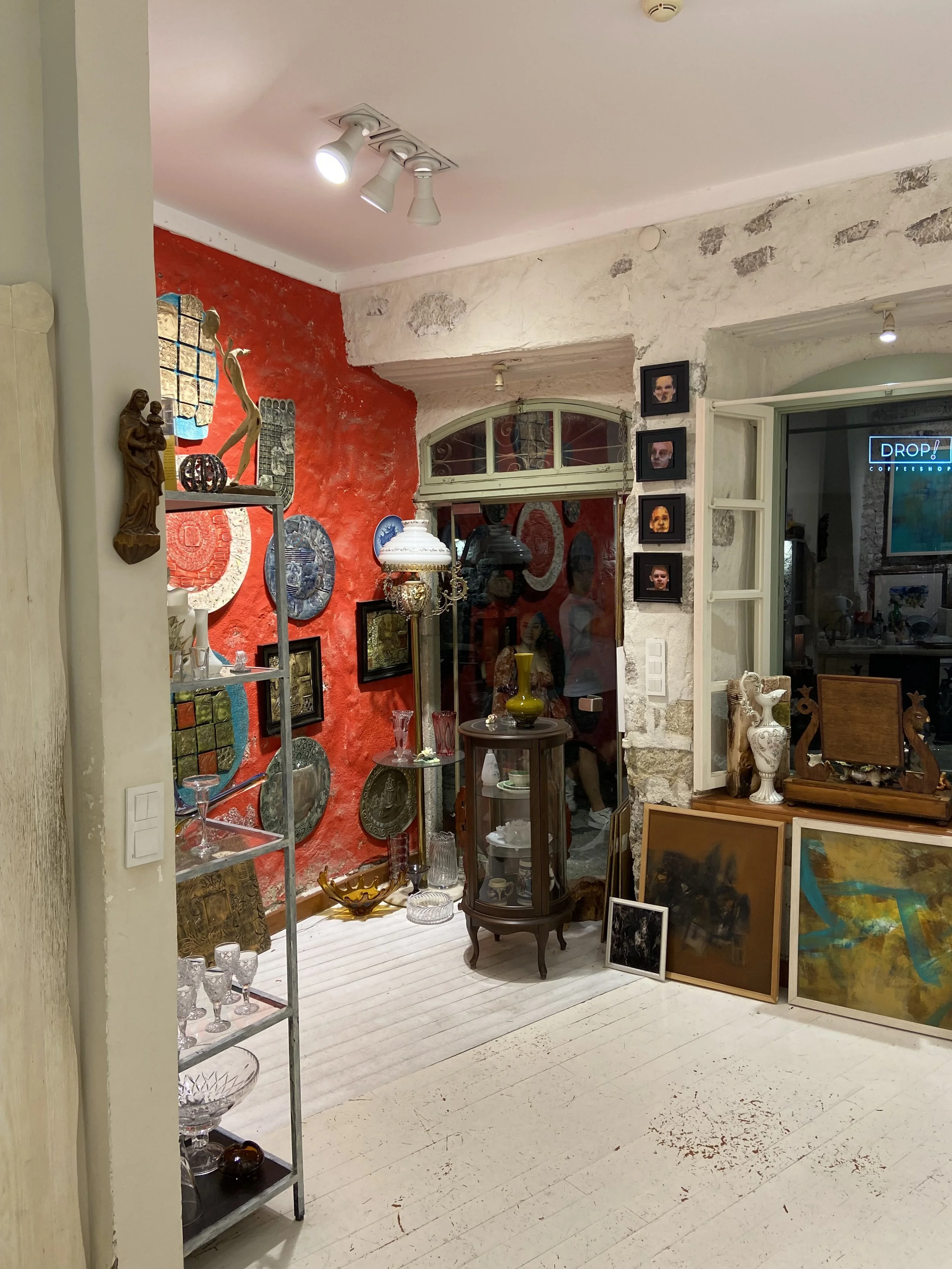
An artist’s shop in Alacati. Su Ertekin-Taner.

A small stone house in Alacati. CharlesFred. CC BY-NC-SA 2.0

We’re close to our final days here, and Alacati is the next stop. We’re met with a sight I have yearned to see for some time: colorful stone houses, boutique hotels, small stores, art galleries, booming bars with music and local restaurants. Because of Alacati’s alluring sights, it’s no surprise that it is the site of many weddings and engagements. 

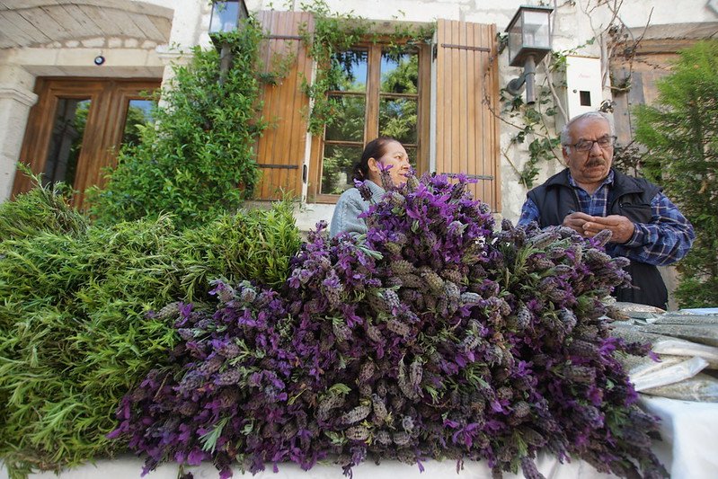
We’re in a “Downtown” part of Alacati, an hour minibus ride away from Cesme and an hour car ride away from the Izmir airport, but I hesitate again to say so, because I still can’t associate the richness of this landscape with any sort of downtown. Just outside of this “Downtown” Alacati are several beaches like Delikli (hole-y) Koy named for the porous rocks along its shore, resorts, markets, the Alacati Marketplace mosque, Alacati’s famous windmills, dating back to 1850, and even windsurf clubs with day and even week-long excursions and lessons, but we’ve decided to be among the Alacati locals. We’re right in the middle of tight streets, nearly unwalkable due to the crowd, but lined with local flora.

The shops that we pass now have oriented themselves similar to the houses of Cesme — nearly on top of one another. Each shop has a well-marked, distinct storefront painted a different color and accompanied by an eager salesperson, ready to sell their own handicraft in many cases or just drinking tea outside socializing, as is Turkish tradition. The local artisans boast hand painted cups, hand-glass blown calligraphy pens, abstract art, handmade jewelry, and more. Still, as we dive deep into the spider webbing streets, the craft doesn’t end.

We reluctantly stop our trek through the tight streets and sit down at a popular Turkish dessert franchise, Ozsut. The cafe offers a selection of ice creams and chocolates as well as more traditional Turkish dessert like kazandibi (a burned pudding with milky and caramel flavors), sutlac (a Turkish rice pudding), and asure (another pudding of dried fruit, nuts, rice, wheat, chickpeas, and beans), but I end up opting for banana ice cream anyway.

Parting

Our trip comes to a close and so does this love letter to the three small towns I visited in West Turkey. To the Aegean sea, the small shops and their local artisans, the tight streets, the delicious fish, the morning, afternoon, and evening tea, to the minibus and the lokma, I wave goodbye — for now.


Su Ertekin-Taner

Su Ertekin-Taner is a first year student at Columbia University majoring in creative writing. Her love for the power of words and her connection to her Turkish roots spills into her satire, flash fiction, and journalistic pieces among other genres. Su hopes to continue writing fearless journalism, untold stories, and prose inspired by her surroundings.

The Life Changing Power of Global Literacy

For the millions of people around the world who cannot read or write, creating educational opportunities for literacy can help close economic and health inequalities.

A child practicing writing in Myanmar. United Nations Photo. CC BY-NC-ND 2.0. 

Within the last five decades, the world has been reading more. Literacy rates have increased around the world, growing from 67% to 86.8% between 1976 and 2020.

However, despite global improvements, there are still some 781 million people around the world who cannot read or write. These numbers do not exist in a vacuum, but rather are intrinsically tied to economic and gender disparities. About 95% of the world’s illiterate population lives in developing countries, and nearly two-thirds are women. Such statistics reflect global gender disparities in which women are more likely to be defined by traditional domestic roles and childcare, roles that — especially in countries where educational opportunities are already limited — cut off women’s access to literacy. 

Child marriages can also derail young girls' education. On Earth today around 650 million women were married before the age of 18.  While child marriages rip young girls of education opportunities, access to education itself actively combat rates of child marriage. Each year of secondary education that a girl completes reduces her risk of marrying before the age of 18 by 5%

Benefits of ReadingWomen attend school in Niger. Global Partnership for Education - GPE. CC BY-NC-ND 2.0.

The benefits of reading and writing skills extend way beyond the pages, as globally literacy works to make the world a healthier, richer and more democratic place. 

Increasing women’s literacy does not just impact lives on an individual level, but entire communities and economies. Every 10% increase of female students in a country leads to a 3% increase in gross domestic product. The real world economic power of literacy plays a crucial role in lifting communities out of poverty. Concern USA estimates that if every student in a low-income country had literacy skills, some 171 million people would escape extreme poverty. 

Opening up educational opportunities, specifically for women, creates a ripple effect among communities. Because women are more likely to be the primary caretakers to children, their own literacy influences whether or not they decide to send their children to school. 

Increasing access to information through literacy can also have long-standing health benefits. Not only does literacy encourage individuals to read and understand medication and treatment options, but it also empowers individuals to seek out medical attention when necessary.  

A study from 2002 found that women in Bolivia who attended literacy programs were more likely to seek out medical help when needed, as well as be more open minded towards receiving vaccinations — both for themselves and their children. Another study found that if a woman was literate she was four times more likely to know how to protect herself from AIDS, while in Nepal literacy has been connected to a more open mind towards family planning.  

In measuring the effects of literacy and its economic and health impacts in communities, UNESCO estimated that infant mortality rates decrease 9% for every year of education that women attend

In addition to increasing access to education and medical knowledge, literacy also strengthens democracy by combating political marginalization and exclusion. Reading and writing are necessary skills for individuals to fill out voting forms necessary in any democratic system, and can also help increase political engagement by granting access to newspapers and written political material. 

Education and Empathy 

Students reading in a classroom in Sejnane. World Bank Photo Collection. CC BY-NC-ND 2.0.

One of the greatest psychological and social benefits of reading is in the way it builds empathy and fosters opportunities for communication and connection. Fiction in particular has been connected to empathy-building. One study in 2006 found that people who read more fiction scored higher in empathy tests. Another study from 2013 found that those who studied fiction improved on empathy tests that measure one’s ability to understand other people’s beliefs and desires that are different from one’s own. 

The effect of fiction on reader’s emotional intelligence stems in part from the way it forces readers to use their imagination and view the world from another’s perspective and life. Fiction writing forces readers to grapple with choices and scenarios that disrupt their expectations and practice empathy towards characters in order to understand their thoughts and actions.

Get Involved

Organizations all around the world are doing their part to make literacy accessible, encouraged, and achievable globally. 

The World Bank seeks to combat global illiteracy through educational interventions, with the goal of reducing the number of children who cannot understand a simple story to half of what it is to today by 2030. The World Bank encourages the public to share information on the global literacy crisis, encourage government officials to invest in literacy programs, and understand the impacts of learning poverty around the world.

Save the Children’s Literacy Boost works to increase literacy rates around the world through individual and communal efforts. The program relies on schools and teacher training as well as community initiatives that support literacy through Book Banks, reading clubs and workshops for parents. A Stanford study found the average child who went through Save the Children’s Literacy Boost program in Rwanda scored higher on reading comprehension tests than 63% of children who did not go through the program.


Jessica Blatt

Jessica Blatt graduated from Barnard College with a degree in English. Along with journalism, she is passionate about creative writing and storytelling that inspires readers to engage with the world around them. She hopes to share her love for travel and learning about new cultures through her work.

24 Hours in Berlin

Getting to know the Grey City in a jiffy.

Brandenburg Gate. Wolfgang Staudt. CC BY-NC-ND 2.0

Berlin is a gritty city, and one whose food, architecture, monuments and culture can only be explained through its grave past. The German capital is a historic center of Europe as the nerve center of Nazi Germany in World War II, the greatest symbol of the Cold War’s infamous Iron Curtain and the prime city to see grand Prussian architecture. While many German institutions like monuments, transportation and active government buildings paint a picture of this historical influence, the picture of Berlin would be left incomplete without mentioning its spirited present. 

In between landmarks like the Reichstag, Germany’s Parliament building, the famous Brandenburg Gate, the remains of the Berlin wall and Prussian palaces lies an amalgamation of diverse restaurants with owners from every corner of the world, a bustling nightlife of clubs and bars, a thriving local music scene and a fashion-forward community. 

Berlin is an urban city through and through; its streets and unassuming apartment buildings (sprinkled between colorful modern architecture) comparable to those of Istanbul with an artistic, stylish flair reminiscent of New York. Live through a bit of history and a bit of present with me as I spend a day in Berlin:


We’re out and about today, but refuse to approach our day on an empty stomach, so we head to a local breakfast place, Erchy’s. Other days we have feasted on the cinnamony pastries of a staple German breakfast cafe, Zeit fur Brot, and even some German-made cheeses bought from German grocery store REWE when we really wanted to masquerade as Berliners. But today is Erchy’s. Their food will fuel the traveling to be done.

Swans in the palace gardens of Charlottenburg. Su Ertekin-Taner.

Graffiti near the S-bahn. Su Ertekin-Taner.

Lily pads in the palace gardens of Charlottenburg. Su Ertekin-Taner.

Charlottenberg. Rfunnell. CC BY-NC-ND 2.0

Graffiti in Berlin. Mitch Altman. CC BY-SA 2.0

We immerse ourselves in Berlin’s public transportation system after food. We use the U-bahn, the German metro, and then the S-bahn, Berlin’s fastest form of transportation to get to today’s location. At times using Berlin’s transportation reveals more about the divide of Berlin via the Berlin wall than any museum could, I think.

Altogether, the journey takes about 45 minutes from the center of East Germany. As we travel, the underground tunnels melt into cloudy skies that overlook old beige buildings decorated completely with graffiti. Berlin’s graffiti scene is one of the most vibrant in the world due to the rise of a countercultural voice during the Cold War and the Berlin Wall days. Graffiti galleries, exhibits, and alleys like the East Side Gallery, Cafe Cinema and Raw Gelande are staples of the Berlin community. As I wander through my thoughts, I sense the train stop. The trek has been made and so, we expect to be met with a reward.

The Charlottenburg Palace more than qualifies as a reward. This Baroque palace was originally constructed on behalf of Friedrich III’s (later King Friedrich I) wife Sophie Charlotte, hence the name. The interior of the palace is richly decorated, representing the height of Prussian high culture: porcelain from the royal porcelain providers KPM lines the walls, mantels are decorated with an East Asian-inspired blue and a ballroom fit with large windows divides the palace in two and overlooks the gate. The signs that guide us through the palace also note, however, the racist portrayal of Middle Eastern and East Asian figures throughout the palace’s art; the Prussian monarchy hoped to assert its dominance in every corner.

Behind the palace, we escape into nature, or a manufactured sort of nature: the Charlottenburg Palace Gardens, inspired by those of Versailles. We walk near rivers of lily pads, greet some sheep tended by palace attendants, swans and even some bike riders; the access to this park is free.

Chicken gemuse kebab at Ruyam. Su Ertekin-Taner.

Doner kebab. Addison Berry. CC BY-NC-SA 2.0

By the late afternoon, we have ambled back near the center of East Berlin. We decided on chicken gemuse doner at Ruyam Doner, which offers the best doner kebab in Berlin, though we did consider a meal at one of the many Vietnamese restaurants — established by the large Vietnamese community —in the area. The line spills out of the restaurant and into the street; everyone is craving some of this chicken gemuse. But the line quickly shortens until we are ordering our kebab of moist chicken, a spicy blend of sauces, and slightly heated bread. 

Turks are the largest ethnic minority group in Germany and often occupy entire neighborhoods like Keuzberg. Many Turks immigrate to Germany for work and stay, or accompany family members who have already migrated. As a Turk, I feel lucky to taste a part of my culture on the streets of Berlin.

A biergarten in Elisabethmarkt. digital cat. CC BY 2.0

We end our day with a biergarten, or beer garden experience. A biergarten usually consists of an open air bar filled with long tables of merry drinkers and well, their drinks; the biergarten is integral to the German citizen and open-air lover. 

We encounter fewer merry drinkers than we plan to, but still sit alongside friends talking and a couple laughing. I have a feeling we’ve arrived in the belly of Berlin, especially as more Berliners gather round, huddle up, and grab some warming alcohol during this chilly summer. 

For travelers hoping to find a warm community with a common motivation–tasting the richness of German beer–a biergarten might fulfill your needs.


While my day quickly ended after my biergarten experience, no two 24 hours in Berlin can be alike, so here are some more options for day adventures to quench your traveling thirst.

Reichstag building. Jurgen Matern. CC BY-SA 3.0

Monuments

Reichstag: The Reichstag, the Parliament building of Germany, actively houses Parliament meetings throughout the year, and somewhat unusually, also allows visitors year round. Attending a tour of the Reichstag means sitting in the German Parliament’s main chamber, observing interior corridors with Russian graffiti completed after the Russian capture of the building in the Battle of Berlin and receiving an oral history from World War II on.

Memorial to the Murdered Jews of Europe: This Holocaust Memorial, designed by New York architect Peter Eisenman, consists of 2711 concrete blocks of varying heights laid out in a rectangular city block. Visitors might note that the blocks increase in height as they approach the middle of the monument; many speculate that this effect reflects the rising fear and agony of the Jewish community throughout World War II. 

Brandenburg Gate: While this neoclassical gate was originally constructed in the 18th century, much of its history lies in the coming centuries. The Quadriga statue of horses perched on the top of the gate, for example, tells a history of Napoleon’s acquisition of Berlin. Napoleon transported the statue out of Berlin to reflect his victory over the Germans. The Brandenburg Gate also symbolizes the division between East and West Berlin during the Cold War, as the Wall was constructed within a couple meters of the gate.

World Clock at Alexanderplatz. Berthold Werner. CC BY-SA 3.0

Berlin TV Tower. A_Peach. CC BY 2.0

Public Squares

Alexanderplatz: This public square named after Russia’s Tsar Alexander I is a commercial and transportation center that houses malls, public art and even live events like concerts. Visit the world-famous World Clock that tells the time of countries around the world, watch a stark yellow tram pass by through crowded streets, or even spot the Berlin TV Tower from afar.

Potsdamer Platz: Potsdamer Platz, located about a mile from the Brandenburg Gate, contains much of the city’s culture. Find the Sony Center dome housing an international cinema, restaurants, offices, museums and the center of underground transportation here —all constructed after the destruction of the public square during World War II.

Museums

Ishtar Gate in the Pergamon Museum. Rictor Norton and David Allen. CC BY 2.0

Pergamon Museum: The Pergamon is one of the museums located on Berlin’s “Museum Island.” The building boasts its collection of classical antiquities from Middle Eastern civilizations and Islamic cultures. The most famous exhibits include the Market Gate of Miletus, the Ishtar Gate that opened up to the processional way to the eponymous capital of the Babylonian Empire and the Aleppo room featuring paneling with images of both the Islamic and Christian faith. 

Topography of Terror: Such a historical city requires a history-based museum. The museum itself is located on a plot that once housed administrative buildings of the Nazi Party, like the headquarters of the SS and the Gestapo. The one-floor museum uses exhibition panels (supported by historical documents and quotes) to guide visitors through the rise and eventual fall of the Nazi Party.

Other

Brandenburg Gate. Dennis Jarvis. CC BY-SA 2.0

Historical Walking Tour: A city with such plentiful history necessitates a historical walking tour. Sightseeing walking tours take visitors through World War II and Cold War monuments like the Memorial to the Murdered Jews of Europe and the demarcation of the Berlin Wall, respectively, as well as some of Berlin’s must-see sights like the Brandenburg Gate and even the Reichstag.

Cuisine

A dish from Madami. George M. Groutas. CC BY 2.0

German cuisine: While much of German food pays its cultural respect to other international cuisines, some German dishes are uniquely synonymous with German culture. Sausages accompanied by sauerkraut or potato salad, rouladen, beef-wrapped bacon, onions, mustard, and pickles and sauerbraten — a German pot roast — all grace the menus of German restaurants. Try restaurants Schwarzwaldstuben in Mitte, Max and Moritz in Kreuzberg, and Clarchens Ballhaus also in Mitte for a taste of Germany.

Vietnamese cuisine: Due to the influx of Vietnamese immigrants —many of whom were temporary contract workers — into East Berlin during the Cold War, the city offers much authentic Vietnamese food. Some high-rated restaurants include Madami located on Rosa Luxemburg Street, Monsieur Vuong on Alte Schonhauser Street, and Maison Umami on Schlesische Street.

Turkish cuisine: Much like the Vietnamese, a Turkish community slowly immigrated to Germany for work and stayed to build institutions that reflect their culture, like the Turkish restaurant. Doner, lahmacun (the Turkish Pizza) and borek (a salty Turkish pastry) proliferate in Berlin. Some high-rated restaurants include Hasir in Kreuzberg, Adana Grillhaus on Manteuffel Street, and Osmans Tochter near Helmholtz Platz.

Nightlife

Clubs: The Berlin party scene is second-to-none. Berlin’s clubs are perfect for those craving a new eccentric song to add to their playlist or a place to wow their friends for a night. Room 4 Resistance’s playlists of tunes with genres ranging from contemporary pop to industrial techno attract a diverse group of music lovers. For those music lovers who prefer to stick to a genre or two, Weeeirdos’ techno sets and Hoe_Mies’s R&B and trap music might be a perfect fit.

Biergarten: Outdoor lovers might prefer the biergarten, or beer garden, night experience. Under a dusk sky, between clumsily strung up lights, lies a comforting community of German beer lovers gathering around wooden benches and tables and self-serving the ale. Try the Prater Beer Garden, Schleusenkrug, and Golgatha Beer Garden for some biergarten action.

Bars: Whether you desire a cocktail or a dance floor for the night, a Berlin bar or two will satisfy your appetite. When in the party capital of Europe, you must do as partiers do, and partiers love to gather on these alcohol-washed oases. Gay bar Model Olfe, aesthetic Victorian-inspired bar Geist im Glas and the traditional Bar 3 are all excellent alternatives for a night of drinking and dancing.


Su Ertekin-Taner

Su Ertekin-Taner is a first year student at Columbia University majoring in creative writing. Her love for the power of words and her connection to her Turkish roots spills into her satire, flash fiction, and journalistic pieces among other genres. Su hopes to continue writing fearless journalism, untold stories, and prose inspired by her surroundings.

Independence and Adventure in Nordic Parenting Culture

Nordic countries’ healthcare and parenting culture allows for an unusual amount of balance and independence — for both children and parents.

Winter stroller walks are the norm. William Fortunato. CC0.

When walking through the streets of Orestad — a developing neighborhood just seven minutes by metro from central Copenhagen, Denmark — it's not uncommon to see dozens of strollers being pushed by young parents clad in thick jackets and scarves. In fact, it seems that this relatively new and modern neighborhood is populated primarily by young parents with babies and toddlers.

Meanwhile, in Oslo, Norway, streets outside of coffee shops and grocery stores are also crowded by parked strollers. Despite the same cold temperatures, the parents are nowhere to be seen. Bundled tightly, the children are left alone to enjoy the cold weather.

Although these two Scandinavian countries take slightly different approaches to monitoring young children, there is much overlap in the parenting cultures of many Scandinavian (and, more broadly, Nordic) countries. In general, many of the parenting techniques new mothers and fathers practice are rooted in a desire to teach their children independence, empathy, respect, and responsibility all while keeping them safe and healthy — even though some tips and tricks may seem shocking to outsiders.

Orestad in Copenhagen, Denmark. Jonas Smith. CC by 2.0.

Perhaps the time and care it takes to foster this unique parenting culture stems from the unusual, yet tremendously beneficial, length of parental (both maternal and paternal) leave in many Nordic countries. In Norway, for example, parents of all genders have the option to take fifteen weeks of paid leave and are paid 100% of their pay, or can take nineteen weeks at 80%. The only difference is that mothers must take the first six weeks after their child’s birth off while their partner begins their quota from week seven after birth. Similarly, in Sweden parents together are entitled to 480 days or paid parental leave (240 per parent). Days off not taken by one parent can be transferred to another if needed. 

The result of these lengthy leaves has not only fostered a deeper sense of shared responsibility by both parents, but also a greater amount of care and attention focused on personalized early childhood development. The level of shared cultural focus on and respect towards young children is just one of the many factors that contribute to the level of safety and health among infants and toddlers in Nordic countries. 

Because of their time at home, a huge staple of Nordic parenting culture is “play” time. Whether children bond with parents at home, or are encouraged to go outside the home and make friends independently, children in Nordic countries are encouraged to explore, play and discover their adventurous side from a young age. There is even a word for this: “friluftsliv.” The word can be roughly translated to “open-air living” and serves as a mantra for parents (and non-parents, too!)

“Friluftsliv” has been a norm for decades. Anders Beer Wilse. CC0.

While play in any capacity is important, play outside is considered especially beneficial to young children. Rather than being scolded for being too rambunctious or messy, children in Nordic countries are encouraged to run and climb to their hearts’ content. Even in the cold weather that pervades Nordic countries for more than half of the year, children bundle up and get outside in the fresh air. 

Rain or shine, it is completely normal to see little ones either running around outside or sleeping! Although there is a deep emphasis on energetic outdoor activities, one of the most prevalent cultural and parenting norms is to leave children outside to sleep. Even in freezing cold temperatures, children are put down to nap outside. Of course, they are accompanied by warm blankets and outerwear. Few in Scandinavia fear the cold, where doctors in Nordic countries recommend outside napping to decrease the risk of illness and infection. 

And, when children aren’t enjoying playtime with parents, bundled-up naps, or outdoor adventure, they have the opportunity to start day care as mere one-year olds. In Denmark, childcare charges are capped at 30% of the actual cost for nurseries and after school centers. In Norway, child centers are open 10 hours per day and charge a maximum fee of US $250 a month.

While having a child is a tremendous responsibility, both the healthcare benefits and parenting culture in Nordic countries allows a balance that eases some stress among new parents. Though unique, many aspects of Nordic parenting culture harness an unprecedented sense of adventure and independence in early childhood.


Carina Cole

Carina Cole is a Media Studies student with a Correlate in Creative Writing at Vassar College. She is an avid journalist and occasional flash fiction writer. Her passion for writing overlaps with environmentalism, feminism, social justice, and a desire to travel beyond the United States. When she’s not writing, you can find her meticulously curating playlists or picking up a paintbrush. 

A 4-day Guide to Exploring Rome

Rome is a city full of must-see sites, but it can be overwhelming to plan for. Here is a 4-day itinerary to make sure you see all the top spots, while getting the atmosphere of a unique European summer.

Rome, Italy. @Bert Kaufmann. CC BY-SA 2.0

“A European Summer” is now the aesthetic of the season, spurred on by Gen Z and Millennial creators on TikTok. It’s a fashion statement, and young American women are obsessed with flowing white dresses, gold jewelry, maxi skirts, and more. The romanticization of European cities is a perfect escape from the monotonous urban environment Stateside. 
Over the past month I was lucky enough to travel to Rome, Italy and experience a taste of the European summer that influencers have been talking about nonstop. But a trip to the Eternal City takes a lot of planning and, while it was only my first time exploring the history-rich city, I feel as though I know enough to compose an ideal 4-day itinerary — so travelers can experience every aspect of the European summer.

Day 1

As your feet touch the streets of Rome, it’s important to keep two things in mind: firstly, your primary means of transportation will be by walking, especially if your hotel accommodations are in the heart of the city itself, something I definitely recommend. So, pack footwear accordingly. Second, temperatures will be soaring. Expect around 100 degrees Fahrenheit, particularly in mid-summer.

Trevi Fountain. @NikonZ711. CC BY-SA 4.0

I recommend getting familiar with the main tourist sites on the first day. These include the Spanish Steps and Trevi Fountain, which are located relatively close to one another. Both are beautiful in the daylight and won’t eat up too much of your time. Throughout the streets it’s common to find small stores that sell gelato or souvenirs — pop into one and notice that prices are surprisingly cheap, especially compared to costs in the US. 

One of the things I enjoyed about my time in Rome was the vibrant nightlife, so make sure to take advantage of all the city has to offer when the sun sets. The temperatures are much more bearable and the streets are filled with small, lively alleyways that offer restaurants and more stores. Live music is usually always playing, especially in places where tourists are likely to flock. If you’re looking for an opportunity to wear that white flowy dress you bought just for the sake of fitting the Italian summer aesthetic, now’s the time. 

Enjoy the unique scenery and environment, and make sure to visit the Spanish Steps once more — while a great place to visit in the daytime, this tourist site comes to life at night and brings that perfect feeling of that “European Summer” the TikToks show so often. 

Day 2

Hopefully you got a full night’s rest, because day two is the perfect day to visit Vatican City — a landlocked independent country within the borders of Rome itself. It’s important to dedicate an entire day to this because, while you’ll most likely only spend a few hours exploring, the exhaustion will set in quickly.

If interested in the Vatican Museums, I strongly recommend buying tickets weeks beforehand and selecting an earlier time. The tourists that were hoping to get tickets on the day of had to wait in line for hours on end in the burning heat. Make sure to arrive early, since the museum is a little further than expected from the main entrance to Vatican City.

Vatican City. @Diliff. CC BY-SA 3.0

Once in the museum, you can either follow your tour guide or explore at your own pace, depending on the ticket you bought. You’ll get a glimpse of St. Peter’s Basilica — a famous church built in Renaissance style — from a viewing platform and get to visit the Sistine Chapel, a Catholic church located inside the Vatican Museums home to some of Michelangelo’s finest work.

Because Vatican City is a Theocratic city-state, most websites will advise you to wear a certain type of outfit. But because it’s so hot in the summer months, it’s alright to push the rules a little. Showing up in shorts and a T-shirt is completely acceptable.

Take the rest of the day to recharge. Walking to, from and around Vatican City can get very tiring, especially if it’s hot out. Stay close to your hotel for dinner, and day two will shoot past in the blink of an eye.

Day 3

Depending on whether or not you’re fascinated by Roman culture, Day 3 is dedicated to the rest of the places you weren’t able to see. For me, this included the Pantheon and Piazza Navona, which are both very close to one another. Shopping in Rome was also a pleasant experience, with such cheap prices, so I recommend it if you’re able to fit it in. 

Pantheon. @laszlo-photo. CC BY 2.0

For dinner, venture on over to Trastevere — a neighborhood filled with authentic Italian restaurants, located just across the Tiber River. The pasta and pizza is, of course, something every visitor should try. Paired with a drink of your choice, it’s hard to question why Rome is a city that attracts so many people from all over the world. The constant chatter of customers, the lights hung up as decoration, and the comfortable temperature combine to make a perfect getaway.

Day 4

Your last day in Rome should be dedicated to doing whatever you want. After three full days of so much walking, your body is bound to be tired, so just take this day as a time to relax and soak this experience in.

I know I haven’t mentioned the Colosseum — and it isn’t because it’s been forgotten. During my trip, I visited the Colosseum at night on my last full day in Rome, and it was the right decision. Of course, depending on the kind of traveler you are, this might not be your ideal itinerary but I loved seeing one of the most iconic landmarks in the world at night. I didn’t have to worry about the heat, and there is something so special about seeing the Colosseum lit up with hundreds of lights as it towers above you. It’s a great image to part Rome with, and along the road you’ll most likely pass the Roman Forum, which is impossible to miss. 

A night view of the Colosseum. @Aaron Logan. CC BY 1.0

Personally, this 4-day itinerary helped me get the feel of every aspect of the “European Summer” — from its nightlife to its famous sites, it didn’t disappoint. Depending on the type of person you are, this itinerary is bound to change but as someone who loves spontaneity and surprises, I followed this rough guide and was able to soak in all the wonders of this eternally beloved city.


Michelle Tian

Michelle is a senior at Boston University, majoring in journalism and minoring in philosophy. Her parents are first-generation immigrants from China, so her love for different cultures and traveling came naturally at a young age. After graduation, she hopes to continue sharing important messages through her work.

Barbie Across Borders

Around the world, countries censure or celebrate Barbie, a film that violates localized beliefs about feminist expression and the satirization of patriarchy.

Barbie Movie Billboard. Brecht Bug. CC BY 2.0

“Barbie” premiered around the world late last month, quickly becoming a global sensation in the weeks that led up to its release. The film follows protagonist Barbie as she ventures on a journey of self-discovery that causes her to question the values  of a patriarchal society. The United States, China, Saudi Arabia and other Middle Eastern countries had mixed reactions to the film, ranging from dissatisfaction with its promotion of women's empowerment to the celebration of female independence and capability. 

The film has caused discourse in China, where movies still include considerably outdated gender roles. Media like Mr. Six and Gentlemen From Eastern 8th are reminders of the sexist normalcies that still exist in Chinese entertainment and society, including the objectification and oppression of women in the roles that they play. Barbie has been praised and disparaged for calling attention to these instances of gender inequality with many women appreciating the film’s recognition of such an “objective reality” and depiction of strong rather than objectified women. In recent years, China’s involvement in the political landscape of feminism has been backsliding, with rejections of sexual harassment lawsuits and arrests of those protesting for greater feminist representation. Because of this, China is not entirely dissimilar to the conservative politics in the United States, both of which believe that the film succeeds at emasculating men. Regardless, across the U.S., the debut of the film was largely met by fans with outfits of pink and reviews acknowledging the film as a “cinematic and emotional masterpiece.” Not long after, fans of the film in China also began to express support for the film by wearing pink and complimented the film as the best expression of feminism

Latin and South American countries have also embraced pink, specifically through food. Vendors in Mexico and Guatemala have sold pink tacos while Venezuela, Chile and El Salvador have created arepas with beet dough for pink coloring. Support for the film has been widespread across the region, as it has reinvigorated radical public protest and prompted movements like “Barbie Buscadora.”

Across countries in the Middle East, “Barbie” has been banned as it was found to promote subversive elements that distort the values of society, namely the protection of public ethics and social traditions. Because of loyalty to these values, the most severe restrictions were issued in Kuwait and Lebanon, where the film was completely banned from theaters as opposed to the more targeted censorship of scenes that challenged social norms around male guardianship and homosexuality. As cultures with heavy importance placed on gender roles within a family, those with a vested interest in the current system find their values contradicted by the film’s feminism. In Lebanon, Mohammed Mortada asked that the film be banned saying that it, “challenges the guidance of the father … ridiculed the role of mothers.” 

Despite aversion to the film’s release in Kuwait and Lebanon, “Barbie” premiered in Saudi Arabia and the United Arab Emirates. With men and women alike flooding theaters to view the film, many felt that the movie had important lessons for everyone regarding their  roles in the world. Saudi Arabia’s perception of the film has reflected the broader changes occurring in the country’s cultural and entertainment landscape. As a country that is steeped in patriarchal gender traditions, specifically repressive guardianship and the imposition of domestic responsibilities on women, the immersion of Western-influenced media into the nation is expected to be regulated. However, the current reception of the film suggests a society capable of combining tradition and progress.

“Barbie” has brought forward an interplay between cultural normalities and evolving societal attitudes across a variety of countries. In some ways, the film could be perceived as a step towards female empowerment, while conversely approached with caution to avoid disrupting traditional values. As a testament to how global media can challenge and align perspectives, the film is one that illustrates the ability to challenge universal themes despite differences in local interpretations. The global tendency in the 21st century has been to encourage the feminist movement across progressive and conservative countries alike, and with such a broad range of perspectives, it’s a film that has caused considerable ripple effects.


Mira White

Mira is a student at Brown University studying international and public affairs. Passionate about travel and language learning, she is eager to visit each continent to better understand the world and the people across it. In her free time she perfects her French, hoping to someday live in France working as a freelance journalist or in international affairs.

10 Natural Disasters that Shook History

Witness the awe-inspiring forces of nature unleashed through devastating hurricanes, volcanic eruptions and catastrophic floods.

The recent havoc wreaked by a wildfire in Hawaii has turned the once-idyllic summer paradise into a scene of devastation. The ferocity of another’s sweep through British Columbia and the Northwest Territories stands as a stark testament to the awe-inspiring might of Mother Nature. In contemporary times, we find ourselves confronting an array of astonishing extreme weather events and disasters. From heart-rending floods in California to merciless storms battering Mississippi, and the earth-shattering earthquakes that shook Afghanistan, these events underscore the delicate balance between human society and the natural world.

Throughout the annals of history, spanning various epochs of human progress, we encounter a recurring theme of dramatic weather and geological upheavals. Presented below are six far-reaching instances of natural disasters, each demanding a profound respect for the forces of nature.

1. The Great Hurricane of 1780

Caribbean Islands

Egmont Robt Fanshawe Esqr, Commander, when dismasted in the Great Hurricane on October 11th 1780 near the Island St Lucia. Royal Museums Greenwich. CC0.

Among the most catastrophic events etched in the annals of the Atlantic Ocean is the Great Hurricane of 1780, a tempest that swept across the Caribbean archipelago and left in its wake a death toll that neared 22,000 victims. The island of Barbados, nestled among the Lesser Antilles and situated to the north of Venezuela, bore the full brunt of this storm’s wrath. Accounts from the local inhabitants paint a grim picture: “Many ships were wrecked and many people were killed…the wall has been completely washed away by the sea and the back of the house has been left only on single struts”. With wind speeds exceeding 200 mph — a velocity that engulfs the length of a football field (300 feet) in just over a second — this storm annihilated every vestige of human civilization in its path. Trees, houses, stones, and wood crumbled before its might. Fortresses, cannons, and ships were tossed haphazardly, like mere playthings, as the tempest raged on. Its course then shifted northwestward, targeting the islands of Saint Lucia, Martinique, Dominica and Guadeloupe.

On Martinique, a nucleus of French sugar production that depended heavily on enslaved labor, the hurricane’s fury claimed a toll of roughly 9,000 lives. But the storm’s impact transcended the natural realm. It unleashed winds that bore the force of history, catalyzing a chain of events that reverberated into the American Revolution. Both British and French troops, staggered by the disaster, bore the brunt of its blow. The catastrophe was particularly unkind to the French forces, then taking part in the American War of Independence as an ally of the newly declared United States — over 40 ships were swallowed by the depths near Martinique, and the death toll among soldiers grew to around 4,000. The impact extended to the British side as well, leaving their once-potent fleet decimated by a trio of consecutive storms. In part as a result, the English presence in the northwestern Atlantic suffered a profound and enduring contraction.

2. Mount Tambora’s Eruption, 1815

Indonesia

Rocks and ashes on the ground with smoke in the background in front of a mountainrange.

Tucked away on the obscure Indonesian island of Sumbawa, the name Mount Tambora might elude recognition today. Yet, its eruption in the spring of 1815 held within it the power to reshape global weather patterns indefinitely. On a seemingly ordinary afternoon, as the sun prepared to dip below the horizon on April 10, 1815, Mount Tambora rumbled to life. An astounding 12 cubic miles of gases surged into the atmosphere, accompanied by a tumultuous eruption of dust and rocks that choked the skies and enveloped both the island of Sumbawa and its surroundings in a shroud of darkness. Amid this scene of apocalypse, inhabitants either met their end in the fiery conflagration or succumbed to the merciless hail of rocks. The handful of survivors found their once-fertile land tainted by volcanic ash and other substances, rendering it incapable of yielding crops. The ensuing famine claimed many remaining lives as starvation took its cruel toll.
The eruption, though spanning merely three days, reached its dramatic pinnacle with the mountain expelling an astounding 300 to 500 million kilograms of material every second. This eruption stands as an unparalleled event in documented history, claiming the lives of 100,000 islanders. It also unleashed the largest recorded volume of toxic sulfurous gases and volcanic ash from a single natural source. The once stately Mount Tambora, which had stood tall, now bore the scars of devastation, losing more than a third of its height as a shattering explosion rent the mountain asunder on that fateful April evening.

The 1815 Mount Tambora eruption. The red areas are maps of the thickness of volcanic ashfall.Wikipedia Commons. CC0.

The aftermath of this eruption reverberated not just in the years that followed, but has cast its shadow even upon the present day, nearly two centuries later. Geographically, the immense explosion carved out colossal craters along Tambora’s rim, plunging to depths of around 1.2 kilometers. It caused a veil of sulfate dust to enshroud the planet, casting a cooling pall over temperatures and unsettling crucial weather systems for over three years. This era, often referred to as the “Year Without a Summer,” cast its shadow in 1816. Across Europe, temperatures plummeted and precipitation surged, ushering food scarcity and triggering widespread upheavals, with protests and riots sweeping across the continent. This tumultuous atmosphere gave birth to iconic gothic literature like Mary Shelley’s “Frankenstein,” John William Polidori's “The Vampyre,” and Lord Byron’s “Darkness”. Meanwhile, North America experienced its share of hardship as well, with New England grappling with snowfall and “killing frost,” a factor that catalyzed the Panic of 1819, the United States’ first major economic depression. Moreover, the impact of this eruption radiated across the ecology of the Indian subcontinent and the Arctic, spawning pandemics and wreaking havoc on ocean currents.

3. Yangtze River floods, 1931

China

A sign for environmental protection at Yangdi village. shankar s. CC BY 2.0.

The city of Wuhan, China has gained global recognition as the ground zero of the Covid-19 outbreak. However, Wuhan's story stretches back beyond this contemporary chapter, encompassing a legacy of natural upheavals spanning nearly a century. China‘s iconic Yangtze River, an aquatic lifeline celebrated for its contributions to sustenance, irrigation, sanitation, trade and industry, harbors another facet — the potential to ravage the land with its powerful floods. The pages of history bear witness to the tumultuous year of 1931, when torrential waters surged and engulfed swaths of central and eastern China. This watery onslaught did not bustling towns of Wuhan and Nanjing, as the Republic China was torn asunder by political tumult, economic strife and relentless conflict. Amid the backdrop of droughts and challenging winters that plagued the 1920s and 1930s, the Yangtze River basin bore witness to a torrent of water cascading downstream in the spring of 1931, as ice and snow yielded to the warming sun.
Within the cradle of civilization that is the Yangtze River Basin, a substantial segment — roughly one-third — of China’s population makes their home. The specter of flooding casts its shadow, further accentuated by deforestation and the unchecked utilization of wetlands. As spring unfolded its petals, waters of the river cascaded into the thoroughfares and mingled with the discharges from Wuhan’s overburdened sewers. By the start of August in 1931, a sprawling area encompassing 180,000 square kilometers — a vast terrain akin to the collective expanse of New York, New Jersey, and Connecticut — was claimed by the deluge. Cities and hamlets submerged were in their entirety, while others stood as half-drowned relics. In the throes of the flood‘s onset, around 150,000 lives soon succumbed to its watery embrace, while the final toll remains a haunting enigma. Economic devastation ensued, obliterating years of hard-earned income for countless individuals. Amidst the aftermath, the specters of famine and disease loomed large, exacting a toll far surpassing the deluge’s immediate impact.

4. Valdivia Earthquake, 1960

Chile

This masonry office building in the downtown area of Concepcion, Chile collapsed as a result of the M 8.8 earthquake on Feb. 27, 2010. U.S. Geological Survey. CC0 1.0.

Chile’s geographical positioning atop a convergent plate boundary leaves it perpetually exposed to Earth’s shifting tectonic plates. One seismic spectacle that resounds through history is the Tsunami of May 22, 1960 — a seismic symphony that crescendoed to a magnitude of 9.5 on the Richter scale. To grasp the significance of this figure, consider that an earthquake registering between 6.1 and 6.9, like the temblor that rattled Little Antelope Valley, California near the Nevada border on July 8, 2021, can already inflict substantial devastation within densely inhabited areas. Now, imagine the seismic intensity of a magnitude 9.5 earthquake, which is an overwhelming 177,827.941 times more potent in terms of energy released than a magnitude 6 quake. This degree of seismic activity can wreak havoc, decimating any settlements in proximity to its epicenter. This seismic reckoning occurred around 3 p.m. on May 21, 1960, approximately 100 miles (160 km) offshore from Chile's coastline, tracing a parallel path to the city of Valdivia. In a time when Chile was gearing up to honor the Battle of Iquique, the coastal haven of Concepcion was suddenly plunged into turmoil. The portents of impending catastrophe manifested in violent tremors, the precursor to the cataclysmic quake that bore a magnitude of 7.9 at its inception.

The grimmest chapter unfolded the ensuing afternoon, as a seismic rupture of staggering scale snaked along a sprawling 600-mile fault line. In a dramatic geological ballet, the Nazca Plate — an expanse of the Pacific seafloor rivaling California in magnitude — descended fifty feet beneath the South American continent. The thriving harbor town of Valdivia met its demise, while a multitude of coastal settlements vanished into oblivion. This seismic drama had unforeseen consequences, expanding Chile’s realm by an area equivalent to around 1,500 football fields. Heightening the seismic spectacle, the epicenter of this cataclysm sprawled along a nearly 700 mile tract along the southern edge of the Chilean coast. The upheaval stirred up tempestuous seas, resulting in ruin across distant shores — from Hawaii and Japan to the Pacific coastline of the United States. An estimated count of two million people found themselves displaced by this seismic upheaval. In terms of monetary toll, the damage in Chile alone amounted to a staggering $550 million, with the aftermath registering a grim tally of several dozen to hundreds of fatalities and casualties from the South American and US West Coast, to Japan and the Philippines at the other end of the Pacific.

5. Bhola Cyclone, 1970

Bangladesh

A woman walks past makeshift shelters in the Cyclone aftermath, Bangladesh, 2007. Direct Relief. CC BY-NC-ND 2.0. 

Bangladesh, a densely-populated delta nation born from eroded Himalayan sediments, endured the catastrophic Bhola Cyclone in 1970, impacting the country (which was then known asEast Pakistan, and part of the Pakistani state that exists today) and India’s West Bengal. The region's history of cyclones left it vulnerable, averaging nearly two annually from 1959 to 1969. Termed the “Bhola Cyclone,” it ranks among the 20th century’s deadliest disasters, claiming 300,000 to 500,000 lives. The storm's origins trace back to a dissipating tropical system over the Malayan Peninsula on November 5. Rapidly intensifying by November 12, it struck with 130 mph winds. But, as traditional danger notifications over Radio Pakistan came to an abrupt halt, coastal residents were left unaware of the impending peril's magnitude, as reported by Pakistan Press International (PPI). In the aftermath of the devastating cyclone, countless survivors were stripped of their belongings, left only with their lives, as entire villages, rice harvests and essential provisions were wiped out. Following this, outbreaks of cholera and typhoid added to the challenges.

The aftermath of the Bhola Cyclone also played a crucial role in East Pakistan's pursuit of independence from the grip of West Pakistani authority. The mishandled response to the disaster allowed the Bengali Awami League to champion both independence and political reform. This movement gathered momentum in December 1970, when the League secured victory in the elections. As a result, East Pakistan transformed into Bangladesh in 1971 — a victory for freedom caused in part by the cyclone’s impact, although independent Bangladesh would undergo periods of tyranny.

6. Tangshan Earthquake, 1976

China

July 28, 1976, Tangshan earthquake, epicenter area. Wikipedia Commons. CC0.

Tangshan, located in Hebei Province, China, felt the earth’s fury in a cataclysmic event that still resonates as one of the deadliest and most destructive earthquakes in recent memory. On the quiet morning of July 28, 1976, as darkness lingered before dawn, the thriving Chinese industrial city of Tangshan was abruptly thrust into chaos. Hints of the impending disaster were strewn outside the village of Baiguantuan. A thousand chickens, typically eager for sustenance, abandoned their feed to sound off an agitated cacophony. Mice and yellow weasels, creatures of the night, scrambled in frantic retreat, sensing the impending upheaval. 

Subsequently, a seismic shock with a magnitude ranging from 7.8 to 8.2 on the Richter scale rocked the region for 23 seconds, reducing 90% of Tangshan's buildings to rubble. This was followed by a series of potent aftershocks, two of which surpassed a magnitude of 6.0. Roughly 15 hours later, a robust aftershock measuring 6.1 struck. The earthquake obliterated coal mines and the industries reliant on them, triggering the collapse of power, water, sewage, telephone, telegraph, and radio networks. The destruction of railway and highway bridges isolated the city entirely. Tragically, half of the city’s population — about a million individuals — lost their lives.

7. Ethiopia Famine, 1983 –1985

Ethiopia

Those who weathered the 1984 famine in Kobo and belong to the elder generation conveyed to ambassadors Haslach and O'Hara that the compounding impact of several unfavorable rainy seasons has resulted in the most formidable drought they have ever experienced. USAID Ethiopia. CC BY-NC-SA 2.0

In spite of a global food supply that typically suffices for the world's growing population,  hunger remains an unfortunate reality in many developing nations. Over the past decade, grain yields per hectare in Africa have plunged by a third, and since 1981, food production has diminished by 15%. The year 1984 marked Ethiopia's encounter with a massive famine that reverberated across the globe, claiming around 2 million lives. A harsh drought intertwined with fierce conflicts to intensify the distress, as Eritreans fought for their autonomy and Tigrayans for their rights. This turmoil unfolded in central Eritrea and the Tigray region in northern Ethiopia, marred by arbitrary incarcerations, expulsions and ethnic cleansing. Manipulating hunger relief, the Ethiopian government used the crisis to relocate and expel Tigrayans, triggering a more volatile conflict that obstructed aid delivery to civilians in controlled areas. Consequently, sick and famished individuals congregated along stretches of Wollo's north-south road, halting vehicles in a desperate plea for sustenance — an unsettlingly frequent sight.

Accounts of hunger in Wollo and Tigray were disregarded by authorities and shrouded in secrecy. Aid organizations overlooked warning signals, prioritizing a rapport with the government. Economically, the majority of Ethiopian farmers are involved in livestock rearing or agricultural activities. Their reliance on the market to meet even their basic consumption needs is profound throughout the year. The drought of 1984 exposed the frailty of Ethiopia's political and economic systems, causing the loss of nearly 8 million lives to famine. Today, the threat of starvation still hangs over Ethiopia, impacting no less than 350,000 individuals in the Tigray region, still wracked by conflict four decades later.

8. Kashmir Earthquake, 2005

Pakistan

The meeting point of the Indian and Eurasian tectonic plates lies right in the heart of Kashmir, giving birth to the grandeur of the Himalayan mountain range through intense geological forces. This collision not only shaped the Himalayas but also unleashed tumultuous seismic activities in the area. In the early dawn of October 8, 2005, a formidable earthquake rocked northern Pakistan, leaving behind a trail of devastation. The consequences were felt deeply: villages were leveled, roads buried under rubble, and vital services such as water and electricity were severed. A staggering three million individuals found themselves homeless, while the grim count of human lives lost reached a tragic toll of at least 80,000. This seismic occurrence stands as the nation’s deadliest earthquake ever experienced. Among the most severely affected regions was Uri, where the heart-wrenching aftermath left 80% of the town in ruins. 
The scene in the Muzaffarabad region of Kashmir was equally haunting, as villages laid in ruins, bearing silent witness to the aftermath of a natural disaster. Over 780,000 structures were left devastated or irreparably damaged, while countless more faced extended periods of unusability. Notably, around 17,000 educational institutions and crucial hospitals situated near the epicenter of the earthquake either crumbled or suffered significant destruction. Reporters on the ground captured heart-wrenching moments, where traumatized parents, their eyes filled with panic, gathered in search of their children. Amid the chaos, faint cries of surviving children could be discerned from the debris, a fragile ray of hope in the overwhelming despair. However, with the passage of time, those cries grew fainter, and as night descended, grieving parents began the grim task of recovering the lifeless bodies of their young ones.

9. Haiti Earthquake, 2010

Haiti

A poor neighborhood in Haiti shows the damage after an earthquake. United Nations Development Programme. CC BY-NC-ND 2.0

The 12th of January, 2010, marks a somber date in Haiti's history, forever associated with a colossal earthquake. The earth shook with a magnitude 7.0, and its epicenter in Port-au-Prince, the capital, was delivered the harshest blow. Once-vibrant neighborhoods and towering structures crumbled, nature’s unyielding might reshaping the cityscape. Haiti's geological position along a fault line between substantial tectonic plates makes it prone to seismic activity, evidenced by historical quakes in 1751, 1770, 1842 and 1946. However, the country's houses, often made of concrete and cinder block to withstand storms prevalent in the Caribbean, displayed vulnerability during earthquakes.
In a nation already locked in poverty’s grip, this catastrophe left an indelible mark. It went down in history as the most catastrophic event ever faced by the Western Hemisphere’s most destitute country. The impact was overwhelming: approximately 3 million people were caught in its fury, with an unimaginable loss of about 250,000 lives and another 300,000 grappling with injuries. A staggering 19 million cubic meters of debris, enough to stretch a mournful line from London to Beirut if gathered, signifying the immense destruction in Port-au-Prince. Amid the ruins, the education sector lay in ruins, with four thousand schools reduced to rubble or severely compromised.

10. Siberian Taiga Fires, 2019 –2020

Russia

An emergency firefighter from the Ministry dousing a forest fire near the Novovoronezh Nuclear Power Plant. RIA Novosti archive, image 733844  Alexey Kudenko. CC-BY-SA 3.0

Picturing Russia’s icy dominion of Siberia, it might appear inconceivable that this frigid realm could ever harbor one of the planet's mightiest wildfires. Yet, in early spring in 2003, this implausible chapter began to unfold, with echoes in 2019 and and again in 2020. The wildfires, sparked by lightning, stand as vital ecological players in the birthing and nurturing of boreal forests. But Siberia’s story in recent decades has taken a dangerous turn. A mix of parched conditions and heightened human involvement has triggered a surge in fires, making them more frequent and covering wider ground. This shift has altered the historical fire patterns. Between 1995 and 2005, the fires in this region shot up tenfold. And then there is 2021, when a single fire claims  40 million acres of forest. Yet, close to half of that destruction occurred in 2019 and 2020. This hints at a potential threshold, potentially already passed, after which extreme fires could become a common occurrence in the region.

With more than a fifth of the world’s forested expanse within its borders, these  lands are home to many Indigenous and local communities in underdeveloped areas that rely on the boreal forest for timber. Real peril surfaces for these groups when they face  Siberia’s peculiar wildfires, aptly named “Zombie” fires. These are wildfires that possess the eerie ability to spontaneously rekindle months after being quelled, maintaining an underground inferno within partially decomposed organic matter in Siberian soil. In the absence of proactive measures to combat global warming and safeguard ancient woodlands, these fires are destined to swell in size and surge in uncontrollability with each successive year.

The aftermath of these catastrophic events has seen age-old landscapes, nurtured and passed down through generations of human stewardship, swept away by transformative suprahuman forces. Through the preservation of the narratives about these occurrences, humanity confronts its identity as an indispensable element in the delicate web of our ecosystem, transcending the notion of a mere overseer.

TO GET INVOLVED:

All Hands Volunteers and Happy Hearts Fund united their efforts back in 2015, right after the devastating earthquake struck Nepal. Their joint endeavor aimed to reconstruct schools and communities fortified against future disasters. Guided by the vision of David Campbell and Petra Nemcova, the fusion of these two forces coalesced around the powerful concept of “Smart Response.” By the fall of 2017, the merger's resonance was clear as All Hands and Hearts stood tall. Learn more about All Hands Volunteers and Happy Hearts Fund here.
Direct Relief International has emerged as a steadfast force, improving the lives of individuals caught in disasters in 80 countries. The group designs a multifaceted response by offering food, drink, shelter and medical care. Direct Relief methodically tailors medical aid to fulfill urgent requirements, keeping a pulse on the particular dynamics of each case and giving search-and-rescue operations, emergency medical services, and quick logistics top priority. This project entails locating essential local healthcare professionals, comprehending the unmet requirements of outlying populations, mobilizing appropriate medications and equipment, and deftly managing the complex logistics of storage, transportation and allocation. Learn more about Direct Relief International here.


Hope Zhu

Hope is a Chinese international student at Wake Forest University in North Carolina studying sociology, statistics, and journalism. She dreams of traveling around the globe as a freelance reporter while touching on a wide range of social issues from education inequality to cultural diversity. Passionate about environmental issues and learning about other cultures, she is eager to explore the globe. In her free time, she enjoys cooking Asian cuisine, reading, and theater.

Pathways and Pilgrimages: Exploring The Camino de Santiago

This pilgrimage to the Cathedral of Santiago de Compostela in Spain has been a centerpiece of Christian spiritual life for thousands of years, and a destination for travelers around the world.

The Santiago de Compostela. Dafydd Parri. CC BY-NC-ND 2.0.

The Camino de Santiago, also known as the Way of St. James, marks a pilgrimage to the Cathedral of Santiago de Compostela in Galicia, an autonomous community in northwestern Spain. Extending roughly 500 miles and taking about 30 to 35 days to complete at an average of around 15 miles per day, the Camino is known today both as a center for Christian spiritual life and a hiking haven for travelers looking to submerge themselves in nature with affordable accommodations and opportunities to adventure through local villages along the way.

Today, around 300,000 travelers make their way through the Camino every year, and those who complete the journey earn a Compostela Pilgrims Certificate. According to measurements from 2021, 45% of travelers reported walking the Camino for “religious and other reasons” while 30% reported walking the Camino strictly for religious reasons and 24% said they had no religious reasons for the pilgrimage. The growing popularity of the Camino as a secular travel experience as well as a religious one is aided by its accessibility. While daily expenditures on the Camino depend largely on the town one is stopping in, travelers can plan to budget for about $30 a day to cover the cost of food. Albergues, or hostels specifically made for pilgrims, are also a reliable and affordable option for accommodations along the Camino, with municipal albergues typically costing between $5 to $10 per person, while private albergues range between $12 and $15 per person. Via Lusitana helps connect travelers to albergues along the Camino Portugues.

While there is no exact starting point to the Camino, there are a handful of popular routes to choose from including Camino del Norte, Camino Primitivo, and Camino Ingles. The two most popular routes are that of the Camino Frances, which begins in Saint-Jean-Pied-de-Port in southwest France, and the Camino Portuguese which starts from Portugal’s coastal city of Porto. While the Camino Frances covers 500 miles, the Camino Portuguese offers two distinct routes: the Camino Portuguese Central route which is 385 miles and the Camino Portuguese Coastal route which is 175 miles. 

The Camino became a UNESCO World Heritage site in 1993 and was recognized as the first European Cultural Route in 1987, however its history is one that dates back to the 9th century,  when remains of the apostle James were believed to be found in Galicia. Saint James preached in the Iberian peninsula before returning to Jerusalem, where he was beheaded by the king Herod Agrippa I in 44 AD. The legend surrounding St. James details how his body was transported from Jerusalem to Spain via a boat and was buried by his followers in Galicia in what is now the city of Santiago de Compostela.

The tomb was discovered in the 9th century by the bishop Theodomir. Upon its discovery the King of Asturia, Alfonso II, widely considered the first pilgrim to the Santiago de Compostela, traveled to the site and ordered that a church be built at the place of burial. Construction began in 1075 and the church was consecrated in 1211.

To accommodate an increase of pilgrimages through the Camino in the Middle Ages, bridges and other infrastructure were built along the route to aid travelers. Between the 11th and 13th century, the Camino’s rising popularity gave rise to a network of housing options and medical services along the route, including hospitals chartered by European kings.

The Camino’s many routes  were created by early travelers who shared information amongst themselves regarding the safest travel conditions, which nearby towns to stop in, and where to source food and water throughout the journey. Though lacking official infrastructure,  these paths became well defined by the pilgrims who traveled them for hundreds of years. It was not until the 1980s that Father Elías Valiña Sampedro, a priest of a neighboring Galician village, added yellow arrows along the path in an attempt to prevent travelers from getting lost.

Camino Frances

El Alto del Perdón. Rocco Rossi. CC BY 2.0.

As the most popular route, the Camino Frances sees around 55% of all travelers on the Camino de Santiago. Embarking on the French Way is one of the most social options to experience the Camino, and those who do so are sure to run into fellow pilgrims and have opportunities to build connections and a sense of camaraderie along the way. 

The entire Camino Frances starts at St Jean Pied de Port, a commune in southwest France, and extends roughly 500 miles and takes about 30 to 34 days to complete with an average of about 15 miles per day. However, the most popular starting point for travelers along the Camino is found at the last 60 miles of the pilgrimage, in the city of Sarria. This last stretch of the Camino takes approximately 7 days and passes through the towns of Portomarin, Melide and Arzua. 

Travelers embarking on the Camino Frances will move through the Pyrenees mountain range and into the La Rioja region of Northern Spain. Travelers interested in enjoying the region’s world famous vineyards can explore a variety of wine tours showcasing the region’s diverse earthly flavors.

Other notable traveling stops along the Camino Frances include the Spanish city of Pamplona, whose yearly San Fermín Festival every July features the country’s world-famous bull runs. When the festival is not happening, the Pamplona remains a popular resting spot for travelers along the Camino to explore Gothic and Renaissance art at the Museum of Navarra and the historic Plaza del Castillo where cafes and bars such as Cafe Iruna served as prominent landmarks in American novelist Ernest Hemmingway’s life and writing.   

Another highlight along the Camino Frances is the sculpture of El Alto del Perdon, which shows metal silhouettes representing pilgrims traveling through the Camino on foot and horseback. The art piece is located near the town of Puente de la Reina, a historical meeting point for early pilgrims traveling the Camino through a variety of routes along the Pyrenees. The town’s current architecture derives from attempts to accommodate pilgrims during the Middle Ages, including the bridge constructed under Queen Muniadona to assist pilgrims in their travels. The bridge is responsible for the town’s namesake, with Puente de la Reina translating to “the queen’s bridge.”

Camino Portugues

Travelers on El Camino. Staffan Andersson. CC0 1.0. 

An alternative to the Camino Frances, the Camino Portugues begins in Portugal and moves the coastline up to Galicia as the second most popular path for the Camino de Santiago pilgrimage. The route gained popularity in the 12th century after Portugal gained its independence when Queen Isabel of Portugal, known as the “Holy Queen,” made the pilgrimage herself in the 14th century. Today, the Camino Portugues sees about 25% of all travelers embarking on the pilgrimage. 

There are three main routes that travelers embarking on the Camino Portugues can choose from: the Central Route, which takes around 12 days, the Coastal Route, which takes between 12-14 days, and the Litoral Route, which follows the Coastal Route in large part while also incorporating pathways onto the beach. All routes meet in the Spanish town of Redondela before reaching Santiago de Compostela. 

Each route carries its own advantages and disadvantages. The Central Route has more infrastructure and access to towns and accommodations, however it is also the busiest route, seeing 70% of all travelers on the Camino Portugues. Comparatively, only about 30% of travelers opt for the Coastal Route, making it a quieter experience with less built-in tourism. 

Those starting the Camino Portugues from Porto will get to enjoy the city’s famous local port wine, the Baroque style Porto Cathedral — or Se do Porto — and the boat tours of the stunning Douro River. 

Vigo is a popular starting point for those who want to experience the last 60 miles  of the Camino, and the city offers a variety of activities including fish markets and a coastline overlooking the Cies Islands. 

Services such as Pilgrim help travelers create a personal guide for their trip, curated towards each individual’s preferred route and transportation type — including walking, cycling and completing the Camino on horseback or with pets. Pilgrim also helps connect travelers to special services while on the road, including the options to order bike gear, rent a car and transport personal luggage.  

Online guides are another helpful tool for travelers when it comes to finding rest stops and maps of nearby towns to explore along the Camino


Jessica Blatt

Jessica Blatt graduated from Barnard College with a degree in English. Along with journalism, she is passionate about creative writing and storytelling that inspires readers to engage with the world around them. She hopes to share her love for travel and learning about new cultures through her work.

Hagia Sophia: Istanbul’s Oldest Building

Having served as a church, mosque and museum, Hagia Sophia represents both religion and history in Istanbul. 

Hagia Sophia. Adli WahidCC BY-SA 3.0.

Built in the 6th Century, Hagia Sophia is the oldest building in Istanbul, Turkey. This ancient structure has been an important spiritual center for both Christians and Muslims, and its history is shown through its architectural features. Here is a deep-dive into the creation of Hagia Sophia, its meaning to different cultures, and how to visit it today.

History

Interior of Hagia Sophia. Wolfgang Guelcker. CC BY 3.0.

Originally named “Megale Ekklesia,” or “Great Church,” Hagia Sophia was built in 360 under Emperor Constantius. After the church was destroyed by riots in 404, it was rebuilt by Emperor Theodosius in 415. During this period, the church received its current name, “Hagia Sophia,” or “Holy Wisdom.” After being burned down during a revolt in 532, the final structure of Hagia Sophia was resurrected under Emperor Justinian I in 537, with some restorations in the 14th century. This version of the church was known as the Cathedral of the Ecumenical Patriarchate of Constantinople, which was a spiritual center of the Eastern Orthodox Church. After the Ottoman Empire took over Constintinople in 1453, Sultan Mehmet II repurposed Hagia Sophia, which served as a mosque until becoming a museum in 1935. In 1985, Hagia Sophia became a UNESCO World Heritage site, giving official recognition its long cherished cultural value. 

Controversy

Greek protest against Turkey. Des Byrne. CC BY 2.0.

In 2020, Hagia Sophia was renamed a mosque under the Turkish government. This decision created controversy between Turkey and other nations, as repurposing it as a mosque draws away from the entirety of the structure’s history and the mutual respect between religions. This also strengthened existing tensions between Turkey and Greece, as Hagia Sophia was once part of the Greek Orthodox Church.

Architecture

Dome

Main dome of Hagia Sophia. Osama Shukir Muhammed Amin. CC BY-SA 4.0.

Following St. Peter’s Basilica in Rome, Hagia Sophia is home to the second largest pendentive dome in the world. The main dome of the structure has a diameter of 107 feet and is supported by 4 pendentives, which are large triangular arches that meet in the middle of a structure. These structures are one of the earliestlarge pendentives to ever be made. There are also two semi-domes on each side of the main one, supported by columns.

Columns

Columns in Hagia Sophia. Serafita. CC BY-SA 4.0.

Hagia Sophia has 140 columns, all from different parts of the world. For example, the purple columns supporting the semi-domes of the structure originated in Egypt. There are also green columns from the Artemis Temple in Ephesus, an ancient Greek city. The most prominent columns are made of Verde Antique stone, which was mined from quarries in the city of Larissa, Greece during the Byzantine empire. These columns are 34 feet tall, and its material was used frequently during the 6th century.

Mosaics

Mosaic of the Virgin Mary and Jesus. World History Encyclopaedia. CC BY-NC-SA 4.0.

Originally, Hagia Sophia displayed many Christian mosaics, but these images were covered during the Ottoman Empire. Some of these mosaics depict angels and praise Jesus and the Virgin Mary, while others take the form of emperors such as Justinian and Constantine. One of the most iconic mosaics shows the Virgin Mary holding baby Jesus, and this image remains uncovered today. Created in the 860s, this is the oldest mosaic in Hagia Sophia.

How to Visit

People visiting Hagia Sophia. Magnus Manske. CC BY 2.0.

Though it has reverted to a mosque, Hagia Sophia is still open to the public. Visitors are required to remove their shoes before walking its carpets. Hagia Sophia is open to the public every day of the week, but closes to non-worshipping visitors during prayer hours. Guided tours of Hagia Sophia are also offered through different websites, usually for a fee.

Click here for more Hagia Sophia visitation guidelines.


Alexandra Copeland

Alexandra is a student at The College of New Jersey studying psychology and journalism. She is a lover of coffee, dancing, and visiting new places. Being raised with her Greek culture has inspired her interest in cultural customs around the world. She is a passionate writer and hopes that her work will make an impact in the future.

Ink Under Fire: The Ongoing Struggle Against Literary Censorship

More books are being banned than ever before, posing a real threat to the universal right to freedom of expression.

A demonstrator holds up a sign against book bans in the US. Craig Bailey. CC BY-SA 2.0

For decades, authors have written about the banning of books and censoring of literature in the context of dystopian societies dominated by harsh autocratic rulers. In a world that values the free exchange of ideas and uses the written word as a means to express and share ideas, beliefs and knowledge, the act of banning books stands as a paradoxical and deeply contentious practice. Nevertheless, 2022 saw a record breaking 2,571 unique titles banned in the US alone, compared to just 566 in 2019, not to mention the handful of other countries around the world with much stronger and infamous censorship policies. Banning books raises questions about the limits of authority, the boundaries of creativity and in some cases, the very nature of truth itself — without literature, those in power can freely rewrite history.

Almost all recently banned books have been targeted due to their inclusion of LGBTQ+ characters or racial themes. Mark Mulligan. CC BY-SA 2.0

Unfortunately, it is not just books that have come under fire: Many library workers across the US and beyond have reported being harassed or even threatened with legal action and violence if they do not take certain titles off the shelves. While some books have been singled out due to racist language and themes — Mark Twain’s “The Adventures of Huckleberry Finn”, Toni Morrison’s “Beloved” and Ralph Ellison’s “The Invisible Man”, to name a few — the undeniable majority of complaints have come from conservatives who take issue with literature that touches on LGBTQ+ or contemporary racial justice topics. This latter category includes books like “Gender Queer” by Maia Kobabe, “The Hate U Give” by Angie Thomas and even the Pulitzer Prize-winning 1619 Project, which chronicles the legacy of American slavery. While some books have returned to the shelves after being banned, many have been put to the side indefinitely, setting dangerous restrictions on the types of history and social commentary available for public consumption. 

A display of books that have been banned over the past two years. Getty Images. CC BY-NC 2.0

Despite the obvious challenges this poses, writers have continued to find ways to defy unfair censorship laws and continue to publish their work. A recent example occurred when internationally renowned author Margaret Atwood published a new, fireproof edition of her award winning book “The Handmaid’s Tale”. First published in 1985, this novel has been banned in countries all over the world for reasons including its sexual content, prominent LGBTQ+ characters and anti-Christian themes. In a nod to the practice of book burning as a popular form of literary censorship, Atwood wrote in The Atlantic that trying to stop young people from reading “The Handmaid’s Tale” will, “only make them want to read it more,” and wished her critics luck. The special edition was auctioned off for $130,000 by Sotheby’s, the proceeds of which went to PEN America for their campaigns to fight literary bans.

82-year-old author Margaret Atwood aiming a flamethrower at her inflammable book, The Handmaid’s Tale. NPR. CC BY-NC-ND 2.0

Given the increased democratization of information due to the internet, Atwood’s words raise the crucial question of whether banning books is actually still an effective way to remove literature from the public sphere. In an effort to counter the effects of such bans, publishing houses, libraries and some academic institutions have compiled online databases of banned books to ensure that they are still available to the public. Another counter-movement saw PEN America join forces with National Youth Poet Laureate Amanda Gorman to challenge the banning of her inauguration poem “The Hill We Climb” at an elementary school in Florida. Even in the face of these efforts, however, the digital domain is still not safe from literary censorship. Just last year, a number of online library and reading apps used widely by students during the pandemic were targeted by parents who were uncomfortable with the titles available to their children; again, the reasons cited revolved around the inclusion of pro-LGBTQ+ themes and supposedly anti-religious content.

Banned books are made available to children at this school in the UK. St Benedict’s School. CC BY-NC 2.0

From the historic book burning bonfires to the rise of online censorship, the conflict over banned books reflects a struggle for control over narratives that challenge conventions and expand our understanding of the world. Literature has the power to challenge norms and provoke curiosity, but doing so has often put it at odds with those seeking to maintain the status quo. In a society driven by information and ideas, the censorship of literature raises a critical question: What does freedom mean if we are denied the opportunity to explore a diversity of perspectives, no matter how discomforting or provocative they may be?


Tanaya Vohra

Tanaya is an undergraduate student pursuing a major in Public Health at the University of Chicago. She's lived in Asia, Europe and North America and wants to share her love of travel and exploring new cultures through her writing.

7 Books by LatinX Authors to Read This Hispanic Heritage Month

From literary classics to modern favorites, here is a list of must-read titles by LatinX authors in celebration of Hispanic Heritage Month.

A traditional dancer performs at a Hispanic Heritage Month festival. GPA Photo Archive. CC0

With an incredibly rich history and huge variety of cultures, it is no surprise that Latin America has consistently produced world famous and award winning authors for decades. From historical fiction about the continent’s troubled colonial past to light-hearted stories about colorful local traditions, the diversity of Latin American literature spans time and space to offer incredible insights into life for bookworms and the average fiction reader alike. In celebration of September as LatinX Heritage Month, here are seven incredible books by LatinX authors to add to your reading list.

“Violeta” - Isabel Allende

Left: Violeta. Goodreads. CC BY-SA 2.0 Right: Isabel Allende. Lesekreis. CC BY-SA 2.0

Multi-award winner Isabel Allende’s most recent novel follows the titular character from her birth to her death over a tumultuous century. Violeta is born during the Spanish Flu in 1920 and lives through the Great Depression, World War II and all the changes brought by the turn of the twenty-first century, while navigating family, romance and her own desires. Allende, arguably the first internationally successful female Chilean author, is known for writing in the “magic realism” style, weaving history with fiction and myth with reality to create engaging plotlines that find their roots in Hispanic culture, society, and politics. This novel is no different, and Violeta’s story, written in the form of a letter to the one person she loves the most, recounts 100 years of Chilean history through the eyes of a determined, humorous woman who, above all else, carries a deep love life.

“Solito” - Javier Zamora

Left: Solito. NBCNews. CC BY-NC 2.0 Right: Javier Zamora. Dan Vera. CC BY-SA 2.0

A poet by trade, Salvadoran writer and activist Javier Zamora has collected his fair share of accolades, and is currently a Radcliffe Fellow at Harvard University. The New York Times bestseller “Solito” is his latest project having been published in 2022 and tells the heart wrenching story of Zamora’s perilous journey from El Salvador to the United States at only nine years of age. Leaving his extended family and childhood home behind, Javier travels almost entirely alone to reunite with his parents who had fled the country years earlier. He has no way of knowing about the seemingly insurmountable obstacles that will stand in his way, or the group of kind-hearted strangers who will come to treat him like one of their own. This biographical memoir is unlike either of Zamora’s earlier published works, and provides an incredible and intimate account of a story shared by millions of Central American migrants who have no choice but to flee their homes due to violence and political unrest.

“A Little Luck” - Claudia Piñero

Left: A Little Luck. Charco Press. CC BY-NC-ND 2.0 Right: Claudia Piñero. Secretaría de Cultura de la Nación. CC BY-NC 2.0

After the success of her earlier novel “Elena Knows,” Argentine novelist and finalist for the 2022 International Booker Prize Claudia Piñero has astounded her readers once again with this 2015 novel which has only recently been translated to English. Piñero has an incredible talent for exploring the depths of unbelievably tragedy and pain while offering her audiences brief moments of hope, and “A Little Luck” is no different. The novel follows Mary Lohan, a woman who fled the suburbs of Buenos Aires after an accident but has finally returned two decades later. While on the outside she in no way resembles her past self, she is very much still the same Mary, and as the past starts to resurface her present begins to crumble. “A Little Luck” is a beautifully crafted story about love, lies, unforgettable places, uninvited people, and most of all, the inescapable power of fate.

“The Brief Wondrous Life of Oscar Wao” - Junot Díaz

Left: The Brief Wondrous Life of Oscar Wao. Biblio. CC BY-NC-ND 2.0 Right. Junot Díaz. American Library Association. CC BY-NC-SA 2.0

Originally published in 2007, this novel won the Pulitzer Prize for Fiction in 2008, along with a host of other awards. Dominican-American author Junot Díaz penned this novel, during his time at MIT, where he continues to teach in the Creative Writing department. Díaz wrote several works while attending the prestigious university, but “The Brief Wondrous Life of Oscar Wao” remains his most well-known and celebrated title to this day. The novel follows the titular character, a lovable and overweight Dominican teenager living in New Jersey with his mother and sister. He wants nothing more than to become a world famous author, except for maybe finding true love, a dream that feels far out of reach given the curse that has afflicted his family for generations and has resulted in only ill-fated romances. With an incredibly skilled hand, Díaz guides his readers through the life of Oscar and his family, both past and present, while also touching on the brutal reign of Dominican dictator Rafael Trujillo.

“Like Water for Chocolate” - Laura Esquivel

Left: Like Water for Chocolate. Grab The Lapels. CC BY-SA 2.0 Right: Laura Esquivel. Secretaría de Cultura de la Ciudad de México. CC BY-SA 2.0

This 1989 novel was translated into English in 1992, and immediately became a modern classic in the pantheon of Latin American literature. The title comes from a common idiom in Spanish-speaking countries, “como agua para chocolate,” which refers to an intense state of emotion, whether it be anger, excitement or even arousal. Mexican author and screenwriter Laura Esquivel chose this for the title of her first novel because of the many references to food and culinary culture throughout the story, which add to her detailed description of family life at the turn of the century in Mexico. The novel makes use of humor and magic to explore a bittersweet love story both relatable and fantastical, as well as its impact on the families at the center of the drama. Each chapter begins with a recipe filled with cleverly chosen words and descriptions which allude to upcoming character and plot developments, an aspect that was unfortunately largely lost when Esquivel wrote the screenplay for the 1992 movie adaptation.

“In the Time of the Butterflies” - Julia Alvarez

Left: In the Time of the Butterflies. Amazon. CC BY-NC-ND 2.0 Right: Julia Alvarez. Julia Alvarez. CC BY-SA 2.0

Julia Alvarez is a Dominican-American essayist, poet, and novelist who is known for her ability to weave fact with fiction and craft irresistible plotlines that detail political and social events through the eyes of colorful and relatable characters. “In the Time of the Butterflies” is a perfect example of this, as a work of historical fiction with its foundations in the very real story of the Mirabal sisters, four young women who tirelessly fought for their country’s freedom under the dictatorship of Rafael Trujillo in the Dominican Republic during the 1900s. Known by Dominicans as “las mariposas” or “the butterflies,” the sisters were unfortunately assassinated in 1960 for their efforts to overthrow the government. Alvarez gives these characters a new life by imagining their time as teenagers, and how they came to be involved with revolutionary efforts before falling victim to the destructive regime. Through the voice of each sister, the story of their political involvement, victimization and deep love for each other slowly but surely come to light.

“100 Years of Solitude” - Gabriel García Márquez

Left: 100 Years of Solitude. Amazon. CC BY-NC-ND 2.0 Right: Gabriel García Márquez. Jose Lara. CC BY-SA 2.0

No list of Latin American literature is complete with this 1982 Nobel Prize-winning classic, and what many consider to be Gabriel García Márquez’s best work. The late Colombian novelist published this novel in 1967, chronicling seven generations of the Buendía family and the rural town of Macondo they built in Colombia between the 1820s and the 1920s. While separated from the rest of Colombian society by an imposing mountain range, Macondo is a microcosm of larger society with its troubles and its magic, although the key to all of the town’s secrets remain hidden in a coded book. Through its delicate blend of magic, reality, history, and tradition, Márquez presents an allegorical insight into the turbulent social and political atmosphere in Colombia during the post-colonial times, and the country’s development over the following century.


Tanaya Vohra

Tanaya is an undergraduate student pursuing a major in Public Health at the University of Chicago. She's lived in Asia, Europe and North America and wants to share her love of travel and exploring new cultures through her writing.

Island Hopping Off The Grid: 5 Filipino Islands You’ve Never Heard Of

From unspoilt beaches and heritage sites to surfing hotspots and sunset views, there is plenty to choose from in the Philippines without running into massive crowds.

The Philippines has literally hundreds of picturesque islands for visitors to choose from. EdseastresD600. CC BY-SA 2.0

With a grand total of more than 7,600 islands, it should come as no surprise that there are many in the Philippines that remain obscure to travelers from abroad. Each one boasts the crystal clear turquoise waters that characterize the popular tourist destination of Cebu, but each also offers its own unique adventures to visitors looking to experience the archipelago’s diverse natural beauty. Many of these islands are surrounded by hundreds of smaller ones, and thus offer island hopping adventures for those who want to explore some of the more isolated atolls in the area. To help get you started, here are 5 incredible and lesser known islands in the Philippines to explore.

1. El Nido

El Nido boasts a large number of private and unspoilt beaches. Boris G. CC BY-NC-SA 2.0

Known amongst locals for its breathtaking natural scenery, El Nido is located at the northern tip of Palawan province and stands as the gateway to the smaller but stunning Bacuit Archipelago. For visitors who want to enjoy luscious tropical greenery and stunning white sand beaches without the crowds, El Nido is the perfect destination, with a number of boat rental services that allow you to discover your own private inlets and limestone cliffs around the island. Because of its relative isolation, the island is also home to a diverse range of animal wildlife including monkeys, deer, peacocks, and even the occasional dolphin; as such, all single use plastic has been banned to help preserve its unique ecosystem. If you tire of the beaches, plan a hike to the summit of Taraw Cliff, which is the highest point on the island at roughly 886 feet (270 meters) and which offers stunning views of the central town and coastline. Alternatively, Nacpan Beach in the northeast hosts a zipline that allows visitors to fly across the water to another island nearby, giving island hopping an entirely new meaning.

2. Mindoro

Reef diving in Mindoro provides an unparalleled opportunity to visit the second largest coral reef in the world. Asia Divers. CC BY-NC-ND 2.0

Mindoro island is the seventh largest in the Philippines and its eighth most populous, located in the west-central region of the country. It remains relatively undeveloped and is thus not the most common tourist destination, but still offers incredible scuba diving opportunities for those looking to explore the area’s variegated coral reef ecosystems. In fact, as the second largest coral reef system in the world, those off the coast of Mindoro are home to 75% of the world’s known coral species and a huge variety of marine life including scorpion fish, manta rays and various shark species. Many of these reefs are located around Puerto Galera, which is also well known for its sugar-sand beaches and which can become quite busy, with locals flocking to the area during national holidays. Climbing the island’s tallest peak, Mount Halcon, with a guide is also an excellent way to explore its massive expanse of rainforest, and the summit provides amazing views over both the oriental and occidental sides of the island. The hike is definitely not for beginners, however, with an elevation of roughly 8,582 feet (2,616 meters), although the smaller foothills are easily manageable and could also allow for a meeting with the Indigenous Mangyan people, who have lived apart from mainstream Filipino society since the sixteenth century.

3. Coron

There are at least 12 shipwrecks to explore off the coast of Coron. Karel Kosman. CC BY-NC-SA 2.0

Like El Nido, Coron is also located towards the northern end of Palawan province and is known for its picturesque freshwater lakes. While there are a whole range of lagoons throughout the island, each with their own beach area and tropical foliage, the most popular of these is definitely Kayangan Lake which is one of the cleanest bodies of water in the country. Additionally, while Mindoro specializes in reef diving, Coron is one of the best spots in the world to go on incredible guided shipwreck diving adventures. A squadron of Japanese supply vessels were sunk by American bombers World War II just off the coast of Coron, and now lie at recreational diving depths suitable for divers of all levels to explore safely. Snorkeling is another great water sport option, especially at Siete Pecados, which boasts some of the healthiest coral reefs in the world and allows for a stunning and up-close view of the marine life in the area. Alternatively, visitors can also experience one of the only saltwater hot springs in the world at Maquinit surrounded by mangrove trees, where the water remains between 98º and 104º Fahrenheit (37º to 40º Celsius) year round. 

4. Bohol

The Chocolate Hills are a National Geological Monument of the Philippines. An diabhal glas. CC BY-NC-SA 2.0

Like the other islands on this list, Bohol is home to a number of beautiful and scenic beaches, but is also one of the best islands on which to engage in on-land activities as well. For one, it is home to the famous Chocolate Hills, a World Heritage Site and Global Geopark which features iconic cone-shaped limestone hills rising out of the jungle canopy at 400 feet (about 122 meters) that were formed from coral reef deposits over 2 million years ago. Travelers can also visit the Tarsier Sanctuary, a large forest dedicated to the protection of the smallest primate species in the world, which is currently under threat of extinction. This site is one of the only that is run by an officially recognized animal conservation organization, and all proceeds generated at the site contribute to the continued upkeep and preservation of the sanctuary. Alternatively, Bohol also offers incredible man-made wonders like the Mahogany Forest, also known as the Bilar Man-Made Forest which, as the name suggests, was the product of a reforestation project in the late 20th century. The towering mahogany trees stretch for roughly 2 kilometers (1.2 miles) along the border of the Bilar and Loboc towns and are so densely packed that the foliage almost entirely blocks out the sun.

5. Siargao

Siargao is a popular destination for the best surfers in the world. Miguel Navaza. CC BY-NC-SA 2.0

Easily identifiable by its teardrop shape, the southern Philippine island of Siargao is the ultimate destination for those looking for an island that has remained largely untouched by mass tourism. It is known among locals as the surfing capital of the country, hosting both the National and Cloud 9 Surfing Cups every year. The latter competition is named for the most popular surf spot on the island, which is located in the East coast municipality of General Luna. During the rainy season between September and November, experienced surfers can enjoy waves between 8 and 12 feet (roughly 2.4 and 3.6 meters), although there are plenty of less intimidating spots for beginners as well like Jacking Horse in the South. There are also a large number of resorts on the island that offer surfing instruction at a variety of levels, as well as independently held surfing camps that run up to a week. If surfing isn’t quite your thing, Siargao is also home to the beautiful freshwater cave pools, waterfalls and white sand beaches where you can swim with non-stinging jellyfish and enjoy other water sports.


Tanaya Vohra

Tanaya is an undergraduate student pursuing a major in Public Health at the University of Chicago. She's lived in Asia, Europe and North America and wants to share her love of travel and exploring new cultures through her writing.

Afghanistan’s Only Female Tour Guide Hosts Virtual Tours

This is the story of 24-year-old Fatima Haidari’s love and dedication to her country — from 3,000 miles away.

Bamyan Province, Afghanistan. Untamed Borders.

Meet Fatima Haidari: a 24-year-old guide who offers virtual tours of her country, Afghanistan. Forced to flee by the Taliban, Fatima now resides in Milan, Italy and provides a detailed tourist experience through Zoom of the Afghan city of Herat — taking visitors through sites such as the Citadel and the Central Blue Mosque.

Before the Taliban seized power in August 2021, Fatima worked as a local tour guide in Herat, using the job as a means to pay for her education, where she studied journalism and mass communication at university. Fatima is also the first ever female tour guide in Afghanistan, recognized in headlines in 2020. While she is no longer able to offer those in-person tours of her homeland, she continues to do what she can to show Herat off to the world — not just because the city is a beautiful and interesting place to explore, but because she doesn’t want outsiders to associate Afghanistan only with war and terror. Rather, its culture and history are what matter to her, and should take center stage.
But her passion and love for her country isn’t the only place Fatima’s heart lies. Growing up in the mountains in the central region of Ghor, Fatima was the youngest of seven children and was denied a rightful education, because she was a woman and because her family lacked the money. She worked for three years, making items such as traditional clothes to earn her way into an education, and was finally able to convince her parents to allow her to go to university in Herat in 2019, where she studied journalism.

Fatima in Herat. Untamed Borders.

Through years of hard work, Fatima was able to get an education. But many girls back home in Afghanistan do not have the same privilege. Considered one of the lucky ones to have fled, Fatima will use a portion of the money she earns from the Afghan virtual tours to donate to a women's education charity, which currently operates in Afghanistan.

Fatima partners with Untamed Borders — a travel operator dedicated to taking groups to some of the most interesting and inaccessible places — to make these virtual tours possible. The approximately 1.5 hour tour will take guests to see the 1,400-year-old Great Mosque, the Herat Citadel and through the city’s bazaars and traditional teahouses, while Fatima narrates stories about Afghanistan that focus on its people, culture and extensive history. 

But this event is a milestone itself. There has never been a virtual tour of Herat, and as Afghanistan’s first-ever female tour guide, this is a groundbreaking step to inspire other women in the nation. As Fatima says, she wants to be a changer, not a victim.

Fatima leading a virtual group tour. Untamed Borders.

And, of course, there can be no frank and open discussion about the people of Afghanistan without mentioning its women. Not only are they denied an education, Fatima has said the reascendant Taliban forces women to marry and perpetrates sexual or physical abuse against them. Things are more expensive for women, even though they are losing their jobs and forced to become housewives. By shining a light on the current situation in Afghanistan, Fatima is able to talk about her homeland while also spreading awareness to those able to make a difference.

Fatima’s next virtual tour will take place on September 12. Guests are able to book through Untamed Borders, and tickets will cost $60. 

Through her own personal experiences and ties to a country seized by tyranny, Fatima hopes to share what makes Afghanistan so distinct and worthy of exploration while also fighting for justice, so that the women there will grow up knowing what it’s like to go to school. 


Michelle Tian

Michelle is a senior at Boston University, majoring in journalism and minoring in philosophy. Her parents are first-generation immigrants from China, so her love for different cultures and traveling came naturally at a young age. After graduation, she hopes to continue sharing important messages through her work.

Off The Beaten Path in Shanghai

From cultural collections to ancient architecture, here are 6 of Shanghai’s esoteric sites.

Shanghai’s skyline hides a city that blends historic culture and ancient tradition. Azizofegypt. CC BY-SA 2.0

The bustling metropolis of Shanghai is home to a whopping 26.3 million people, with an additional 632,000 tourists journeying to experience the city’s incredible history and traditions each year. Beyond the Bund’s iconic skyline and unbeatable nightlife, however, lie a treasure trove of hidden museums, culinary experiences and historical landmarks all waiting to be discovered. These lesser known enclaves will take you off the traditional tourist trails along the Bund or up the Pearl Tower, and will introduce you to new sides of the city’s multifaceted personality and culture.

1. Madame Mao’s Dowry

Madame Mao’s Dowry is chock full with vintage and modern Mao-inspired designs. Shanghai Collected. CC BY-SA 2.0

Whether you're an avid fashionista, a history enthusiast or simply curious about China's cultural heritage, a visit to Madame Mao's Dowry promises a full introduction to the impact of the Cultural Revolution and Mao Zedong’s rule on contemporary Chinese design. Its collection of artifacts ranges from photographs and posters to clothing and stationery, all displayed on antique furniture dating between 1949 and 1976, a period known eponymously as the Mao Era. Since 2001, Madame Mao’s has endeavored to highlight the complex connection between Mao’s political legacy and art by running various projects that encourage the use of old propaganda in modern visual art culture. In addition to the vintage items, the store also displays pieces by a handful of local Shanghai artists whose work draws from and reflects the artistic trends of the era, as well as housing their very own line of Mao-inspired paraphernalia. The intimate cultural space is occasionally transformed into a salon in partnership with Literary Shanghai, and hosts poetry readings, writing workshops and book launches among other events. Located in the Jing’An neighborhood to the west of the river, this store cum museum is definitely worth a visit.

2. Sheshan National Forest Park

Sheshan Basilica and the observatory sit atop the highest peak in the forest park. Meet In Shanghai. CC BY-NC 2.0

With an extensive and efficient public transport network, there is little excuse for overlooking destinations outside the city center. Sheshan National Forest Park is easily accessible from Sheshan Station and is the only natural mountain forest in the city’s vicinity. Covering over 400 hectares of land, the so-called resort includes several smaller parks and a multitude of hiking trails of varying difficulty, including the West Hill park in which stands the majestic Sheshan Basilica. Dating back to 1942, this towering 20 meter tall (roughly 70 feet) Roman Catholic cathedral has withstood extensive damage and unrest since its construction, and fuses traditional Chinese craftsmanship with the Western architectural tradition. In addition to the Basilica, the forest is home to China’s oldest observatory, an ancient tea garden, and 10,000 birds from over 50 distinct species. If visiting in the Spring, be sure to stick around for the Bamboo Shoot Festival, in which fresh bamboo shoots that break ground following the annual spring rains are harvested and prepared in local delicacies. Sheshan Forest Park is not to be missed by nature lovers or cultural explorers.

3. Propaganda Poster Art Center

The Propaganda Poster Art Center is tucked away in the basement of an apartment complex. Yasmin Crawford-Hunt. CC BY-SA 2.0

As its name suggests, Shanghai’s Propaganda Poster Art Center is home to the world’s largest collection of Mao Era propaganda posters, with over 6,000 individual artifacts on display. In addition to traditional paper signs that had been plastered all over public surfaces, the center has an impressive number of vintage cloth and woodcut pieces, as well as posters made in the “dazibao” or big character style, sheets covered in political speeches written in traditional calligraphy. Almost every year since 2010, this private museum has held special exhibitions around the world to showcase particular items and new additions to their collection in an effort to ensure that China’s recent history is not forgotten and to highlight the importance of propaganda art as a cultural, social and political tool. Just recently, the museum came into possession of hundreds of Shanghai Lady posters dating back to as early as 1910, which provide an even earlier glimpse into the use of propaganda in Chinese culture. Located in the Changning District on the west side of the river, this collection is a must for those interested in contemporary Chinese history, or for anyone looking for a unique souvenir.

4. Jiading District

The Ancient Town center of Jiading is accessible by boat. Chloe_cpc. CC BY-SA 2.0

This northwestern suburb was a thriving hub back during the Song Dynasty (1127-1279 AD), well before Shanghai grew to be the urban metropolis it is today. Despite its surroundings being full of factories and industrial production plants, Jiading District remains an enclave of cultural museums, ancient pagodas and scenic canals. For those looking for more contemporary attractions, Jiading is home to the Shanghai International Circuit, where the Chinese Formula 1 Grand Prix takes place. The district’s best sites, however, date back hundreds of years: Jiading’s Ancient Town was built during the early Qing Dynasty (1636-1912) and the main Confucian Temple from 1219 is one of the best-preserved in the world. The former can be toured by boat and explored via the many canals that run through the streets, the perfect way to step back in time and learn why the neighborhood was designated a “water town”. This area is also the birthplace of the world famous and universally loved Xiao Long Bao steamed soup dumplings, in addition to a variety of other unique local bites. For a day away from the crowds and noise of Shanghai’s city center, Jiading is the perfect getaway.

5. Hinichijou

Crowds gather to buy coffee from the friendly bear paw. China Daily. CC BY-NC-ND 2.0

On December 3, 2020, a cafe opened on Yongkang Road in Shanghai’s Xuhui District, an area highly popular among locals for its abundance of cafes and for its Instagram-worthy aesthetic. This establishment, however, was something special: through a literal hole in the gray wall, a furry bear paw emerged, pointing to the QR code hanging just beneath and encouraging passers-by to place their orders. This adorable gimmick was actually only part of the attraction, as customers soon found out that the cafe exclusively employed baristas with disabilities through the China Disabled Persons’ Federation, because it wanted to support and help provide employment opportunities for those with disabilities. The store’s opening coincided with the International Day of People With Disabilities and was then operated by two hearing impaired baristas. Since then, it has received incredible amounts of public support and has been able to open nine branches across the city, despite the general hardship caused by the COVID-19 pandemic. The chain has also furthered its mission by visiting with other similar businesses it has inspired across Southeast Asia and providing training to their employees as well. Its next project is to open another location in partnership with a local school for the visually impaired, before expanding overseas as well. For a quick coffee break with a conscience, Hinichijou is the place to go.

6. People’s Park Marriage Market

Umbrellas are laid out with marriage resumes on top. Fiona Mai. CC BY-SA 2.0

It was not long ago that all marriages in China were arranged. While most of the country has moved on, the weekly Marriage Market in the centrally located People’s Park is a striking remnant of such traditions. From noon till 5pm every weekend, parents gather and display their children’s marriageability resumes by balancing them on umbrellas or posting them on fences, highlighting their salaries, career prospects, and property ownership in the hopes of attracting an interested party. Photos are rarely included on the resumes, and there is little information about physical appearance or personal interests. Visitors are welcome to observe the proceedings without participating themselves, although be sure to respect the fact that for many of these parents, this is their last hope at finding partners for their children before they are deemed “leftover” men and women by society. According to unspoken tradition, it is customary to be married by the age of 25 and to be starting a family within two after that years, after which remaining single is often stigmatized or heavily questioned. For a one-of-a-kind immersive cultural experience, the Marriage Market is an event to see.


Tanaya Vohra

Tanaya is an undergraduate student pursuing a major in Public Health at the University of Chicago. She's lived in Asia, Europe and North America and wants to share her love of travel and exploring new cultures through her writing.

Oppenheimer’s Critical Omission: The Relocation of Hispanic and Indigenous Populations

Intricate but incomplete, Christopher Nolan’s Oppenheimer disregards the true history of Hispanic and Indigenous populations in New Mexico.

Trinity Nuclear Test. U.S. National Archives and Records Administration. CC0.

A picturesque aquamarine sky hangs lazily above a dusty, deserted New Mexico landscape. Through a tangle of brush, a lanky Robert Oppenheimer, played by Irish actor Cillian Murphy, emerges on horseback. His eyes feast on the remote plains and he declares that besides a local boys’ school and “Indian” burial grounds, Los Alamos will be the perfect site to construct the world’s first atomic weapons.

These momentous decisions and moral quandaries are explored in Christopher Nolan’s Oppenheimer. Grossing $450 million in its first fourteen days at the box office, the 1940s period piece has cemented itself as a somewhat unlikely cultural icon. Gone are the days of Nolan’s slightly fantastical films — notably Inception (2010) and Interstellar (2014). Recently, the Academy Award-nominated director has been dipping his toes in the realism of period pieces, beginning with Dunkirk (2017) and continuing with Oppenheimer.
Nolan’s portrayal of Oppenheimer — based on the biography American Prometheus: The Triumph and Tragedy of J. Robert Oppenheimer by Kai Bird and Martin J. Sherwin — is deliberately layered. The audience travels alongside Oppenheimer over the course of his life for three hours. On one hand, Oppenheimer’s humanity is a gut punch: viewers experience his mistress’s death, his tumultuous marriage, and his gradual realization of the death and destruction his scientific creation has wrought. On the other, viewers gaze upon the physicist with disgust: the man was, as he infamously declared himself, a destroyer of worlds.

J. Robert Oppenheimer. U.S. National Archives and Records Administration. CC0.

The use of the first atomic bomb by the United States to defeat Japan and win World War II is one of the signal events of the modern era, arguably helping to prevent a land invasion of Japan that could have killed millions. Despite the magnitude of this technical and geopolitical accomplishment, the legacy of the destruction of Hiroshima and Nagasaki will forever cast a negative light on the United States government and the team of nuclear physicists involved in the development of the atomic bomb. While Nolan acknowledges this complex legacy, his portrayal of key elements of the Manhattan Project and the Los Alamos Laboratory obscures another historical moral quandary. The remote sandy vistas in Nolan’s cinematography smother the true story of Los Alamos and the Trinity nuclear test.

The reality, omitted from Nolan’s film, is that during the Manhattan Project the U.S. Government forcibly relocated Indigenous and Hispanic populations that resided in Los Alamos, New Mexico. Contrary to the movie’s dialogue, there were two dozen homesteaders and a ranch occupying the land that was taken by the government for the project, in addition to the school mentioned by Oppenheimer. The government seized the land and offered the owners compensation based on an appraisal of the land — an amount of compensation that the government itself thought was fit. Some homesteaders, however, objected to the compensation offered by the government, considering it far too little. Many in the Federal Government would eventually come to agree with them; in 2004, decades after the original compensation, Congress established a $10 million fund to pay back the homesteaders. 
Moreover, it was difficult for the homesteaders to object in the first place due to the language barrier. Most homesteaders spoke Spanish, while government officials often only communicated in English. Some families were even held at gunpoint as they were forced to leave with no explanation, due to the project’s secrecy. Livestock and other animals on property were shot or let loose. Livelihoods were destroyed along with these animals.

Los Alamos Colloquium of Physicists. Los Alamos National Laboratory. CC0.

The element of secrecy surrounding the Manhattan Project and the Trinity nuclear test disrupted the lives of families living directly on Los Alamos land. But, for the 13,000 New Mexicans living within a fifty mile radius of the Trinity test (in Jornada del Muerto, New Mexico), the nuclear explosion truly seemed to be the end of the world. Because the mushroom cloud was visible from up to 200 miles away from the test site, and no civilians knew tests were being conducted, fear erupted in concert with the explosion. 

Nolan’s film not only fails to indicate that homesteaders on Los Alamos were forcibly relocated — it also fails to mention that civilians from northern to southern New Mexico were exposed to harmful radiation from the bomb. Radioactive fallout initially contaminated water and livestock, and in turn, civilians. There were no studies or treatment conducted on individuals exposed to radiation, which could have exposed the highly classified program. Those who were in the radius or downwind of the fallout became known as “downwinders,” and began to develop autoimmune diseases, chronic illness and cancer. 

Manhattan Project U.S. Map. Wikimedia Commons. CC by 3.0.

Eventually, the Hispanic American and Indigenous populations who lived in the area returned to Los Alamos to work for the project without knowing its true nature or extent. They returned as maids or as construction workers, often handling radioactive and contaminated materials without knowledge of the harm and risk of exposure. Many became economically dependent on a laboratory that posed environmental and health risks for the greater Los Alamos population. This led to struggles with physical and mental health that have continued to the present time. 

The legacy of the Manhattan Project, the Los Alamos Laboratory and the Trinity nuclear test hangs in a state of limbo. It transcends time — becoming the past, present and future for Hispanic and Indigenous populations in New Mexico. Nolan’s failure to acknowledge these populations’ displacement and unwitting contamination silences their narratives and obscures this unique patrimony. J. Robert Oppenheimer’s depiction as a thumbtack in sandy nothingness is historically inaccurate — Nolan’s cinematic depiction of desolation glosses over a more complex reality. Los Alamos was, and is, living and breathing.


Carina Cole

Carina Cole is a Media Studies student with a Correlate in Creative Writing at Vassar College. She is an avid journalist and occasional flash fiction writer. Her passion for writing overlaps with environmentalism, feminism, social justice, and a desire to travel beyond the United States. When she’s not writing, you can find her meticulously curating playlists or picking up a paintbrush.

Visual Protest: The History and Legacy of the Berlin Wall Art

The Berlin Wall spent decades as a symbol for ideological division, but has become an outlet for personal expression.

Thierry Noir’s heads at the East Side Gallery. Paul VanDerWerf. CC by 2.0.

Visually, the East Side Gallery in Berlin, Germany is a vast edifice of technicolor concrete. Although only fragments of the original 96 mile (155 kilometer) wall remain, the sections that still stand are striking. From the flashes of aquamarine and mustard yellow featured in Thierry Noir’s iconic cartoon heads to the dark spray paint outlining miscellaneous graffiti, the murals are simultaneously imposing and welcoming. But the gallery's importance runs deeper than its appearance; decades of history and political turbulence echo through its fallen walls. 

When fully intact from 1961 until 1989, the Berlin Wall separated East Berlin from West Berlin; both halves were located well within East German territory, making West Berlin a NATO exclave in the Eastern Bloc. Prior to the wall's construction, emigration to West Germany by skilled workers, professionals, and intellectuals threatened East Germany’s economy. A few years after World War II, East Germany was constituted as a communist state controlled by the Soviet Union, while West Germany was formed out of the French, British and American occupation zones. The wall became a physical symbol of the Cold War: a division not only of Europe geographically, but also the global ideological divide between communism and democracy. 
In the midst of longstanding Soviet de facto control of East Berlin, in 1985 then-Soviet leader Mikhail Gorbachev introduced the reform policies of glasnost (“openness”) and perestroika (“restructuring”), referring primarily to freedom of expression and economic reform, respectively. This decision, coupled with the growing number of protests sweeping across multiple Soviet republics, created a breaking point that eventually erupted into mass action. On November 9th, 1989, East German spokesman Günter Schabowski announced that East Germans would be free to travel into West Germany, starting immediately. In reality, travel was supposed to commence the following day, with regulations to prevent complete freedom of movement. But it was too late for regulations, and the crowds of people from East Germany immediately began to climb and even physically break down the wall.

The fall of the Berlin Wall, 1989. Gavin Stewart. CC by 2.0.

Because of the long period of repression associated with the barrier, one might assume that civilians who had lived on either side would want nothing to do with it ever again. But in 1990, just months after the Wall fell, some of the most famous murals of the Berlin Wall were painted (some of the preserved graffiti, including Thierry Noir’s brightly-colored heads, was created even before the Wall fell). With a newfound sense of freedom, people found their voice through art and created pointed political, social and cultural commentary.

Arguably the most famous of these works is Dmitri Vrubel’s “My God, Help Me to Survive this Deadly Love.” Commonly referred to as “Fraternal Kiss,” Vrubel’s piece depicts East German leader Erich Honecker and Soviet leader Leonid Brezhnev kissing. The kiss between the two socialist leaders was a rare, but not unknown greeting — often socialist leaders would kiss each other thrice on each cheek after embracing and, at special events, would kiss on the mouth to demonstrate solidarity and brotherhood
The Brezhnev-Honecker mural was based on a real photograph of the event taken by Regis Bossu eleven years earlier, in 1979. The kiss took place after an economic agreement between the USSR and German Democratic Republic (the formal name of communist East Germany). The image was famous when it was originally taken, but Vrubel’s artistic rendering took its notoriety to new, unforeseen heights.

“My God, Please Help Me Survive this Deadly Love.” Andy Hay. CC by 2.0.

Although Vrubel’s iconic piece is perhaps the most recognizable mural, much of Berlin’s wall art would not have been painted without the help of Kani Alavi. Alavi was an organizer of the East Side Gallery, which invited artists from around the world to paint and express their reflections on the Cold War ideological divide and personal experiences. Alavi’s own visual contribution, “It Happened in November,” is a synthesis of personal experience and political commentary. The Berlin Wall consisted of two distinct walls separated by a gap for maximum security, and Alavi’s mural depicts thousands of faces walking between them on the day it came down. Alavi had viewed this scene personally from his apartment overlooking Checkpoint Charlie, which was the best-known border crossing between East and West Berlin.

“It Happened in November.” Fraser Mummery. CC by 2.0.

Alavi also directly helped inspire another of the most notable murals, the “Berlin Wall Trabant” by artist Birgit Kinder. Supposedly, Alavi told Kinder to paint anything she wanted on the wall, but she hesitated for a moment. It was only when she looked at her East-German manufactured Trabant car that she felt inspired. She began painting her car forcefully bursting through the wall, symbolizing the city’s escape from Soviet rule. Close observers will note that the license plate reads “Nov 9-89,” which is the day the Berlin Wall fell.

“Berlin Wall Trabant.” Judith. CC BY-NC 2.0.

When the wall fell, and the Soviet grip on East Germany loosened, creativity flowed. Artists visually translated their newfound freedom onto a canvas that had once held them captive. Their murals symbolized the reclamation of power by East Berlin’s formerly oppressed inhabitants. And with this somewhat-unlikely canvas they were able to recount their lived experience and depict the conflict and compromise of the world around them, concretely living in vivid color, forever.


Carina Cole

Carina Cole is a Media Studies student with a Correlate in Creative Writing at Vassar College. She is an avid journalist and occasional flash fiction writer. Her passion for writing overlaps with environmentalism, feminism, social justice, and a desire to travel beyond the United States. When she’s not writing, you can find her meticulously curating playlists or picking up a paintbrush.