24 Hours in Berlin

Getting to know the Grey City in a jiffy.

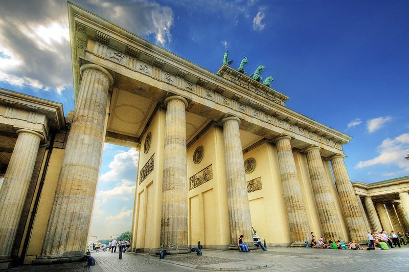
Brandenburg Gate. Wolfgang Staudt. CC BY-NC-ND 2.0

Berlin is a gritty city, and one whose food, architecture, monuments and culture can only be explained through its grave past. The German capital is a historic center of Europe as the nerve center of Nazi Germany in World War II, the greatest symbol of the Cold War’s infamous Iron Curtain and the prime city to see grand Prussian architecture. While many German institutions like monuments, transportation and active government buildings paint a picture of this historical influence, the picture of Berlin would be left incomplete without mentioning its spirited present. 

In between landmarks like the Reichstag, Germany’s Parliament building, the famous Brandenburg Gate, the remains of the Berlin wall and Prussian palaces lies an amalgamation of diverse restaurants with owners from every corner of the world, a bustling nightlife of clubs and bars, a thriving local music scene and a fashion-forward community. 

Berlin is an urban city through and through; its streets and unassuming apartment buildings (sprinkled between colorful modern architecture) comparable to those of Istanbul with an artistic, stylish flair reminiscent of New York. Live through a bit of history and a bit of present with me as I spend a day in Berlin:


We’re out and about today, but refuse to approach our day on an empty stomach, so we head to a local breakfast place, Erchy’s. Other days we have feasted on the cinnamony pastries of a staple German breakfast cafe, Zeit fur Brot, and even some German-made cheeses bought from German grocery store REWE when we really wanted to masquerade as Berliners. But today is Erchy’s. Their food will fuel the traveling to be done.

Swans in the palace gardens of Charlottenburg. Su Ertekin-Taner.

Graffiti near the S-bahn. Su Ertekin-Taner.

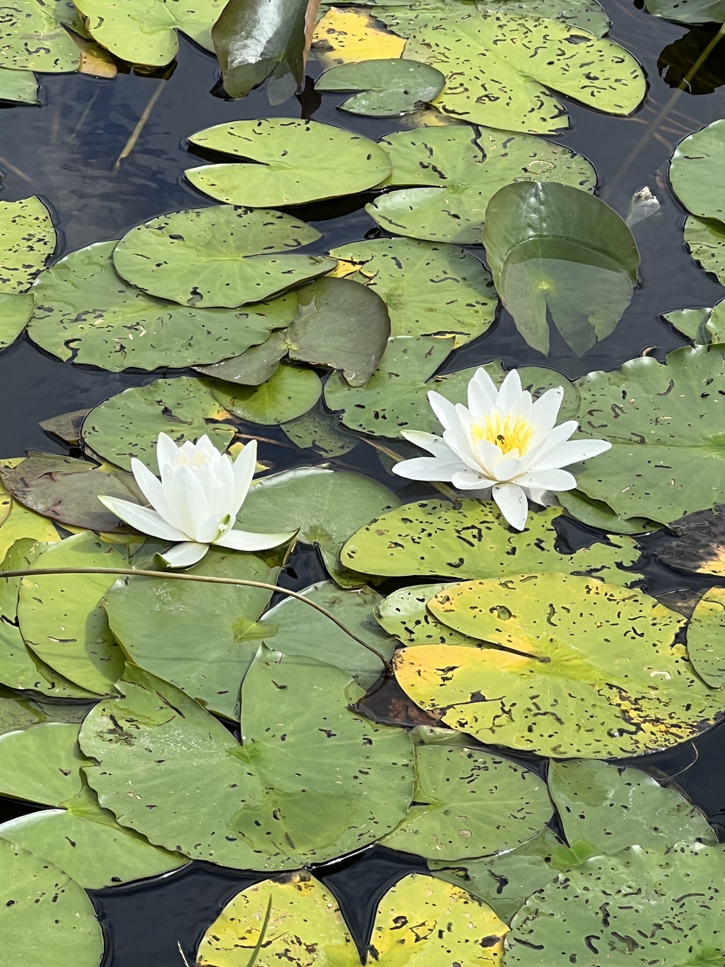
Lily pads in the palace gardens of Charlottenburg. Su Ertekin-Taner.

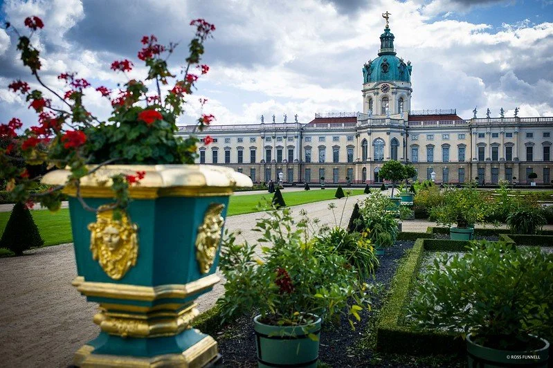
Charlottenberg. Rfunnell. CC BY-NC-ND 2.0

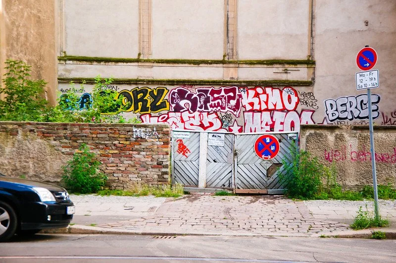
Graffiti in Berlin. Mitch Altman. CC BY-SA 2.0

We immerse ourselves in Berlin’s public transportation system after food. We use the U-bahn, the German metro, and then the S-bahn, Berlin’s fastest form of transportation to get to today’s location. At times using Berlin’s transportation reveals more about the divide of Berlin via the Berlin wall than any museum could, I think.

Altogether, the journey takes about 45 minutes from the center of East Germany. As we travel, the underground tunnels melt into cloudy skies that overlook old beige buildings decorated completely with graffiti. Berlin’s graffiti scene is one of the most vibrant in the world due to the rise of a countercultural voice during the Cold War and the Berlin Wall days. Graffiti galleries, exhibits, and alleys like the East Side Gallery, Cafe Cinema and Raw Gelande are staples of the Berlin community. As I wander through my thoughts, I sense the train stop. The trek has been made and so, we expect to be met with a reward.

The Charlottenburg Palace more than qualifies as a reward. This Baroque palace was originally constructed on behalf of Friedrich III’s (later King Friedrich I) wife Sophie Charlotte, hence the name. The interior of the palace is richly decorated, representing the height of Prussian high culture: porcelain from the royal porcelain providers KPM lines the walls, mantels are decorated with an East Asian-inspired blue and a ballroom fit with large windows divides the palace in two and overlooks the gate. The signs that guide us through the palace also note, however, the racist portrayal of Middle Eastern and East Asian figures throughout the palace’s art; the Prussian monarchy hoped to assert its dominance in every corner.

Behind the palace, we escape into nature, or a manufactured sort of nature: the Charlottenburg Palace Gardens, inspired by those of Versailles. We walk near rivers of lily pads, greet some sheep tended by palace attendants, swans and even some bike riders; the access to this park is free.

Chicken gemuse kebab at Ruyam. Su Ertekin-Taner.

Doner kebab. Addison Berry. CC BY-NC-SA 2.0

By the late afternoon, we have ambled back near the center of East Berlin. We decided on chicken gemuse doner at Ruyam Doner, which offers the best doner kebab in Berlin, though we did consider a meal at one of the many Vietnamese restaurants — established by the large Vietnamese community —in the area. The line spills out of the restaurant and into the street; everyone is craving some of this chicken gemuse. But the line quickly shortens until we are ordering our kebab of moist chicken, a spicy blend of sauces, and slightly heated bread. 

Turks are the largest ethnic minority group in Germany and often occupy entire neighborhoods like Keuzberg. Many Turks immigrate to Germany for work and stay, or accompany family members who have already migrated. As a Turk, I feel lucky to taste a part of my culture on the streets of Berlin.

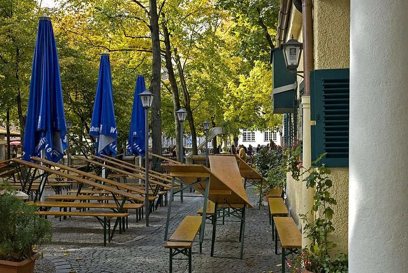
A biergarten in Elisabethmarkt. digital cat. CC BY 2.0

We end our day with a biergarten, or beer garden experience. A biergarten usually consists of an open air bar filled with long tables of merry drinkers and well, their drinks; the biergarten is integral to the German citizen and open-air lover. 

We encounter fewer merry drinkers than we plan to, but still sit alongside friends talking and a couple laughing. I have a feeling we’ve arrived in the belly of Berlin, especially as more Berliners gather round, huddle up, and grab some warming alcohol during this chilly summer. 

For travelers hoping to find a warm community with a common motivation–tasting the richness of German beer–a biergarten might fulfill your needs.


While my day quickly ended after my biergarten experience, no two 24 hours in Berlin can be alike, so here are some more options for day adventures to quench your traveling thirst.

Reichstag building. Jurgen Matern. CC BY-SA 3.0

Monuments

Reichstag: The Reichstag, the Parliament building of Germany, actively houses Parliament meetings throughout the year, and somewhat unusually, also allows visitors year round. Attending a tour of the Reichstag means sitting in the German Parliament’s main chamber, observing interior corridors with Russian graffiti completed after the Russian capture of the building in the Battle of Berlin and receiving an oral history from World War II on.

Memorial to the Murdered Jews of Europe: This Holocaust Memorial, designed by New York architect Peter Eisenman, consists of 2711 concrete blocks of varying heights laid out in a rectangular city block. Visitors might note that the blocks increase in height as they approach the middle of the monument; many speculate that this effect reflects the rising fear and agony of the Jewish community throughout World War II. 

Brandenburg Gate: While this neoclassical gate was originally constructed in the 18th century, much of its history lies in the coming centuries. The Quadriga statue of horses perched on the top of the gate, for example, tells a history of Napoleon’s acquisition of Berlin. Napoleon transported the statue out of Berlin to reflect his victory over the Germans. The Brandenburg Gate also symbolizes the division between East and West Berlin during the Cold War, as the Wall was constructed within a couple meters of the gate.

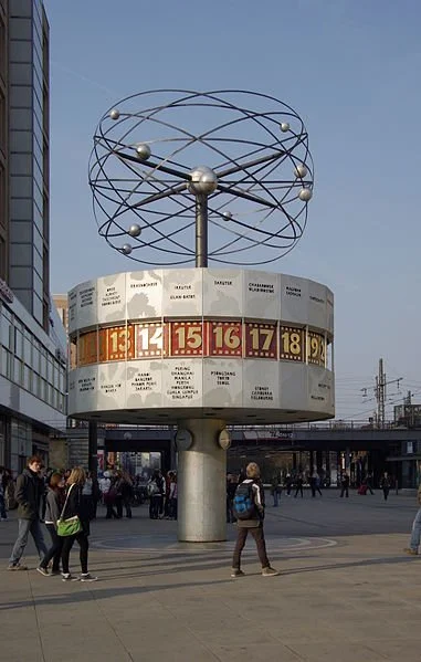
World Clock at Alexanderplatz. Berthold Werner. CC BY-SA 3.0

Berlin TV Tower. A_Peach. CC BY 2.0

Public Squares

Alexanderplatz: This public square named after Russia’s Tsar Alexander I is a commercial and transportation center that houses malls, public art and even live events like concerts. Visit the world-famous World Clock that tells the time of countries around the world, watch a stark yellow tram pass by through crowded streets, or even spot the Berlin TV Tower from afar.

Potsdamer Platz: Potsdamer Platz, located about a mile from the Brandenburg Gate, contains much of the city’s culture. Find the Sony Center dome housing an international cinema, restaurants, offices, museums and the center of underground transportation here —all constructed after the destruction of the public square during World War II.

Museums

Ishtar Gate in the Pergamon Museum. Rictor Norton and David Allen. CC BY 2.0

Pergamon Museum: The Pergamon is one of the museums located on Berlin’s “Museum Island.” The building boasts its collection of classical antiquities from Middle Eastern civilizations and Islamic cultures. The most famous exhibits include the Market Gate of Miletus, the Ishtar Gate that opened up to the processional way to the eponymous capital of the Babylonian Empire and the Aleppo room featuring paneling with images of both the Islamic and Christian faith. 

Topography of Terror: Such a historical city requires a history-based museum. The museum itself is located on a plot that once housed administrative buildings of the Nazi Party, like the headquarters of the SS and the Gestapo. The one-floor museum uses exhibition panels (supported by historical documents and quotes) to guide visitors through the rise and eventual fall of the Nazi Party.

Other

Brandenburg Gate. Dennis Jarvis. CC BY-SA 2.0

Historical Walking Tour: A city with such plentiful history necessitates a historical walking tour. Sightseeing walking tours take visitors through World War II and Cold War monuments like the Memorial to the Murdered Jews of Europe and the demarcation of the Berlin Wall, respectively, as well as some of Berlin’s must-see sights like the Brandenburg Gate and even the Reichstag.

Cuisine

A dish from Madami. George M. Groutas. CC BY 2.0

German cuisine: While much of German food pays its cultural respect to other international cuisines, some German dishes are uniquely synonymous with German culture. Sausages accompanied by sauerkraut or potato salad, rouladen, beef-wrapped bacon, onions, mustard, and pickles and sauerbraten — a German pot roast — all grace the menus of German restaurants. Try restaurants Schwarzwaldstuben in Mitte, Max and Moritz in Kreuzberg, and Clarchens Ballhaus also in Mitte for a taste of Germany.

Vietnamese cuisine: Due to the influx of Vietnamese immigrants —many of whom were temporary contract workers — into East Berlin during the Cold War, the city offers much authentic Vietnamese food. Some high-rated restaurants include Madami located on Rosa Luxemburg Street, Monsieur Vuong on Alte Schonhauser Street, and Maison Umami on Schlesische Street.

Turkish cuisine: Much like the Vietnamese, a Turkish community slowly immigrated to Germany for work and stayed to build institutions that reflect their culture, like the Turkish restaurant. Doner, lahmacun (the Turkish Pizza) and borek (a salty Turkish pastry) proliferate in Berlin. Some high-rated restaurants include Hasir in Kreuzberg, Adana Grillhaus on Manteuffel Street, and Osmans Tochter near Helmholtz Platz.

Nightlife

Clubs: The Berlin party scene is second-to-none. Berlin’s clubs are perfect for those craving a new eccentric song to add to their playlist or a place to wow their friends for a night. Room 4 Resistance’s playlists of tunes with genres ranging from contemporary pop to industrial techno attract a diverse group of music lovers. For those music lovers who prefer to stick to a genre or two, Weeeirdos’ techno sets and Hoe_Mies’s R&B and trap music might be a perfect fit.

Biergarten: Outdoor lovers might prefer the biergarten, or beer garden, night experience. Under a dusk sky, between clumsily strung up lights, lies a comforting community of German beer lovers gathering around wooden benches and tables and self-serving the ale. Try the Prater Beer Garden, Schleusenkrug, and Golgatha Beer Garden for some biergarten action.

Bars: Whether you desire a cocktail or a dance floor for the night, a Berlin bar or two will satisfy your appetite. When in the party capital of Europe, you must do as partiers do, and partiers love to gather on these alcohol-washed oases. Gay bar Model Olfe, aesthetic Victorian-inspired bar Geist im Glas and the traditional Bar 3 are all excellent alternatives for a night of drinking and dancing.


Su Ertekin-Taner

Su Ertekin-Taner is a first year student at Columbia University majoring in creative writing. Her love for the power of words and her connection to her Turkish roots spills into her satire, flash fiction, and journalistic pieces among other genres. Su hopes to continue writing fearless journalism, untold stories, and prose inspired by her surroundings.

A 4-day Guide to Exploring Rome

Rome is a city full of must-see sites, but it can be overwhelming to plan for. Here is a 4-day itinerary to make sure you see all the top spots, while getting the atmosphere of a unique European summer.

Rome, Italy. @Bert Kaufmann. CC BY-SA 2.0

“A European Summer” is now the aesthetic of the season, spurred on by Gen Z and Millennial creators on TikTok. It’s a fashion statement, and young American women are obsessed with flowing white dresses, gold jewelry, maxi skirts, and more. The romanticization of European cities is a perfect escape from the monotonous urban environment Stateside. 
Over the past month I was lucky enough to travel to Rome, Italy and experience a taste of the European summer that influencers have been talking about nonstop. But a trip to the Eternal City takes a lot of planning and, while it was only my first time exploring the history-rich city, I feel as though I know enough to compose an ideal 4-day itinerary — so travelers can experience every aspect of the European summer.

Day 1

As your feet touch the streets of Rome, it’s important to keep two things in mind: firstly, your primary means of transportation will be by walking, especially if your hotel accommodations are in the heart of the city itself, something I definitely recommend. So, pack footwear accordingly. Second, temperatures will be soaring. Expect around 100 degrees Fahrenheit, particularly in mid-summer.

Trevi Fountain. @NikonZ711. CC BY-SA 4.0

I recommend getting familiar with the main tourist sites on the first day. These include the Spanish Steps and Trevi Fountain, which are located relatively close to one another. Both are beautiful in the daylight and won’t eat up too much of your time. Throughout the streets it’s common to find small stores that sell gelato or souvenirs — pop into one and notice that prices are surprisingly cheap, especially compared to costs in the US. 

One of the things I enjoyed about my time in Rome was the vibrant nightlife, so make sure to take advantage of all the city has to offer when the sun sets. The temperatures are much more bearable and the streets are filled with small, lively alleyways that offer restaurants and more stores. Live music is usually always playing, especially in places where tourists are likely to flock. If you’re looking for an opportunity to wear that white flowy dress you bought just for the sake of fitting the Italian summer aesthetic, now’s the time. 

Enjoy the unique scenery and environment, and make sure to visit the Spanish Steps once more — while a great place to visit in the daytime, this tourist site comes to life at night and brings that perfect feeling of that “European Summer” the TikToks show so often. 

Day 2

Hopefully you got a full night’s rest, because day two is the perfect day to visit Vatican City — a landlocked independent country within the borders of Rome itself. It’s important to dedicate an entire day to this because, while you’ll most likely only spend a few hours exploring, the exhaustion will set in quickly.

If interested in the Vatican Museums, I strongly recommend buying tickets weeks beforehand and selecting an earlier time. The tourists that were hoping to get tickets on the day of had to wait in line for hours on end in the burning heat. Make sure to arrive early, since the museum is a little further than expected from the main entrance to Vatican City.

Vatican City. @Diliff. CC BY-SA 3.0

Once in the museum, you can either follow your tour guide or explore at your own pace, depending on the ticket you bought. You’ll get a glimpse of St. Peter’s Basilica — a famous church built in Renaissance style — from a viewing platform and get to visit the Sistine Chapel, a Catholic church located inside the Vatican Museums home to some of Michelangelo’s finest work.

Because Vatican City is a Theocratic city-state, most websites will advise you to wear a certain type of outfit. But because it’s so hot in the summer months, it’s alright to push the rules a little. Showing up in shorts and a T-shirt is completely acceptable.

Take the rest of the day to recharge. Walking to, from and around Vatican City can get very tiring, especially if it’s hot out. Stay close to your hotel for dinner, and day two will shoot past in the blink of an eye.

Day 3

Depending on whether or not you’re fascinated by Roman culture, Day 3 is dedicated to the rest of the places you weren’t able to see. For me, this included the Pantheon and Piazza Navona, which are both very close to one another. Shopping in Rome was also a pleasant experience, with such cheap prices, so I recommend it if you’re able to fit it in. 

Pantheon. @laszlo-photo. CC BY 2.0

For dinner, venture on over to Trastevere — a neighborhood filled with authentic Italian restaurants, located just across the Tiber River. The pasta and pizza is, of course, something every visitor should try. Paired with a drink of your choice, it’s hard to question why Rome is a city that attracts so many people from all over the world. The constant chatter of customers, the lights hung up as decoration, and the comfortable temperature combine to make a perfect getaway.

Day 4

Your last day in Rome should be dedicated to doing whatever you want. After three full days of so much walking, your body is bound to be tired, so just take this day as a time to relax and soak this experience in.

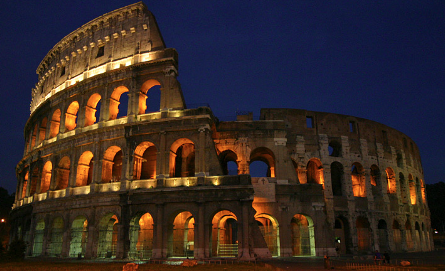
I know I haven’t mentioned the Colosseum — and it isn’t because it’s been forgotten. During my trip, I visited the Colosseum at night on my last full day in Rome, and it was the right decision. Of course, depending on the kind of traveler you are, this might not be your ideal itinerary but I loved seeing one of the most iconic landmarks in the world at night. I didn’t have to worry about the heat, and there is something so special about seeing the Colosseum lit up with hundreds of lights as it towers above you. It’s a great image to part Rome with, and along the road you’ll most likely pass the Roman Forum, which is impossible to miss. 

A night view of the Colosseum. @Aaron Logan. CC BY 1.0

Personally, this 4-day itinerary helped me get the feel of every aspect of the “European Summer” — from its nightlife to its famous sites, it didn’t disappoint. Depending on the type of person you are, this itinerary is bound to change but as someone who loves spontaneity and surprises, I followed this rough guide and was able to soak in all the wonders of this eternally beloved city.


Michelle Tian

Michelle is a senior at Boston University, majoring in journalism and minoring in philosophy. Her parents are first-generation immigrants from China, so her love for different cultures and traveling came naturally at a young age. After graduation, she hopes to continue sharing important messages through her work.

Pathways and Pilgrimages: Exploring The Camino de Santiago

This pilgrimage to the Cathedral of Santiago de Compostela in Spain has been a centerpiece of Christian spiritual life for thousands of years, and a destination for travelers around the world.

The Santiago de Compostela. Dafydd Parri. CC BY-NC-ND 2.0.

The Camino de Santiago, also known as the Way of St. James, marks a pilgrimage to the Cathedral of Santiago de Compostela in Galicia, an autonomous community in northwestern Spain. Extending roughly 500 miles and taking about 30 to 35 days to complete at an average of around 15 miles per day, the Camino is known today both as a center for Christian spiritual life and a hiking haven for travelers looking to submerge themselves in nature with affordable accommodations and opportunities to adventure through local villages along the way.

Today, around 300,000 travelers make their way through the Camino every year, and those who complete the journey earn a Compostela Pilgrims Certificate. According to measurements from 2021, 45% of travelers reported walking the Camino for “religious and other reasons” while 30% reported walking the Camino strictly for religious reasons and 24% said they had no religious reasons for the pilgrimage. The growing popularity of the Camino as a secular travel experience as well as a religious one is aided by its accessibility. While daily expenditures on the Camino depend largely on the town one is stopping in, travelers can plan to budget for about $30 a day to cover the cost of food. Albergues, or hostels specifically made for pilgrims, are also a reliable and affordable option for accommodations along the Camino, with municipal albergues typically costing between $5 to $10 per person, while private albergues range between $12 and $15 per person. Via Lusitana helps connect travelers to albergues along the Camino Portugues.

While there is no exact starting point to the Camino, there are a handful of popular routes to choose from including Camino del Norte, Camino Primitivo, and Camino Ingles. The two most popular routes are that of the Camino Frances, which begins in Saint-Jean-Pied-de-Port in southwest France, and the Camino Portuguese which starts from Portugal’s coastal city of Porto. While the Camino Frances covers 500 miles, the Camino Portuguese offers two distinct routes: the Camino Portuguese Central route which is 385 miles and the Camino Portuguese Coastal route which is 175 miles. 

The Camino became a UNESCO World Heritage site in 1993 and was recognized as the first European Cultural Route in 1987, however its history is one that dates back to the 9th century,  when remains of the apostle James were believed to be found in Galicia. Saint James preached in the Iberian peninsula before returning to Jerusalem, where he was beheaded by the king Herod Agrippa I in 44 AD. The legend surrounding St. James details how his body was transported from Jerusalem to Spain via a boat and was buried by his followers in Galicia in what is now the city of Santiago de Compostela.

The tomb was discovered in the 9th century by the bishop Theodomir. Upon its discovery the King of Asturia, Alfonso II, widely considered the first pilgrim to the Santiago de Compostela, traveled to the site and ordered that a church be built at the place of burial. Construction began in 1075 and the church was consecrated in 1211.

To accommodate an increase of pilgrimages through the Camino in the Middle Ages, bridges and other infrastructure were built along the route to aid travelers. Between the 11th and 13th century, the Camino’s rising popularity gave rise to a network of housing options and medical services along the route, including hospitals chartered by European kings.

The Camino’s many routes  were created by early travelers who shared information amongst themselves regarding the safest travel conditions, which nearby towns to stop in, and where to source food and water throughout the journey. Though lacking official infrastructure,  these paths became well defined by the pilgrims who traveled them for hundreds of years. It was not until the 1980s that Father Elías Valiña Sampedro, a priest of a neighboring Galician village, added yellow arrows along the path in an attempt to prevent travelers from getting lost.

Camino Frances

El Alto del Perdón. Rocco Rossi. CC BY 2.0.

As the most popular route, the Camino Frances sees around 55% of all travelers on the Camino de Santiago. Embarking on the French Way is one of the most social options to experience the Camino, and those who do so are sure to run into fellow pilgrims and have opportunities to build connections and a sense of camaraderie along the way. 

The entire Camino Frances starts at St Jean Pied de Port, a commune in southwest France, and extends roughly 500 miles and takes about 30 to 34 days to complete with an average of about 15 miles per day. However, the most popular starting point for travelers along the Camino is found at the last 60 miles of the pilgrimage, in the city of Sarria. This last stretch of the Camino takes approximately 7 days and passes through the towns of Portomarin, Melide and Arzua. 

Travelers embarking on the Camino Frances will move through the Pyrenees mountain range and into the La Rioja region of Northern Spain. Travelers interested in enjoying the region’s world famous vineyards can explore a variety of wine tours showcasing the region’s diverse earthly flavors.

Other notable traveling stops along the Camino Frances include the Spanish city of Pamplona, whose yearly San Fermín Festival every July features the country’s world-famous bull runs. When the festival is not happening, the Pamplona remains a popular resting spot for travelers along the Camino to explore Gothic and Renaissance art at the Museum of Navarra and the historic Plaza del Castillo where cafes and bars such as Cafe Iruna served as prominent landmarks in American novelist Ernest Hemmingway’s life and writing.   

Another highlight along the Camino Frances is the sculpture of El Alto del Perdon, which shows metal silhouettes representing pilgrims traveling through the Camino on foot and horseback. The art piece is located near the town of Puente de la Reina, a historical meeting point for early pilgrims traveling the Camino through a variety of routes along the Pyrenees. The town’s current architecture derives from attempts to accommodate pilgrims during the Middle Ages, including the bridge constructed under Queen Muniadona to assist pilgrims in their travels. The bridge is responsible for the town’s namesake, with Puente de la Reina translating to “the queen’s bridge.”

Camino Portugues

Travelers on El Camino. Staffan Andersson. CC0 1.0. 

An alternative to the Camino Frances, the Camino Portugues begins in Portugal and moves the coastline up to Galicia as the second most popular path for the Camino de Santiago pilgrimage. The route gained popularity in the 12th century after Portugal gained its independence when Queen Isabel of Portugal, known as the “Holy Queen,” made the pilgrimage herself in the 14th century. Today, the Camino Portugues sees about 25% of all travelers embarking on the pilgrimage. 

There are three main routes that travelers embarking on the Camino Portugues can choose from: the Central Route, which takes around 12 days, the Coastal Route, which takes between 12-14 days, and the Litoral Route, which follows the Coastal Route in large part while also incorporating pathways onto the beach. All routes meet in the Spanish town of Redondela before reaching Santiago de Compostela. 

Each route carries its own advantages and disadvantages. The Central Route has more infrastructure and access to towns and accommodations, however it is also the busiest route, seeing 70% of all travelers on the Camino Portugues. Comparatively, only about 30% of travelers opt for the Coastal Route, making it a quieter experience with less built-in tourism. 

Those starting the Camino Portugues from Porto will get to enjoy the city’s famous local port wine, the Baroque style Porto Cathedral — or Se do Porto — and the boat tours of the stunning Douro River. 

Vigo is a popular starting point for those who want to experience the last 60 miles  of the Camino, and the city offers a variety of activities including fish markets and a coastline overlooking the Cies Islands. 

Services such as Pilgrim help travelers create a personal guide for their trip, curated towards each individual’s preferred route and transportation type — including walking, cycling and completing the Camino on horseback or with pets. Pilgrim also helps connect travelers to special services while on the road, including the options to order bike gear, rent a car and transport personal luggage.  

Online guides are another helpful tool for travelers when it comes to finding rest stops and maps of nearby towns to explore along the Camino


Jessica Blatt

Jessica Blatt graduated from Barnard College with a degree in English. Along with journalism, she is passionate about creative writing and storytelling that inspires readers to engage with the world around them. She hopes to share her love for travel and learning about new cultures through her work.

Island Hopping Off The Grid: 5 Filipino Islands You’ve Never Heard Of

From unspoilt beaches and heritage sites to surfing hotspots and sunset views, there is plenty to choose from in the Philippines without running into massive crowds.

The Philippines has literally hundreds of picturesque islands for visitors to choose from. EdseastresD600. CC BY-SA 2.0

With a grand total of more than 7,600 islands, it should come as no surprise that there are many in the Philippines that remain obscure to travelers from abroad. Each one boasts the crystal clear turquoise waters that characterize the popular tourist destination of Cebu, but each also offers its own unique adventures to visitors looking to experience the archipelago’s diverse natural beauty. Many of these islands are surrounded by hundreds of smaller ones, and thus offer island hopping adventures for those who want to explore some of the more isolated atolls in the area. To help get you started, here are 5 incredible and lesser known islands in the Philippines to explore.

1. El Nido

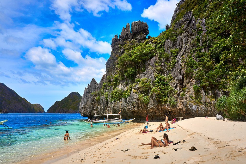
El Nido boasts a large number of private and unspoilt beaches. Boris G. CC BY-NC-SA 2.0

Known amongst locals for its breathtaking natural scenery, El Nido is located at the northern tip of Palawan province and stands as the gateway to the smaller but stunning Bacuit Archipelago. For visitors who want to enjoy luscious tropical greenery and stunning white sand beaches without the crowds, El Nido is the perfect destination, with a number of boat rental services that allow you to discover your own private inlets and limestone cliffs around the island. Because of its relative isolation, the island is also home to a diverse range of animal wildlife including monkeys, deer, peacocks, and even the occasional dolphin; as such, all single use plastic has been banned to help preserve its unique ecosystem. If you tire of the beaches, plan a hike to the summit of Taraw Cliff, which is the highest point on the island at roughly 886 feet (270 meters) and which offers stunning views of the central town and coastline. Alternatively, Nacpan Beach in the northeast hosts a zipline that allows visitors to fly across the water to another island nearby, giving island hopping an entirely new meaning.

2. Mindoro

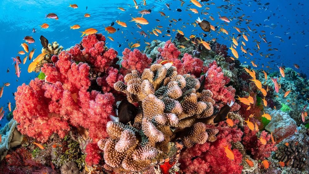
Reef diving in Mindoro provides an unparalleled opportunity to visit the second largest coral reef in the world. Asia Divers. CC BY-NC-ND 2.0

Mindoro island is the seventh largest in the Philippines and its eighth most populous, located in the west-central region of the country. It remains relatively undeveloped and is thus not the most common tourist destination, but still offers incredible scuba diving opportunities for those looking to explore the area’s variegated coral reef ecosystems. In fact, as the second largest coral reef system in the world, those off the coast of Mindoro are home to 75% of the world’s known coral species and a huge variety of marine life including scorpion fish, manta rays and various shark species. Many of these reefs are located around Puerto Galera, which is also well known for its sugar-sand beaches and which can become quite busy, with locals flocking to the area during national holidays. Climbing the island’s tallest peak, Mount Halcon, with a guide is also an excellent way to explore its massive expanse of rainforest, and the summit provides amazing views over both the oriental and occidental sides of the island. The hike is definitely not for beginners, however, with an elevation of roughly 8,582 feet (2,616 meters), although the smaller foothills are easily manageable and could also allow for a meeting with the Indigenous Mangyan people, who have lived apart from mainstream Filipino society since the sixteenth century.

3. Coron

There are at least 12 shipwrecks to explore off the coast of Coron. Karel Kosman. CC BY-NC-SA 2.0

Like El Nido, Coron is also located towards the northern end of Palawan province and is known for its picturesque freshwater lakes. While there are a whole range of lagoons throughout the island, each with their own beach area and tropical foliage, the most popular of these is definitely Kayangan Lake which is one of the cleanest bodies of water in the country. Additionally, while Mindoro specializes in reef diving, Coron is one of the best spots in the world to go on incredible guided shipwreck diving adventures. A squadron of Japanese supply vessels were sunk by American bombers World War II just off the coast of Coron, and now lie at recreational diving depths suitable for divers of all levels to explore safely. Snorkeling is another great water sport option, especially at Siete Pecados, which boasts some of the healthiest coral reefs in the world and allows for a stunning and up-close view of the marine life in the area. Alternatively, visitors can also experience one of the only saltwater hot springs in the world at Maquinit surrounded by mangrove trees, where the water remains between 98º and 104º Fahrenheit (37º to 40º Celsius) year round. 

4. Bohol

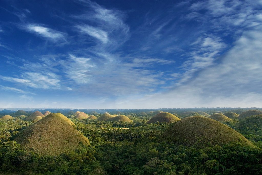
The Chocolate Hills are a National Geological Monument of the Philippines. An diabhal glas. CC BY-NC-SA 2.0

Like the other islands on this list, Bohol is home to a number of beautiful and scenic beaches, but is also one of the best islands on which to engage in on-land activities as well. For one, it is home to the famous Chocolate Hills, a World Heritage Site and Global Geopark which features iconic cone-shaped limestone hills rising out of the jungle canopy at 400 feet (about 122 meters) that were formed from coral reef deposits over 2 million years ago. Travelers can also visit the Tarsier Sanctuary, a large forest dedicated to the protection of the smallest primate species in the world, which is currently under threat of extinction. This site is one of the only that is run by an officially recognized animal conservation organization, and all proceeds generated at the site contribute to the continued upkeep and preservation of the sanctuary. Alternatively, Bohol also offers incredible man-made wonders like the Mahogany Forest, also known as the Bilar Man-Made Forest which, as the name suggests, was the product of a reforestation project in the late 20th century. The towering mahogany trees stretch for roughly 2 kilometers (1.2 miles) along the border of the Bilar and Loboc towns and are so densely packed that the foliage almost entirely blocks out the sun.

5. Siargao

Siargao is a popular destination for the best surfers in the world. Miguel Navaza. CC BY-NC-SA 2.0

Easily identifiable by its teardrop shape, the southern Philippine island of Siargao is the ultimate destination for those looking for an island that has remained largely untouched by mass tourism. It is known among locals as the surfing capital of the country, hosting both the National and Cloud 9 Surfing Cups every year. The latter competition is named for the most popular surf spot on the island, which is located in the East coast municipality of General Luna. During the rainy season between September and November, experienced surfers can enjoy waves between 8 and 12 feet (roughly 2.4 and 3.6 meters), although there are plenty of less intimidating spots for beginners as well like Jacking Horse in the South. There are also a large number of resorts on the island that offer surfing instruction at a variety of levels, as well as independently held surfing camps that run up to a week. If surfing isn’t quite your thing, Siargao is also home to the beautiful freshwater cave pools, waterfalls and white sand beaches where you can swim with non-stinging jellyfish and enjoy other water sports.


Tanaya Vohra

Tanaya is an undergraduate student pursuing a major in Public Health at the University of Chicago. She's lived in Asia, Europe and North America and wants to share her love of travel and exploring new cultures through her writing.

Off The Beaten Path in Shanghai

From cultural collections to ancient architecture, here are 6 of Shanghai’s esoteric sites.

Shanghai’s skyline hides a city that blends historic culture and ancient tradition. Azizofegypt. CC BY-SA 2.0

The bustling metropolis of Shanghai is home to a whopping 26.3 million people, with an additional 632,000 tourists journeying to experience the city’s incredible history and traditions each year. Beyond the Bund’s iconic skyline and unbeatable nightlife, however, lie a treasure trove of hidden museums, culinary experiences and historical landmarks all waiting to be discovered. These lesser known enclaves will take you off the traditional tourist trails along the Bund or up the Pearl Tower, and will introduce you to new sides of the city’s multifaceted personality and culture.

1. Madame Mao’s Dowry

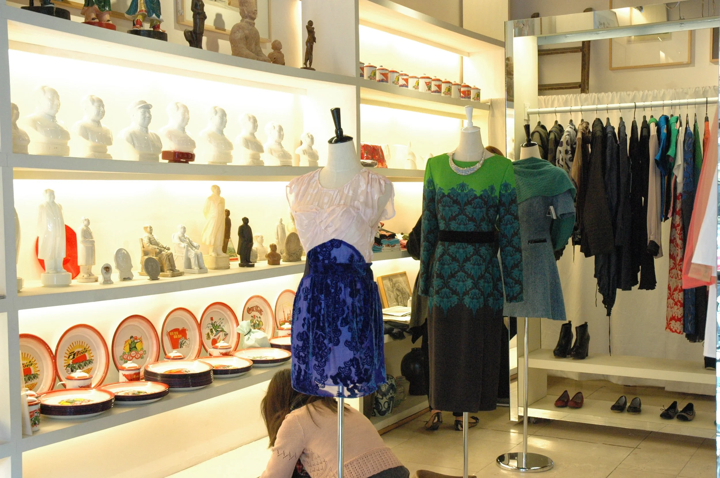
Madame Mao’s Dowry is chock full with vintage and modern Mao-inspired designs. Shanghai Collected. CC BY-SA 2.0

Whether you're an avid fashionista, a history enthusiast or simply curious about China's cultural heritage, a visit to Madame Mao's Dowry promises a full introduction to the impact of the Cultural Revolution and Mao Zedong’s rule on contemporary Chinese design. Its collection of artifacts ranges from photographs and posters to clothing and stationery, all displayed on antique furniture dating between 1949 and 1976, a period known eponymously as the Mao Era. Since 2001, Madame Mao’s has endeavored to highlight the complex connection between Mao’s political legacy and art by running various projects that encourage the use of old propaganda in modern visual art culture. In addition to the vintage items, the store also displays pieces by a handful of local Shanghai artists whose work draws from and reflects the artistic trends of the era, as well as housing their very own line of Mao-inspired paraphernalia. The intimate cultural space is occasionally transformed into a salon in partnership with Literary Shanghai, and hosts poetry readings, writing workshops and book launches among other events. Located in the Jing’An neighborhood to the west of the river, this store cum museum is definitely worth a visit.

2. Sheshan National Forest Park

Sheshan Basilica and the observatory sit atop the highest peak in the forest park. Meet In Shanghai. CC BY-NC 2.0

With an extensive and efficient public transport network, there is little excuse for overlooking destinations outside the city center. Sheshan National Forest Park is easily accessible from Sheshan Station and is the only natural mountain forest in the city’s vicinity. Covering over 400 hectares of land, the so-called resort includes several smaller parks and a multitude of hiking trails of varying difficulty, including the West Hill park in which stands the majestic Sheshan Basilica. Dating back to 1942, this towering 20 meter tall (roughly 70 feet) Roman Catholic cathedral has withstood extensive damage and unrest since its construction, and fuses traditional Chinese craftsmanship with the Western architectural tradition. In addition to the Basilica, the forest is home to China’s oldest observatory, an ancient tea garden, and 10,000 birds from over 50 distinct species. If visiting in the Spring, be sure to stick around for the Bamboo Shoot Festival, in which fresh bamboo shoots that break ground following the annual spring rains are harvested and prepared in local delicacies. Sheshan Forest Park is not to be missed by nature lovers or cultural explorers.

3. Propaganda Poster Art Center

The Propaganda Poster Art Center is tucked away in the basement of an apartment complex. Yasmin Crawford-Hunt. CC BY-SA 2.0

As its name suggests, Shanghai’s Propaganda Poster Art Center is home to the world’s largest collection of Mao Era propaganda posters, with over 6,000 individual artifacts on display. In addition to traditional paper signs that had been plastered all over public surfaces, the center has an impressive number of vintage cloth and woodcut pieces, as well as posters made in the “dazibao” or big character style, sheets covered in political speeches written in traditional calligraphy. Almost every year since 2010, this private museum has held special exhibitions around the world to showcase particular items and new additions to their collection in an effort to ensure that China’s recent history is not forgotten and to highlight the importance of propaganda art as a cultural, social and political tool. Just recently, the museum came into possession of hundreds of Shanghai Lady posters dating back to as early as 1910, which provide an even earlier glimpse into the use of propaganda in Chinese culture. Located in the Changning District on the west side of the river, this collection is a must for those interested in contemporary Chinese history, or for anyone looking for a unique souvenir.

4. Jiading District

The Ancient Town center of Jiading is accessible by boat. Chloe_cpc. CC BY-SA 2.0

This northwestern suburb was a thriving hub back during the Song Dynasty (1127-1279 AD), well before Shanghai grew to be the urban metropolis it is today. Despite its surroundings being full of factories and industrial production plants, Jiading District remains an enclave of cultural museums, ancient pagodas and scenic canals. For those looking for more contemporary attractions, Jiading is home to the Shanghai International Circuit, where the Chinese Formula 1 Grand Prix takes place. The district’s best sites, however, date back hundreds of years: Jiading’s Ancient Town was built during the early Qing Dynasty (1636-1912) and the main Confucian Temple from 1219 is one of the best-preserved in the world. The former can be toured by boat and explored via the many canals that run through the streets, the perfect way to step back in time and learn why the neighborhood was designated a “water town”. This area is also the birthplace of the world famous and universally loved Xiao Long Bao steamed soup dumplings, in addition to a variety of other unique local bites. For a day away from the crowds and noise of Shanghai’s city center, Jiading is the perfect getaway.

5. Hinichijou

Crowds gather to buy coffee from the friendly bear paw. China Daily. CC BY-NC-ND 2.0

On December 3, 2020, a cafe opened on Yongkang Road in Shanghai’s Xuhui District, an area highly popular among locals for its abundance of cafes and for its Instagram-worthy aesthetic. This establishment, however, was something special: through a literal hole in the gray wall, a furry bear paw emerged, pointing to the QR code hanging just beneath and encouraging passers-by to place their orders. This adorable gimmick was actually only part of the attraction, as customers soon found out that the cafe exclusively employed baristas with disabilities through the China Disabled Persons’ Federation, because it wanted to support and help provide employment opportunities for those with disabilities. The store’s opening coincided with the International Day of People With Disabilities and was then operated by two hearing impaired baristas. Since then, it has received incredible amounts of public support and has been able to open nine branches across the city, despite the general hardship caused by the COVID-19 pandemic. The chain has also furthered its mission by visiting with other similar businesses it has inspired across Southeast Asia and providing training to their employees as well. Its next project is to open another location in partnership with a local school for the visually impaired, before expanding overseas as well. For a quick coffee break with a conscience, Hinichijou is the place to go.

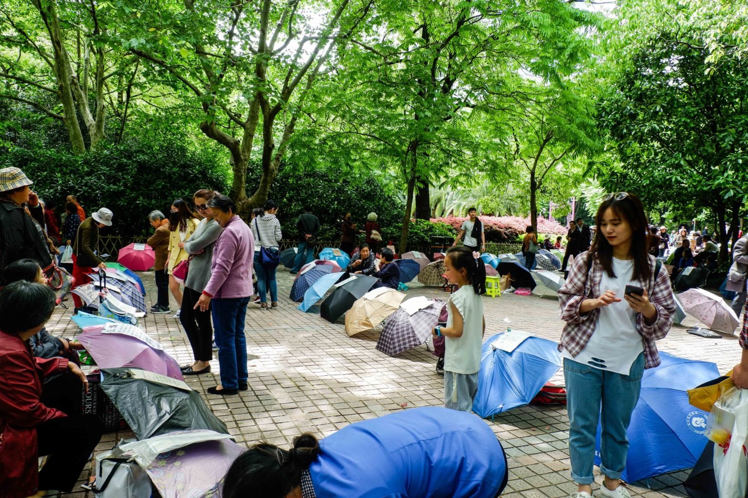
6. People’s Park Marriage Market

Umbrellas are laid out with marriage resumes on top. Fiona Mai. CC BY-SA 2.0

It was not long ago that all marriages in China were arranged. While most of the country has moved on, the weekly Marriage Market in the centrally located People’s Park is a striking remnant of such traditions. From noon till 5pm every weekend, parents gather and display their children’s marriageability resumes by balancing them on umbrellas or posting them on fences, highlighting their salaries, career prospects, and property ownership in the hopes of attracting an interested party. Photos are rarely included on the resumes, and there is little information about physical appearance or personal interests. Visitors are welcome to observe the proceedings without participating themselves, although be sure to respect the fact that for many of these parents, this is their last hope at finding partners for their children before they are deemed “leftover” men and women by society. According to unspoken tradition, it is customary to be married by the age of 25 and to be starting a family within two after that years, after which remaining single is often stigmatized or heavily questioned. For a one-of-a-kind immersive cultural experience, the Marriage Market is an event to see.


Tanaya Vohra

Tanaya is an undergraduate student pursuing a major in Public Health at the University of Chicago. She's lived in Asia, Europe and North America and wants to share her love of travel and exploring new cultures through her writing.

Visual Protest: The History and Legacy of the Berlin Wall Art

The Berlin Wall spent decades as a symbol for ideological division, but has become an outlet for personal expression.

Thierry Noir’s heads at the East Side Gallery. Paul VanDerWerf. CC by 2.0.

Visually, the East Side Gallery in Berlin, Germany is a vast edifice of technicolor concrete. Although only fragments of the original 96 mile (155 kilometer) wall remain, the sections that still stand are striking. From the flashes of aquamarine and mustard yellow featured in Thierry Noir’s iconic cartoon heads to the dark spray paint outlining miscellaneous graffiti, the murals are simultaneously imposing and welcoming. But the gallery's importance runs deeper than its appearance; decades of history and political turbulence echo through its fallen walls. 

When fully intact from 1961 until 1989, the Berlin Wall separated East Berlin from West Berlin; both halves were located well within East German territory, making West Berlin a NATO exclave in the Eastern Bloc. Prior to the wall's construction, emigration to West Germany by skilled workers, professionals, and intellectuals threatened East Germany’s economy. A few years after World War II, East Germany was constituted as a communist state controlled by the Soviet Union, while West Germany was formed out of the French, British and American occupation zones. The wall became a physical symbol of the Cold War: a division not only of Europe geographically, but also the global ideological divide between communism and democracy. 
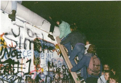
In the midst of longstanding Soviet de facto control of East Berlin, in 1985 then-Soviet leader Mikhail Gorbachev introduced the reform policies of glasnost (“openness”) and perestroika (“restructuring”), referring primarily to freedom of expression and economic reform, respectively. This decision, coupled with the growing number of protests sweeping across multiple Soviet republics, created a breaking point that eventually erupted into mass action. On November 9th, 1989, East German spokesman Günter Schabowski announced that East Germans would be free to travel into West Germany, starting immediately. In reality, travel was supposed to commence the following day, with regulations to prevent complete freedom of movement. But it was too late for regulations, and the crowds of people from East Germany immediately began to climb and even physically break down the wall.

The fall of the Berlin Wall, 1989. Gavin Stewart. CC by 2.0.

Because of the long period of repression associated with the barrier, one might assume that civilians who had lived on either side would want nothing to do with it ever again. But in 1990, just months after the Wall fell, some of the most famous murals of the Berlin Wall were painted (some of the preserved graffiti, including Thierry Noir’s brightly-colored heads, was created even before the Wall fell). With a newfound sense of freedom, people found their voice through art and created pointed political, social and cultural commentary.

Arguably the most famous of these works is Dmitri Vrubel’s “My God, Help Me to Survive this Deadly Love.” Commonly referred to as “Fraternal Kiss,” Vrubel’s piece depicts East German leader Erich Honecker and Soviet leader Leonid Brezhnev kissing. The kiss between the two socialist leaders was a rare, but not unknown greeting — often socialist leaders would kiss each other thrice on each cheek after embracing and, at special events, would kiss on the mouth to demonstrate solidarity and brotherhood
The Brezhnev-Honecker mural was based on a real photograph of the event taken by Regis Bossu eleven years earlier, in 1979. The kiss took place after an economic agreement between the USSR and German Democratic Republic (the formal name of communist East Germany). The image was famous when it was originally taken, but Vrubel’s artistic rendering took its notoriety to new, unforeseen heights.

“My God, Please Help Me Survive this Deadly Love.” Andy Hay. CC by 2.0.

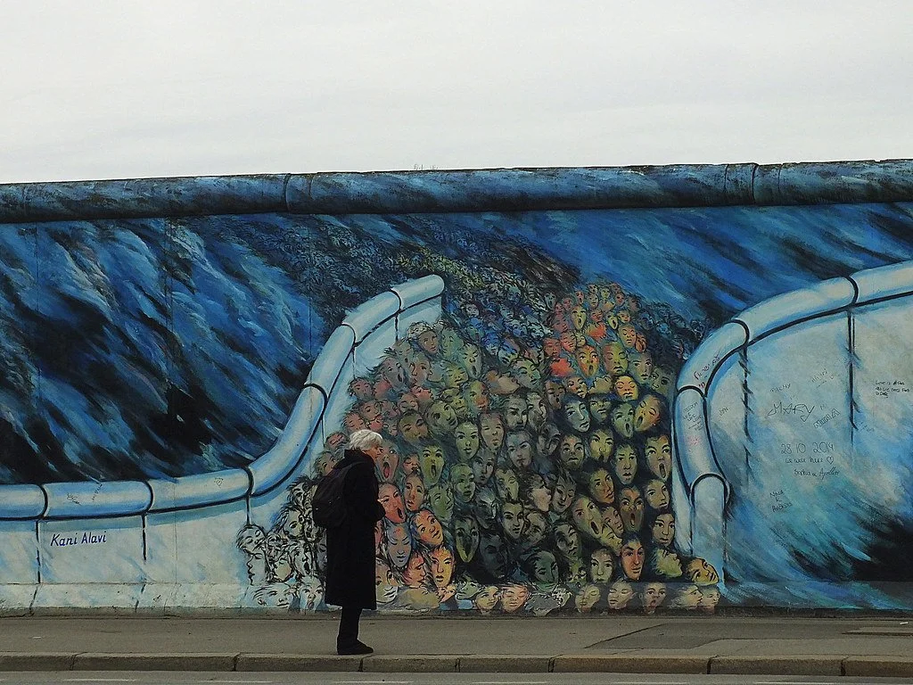
Although Vrubel’s iconic piece is perhaps the most recognizable mural, much of Berlin’s wall art would not have been painted without the help of Kani Alavi. Alavi was an organizer of the East Side Gallery, which invited artists from around the world to paint and express their reflections on the Cold War ideological divide and personal experiences. Alavi’s own visual contribution, “It Happened in November,” is a synthesis of personal experience and political commentary. The Berlin Wall consisted of two distinct walls separated by a gap for maximum security, and Alavi’s mural depicts thousands of faces walking between them on the day it came down. Alavi had viewed this scene personally from his apartment overlooking Checkpoint Charlie, which was the best-known border crossing between East and West Berlin.

“It Happened in November.” Fraser Mummery. CC by 2.0.

Alavi also directly helped inspire another of the most notable murals, the “Berlin Wall Trabant” by artist Birgit Kinder. Supposedly, Alavi told Kinder to paint anything she wanted on the wall, but she hesitated for a moment. It was only when she looked at her East-German manufactured Trabant car that she felt inspired. She began painting her car forcefully bursting through the wall, symbolizing the city’s escape from Soviet rule. Close observers will note that the license plate reads “Nov 9-89,” which is the day the Berlin Wall fell.

“Berlin Wall Trabant.” Judith. CC BY-NC 2.0.

When the wall fell, and the Soviet grip on East Germany loosened, creativity flowed. Artists visually translated their newfound freedom onto a canvas that had once held them captive. Their murals symbolized the reclamation of power by East Berlin’s formerly oppressed inhabitants. And with this somewhat-unlikely canvas they were able to recount their lived experience and depict the conflict and compromise of the world around them, concretely living in vivid color, forever.


Carina Cole

Carina Cole is a Media Studies student with a Correlate in Creative Writing at Vassar College. She is an avid journalist and occasional flash fiction writer. Her passion for writing overlaps with environmentalism, feminism, social justice, and a desire to travel beyond the United States. When she’s not writing, you can find her meticulously curating playlists or picking up a paintbrush.

Humans are Leading Blue Whales Toward Extinction in Sri Lanka

Human activity has compromised the blue whale habitats in Sri Lankan waters. Here’s what is being done about it.

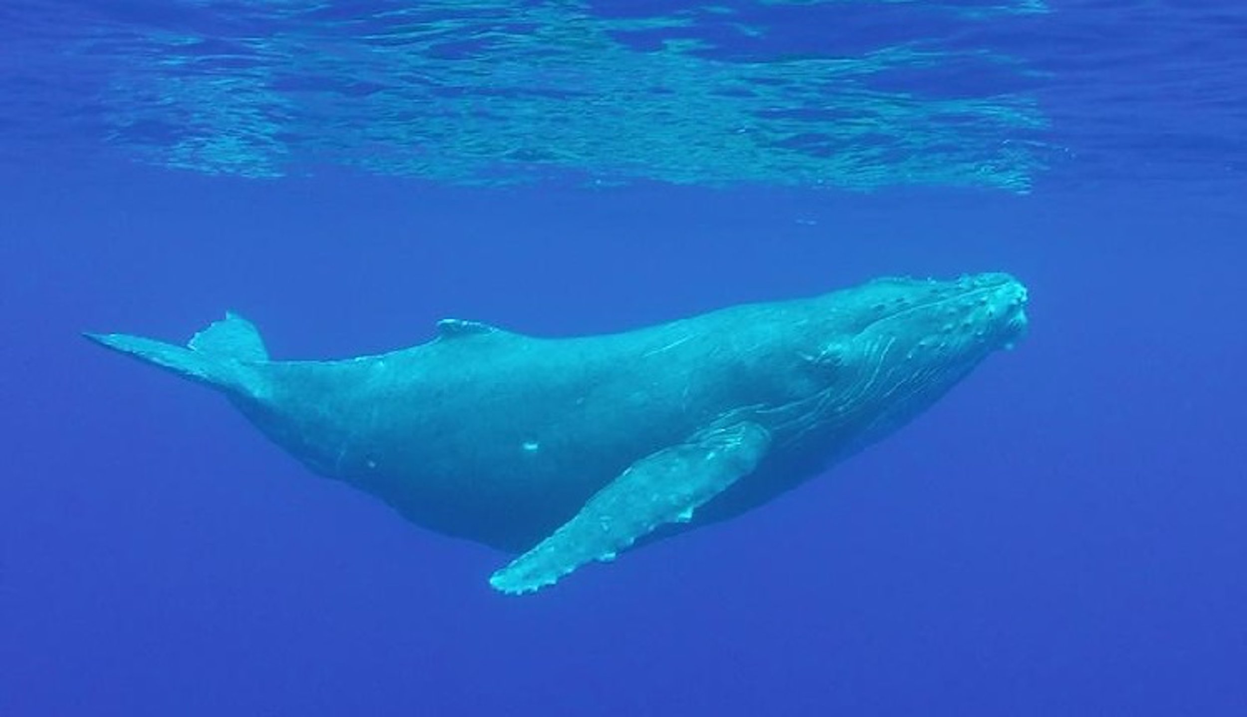
Blue whale. U.S. Embassy New Zealand. CC0 1.0.

Though blue whales are the largest animal species on Earth, their population has been shrunk by human activity. There are an estimated 10,000 to 25,000 blue whales left on Earth, compared to a population of at least 100,000 just a century ago. A traditional hotspot for these endangered gentle giants is the northern Indian Ocean, in Sri Lankan waters. Human actions, such as fishing and shipping, have contributed to the death of blue whales in this area, pushing this species ever closer to extinction. Here are some ways that humans have negatively impacted the blue whale population, as well as some potential solutions.

Pollution

Microplastic. Oregon State University. CC BY-SA 2.0.

Pollution, particularly of microplastics, has contributed toward the decrease in the blue whale populations. As their name suggests, microplastics are tiny pieces of plastic that are created when larger objects break down, or are manufactured at tiny sizes for beauty products such as face scrubs. Krill often consume this type of debris, and are themselves food for whales in huge quantities. Because of the enormous amount of krill they eat, filter feeding baleen whales may consume about 10 million pieces of microplastic per day, equivalent to about 96 pounds of plastic. Blue whales in Sri Lankan waters are especially vulnerable to plastic pollution, as this area is a major shipping lane and microplastics are used in product packaging, leading to an increased risk of exposure. Though the mechanisms by which microplastics harm whales are still under investigation, they can carry toxic materials, which may be a contributing factor toward increased blue whale mortality.

Entanglement

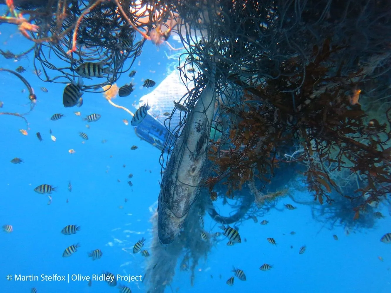
Marine organisms caught in fishing nets. Martin Stelfox. CC BY-SA 4.0.

Whales can get entangled in fishing gear, resulting in injuries and infections. Whales may also carry around tangled fishing nets for years, making it  more difficult for them to swim and feed,and leading to exhaustion. It has been found that about 300,000 whales and dolphins die from entanglement every year. Entanglement is one of the leading causes of death for blue whales in Sri Lanka.

Shipping Accidents

Ships in Sri Lankan waters. NZ Defence Force. CC BY 3.0 NZ.

The northern Indian Ocean contains a major shipping lane, and this lane happens to be a large feeding ground for blue whales. Due to the overlapping use of this area by boats, many blue whales have been killed in collisions with ships. Within the last decade, there has been an increase of shipping traffic by 300 percent, with more than 200 ships using the lane in Sri Lankan waters per day. There are differing estimates on the number of whales killed by ships, but it is suggested that as many as 56 whales die this way each year.

Resolutions

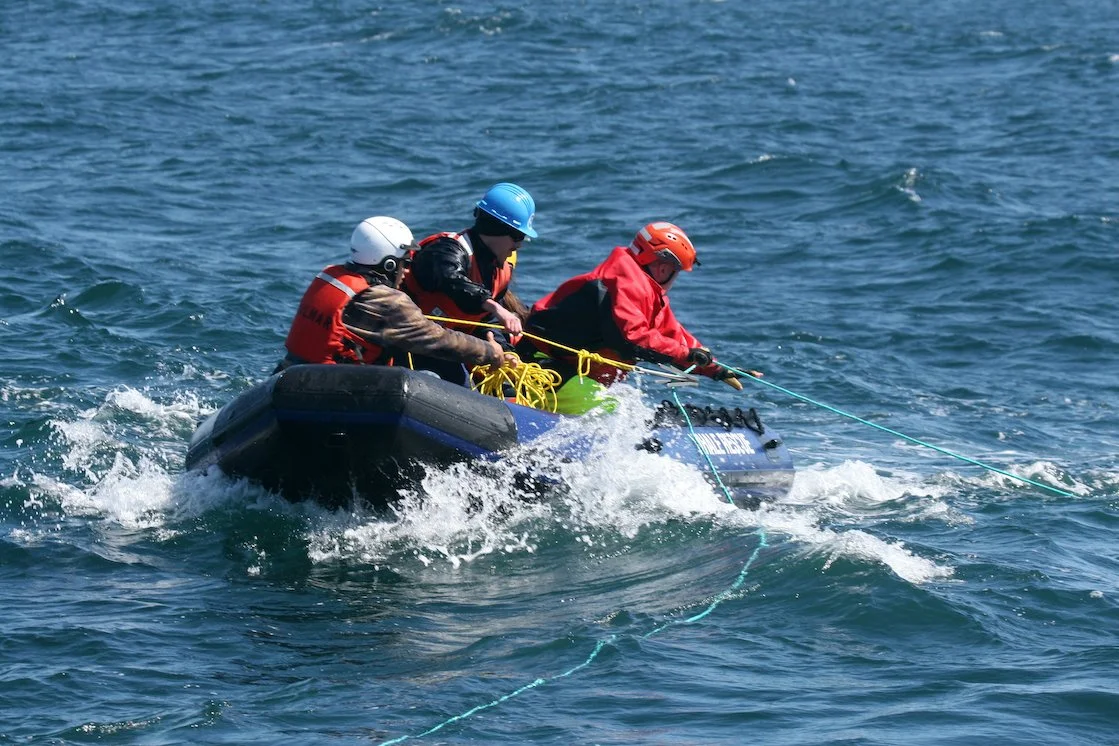
Whale disentanglement training. Nicole Capps. CC0 1.0.

Change of Shipping Routes

There are currently efforts to relocate Sri Lanka’s shipping lanes to decrease harm done to whales. It has been found that by directing ships 15 miles south of the current route, 95 percent of whale fatalities in the area may be avoided. Organizations such as International Fund for Animal Welfare (IFAW), the International Maritime Organization (IMO), and OceanCare have requested changes in this shipping route. The major shipping corporation, MSC Group, has agreed to move these routes south in order to benefit the blue whale population. Although this action has now been approved, it was previously rejected by the former Sri Lankan government due to economic concerns.

Entanglement Response

There are current international efforts to save whales that have been entangled in fishing nets. The International Whaling Commission (IWC), which regulates whale hunting and preservation globally, provides training workshops on disentanglement, reaching over 1300 government representatives, scientists and conservationists globally. The Center for Coastal Studies also has a “Disentanglement Network,” where trained response teams visit popular whale feeding and calving areas to assist any possible whales-in-need.

Addressing Microplastic

The Whale and Dolphin Conservation, Environmental Investigation Agency, Humane Society International and OceanCare recently got the European Union  push for the IWC to prioritize plastic pollution in its conservation efforts. The motion received consensus approval; all votes were in favor. Individual efforts against the use of plastic can help reduce its prevalence in the ocean, such as taking small measures like recycling, using reusable products instead of single-use, and avoiding beauty products that contain microplastic beads.

TO GET INVOLVED

Click here to donate to the International Fund for Animal Welfare.

Click here to donate to Marine Life Studies.
Click here to donate to Greenpeace.


Alexandra Copeland

Alexandra Copeland is a student at The College of New Jersey studying psychology and journalism. She is a lover of coffee, dancing, and visiting new places. Being raised with her Greek culture has inspired her interest in cultural customs around the world. She is a passionate writer and hopes that her work will make an impact in the future.

Manaus: Capital of the Amazon

My visit to the Amazon’s largest and most contradictory city.

City of Manaus. Dennis Jarvis. CC BY-SA 2.0

My first guide in Manaus explained that when people think about a city in the middle of the Amazon, they expect the city to be wild and see snakes crossing the streets. The reality of the Amazon’s largest city, located in Brazil’s Amazonas Province, is completely different. This past May I spent one of the most memorable weeks of my life in this province. During that time, I did go deep into the Amazon, where I saw a tree Boa, a large snake. But, I also visited a beautiful pink opera house, a fish market, antique bookstores, fancy restaurants, the Presidente Figueiredo Waterfalls, and even the Ponta Negra Beach, which was lined with tall buildings that seemed to be hotels, just like any beach town you’d find in the US.

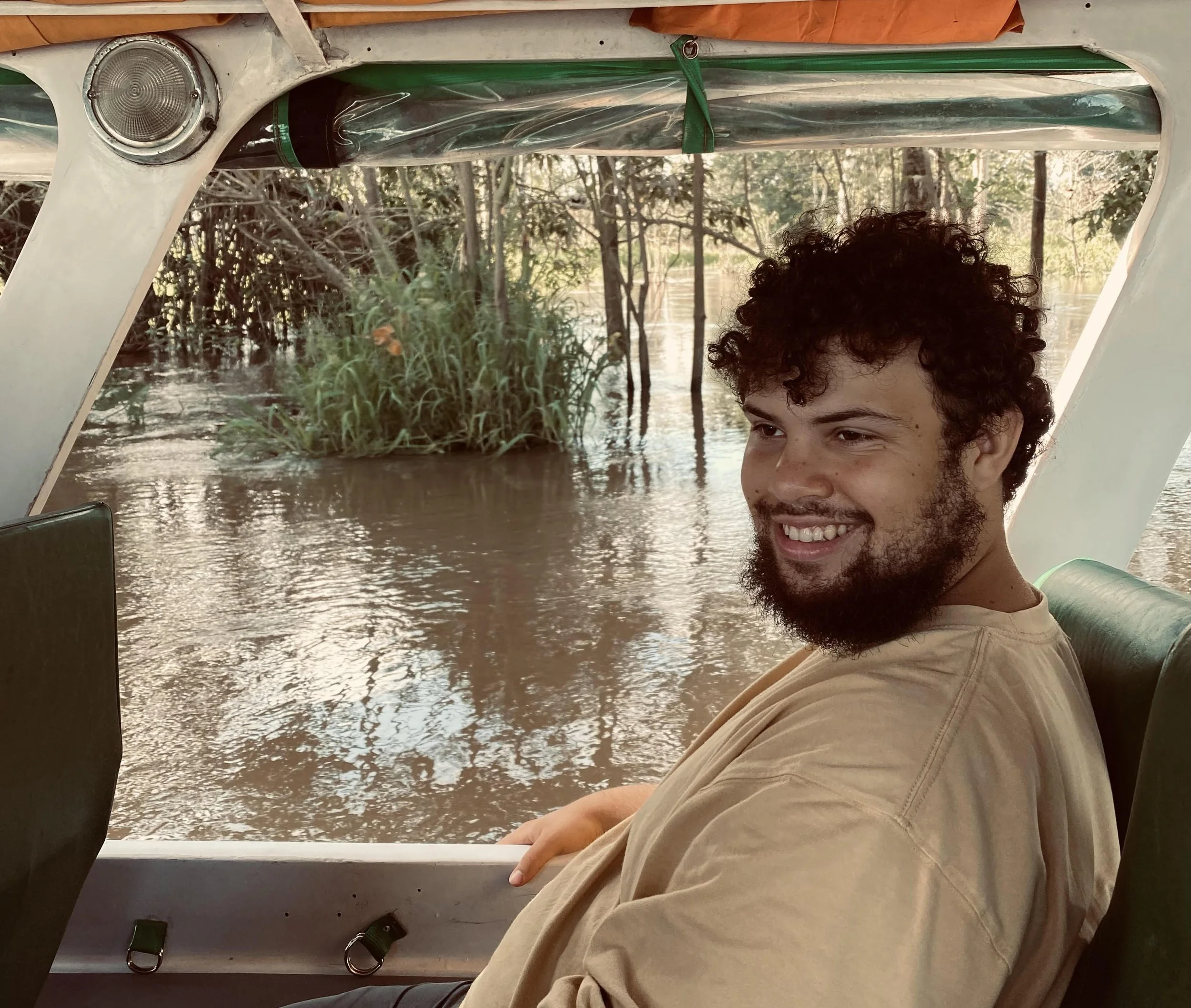
Me, in the Amazon outside of Manaus. Jeremy Giles

This city of over two million people borders both the Rio Negro and the Amazon River, and is the access point to reach many communities deeper within the Amazon jungle. It is also one of Brazil’s largest industrial centers, including businesses that have nothing to do with the rainforest it borders. In my experience, Manaus is a city unlike any other, and thrives off defying expectations.

The History

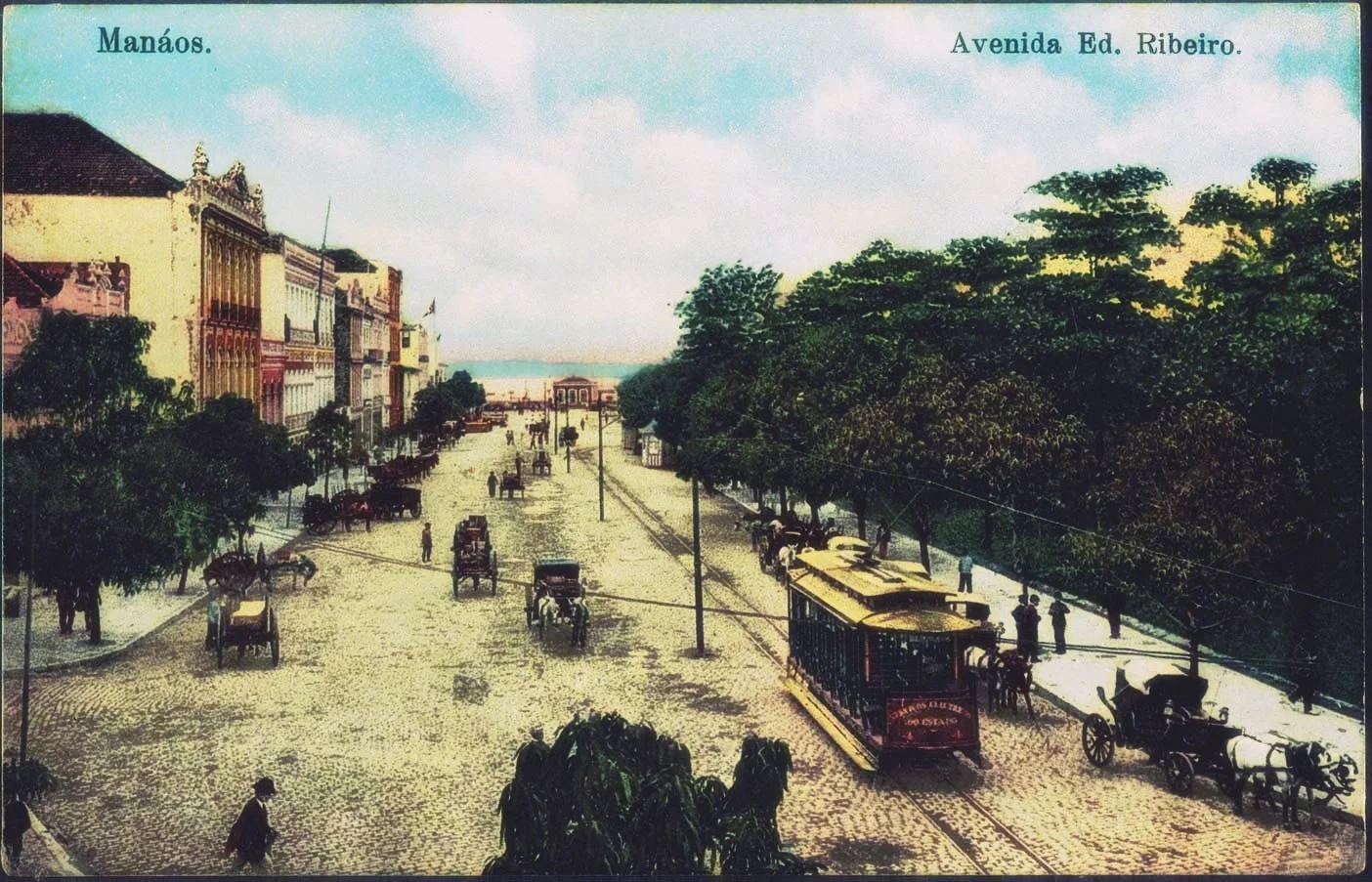
Manáos, Eduardo Ribeiro Avenue in 1909. National Library of Brazil, public domain.

Manaus was originally founded in 1669 as a Portuguese fort. By 1832, the fort grew into a town, and received its modern name, Manaus, meaning “mother of the gods,” from the indigenous Manaós tribe. Only 16 years later Manaus expanded into a city. Two years after that, it was officially declared the capital of the Amazonas province.

After the invention of cars in the late 1800s, Manaus became the center of the rubber boom due to the almost complete South American monopoly of rubber trees, which are native to the Amazon basin. This completely changed the city, as it became viewed as the gateway to the Amazon, and became home to many incredibly wealthy rubber barons. These ridiculously rich families had more money than things to spend it on, and began to focus on architecture, shipping materials all the way from Europe to build huge beautiful masterpieces, many of which still exist today.

By the early to mid 1900s the rubber boom had almost completely left Brazil, being replaced by rubber trees brought to Southeast Asia. This spelled financial ruin for Manaus, which sank into desperation. This poverty continued until 1967, when Manaus was named a duty free zone, making it cheap for companies to move there. This allowed Manaus to grow into the economic hub it is today, currently being a Brazilian access point for over 600 global companies.

The Amazonas Theatre

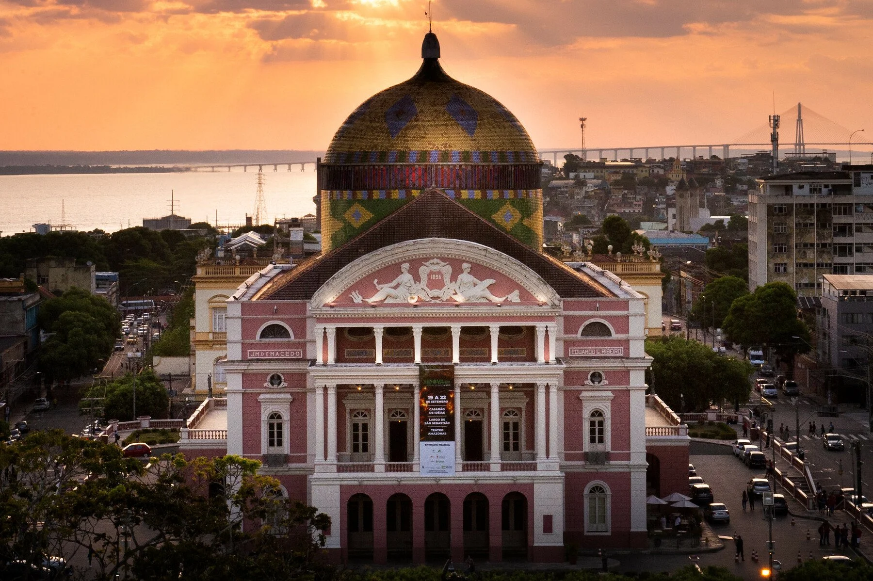
Amazon Theatre in Manaus. Rafael Zart. CC BY 2.0.

The Amazonas Theatre opened in 1897, carrying with it Manaus’ nickname “the Paris of the Tropics.” The opera theater was built almost entirely using materials imported from Europe, topped with a beautiful dome of Brazil’s flag.

At the time of its opening, the opera theater was in many ways a sign of all that was wrong in Manaus. It was built for Manaus’ uber-wealthy, using the money they made by exploiting the local population to harvest the rubber they sold abroad. Moreover, even the few who could enter the opera house valued the status it brought them more than the opera itself. The most expensive seats in the opera house were those that were the most visible to the public. Ironically, these spots actually had the worst view of the stage itself. 

Today, the opera house, which remains a top opera house in the world, has come a long way from its imperialistic origins. Most performances at the theater are free, and those that aren’t are very affordable. The performances feature both local artists and acts from around the world. Moreover, to encourage all to join, a large screen is often set up in the plaza in front of the opera house, allowing as many people to see the performances as possible.

The Ports

Manaus market from the river. archer10 (Dennis). CC BY-SA 2.0.

In many ways, the center of Manaus is its ports. Manaus is bordered by both the Rio Negro and the Amazon River, allowing for a large number of ships and ferries, both for tourists and locals. These boats can take you deeper into the Amazon or out of it entirely, allowing ocean freight ships to transport goods directly to Manaus.

In addition, much of Manaus’ culture and nature revolves around the ports. A little over a half hour by boat from Manaus’ ports is the meeting of the waters, a line where the Rio Negro meets the Amazon River. This line is clearly visible with the water looking different and being a clearly different temperature on either side of the line. 

On land, about a five minute walk from Manaus’ largest port is an amazing market “Mercado Municipal” that, every morning, is filled with different fresh fish, including some of the biggest fish in the world. My personal favorite of these huge fish is Tambaqui, a cousin of the Piranha and one of the most delicious meals I’ve ever had. The fish is so big that its ribs are visible and alone big enough for a meal. In fact, I’d go even further to say that, to me at least, the ribs are the best part.

Amazon Rainforest

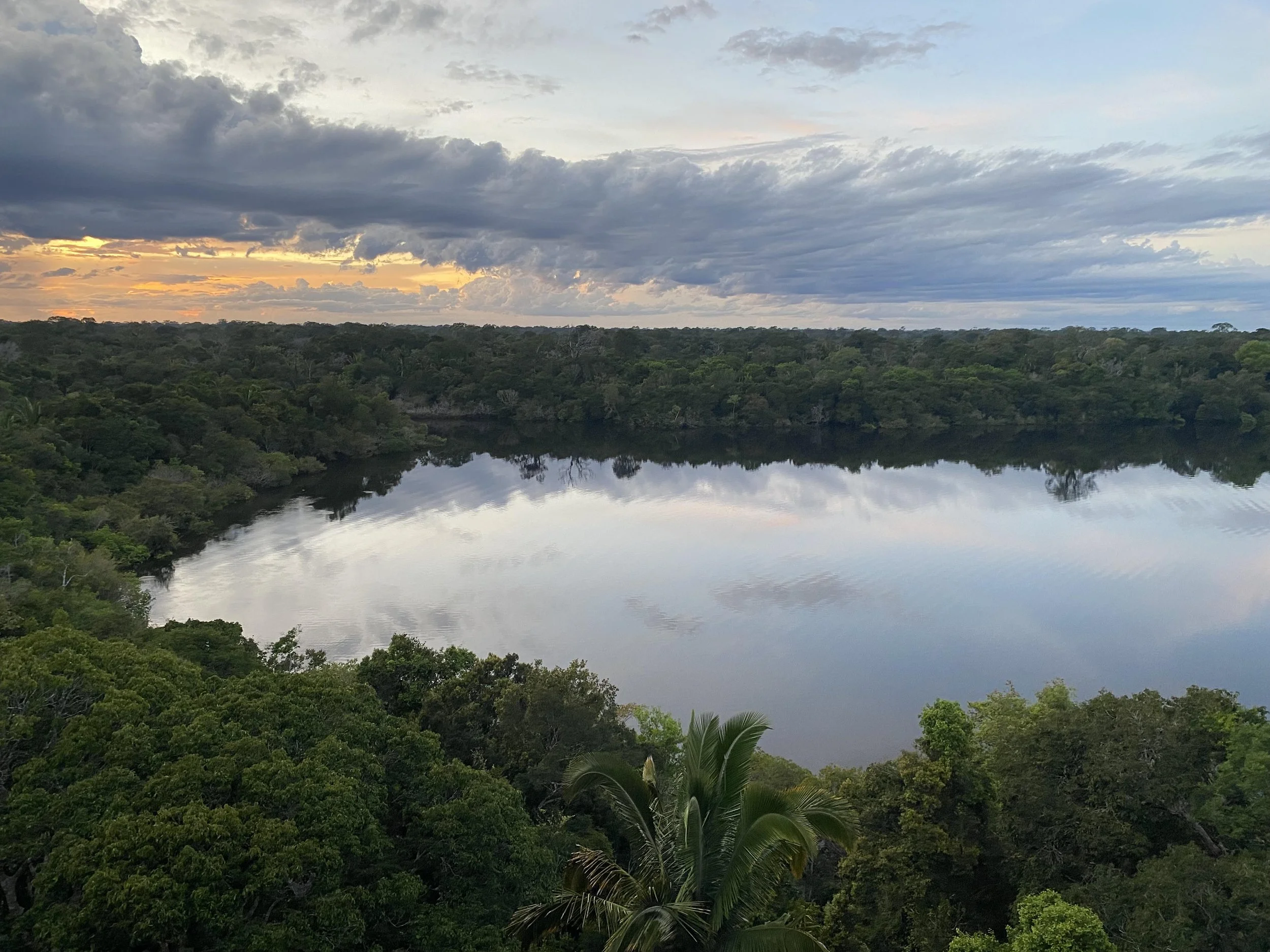
The Amazon Rainforest, a few hours from Manaus. Jeremy Giles

While Manaus itself is a big city, much of the land around it is still forested and filled with natural wonders. If you go an hour or two downstream on the Rio Negro, you will be greeted by intensely green trees on both sides which, in the right conditions, are perfectly reflected by the black water below you. In the wet season this water will rise several meters, causing many of the trees to jut out of the water itself. Just to note, climate change has caused the water to rise more now than in the past, however, the water rising multiple meters is a natural phenomenon and one that actually helps the trees survive.

When you’re surrounded by the trees you may start to be greeted by animals almost immediately. Howler and spider monkeys can be seen leaping from tree to tree, sometimes carrying their babies, and boas can be found curled up on branches. The water itself is dotted with caiman and different kinds of fish. The lucky will get to see pink river dolphins breaching the water’s surface.

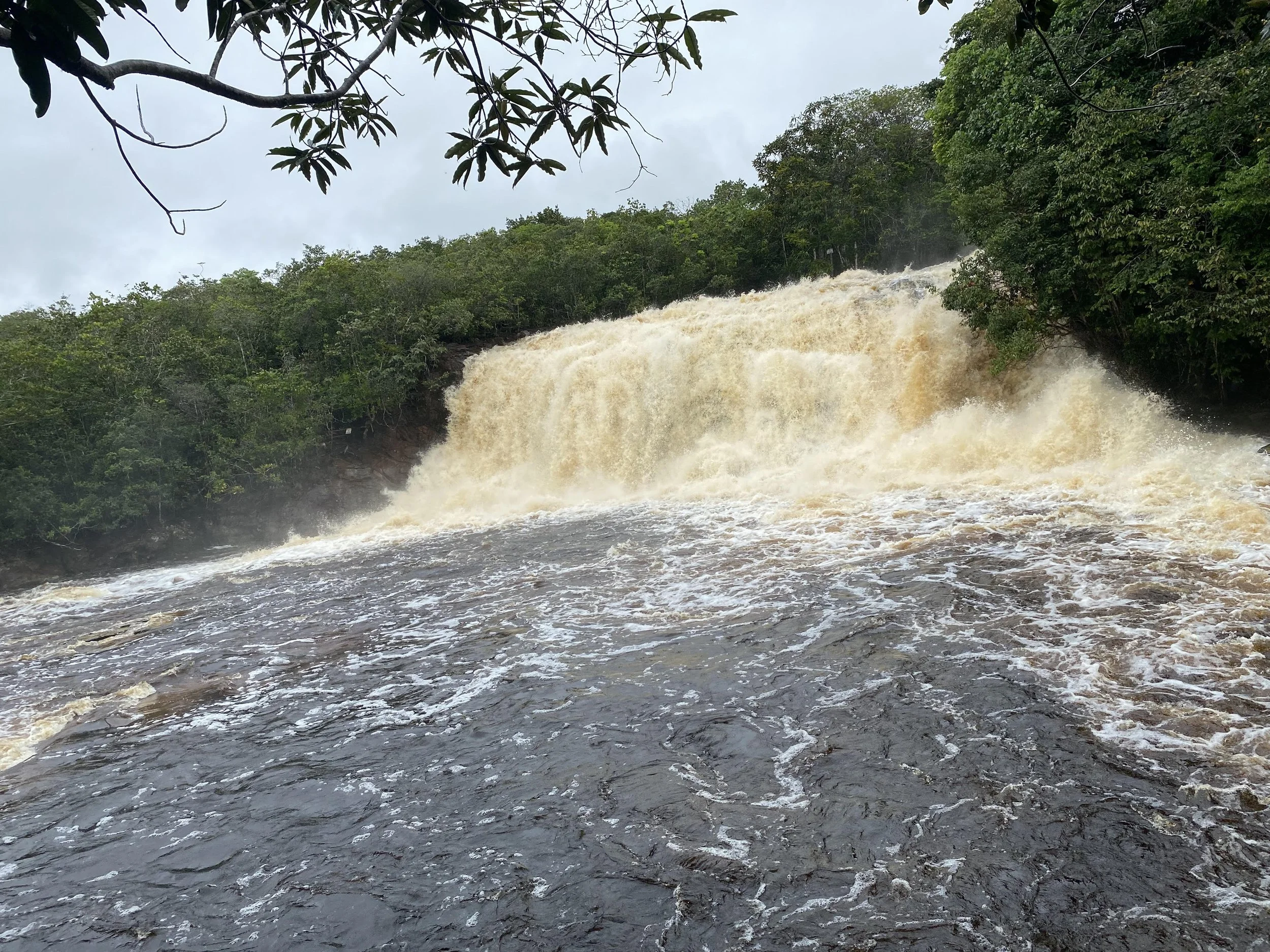
A waterfall at El Presidente Figueiredo. Jeremy Giles

There is plenty to see around Manaus and in Manaus on land as well. Most notably, about an hour and a half drive from Manaus are the Presidente Figueiredo waterfalls. These waterfalls are all stunning to look it, with fast moving water from the Rio Negro. However, they do vary in size. The first waterfall I was unable to approach because it was too big. The second one was small enough that I was able to climb behind it.

The Rio Negro, or Black River in English, gets its color from the decaying vegetation that falls into it. Beyond giving the river a wondrous dark hue, this decay causes the river to be relatively acidic. While it is perfectly okay for humans to swim in the water, the same cannot be said for mosquitoes, who almost completely avoid the river. This is amazing for Manaus, which borders the Rio Negro, as the city has relatively few mosquitos despite being in the middle of the Amazon.

The Technology Industry

President Lula visiting a motorcycle factory in Manaus. Brasil em Mapas Brazilmaps. CC BY 2.0

While much of Manaus’ economy does revolve around the Amazon, the tech industry is actually one of the city’s largest. Brazil’s largest research and development Institute, the Sidia Institute of Science and Technology, is based in Manaus. Moreover, Manaus is known for its extensive motorcycle industry, producing over 1.4 million motorcycles in 2022.

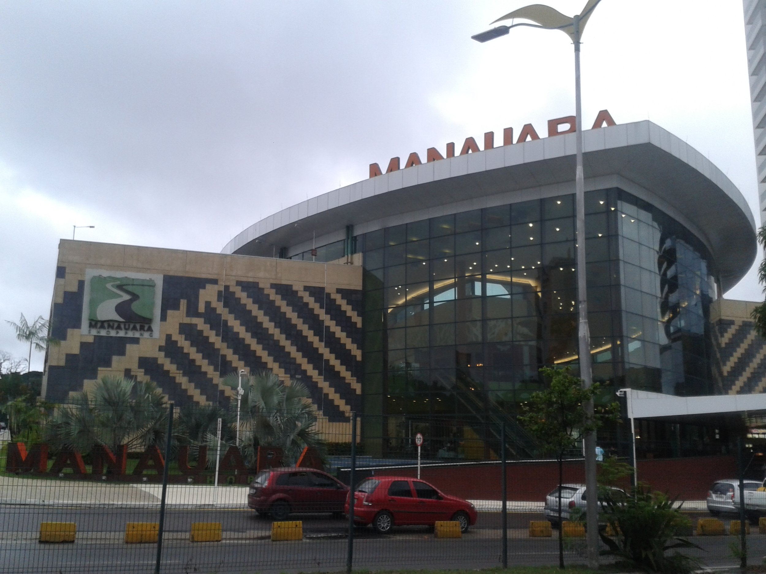
Manauara Shopping Center. Naldo Arruda. CC BY 2.0

I’ve spent the past few days trying to think of what, out of everything I saw, best represents Manaus. I believe I’ve found it, but, like everything else with the city, it’s not what you would expect. 

The Manauara Shopping mall is a huge and beautiful structure, with big glass windows lining the outside, seeming to connect the building to the world beyond its walls. It has more than 200 stores, which range from those selling wooden crafts and acai from the Amazon to big brands on national and international levels. The moment I remember most is when, after exploring the first three levels of the mall, my family decided to visit the basement food court. Going down the escalator, we saw the same glass windows from the front of the building, except this time, they were facing inwards. We walked towards a door under the hulking glass and through it outside into open space. I looked up and spiraling branches blanketed with green leaves towered above me, almost blocking my view of the night sky. I breathed in the air deeply, letting go of a tension I didn’t know I was holding. Looking back, in this moment, in a rainforest in the middle of a mall, I truly experienced Manaus most.


Jeremy Giles

Jeremy is a Writing Seminars and International Studies major at Johns Hopkins University. He is an avid writer and the Co-Founder of Writers’ Warehouse, Johns Hopkins’ first creative writing group. He is an advocate for Indigenous rights, and studies how Indigenous philosophies can be used to help prevent climate change. Using his writing, he hopes to bring attention to underrepresented voices in today’s world.

Frozen Glory: Inside the Eskimo-Indian Olympics

From cultural preservation to sheer athletic spectacle, the World Eskimo-Indian Olympics are a highlight of the Native Alaskan calendar.

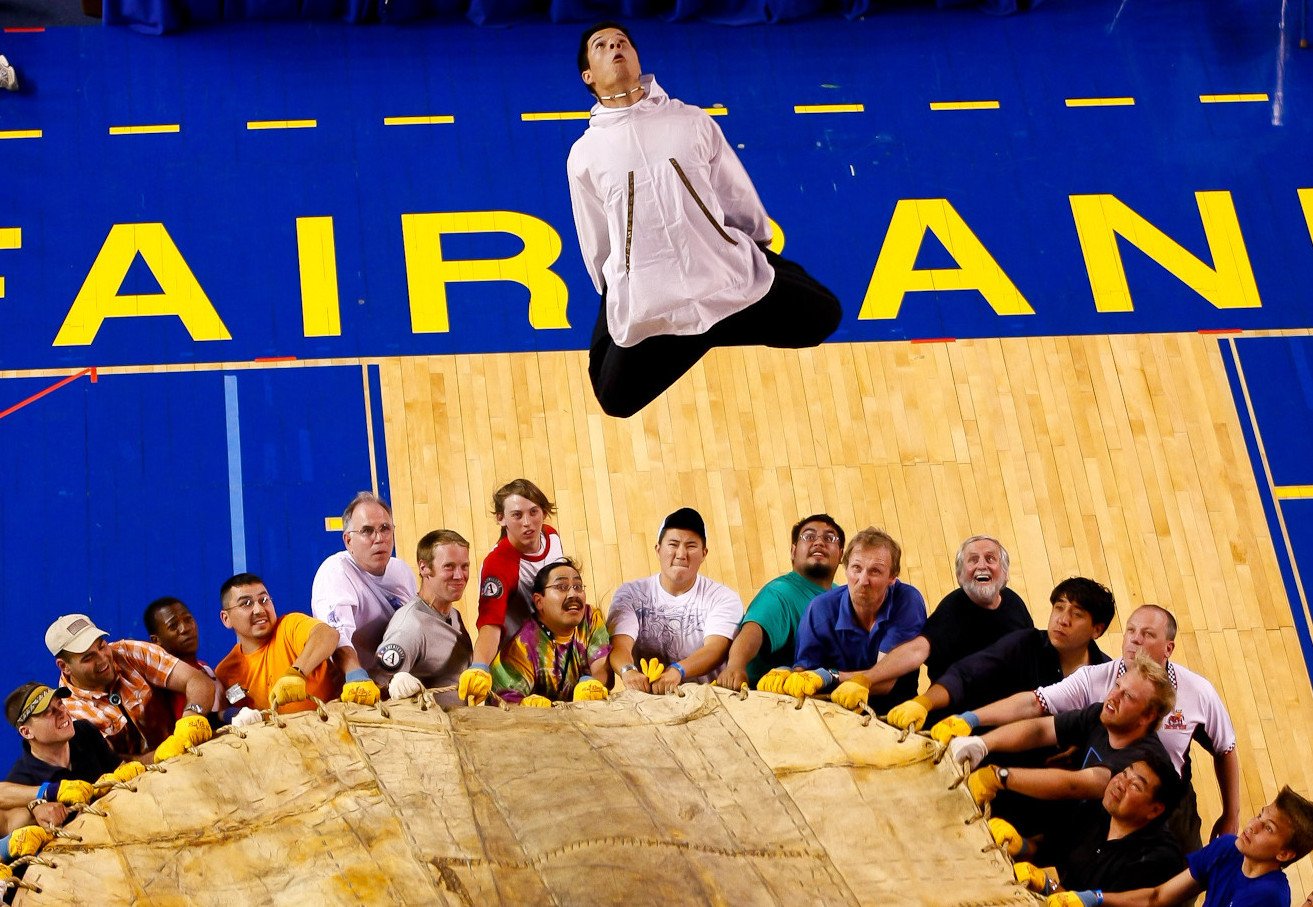
An athlete competes in the blanket toss event at the WEIO. KNOM Radio. CC BY-SA 2.0

In the early 1960s, two non-Indigenous pilots who regularly made trips over Alaska’s rural communities kept observing the celebration of an interesting cultural event. This sporting event, as they later came to realize it was, dated back far beyond living memory and honored strength, resilience and endurance through a series of events meant to test the skills necessary to live in such an unforgiving environment. Given that Alaska had just recently become an American state in 1959, the early 60s saw the gradual encroachment of mainstream American culture into its more remote outlying communities, posing a serious threat to local traditions and practices. After the pilots shared their concerns with various groups in Fairbanks, the World Eskimo-Indian Olympics (WEIO) was officially born in 1961 and drew Native participants and spectators from around the Fairbanks area to participate on the banks of the Chena River.

The WEIO has grown significantly since then, with thousands of people traveling to watch the best of Alaska’s Indigenous athletes compete in the Big Dipper Ice Arena for four days each July. Aside from a minimum age limit of 12 years, there are no age categories for any of the events, which means that several generations of the same family can be seen competing against each other. It is also common for older and more experienced competitors to coach and advise the younger athletes during the competition: rather than trying to beat one’s opponents, the larger goal is to compete against and better oneself.

Athletes Sean O’Brien (left) and Chris Kalmakoff (right) compete in the Eskimo stick pull event. Erich Engman. CC BY-NC-ND 2.0

Many of the events, however, are still extremely competitive, and involve intimate face-offs between athletes. The Indian Stick Pull, for example, calls for athletes to wrench a short greased stick from their opponent, an event meant to replicate the grip strength necessary when trying to keep hold of a freshly caught fish by its tail. The Ear Pull is a contest of stamina to demonstrate the athletes’ ability to withstand pain, a valued trait in the often cruel conditions of the Alaskan North. In this event, string is looped around the opposite ears of two athletes as they face each other as they pull away in a tug-of-war with their ears until one cedes the match.

Other events are competed individually, but with just as much rigor and excitement. The Greased Pole Walk, as its name suggests, tests the balance needed for crossing creeks on slippery logs by having contestants walk as far as they can barefoot along a greased wooden pole. A favorite among both competitors and spectators alike, the Two-Foot High Kick requires competitors to jump vertically and kick a suspended ball with both feet before landing and maintaining their balance. Hundreds of years ago, villages along the coast would perform these kicks as a way to communicate to the village that a whale or some other game had been caught, and to prepare themselves to assist the hunters upon their return.

Athlete Ezra Elissoff competes in the Two-Foot High Kick final at the 2021 WEIO. Jeff Chen. CC BY-SA 2.0

Despite the popularity of basketball and ice hockey, the traditional sports seem to be gaining popularity among young children and teenagers, and are also contributing to the difficult task of preserving and passing on Native Alaskan culture. Miley Kakaruk, a 15-year-old athlete of the Inupiaq tribe of Northwestern Alaska, says that she imagines her ancestors competing in the same events centuries ago, vying to be chosen for their village’s next hunting party. Because each event is so heavily rooted in their history, younger competitors are able to learn the customs and stories that so heavily influence the culture and lifestyle of their people.

Equally important is the power of these games to forge a connection between athletes and society. Historically, studies have shown that Native Alaskans suffer from some of the highest rates of alcoholism and drug abuse in the US. A number of the people that the WEIO Board works with and recruits are young adults who are at risk of or actively battling addiction. According to Gina Kalloch, a board member and ex-athlete, discovering their culture through such a fondly practiced social tradition has allowed many of these people to develop a sense of pride in themselves and their culture, and helped to reorient their lives.

Native Alaskan women compete in the Miss WEIO Cultural Pageant alongside the athletic events each year. Danny Martin. CC BY-SA 2.0

While this year’s edition of the Olympics already took place between July 12 and 15, highlights of both the sporting events and the accompanying Miss WEIO Cultural Pageant are freely available on the internet.


Tanaya Vohra

Tanaya is an undergraduate student pursuing a major in Public Health at the University of Chicago. She's lived in Asia, Europe and North America and wants to share her love of travel and exploring new cultures through her writing.

5 Reasons to Visit Andorra

Here are some ways to enjoy the beauty and history of one of Europe’s smallest countries.

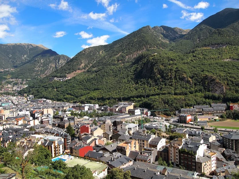
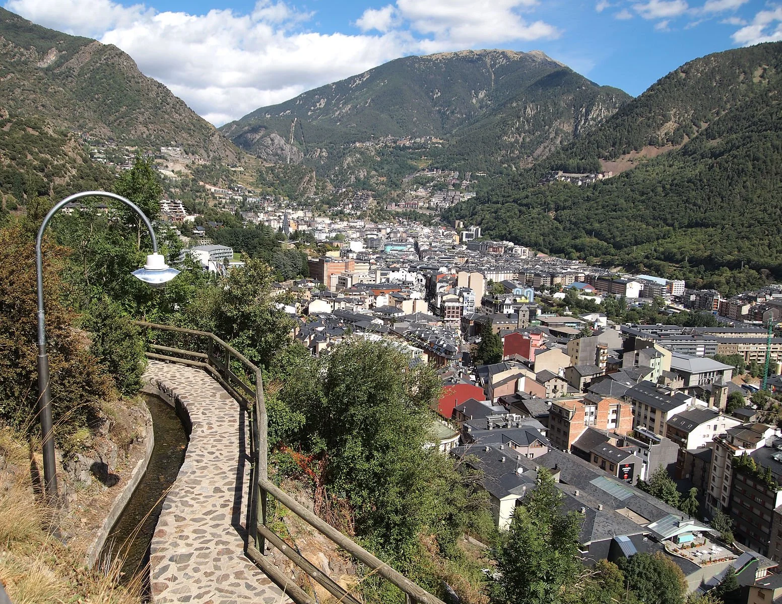
Andorra’s capital, Andorra la Vella. Tiia Monto. CC BY-SA 3.0.

Located between France and Spain, Andorra is a country of the Pyrenees mountains. The official language of Andorra is Catalan, yet many residents also speak Spanish, Portuguese, and French. With an area of 180 square miles and a population of fewer than 80,000 people, Andorra is one of the smallest countries in Europe. Though small, Andorra has much to offer, with sights and activities that make a visit well worth it. Here are five things to do when visiting Andorra.

1. Skiing

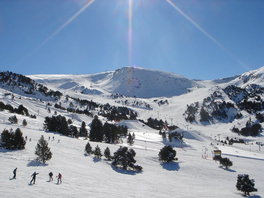
Grandvalira ski resort. Llull~commonswiki. CC BY-SA 2.0.

Due to its mountainous location, Andorra is home to great skiing locales. The country has three main ski areas, which are Grandvalira, Vallnord, and Ordino Arcalís. Grandvalira is the largest of the three resorts, with 130 miles of slope, most of that at the intermediate level. Vallnord has a ski lift connecting the villages of Arinsal and Pal, and you can try Speed Riding there, which is a mix of hand gliding and skiing. Ordino Arcalís is a smaller and less crowded resort. With its northern location, it produces the most snow of all of the resorts, and therefore has a longer ski season.

2. Visit the Mirador Roc del Quer

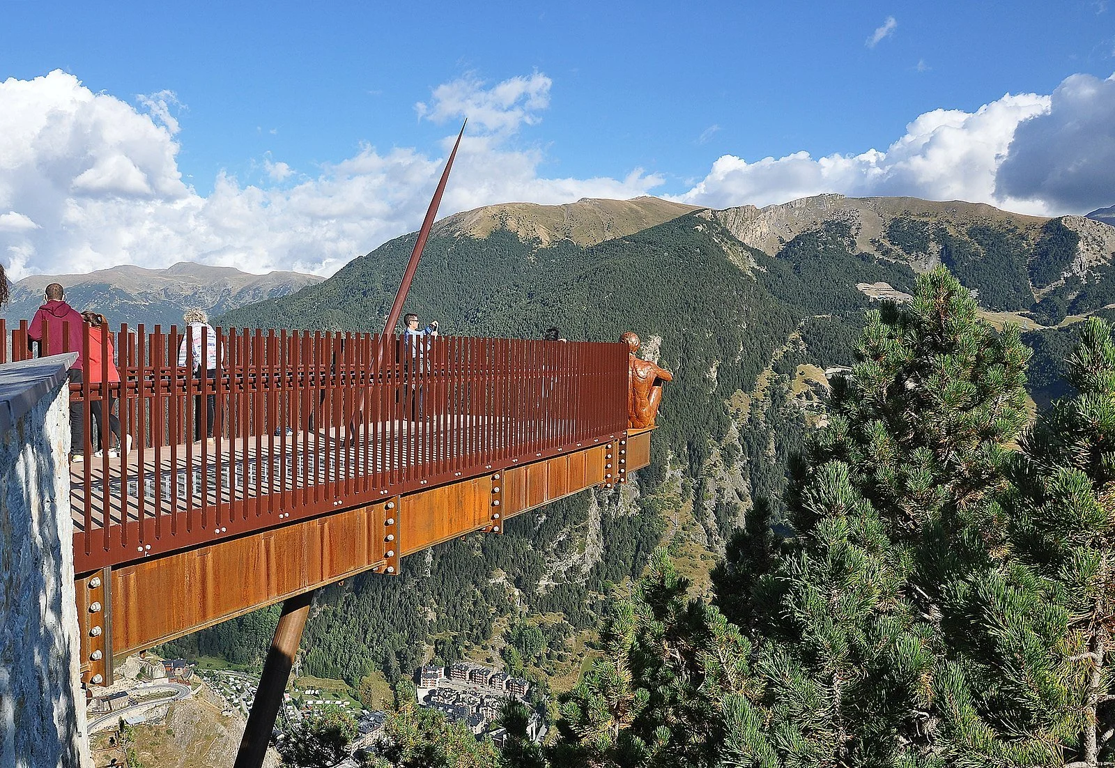
Mirador Roc del Quer. Roberto-g-rovi. CC BY 3.0.

At 6,417 feet, the Mirador Roc del Quer lookout provides a great view of the Pyrenees mountains. With 12 meters of the walkway being detached from the ground, it creates the illusion of walking through the scenic view. At the end of the Mirador Roc del Quer, there is a statue called “The Ponderer” by artist Miguel Ángel González. This statue depicts a man calmly sitting on a beam looking at the view, unbothered by the drop from where he is sitting. Whether it be for sightseeing or picture-taking, the Mirador Roc del Quer is worth visiting when in Andorra.

3. Tour La Casa de la Vall

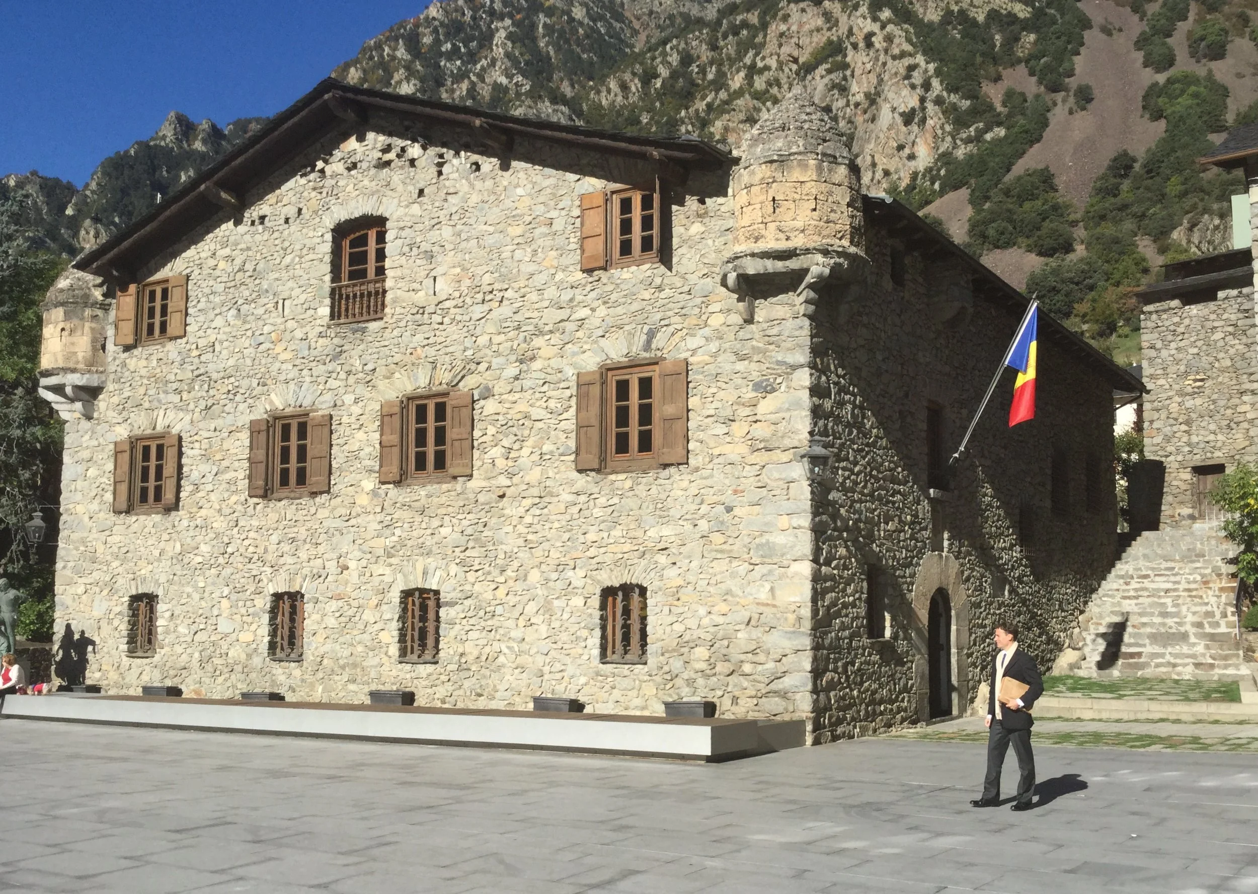
La Casa de la Vall. Zinneke. CC BY-SA 3.0.

Built in 1580, La Casa de la Vall was originally built as a manor house for the Busquets family. From 1702 until 2011, it served as headquarters for the Consell General, which is Andorra’s parliament. Today, it serves as a monument that is open to the public. The first floor once held the Criminal Court, as well as the Hall of Lost Steps, a room with walls made of 16th century paintings. This floor also holds the Cupboard of Seven Keys, which has a key to each of the seven Andorran parishes, along with significant historical documents. The second floor of La Casa de la Vall was once an attic, but it was renovated to become a multipurpose area, often used for exhibitions.

4. Hike Rec del Solà

Rec del Solà. Kulmalukko. CC BY-SA 3.0.

Within its mountains, Andorra offers many hiking opportunities. Beginning at the San Ermengol plateau, Rec del Sola is a five mile hiking trail connecting to the Rec del Obac trail. With an altitude of 1,122 meters, this trail passes through orchards and gardens, where local Andorrans grow vegetables. Towards the middle of the trail, there is a picnic area, where hikers can take a break and enjoy the view. Most of the trail is shaded from the sun, making it a great option for the summer season.

5. Visit the Museo Postal

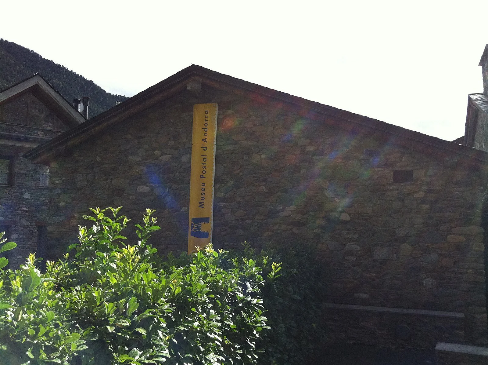
Museo Postal. Kippelboy. CC BY-SA 3.0.

The Museo Postal, or Postal Museum, exhibits the history of Andorra’s postal services. By foot and by ski, the museum shows the complete history of delivery methods in Andorra over the years. There are 50,000 Andorran stamps displayed, along with exhibits that show how these stamps were made and the process of mail delivery in Andorra today. The museum offers guided tours to guests, but visitors can also explore on their own with an audio guide.


Alexandra Copeland

Alexandra is a student at The College of New Jersey studying psychology and journalism. She is a lover of coffee, dancing, and visiting new places. Being raised with her Greek culture has inspired her interest in cultural customs around the world. She is a passionate writer and hopes that her work will make an impact in the future.

Between the Cracks in Turkey: Exploring the Small Towns of the Crossroads of the World

Step off the beaten path and discover these six small towns in Turkey brimming with artifacts, natural wonders and rich history.

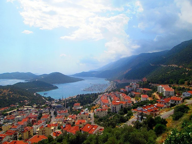
The beachtown of Kaş. Tutky Çetinel. CC BY 3.0.

One of the most renowned and well traveled cities in the world, Istanbul, peaked at 16 million tourists last year. The mosque- and artifact-riddled city attracts crowds that make it, for lack of a better word, a travel destination. Yet, some of Turkey’s most beautiful landscapes, edifices and history lie outside of its metropolis. Trek off the beaten path and journey to these six small towns in rural Turkey.

1. Safranbolu

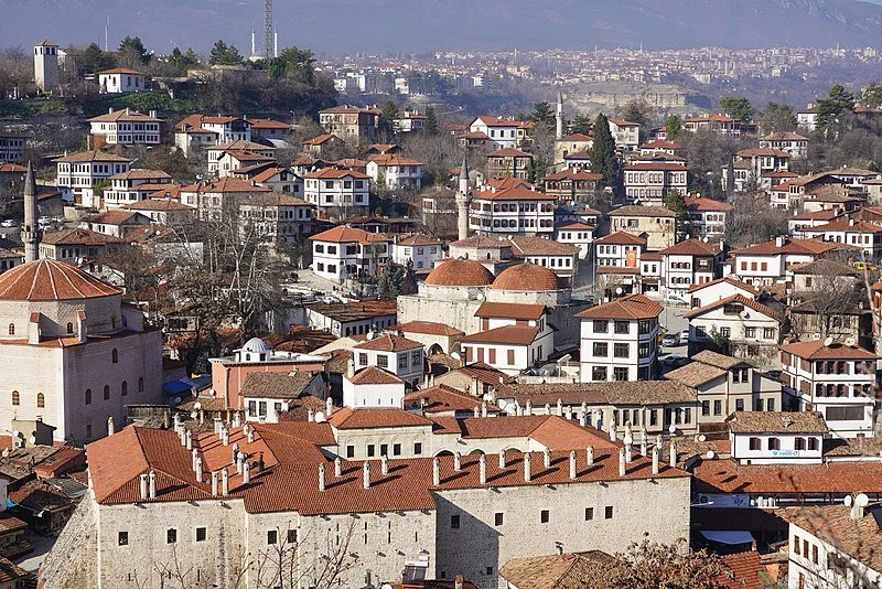
Overview of Safranbolu. Ray Swi-hymn. CC BY-SA 2.0.

Once a trading center, this historic town is now home to many artifacts scattered throughout its ~390,000 square miles and among its three historical districts: Cukur, Kirankoy and Baglar. Some of its characteristic antiquities found in the Old Town include tombs, baths, mosques, fountains, and houses. Dive further into exploration with Safronbolu’s Old Mosque, the Old Bath, and the Suleyman Pasha Medrese, an Islamic religious institution, built in the 14th century. This UNESCO World Heritage site is worth discovering.

2. Kas

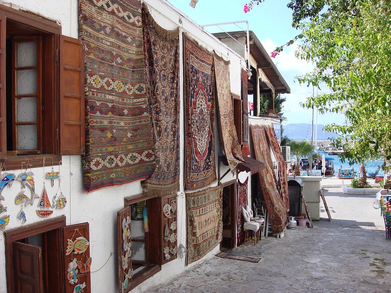
Rugs on a building in Kas. Julian Mason. CC BY 2.0.

This delightful beach town in Turkey’s Antalya Province doesn’t resemble the tourist-filled streets of the region’s eponymous city. Kas’s pleasant turquoise waters and lively color make the town stand out from Antalya’s busy, fast-paced life. While outdoor activities abound in this town — for example, canyoning is open to all travelers and day-long outdoor attractions like the Xanthos and Patara antique cities — a vibrant nightlife along the beautiful beaches awaits all visitors. Jazz clubs and rock bars alike welcome you to the wondrous city of Kas.

3. Iskilip

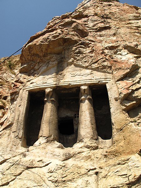
Rock tombs of Iskilip. Aerdemsenturk. CC BY-SA 4.0.

Just a 3-hour drive away from Ankara, Iskilip is another UNESCO heritage site on our list. This castle town’s epicenter is the Iskilip Castle, bordered by the town’s verdant mountains. While the Iskilip Castle is itself a site of historical importance, its base contains many Roman era tombs that are the real draw for many visitors. Iskilip is also a town of craftsmen; copper smiths, basket weavers, blacksmiths, cobblers, wood carvers and more set up shop in between houses, in houses, and everywhere in the town.

4. Midyat

Mor Sarbel Church. Senol Demir. CC BY 2.0.

In between the narrow cobblestone streets of Midyat lie ~410,000 square miles of artifacts, a structural chronicle of the past. The town, an hour drive from the Mardin province, houses unique sand-colored buildings. Among them is a series of religious edifices like the Ulu Cami, or mosque, with its characteristic minaret that towers over the surrounding buildings, the Mor Barsarmo Kilise, a church, and the Syrian-Orthodox Mor Sarbel church. Perhaps interesting, however, is Matiate, the official name of Midyat’s underground sites. Matiate is the largest cave system in the world, and is worth exploring along with the other wonders of Midyat.

5. Amasya

Houses in Amasya. Cobija. CC BY-SA 4.0.

This small town, much like others in this list, is a site of historical gravity. Three historical structures frame and define Amasya. First, the Amasya Castle, located at the top of Mount Harsena, is the center of this riverside city. While the climb to reach the castle can be steep, the view of Amasya’s green river and quaint houses has no peers. Second, the Amasya Museum is home to 24,000 artifacts from Anatolia including great stoneworks credited to the Hittites, Romans, Byzantines and Ottomans. Lastly, the Pontic Kings’ Rock Tombs, sepulchers carved into limestone rock formations, remind visitors of the once great Hellenistic Kingdom of Pontus, a stalwart enemy of Rome. 

6. Camlihemsin

A river in Camlihemsin. Serra Kiziltas. CC BY-SA 4.0.

Located near the Black Sea region of Turkey, Camlihemsin  is the smallest of the towns listed here, with an area of ~340,000 square miles. Much of the appeal of this town is its flora and fauna: with stately trees and grass-covered mountains, the town is perfect for hiking and mountain climbing. Hilltops embraced by surrounding clouds beautify the landscape. Waterfalls such as the Palovit Selalesi, a frequent reward for long hikes, also grace the town. Of course, one particular large historical artifact — the Zilkale medieval castle located in Fırtına Valley — caters to nature-naysayers.


Su Ertekin-Taner

Su is a first year student at Columbia University majoring in creative writing. Her love for the power of words and her connection to her Turkish roots spills into her satire, flash fiction, and journalistic pieces among other genres. Su hopes to continue writing fearless journalism, untold stories, and prose inspired by her surroundings.

Why You Should Visit the Makah Tribe on the Coast of Washington State

Visiting this region offers a unique opportunity to immerse yourself in a rich Indigenous culture that dates back thousands of years. 

View from Cape Flattery Bluff. Manuel Bahamondez H. CC BY-NC-ND 2.0

The Makah Tribe's reservation, resting on the extreme northwest tip of Washington State, boasts an ethereal landscape and thriving cultural practices. The land and the Tribe's community inspire and nurture ongoing engagement with nature and rich family connections. Despite its remote location, accessible by a single, winding route, the rich culture and natural beauty of this community offer a magical experience for curious travelers. 

The reservation sits at the farthest point north and west in the continental United States, cradled between gentle hills covered by tall Douglas Fir, Sitka Spruce, and Western Red Cedar trees on one side and the rugged Pacific coastline on the other. In the wake of a century-long fight against colonization the Makah continue to protect their sovereignty through the teaching of their Indigenous language, the celebration of cultural rituals and artifacts in their local museum and schools, and the preservation of the tribe’s traditional and sustainable reliance on native plants and animal species. The Tribe welcomes visitors from near and far to reflect on the reservations’ deep culture and lush natural landscapes. Hiking, surfing, and other outdoor activities are easily accessible from this scenic location and cultural hub. Visiting the Makah Tribe offers a unique opportunity to immerse yourself in a rich Native American culture that dates back thousands of years. The stunning natural beauty surrounding the Makah Tribe, including picturesque beaches and rugged cliffs, provides a breathtaking backdrop for your visit.

Sunset on First Beach. Jaisril. CC-BY-NC-ND 2.0

Generation after generation, the fabric of the Tribe’s community is woven through its cultivation of the natural world and artistic endeavors. Today, a significant number of Makah individuals thrive as artists, making a living through the sale of intricately crafted goods which are sold to galleries, shops, and collectors across the globe. A major source of income comes from the exportation of these artistic goods and is a key element of the Tribe’s livelihood. Carvings and masks in particular are a distinct feature of Makah art and have garnered the attention of tourists and art sellers alike for generations. The pieces often feature animals that hold deep cultural importance to the Makah. Whales, salmon, halibut, ravens, eagles, otters, herons, and wolves are commonly depicted in these designs. Each carving tells a story, chronicling the rich narratives of the origins and struggles which are passed down through generations within the community and amongst families.

The Makah are highly skilled woodworkers, capable of fashioning a wide array of items from the trees that thrive in their surrounding forests. While western red cedar is most frequently used, you can also find artists working with alder, yew, and spruce. Carvings range in size, from intricate jewelry to grand ocean-worthy canoes and towering totems. The incorporation of nature imagery and the sourcing of natural materials reinforces and honors the Makah’s reverence for their lands and waters.

Example of Makah style art. A. Davey. CC-BY-NC-ND 2.0 

Long before the advent of written language, the tribe used dance, song, and storytelling to receive and retain intergenerational knowledge. These melodic traditions are shared and reinforced on various occasions, including weddings, naming ceremonies, memorials, and other family or community celebrations. The Makah reservation museum hosts a compelling collection of artifacts, information guides, as well as a garden with plants labeled with the native language and traditional uses. 

For instance, the tribe once maintained five, thriving and permanent villages: Waatch, Sooes, Deah, Ozette and Bahaada. Their ancient way of life began to shift in the late 1770s, when Spanish explorers first settled in and around Neah Bay in 1779. The Spanish and other European groups were eager to exploit the natural resources of the Makah's land and brought in non-Indigenous modes of technology, among the most important of which were guns. The exploitation of the land's natural resources resulted in extinction of native plants and animals (e.g., otters and whales). Not only did the Europeans bring new technologies, they brought diseases, such as smallpox and measles, which plagued the less resistant indigenous communities. The Tribe's traditional ways of life were disrupted, and its inter-generational familial and domestic structures were gravely impacted as a result of death and the loss of land ownership. In the winter of 1855, Makah leaders and the American government signed theTreaty of Neah Bay, which stipulated that the Tribe give up ownership of much of its land, with the exception of rights for certain Indigenous practices, such as whaling, seal hunting, and fishing. The Makah were forced to cope with changes and shift to a more European lifestyle. In exchange, the United States government promised to provide public education and health care. To this day much of the tribe’s coastlines and forests are still under shared jurisdiction with the National Parks Service and the United States Government. 

Makah Whale Hunting Ceremony. U.S. Forest Service- Pacific Northwest Region. CC0

As with so many Indigenous tribes across the country, the Makah have resisted the pull of corporate behemoths endeavoring to exploit the natural resources and cultural traditions that rightfully belong to the tribes. These tribes have fought to ensure their histories are not just archived but are alive and flourishing. One of the best ways to protect the ongoing strength of these communities is to visit these places and engage respectfully with the work and lifestyles of the Indigenous peoples, and to listen to and learn their histories. 


Avery Patterson

A rising junior at Vassar College in New York State, Avery is a Media Studies and French double major. She is an avid reader, writer, and traveler. She loves to immerse herself in new cultures and is an avid explorer who loves being in nature. She is passionate about climate and social justice and hopes to use her love of writing as a catalyst for positive change.

Finding Adventure in Ecuador

A country of volcanoes and valleys, Ecuador offers travelers innumerable ways to push their limits and get their hearts racing.

Swing Jumping in Baños, Ecuador. Courtesy of Jeremy Giles.

The above picture is of me jumping into a 100 meter drop from a bridge in Baños, a city bordering the Ecuadorian Amazon. It took me three tries to actually jump; the first two times I stood on the platform, I got scared and had to come down. I probably only ended up jumping because I saw two people go before me and not die. On the third try, I took a deep breath, knowing that if I didn’t jump then I never would, and leaped off. The adrenaline pumped furiously for one of the longest, most terrifying seconds of my life. Then, of course, the line pulled taut and swung me under the bridge, stopping my fall.

Canopy, Baños, Ecuador, Rinaldo Wurglitsch, CC BY 2.0

Baños, however, is more than just a city I jumped off a bridge in. It has the Andes in the West and the Amazon in the East, making it a beautiful space to see the transition between the two, home to both forests and mountains. Even more, it is the Ecuadorian hub for extreme sports. The entire town center is filled with restaurants and travel agencies, each of the latter offering what felt like hundreds of different extreme sports. Later, on the same day I bungee jumped, I went on a beautiful 6 part zipline system called the canopy, where they let you zipline upside down and even hold hands with another rider. I did it with my friend, but I imagine that if you went with a partner it would be quite romantic.

Paragliding in Ecuador, Jsan92, CC BY-SA 4.0

While Baños may be the center of extreme sports in Ecuador, it's hardly the only locale. During my first month in Ecuador I lived in Cumbaya, a suburb outside of the country’s capital Quito. One of the very first things I noticed was the steady stream of paragliders coming from a mountain behind my house. Almost every day over the next month, I’d see a few paragliders in the sky above me. Eventually I got so curious that my host dad walked me to the paragliders’ landing spot. There we learned two important things. First, while this location is good, it is also possible to paraglide on a mountain next to Quito, which is the prime location for the sport and on my bucket list of things to do when I return to Ecuador. Secondly, we saw on the ground below the paragliders a hopeful fiance-to-be had written a marriage proposal. We didn’t stay to see if the proposal was accepted, but I wish them the best of luck.

Chimborazo, Ecuador, André Hübner, CC BY-SA 3.0.

In Ecuador, a country smaller than Colorado, there are 47 volcanoes, 32 of which are on its mainland. The tallest volcano (and mountain) in Ecuador is Chimborazo, whose summit is a 6-9 hour climb, but provides such beautiful vistas as to make the trip well worth the effort. The peak of the volcano, due to the bulge of the Earth around the equator, is the farthest point from the center of the Earth on the planet’s surface. While Chimborazo was thought to be extinct, it has recently been found to be a still-active volcano. 

Cotopaxi from Iliniza, Jo Simon, CC BY 2.0.

With that said, there has never been a doubt the Cotopaxi volcano, Ecuador’s second-tallest mountain, is active. Cotopaxi has erupted at least 50 times in the last 300 years. It is perhaps the most popular climbing destination in Ecuador, and towers over Quito, making its amazing views easily accessible.

If you’re interested in these experiences, offers for them can readily be found both on-site and online. Bungee jumping and zip lining in Baños costs about $20-40 per person and the paragliding near my home in Cumbaya was approximately $60-75, although I imagine it would be a bit more in Quito itself. Mountain climbing depends on the mountain and your individual plans.


Jeremy Giles

Jeremy is a Writing Seminars and International Studies major at Johns Hopkins University. He is an avid writer and the Co-Founder of Writers’ Warehouse, Johns Hopkins’ first creative writing group. He is an advocate for Indigenous rights, and studies how Indigenous philosophies can be used to help prevent climate change. Using his writing, he hopes to bring attention to underrepresented voices in today’s world.

Filming "Beyond the Surface" in India

“Unite those with positive minds and compassionate hearts and good things happen…” I thought to myself, after meeting Emi Koch in San Diego and chatting with Crystal Thornburg-Homcy about her idea to make a unique surf film in India.

She and her husband, renowned filmmaker, Dave Homcy, planned to document Emi’s work in India under her NGO, Beyond the Surface International, and other inspiring cases of youth and women’s empowerment through surfing, yoga, and ecological creativity. 

On a scouting mission, they serendipitously met Ishita Malaviya, India’s first female surfer and a powerful voice for Indian women, who happily agreed to accompany us on the adventure. Shortly after, Damian Handisides of Free Theo Productions joined the team and the project’s momentum became unstoppable. I was honored to be a participant, along with Lauren Hill who is the founder of The Sea Kin, and Kate Baldwin, yogini extraordinaire. 

We all met in India from our various points on the globe this past April with the hope of exchanging light and love with the people we met along the way, especially those facing poverty, gender inequality, and social disparity. At the same time, the adventure would be a platform of growth for our own individual paths of self-realization. Our three unforgettable weeks were abound with surprises, beauty, surf, and new friendships while touring and filming in southern India. We explored together in search of a deeper connection to our fellow humans and Mother Nature.

Learn more about Beyond the Surface here.


Liz Clark

Liz is a professional free surfer, writer, environmental activist and adventurer who has captained her 40ft sailboat, Swell, over 18,000 miles on a surfing expedition in the Pacific since 2005. Through her website/blog, she shares her journey with the world in an effort of inspire people to live out their passions, spend more time in nature, engage in self-awareness and personal growth, and develop a consciousness of their everyday planetary impact.

The Four Worlds of Ecuador

In a country smaller than Colorado, there are four distinct geographical regions from the coast to the Amazon, each representing its own culture.

Quito Sunset, szeke, CC BY-SA 2.0.

Per square mile, Ecuador is the most biodiverse country in the world. In the east lies the Amazon Rainforest, known in Ecuador as “el oriente,” or “the orient” in English. The Andes rise like a spine through the middle of the country , and are known in Ecuador as “la sierra.” It is here that Ecuador’s Capital Quito is located, making it the second highest capital in the world. Bordering the ocean is the country’s coast, known as “la costa,” home to Guayaquil, Ecuador’s largest city. Finally, about 600 miles off the coast of Ecuador is the biological treasure of the Galapagos Islands, home of the Galapagos Tortoises, the biggest tortoises in the world. 

I have spent the past 3 and a half months studying in Ecuador. During that time I visited three of the four major regions, and lived in both the Amazon and the Andes. Beyond the geographical differences, each region has its own cultures unique to itself. Based on my research and experiences, this article will discuss what makes each region special.

“La Sierra” - The Andes

Quito. Jeremy Giles

Quito, the capital of Ecuador and its most famous city, is located in the Andes at the center of not only Ecuador but also the world, positioned almost exactly on the Equator line, a fact that appeals to tourist so much that there are not one but two “centers of the world” in and around Quito. The “center of the world” is supposed to be the exact 0.0 line of Ecuador, so having two is very much not possible. Although only one of them is real, both are constantly crowded and attract plenty of visitors every year. In my opinion, the fake one, built up to the point it seems like its own little town, is actually nicer than the real site.

Fake Center of the Earth, Maros M r a z (Maros), CC BY-SA 3.0

If you drive away from Quito in almost any direction, you will run into a volcano. There are 17 volcanoes surrounding the city. Two of the most famous of the volcanoes, Pinchicha and Cotopaxi, are both very much active and occasionally release smoke. The volcanic mountains can be seen throughout most of Quito, creating beautiful vistas wherever you care to look. 

A picture from on top of the Basilica del Voto Nacional. Jeremy Giles

Within the city itself, the star is “el centro historico,” the historic and colonial center of Quito. Here the buildings are hundreds of years old, all built in a Spanish style in a wondrous variety of pastel colors, all on top of slanting roads curving with the mountains underneath it. This branch of the city is home to the Presidential Palace and many other beautiful government buildings and churches. My favorite of all is the Basilica de Voto Nacional, a huge building with two beautiful towers looming over the city, and unlike any other Church I’ve been to, you are actually able to climb up it, giving you spectacular views of the capital. Beyond this, if you look up at the Basilica from the ground, you can see that instead of Gargoyles lining it like a typical Basilica there are famous animals from all different parts of Ecuador.

Otavalo Market, Jeremy Giles

While Quito is by far the biggest city in La Sierra, it is not the region’s only attraction. About a two hour drive from Quito is the city of Otavalo, one of the two largest Kichwa areas of Ecuador. The Kichwa peoples were part of the Inca Empire and have been in Ecuador for thousands of years. Today, their culture and language is still very much living. Otavalo is famous for its Kichwa market, where beautiful handmade blankets, sweaters, hammocks and more are created from incredibly soft alpaca wool. The prices are amazing; when I was last there I bought a beautiful alpaca wool blanket for only 20 dollars.

Cuenca, Ecuador, Bernard Gagnon, CC BY-SA 3.0 

While I never had the opportunity to visit it, maybe the most beautiful city in La Sierra is Ecuador’s third largest city, Cuenca. This andean city is known for its thriving culinary scene, often serving some of Ecuador’s best traditional dishes. It has an incredibly charming appeal and is home to the beautiful El Cajas National park. When I next return to Ecuador Cuenca is for sure one of the top destinations on my list.

“El Oriente” - The Amazon Rainforest

Meeting of the Rivers, Cuenca, Ecuador

To reiterate, Ecuador is known as the most biodiverse country in the world per square mile. The Ecuadorian Amazon is the center of that biodiversity. The Amazon in Ecuador has 300 different species of mammals, 350 of reptiles, 800 of fish, and 1,600 of birds. These species are some of the centerpoints of Amazonian culture in Ecuador. Per indigenous Kichwa beliefs, the Pachamama created the Earth, and the Amazon for its people. When shamans, traditional healers, die, they become a “boa” or “tigre,” general words in the Ecuadorian Amazon for a very large snake or a big cat. The latter is a false friend for English speakers; although “tigre” translates directly to “tiger,” there aren’t actually any tigers in the Amazon.

Mocahuas, David C. S., CC BY-SA 4.0

While visiting the Amazon I lived in the Pastaza province, the largest province in Ecuador, and an area almost entirely covered by the Rainforest. Somehow, Pastaza manages to be just as diverse culturally as it is biologically. In Pastaza alone, there are seven different independent Indigenous groups, each with its own separate language, culture, and customs. There are significant efforts in the region to make sure these languages survive, and in schools students learn both Spanish and their Indigenous language.

A street in Puyo, Ecuador, Jeremy Giles

For the month I was in Pastaza, I stayed in its capital Puyo, an incredibly diverse multi-ethnic city of about 40,000 people. There, I felt as welcomed as I’ve ever felt anywhere. Through the generosity of my host families I got to experience many of the special things about Puyo. Here, I will share with you one of my favorites: the food. The Amazon river provides the families of Puyo with an amazing abundance of fresh fish, particularly tilapia, at prices even cheaper than Ecuadorian norm. Once, my host family bought nine individual portion sized live tilapia for 12 dollars.

Maito, Iestrella, CC BY-SA 4.0

After buying the fish, the typical method of preparation is to make a dish called “Maito.” When cooking Maito the family will cut down a really big leaf. They will then put the fish in the leaf and wrap it up. They put this over the fire and let the fish cook. Then they will open the leaf and serve with fish, often accompanied with grilled plantains and a potato-like root vegetable called yucca that is native to the region. Traditionally, the family does not filet fish or remove the skin and eats everything but the bones. I did this while I was there and while it is often avoided in the west, I found the skin quite rich. 

“La Costa” - The Coast

An Aerial View of Guayaquil, JorgeAlejanDroo, CC BY-SA 4.0

It's impossible to talk about the Ecuadorian coast without discussing the biggest city in all of Ecuador, Guayaquil. While Guayaquil lacks the aesthetic beauty of Quito in the Andes, it is impressive in its own right. Quito is an old city that is sprawled over many many miles, with hardly any tall buildings. Because of this, Guayaquil, a city working hard to modernize, is the home to Ecuador’s tallest building. Along with this is “la perla” or “The Pearl,” which, during its opening in 2015, was the largest ferris wheel in South America. 

Ferris Wheel in Guayaquil, Sebastian Reategui, CC0, via Wikimedia Commons

Although the star of Guayaquil, and home to said ferris wheel, is “El Malecon 2000.” El Malecon 2000, named after the year it was opened, is a gorgeous 2.5 kilometer riverfront promenade. Located along the path are plenty of attractions, including a museum of anthropology, an Imax theater and a garden, adorned with its own koi ponds.

Malecon 2000, Guayaquil, Padaguan, CC BY-SA 3.0

It should be noted, however I was in Ecuador as part of a study abroad program. During the program, in our last month, we were allowed to select almost anywhere in Ecuador to conduct an independent study. The two places we were not allowed to study were Ecuador’s border with Colombia, and Guayaquil. Ecuador as a whole has a problem with theft and crime. During my time living in and around Quito and Puyo that was always manageable. If you take common sense precautions and are careful, generally speaking, you’ll be okay, just like in a large city in the United States. The same cannot always be said for Guayaquil, especially for foreigners, who may become more of a target because of their manner of speaking and the color of their skin. Guayaquil is a beautiful city that locals frequent often for its climate, culture, and the amazing beaches of Ecuador’s coast. Foreigners can visit too, but they must exercise a considerable amount of caution.

The Galapagos Islands

Galapagos Tortoise, Mike's Birds from Riverside, CA, US, CC BY-SA 2.0

The Galapagos Islands are famous for their finches, which Darwin used to prove the existence of evolution. These birds, ironically, while perhaps the most famous species of the islands, are also one of their least impressive, looking just like small sparrows. The Galapagos’ namesake species however, the Galapagos tortoise, is a different story. These gentle behemoths are the biggest tortoises in the world, and one of the few creatures on Earth with a longer lifespan than humans, frequently living over 120 years old. 

Sea Lions laying on a beach, Jeremy Giles

To add to the tortoises, the Galapagos has a slew of amazing native species, many of which can only be found on the islands. There are native penguins and flamingos, frigate birds with huge red pouches under their throats that can blow up like balloons and a bevy of sea lions loitering across the beaches. My personal favorite is the marine iguana, the only marine lizard species in the world and one that, while swimming, looks almost like a snake with legs.
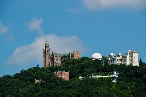
Puerto Ayora Harbor, Santa Cruz Island, Galapagos, David Broad, CC BY 3.0

In addition to the animal species, the Galapagos also has a significant population of people. Four of the 13 major islands are home to around 30,000 permanent residents. While the islands are in the same region, each one has its own individual culture and way of seeing the world. These cultures, due to the interests of foreign countries in protecting the Galapagos, are often very diverse, creating a very interesting dining scene. The biggest town in the Galapagos is Puerto Ayora on Santa Cruz Islands, with a population of more than 10,000.
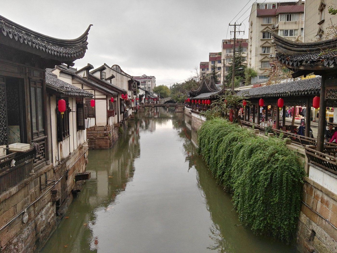

Jeremy Giles

Jeremy is a Writing Seminars and International Studies major at Johns Hopkins University. He is an avid writer and the Co-Founder of Writers’ Warehouse, Johns Hopkins’ first creative writing group. He is an advocate for Indigenous rights, and studies how Indigenous philosophies can be used to help prevent climate change. Using his writing, he hopes to bring attention to underrepresented voices in today’s world.

Eat for Under $15 at these 7 Global Cuisine Restaurants in NYC

Let your tastebuds travel without leaving the Big Apple.

Chinatown in New York City. Norbert Nagel. CC by 3.0.

Beyond its famous museums and fashion, New York City is recognized as the food capital of the United States. Every year foodies flock to the city’s restaurants for unique menus and interpretations of global cuisine. But this top-notch culinary environment typically comes—quite literally— with a price. New York restaurants are often criticized for their exorbitant prices. But fear not, there are plenty of restaurants in the city that offer authentic international cuisine for a reasonable price. Whether you are a college student on a budget or a lifelong fan of global cuisine looking for food made with a lot of love, these restaurants will leave both your stomach and your wallet happy.  
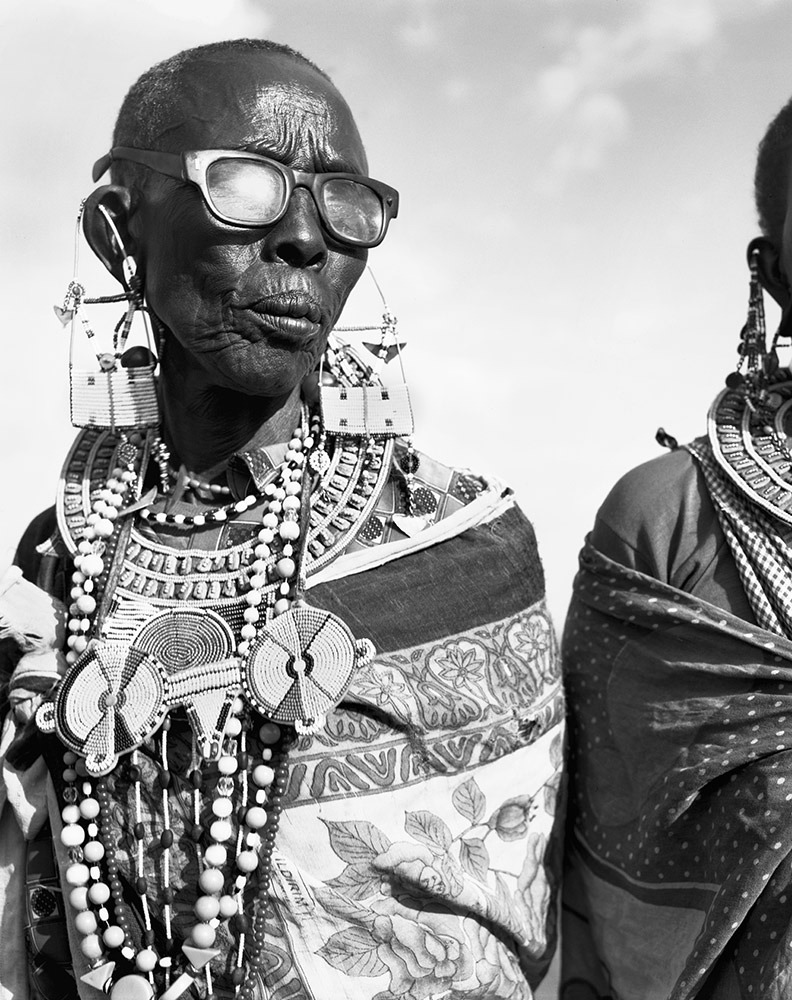
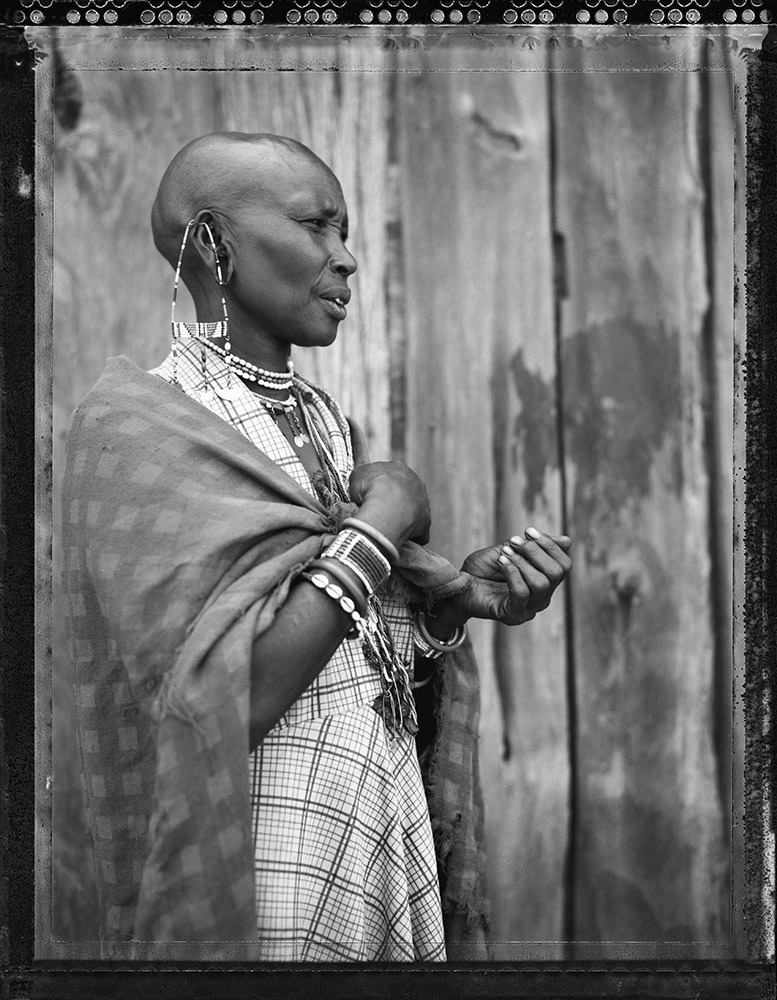
1. Super Taste

Hand-Pulled Noodles with Lamb. Jason Lam. CC by 2.0.

Located in the famous culinary neighborhood of Chinatown, Super Taste may be the most well-known restaurant on this list. If you find yourself craving Chinese food, Super Taste is a classic, must-go stop. The most notable dish on the menu is their hand-pulled noodles. These silky and addictive noodles can be paired with chicken, beef, or mutton at the customer’s request. But if you aren’t in the mood for noodles, the five for $10 pork and chive dumplings drenched in sweet-spicy chili oil are always a crowd pleaser. Although there is limited seating inside, Super Taste is perfect for on-the-go enjoying. Their menu can be found here

2. Pyza

Borscht topped with sour cream. Liz West. CC by 2.0.

Warm and delicious, Pyza serves Polish food so good it could be mistaken for a home-cooked meal. Located in Greenpoint, Brooklyn, this restaurant specializes in plates piled high with food that makes you feel like family. Its menu features traditional dishes like stuffed cabbage, tongue in horseradish sauce, and various types of pierogies. A stand-out dish is their chicken cutlet, breaded and paired with a dollop of sour cream. Their soups range from a reasonable $5-$8, so tuck in with a bowl of borscht and enjoy the homey atmosphere. Additional items and prices can be found here

3. Birria-Landia

Brooklyn location of Birria-Landia. Andre Carrotflower. CC by 4.0.

This Mexican spot may differ from most foodies’ perceptions of a typical restaurant. Instead of a usual sit-down experience, Birria-Landia started as a single Jackson Heights food truck. The operation has since expanded to include additional trucks in the Lower East Side, the Bronx, Jackson Heights, and Williamsburg. Their specialty dish, birria, features tacos topped with fresh cilantro and salsa paired with a rich, smooth dipping broth. The meat of the tacos—often beef—is first marinated in mixtures of spices and dried chillies before being cooked low and slow in broth. This lengthy process creates mouth-watering and juicy tacos that can be enjoyed for only $4.50. In addition to their exceptional tacos, their consummé broths, tostadas, and quesadillas can be found here.

4. Kassim’s Bakery

Aalu Roti. Guarav Dhwaj Khadka. CC by 4.0.

Whether you prefer your dishes savory or sweet, there is something for everyone at this Queens restaurant. Kassim’s serves a wide variety of Caribbean lunch and dinner foods, but also offers a tasty variety of pastries and baked goods. One of the menu’s highlights is the selection of roti; each variation of the dish is under $10. Roti is a wheat flatbread that at Kassim’s is paired with beef, chicken, duck, goat, and pachownie (innards of lamb). After finishing a main dish, customers can explore Kassim’s dessert menu. Their cassava pone is perfect for those with a sweet tooth; cassava, also called yuca, has an edible root often used to make starchy desserts. More of Kassim’s sweet and savory treats can be found here.

5. Punjabi Grocery & Deli

Samosas paired with chutney. K Spoddar. CC by 4.0.

Can you claim to have visited New York if you didn’t find yourself in a deli at some point during the trip? Although it also doubles as a grocery store, this Lower East Side joint’s Indian food makes it stand out. Even better, the deli only serves vegetarian food, making it the perfect spot for travelers with this dietary restriction. At only 50 cents, Punjabi Deli might have the most affordable Samosas in the city. They also offer an assortment of rice dishes where customers can mix and match different vegetable options to create the perfect bowl for only $6 or $8, depending on if you want a small or large meal. The $2 chai is a perfect way to wash everything down. More exciting dishes and beverages can be found here

6. SVL Souvlaki Bar

Grilled kebabs. Glen Edelson. CC by 2.0.

From spanakopita to greek fries, SVL Souvlaki Bar combines tradition with innovation to create unique Greek food. They have two Queens locations, with one on Steinway Street and the other on Astoria Boulevard. Perhaps the most exciting aspect of this quick and fresh spot is their “build your own” options. You can customize salads and bowls, or even create entire plates filled with pita, kebabs, vegetables, and sauces. Their iconic SVL sauce combines sweet, tangy, and creamy flavors— it is the perfect way to top off any customized dish. Or, if the extent of customization is intimidating, you can always enjoy classic chicken souvlaki kebab for only $4.50. Even better, the Bar’s food is made with hormone-free meat and fresh produce. Read more about their ingredients, mission, and menu here

7. Bunna Cafe

Injera topped with assorted vegetables. Kurt Kaiser. CC by 2.0.

If you’re looking for more of a sit-down experience, Bunna Cafe is the perfect destination. They are a Black-owned and vegan Ethiopian restaurant located in Bushwick, Brooklyn. The restaurant’s family-style meal environment creates the perfect atmosphere for hearty food paired with good conversation. Scoops of vegetables are served in piles on injera, a fermented sourdough flatbread. Customers can select a variety of different sides, mixing to create new flavors and combinations. Or, if you’re dining alone, the $12 lunch special comes with individual scoops of four different items. Although, with such generous portions, you may want to bring a friend to share. Further details about their menu and strong variety of sides can be found here.


Carina Cole

Carina Cole is a Media Studies student with a Correlate in Creative Writing at Vassar College. She is an avid journalist and occasional flash fiction writer. Her passion for writing overlaps with environmentalism, feminism, social justice, and a desire to travel beyond the United States. When she’s not writing, you can find her meticulously curating playlists or picking up a paintbrush.