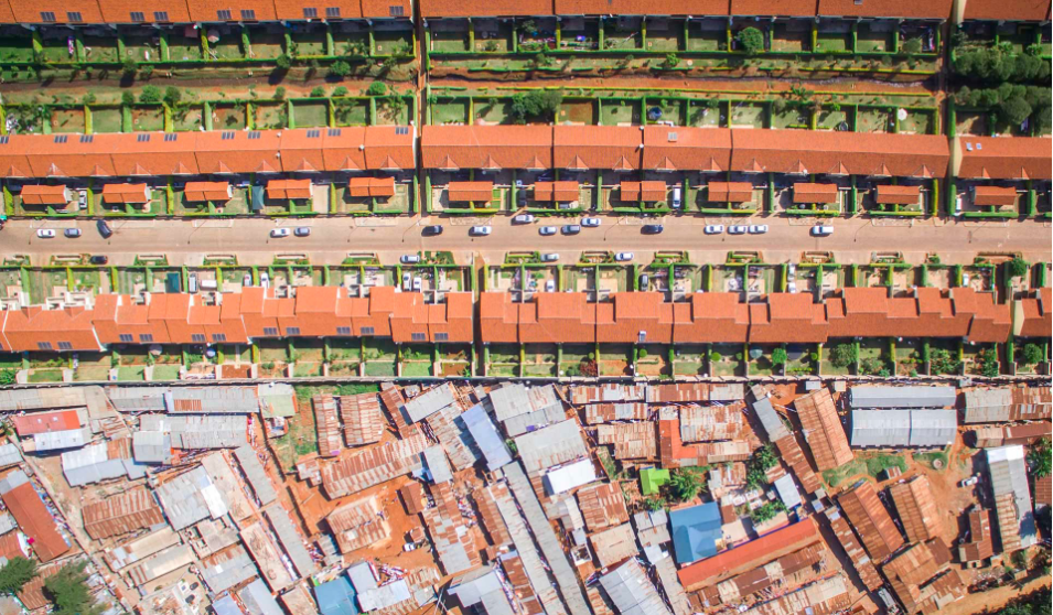
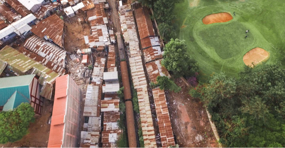
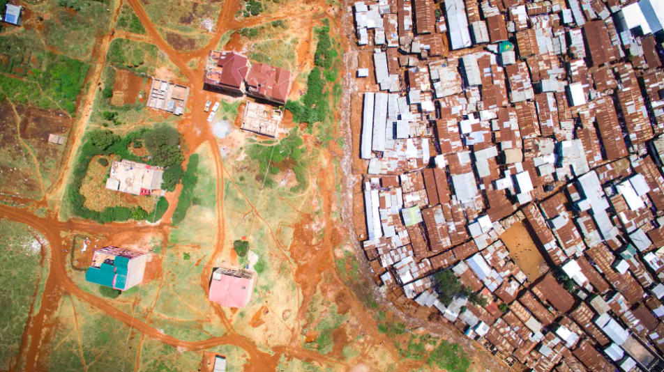
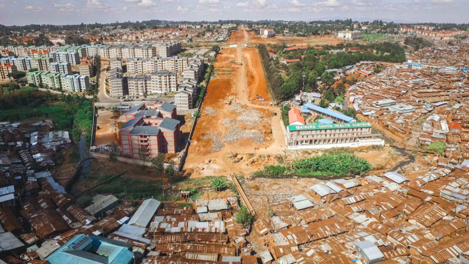
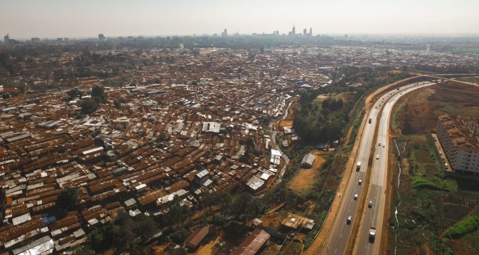
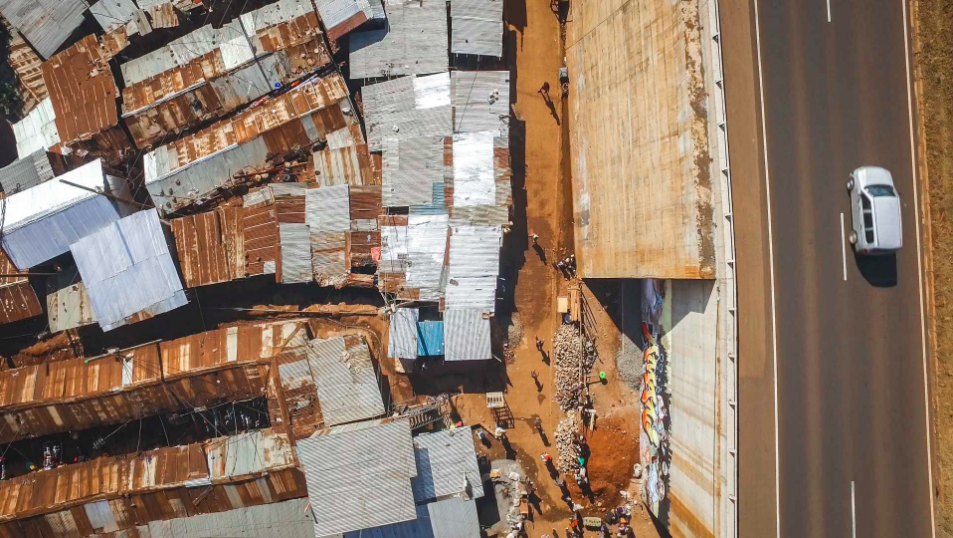
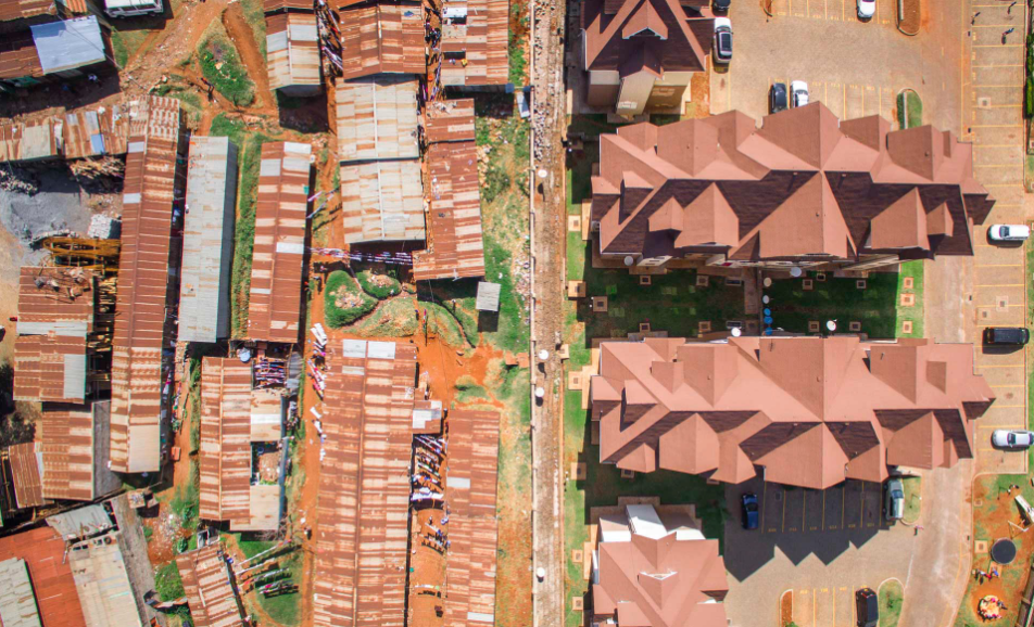
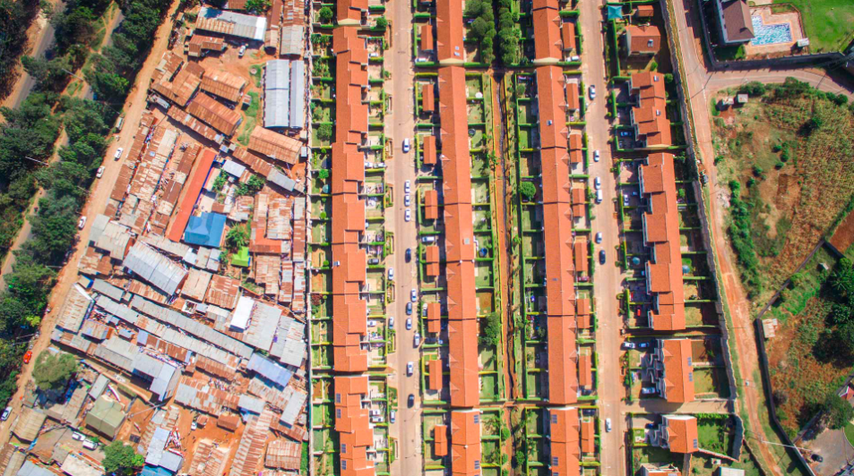
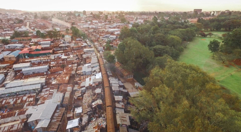
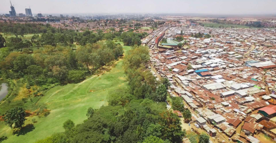
Warm Waters

WARM WATERS is a long-term photographic project investigating the impacts of climate change on the vulnerable communities and environments throughout the Pacific Region. From rising sea levels and the effects of increasingly extreme weather effects, such as El Niño and super typhoons, to floods and droughts, the destruction of coast, and the first climate refugees — I am collecting visual evidence of what is happening on the front lines of man-made global warming today, and how these phenomena are being dealt with.

ABOVE: Residents of the South Tarawa Atoll in Kiribati, bathing in the lagoon near the town of Bairiki. Seawalls protect the tiny islets of the atoll from the rising sea levels, however, many of them are constantly destroyed by high tides. (South Tarawa, Kiribati)

ABOVE: Dead coconut trees on the atoll of Abaiang, in an area of land where soils have become increasingly eroded and salinated by the regular flooding that occurs during high tides. Abaiang is one of Kiribati’s most threatened threatened islands. The government says this area is a “barometer for what Kiribati can expect in the future.” Since the 1970s the residents of Tebunginako have seen the sea levels rise and today a major part of the village has had to be abandoned. (Tebunginako, Kiribati)

Since 2013 I have travelled across most of the countries in Oceania — covering sea level rise in Tuvalu, Kiribati, Tokelau and the Marshall Islands, land grabs and related climate change issues in Papua New Guinea, super cyclones in Vanuatu, Tuvalu and Fiji, and climate change related migrations in Solomon Islands. One of the biggest issues facing mankind today, I aim to document climate change through the prism of communities whose very existence is threatened. Warm Waters shows that global warming is not a distant reality for future generations, but a critical issue for which we must all take collective responsibility and immediate action.

ABOVE: A plastic barrel of drinking water is hoisted up in the coastal village of Hanuabada in Papua New Guinea. With climate change, tides here are rising, exacerbating already severe sanitation issues. During high tide events, human waste flows freely between water resources, water-borne diseases like diarrhoea, dysentery, and typhoid start spreading, and potable water becomes scarce. (Hanuabada village, Port Moresby, Papua New Guinea)

ABOVE: Children in front of the Kiribati Parliament House in South Tarawa. Kiribati is one of the four atoll nations that are located in the Pacific Ocean. Most of Kiribati’s atolls rise no more than a couple of metres above sea level, and are very vulnerable to rising seas. (South Tarawa, Kiribati)

2015 was the warmest year on record and sea temperatures are increasing. Responsible for many of the climate conditions in the Pacific, El Niño weather patterns are intensifying. From Category 5 Cyclone Pam in South Pacific, to ice melting beneath First Nations’ feet — storms, droughts, floods, and heatwaves are becoming more severe and frequent.

The ramifications of shifting weather conditions are extremely complex. Physical environmental changes are implicating culture, history and tradition. Rising sea levels and erosion are shrinking already tiny land masses and changes to ecosystems are affecting food resources and tourism. As quickly as communities build sea walls, they are destroyed by storm surges. As people rebuild homes and schools after a cyclone, they are damaged by another. Rising temperatures are fracturing once solid ice and cracks are appearing in otherwise strong communities. People need move inland, and in the most extreme cases, relocate entirely.

“They are not escaping war or persecution, they are fleeing their own environment. They are the world’s first climate change refugees.”

ABOVE: An aerial view of Majuro, the capital of the Marshall Islands. The Marshall Islands comprises two chains of coral atolls, together with more than 1,000 islets. It is on average just two meters above sea level. The country faces an existential threat from rising sea levels with some predictions claiming that the islands will be swamped by the end of the 21st century. (Majuro, Marshall Islands)

ABOVE: A collapsed house on the banks of Mataniko River in Honiara, the capital of the Solomon Islands. In 2014 the region was badly affected by flash floods, which took the lives of 22 people and left 9,000 homeless. Thousands of homes located on Mataniko’s banks were washed away and many gardens were destroyed. (Honiara, Solomon Islands)

The longer the locals on these submerging islands search for solutions, the more their landmass is decreasing. While discussions elsewhere in the world still revolve primarily around the causes of climate change, the lives of those living in the Pacific revolve around adaptation and survival. Carbon dioxide emissions continue to accumulate in the atmosphere and these communities, some of the world’s most vulnerable, are already experiencing the reality of one of the greatest challenges facing humanity.

ABOVE: A father and son building a sea wall in front of their house in Fale village, Fakaofo Atoll, Tokelau. About 350 people live on this islet, which has a height of no than two metres above the high water mark during ordinary tides. In an attempt to fight the rising sea levels, Fale residents have enclosed their islet in concrete, with 5 to 7 metres high sea walls, hoping to protect their homes from storm surges. (Fakaofo Atoll, Tokelau)

ABOVE: Children playing in the water near a seawall in Tebikenikoora village, one of the islands most affected by sea level rise area in Kiribati. The village is regularly flooded during high tides despite residents attempts to build sea walls or take care of those that were built by the local government, but frequent big waves continue to damage them, putting resident’s houses, and gardens, under constant threat. (South Tarawa, Kiribati)

In 2014 and 2016, I visited Kiribati and the Marshall Islands — small, submerging island states that are starting to disappear because of rising sea levels and the extreme power of super typhoons, which fall on them far more often than in previous decades. Scientists say that they will be unsuitable for habitation by the end of the century. These countries are located on coral atolls, pieces of land in the middle of the vast ocean, which are only several dozen meters wide in their narrowest parts.

During high tides and severe storms, huge waves flood the roads, and seawater gets into the houses, also destroying gardens and vegetable patches. In some parts of Kiribati, whole villages have had to move inside the island because of coastal erosion.

“People live in constant fear that their homes will be destroyed, and their small children washed into the ocean, so during bad weather some parents tie up their children to heavy objects inside the house.”

ABOVE: Children playing on a sea wall in the town of Betio, near the rusting remains of a wrecked ship that was lifted and smashed onto the wall during a king tide in February 2015. (Betio, South Tarawa, Kiribati)

ABOVE: Jorlang Jorlang, 70, lies on his bed while his wife Tita finishes hanging laundry. In April 2014 a ‘king tide’ hit their house in Jenrok village on the Marshall Islands, and the seawater came inside. The rest of the family evacuated the house, but Jorlang couldn’t move, due to his disability. His wife had to stay with him for two days and wait until the water was gone. (Jenrok, Marshall Islands)

In Majuro, the capital of the Marshall Islands, I visited a cemetery where the graves are gradually submerging. For me, this one of the most convincing arguments for those who deny the effects of climate change and global warming , because why would anyone build cemeteries within reach of the tide on purpose? Several decades ago the locals would never have thought that the bones of their ancestors would be underwater.

ABOVE: A graveyard in Jernok village that is slowly being destroyed by the rising seas, in the Marshall Islands’ capital Majuro. “Cemeteries along the coastline are being affected,” says Kaminga Kaminga, a climate change negotiator for the Marshall Islands. “Gravesites are falling into the sea. Even in death we’re affected.” In June 2014, rising sea levels washed out the remains of 26 Japanese WWII soldiers on Santo Island. (Jernok, Marshall Islands)

ABOVE: Children playing ‘hide and seek’ in Teone’s graveyard in Funafuti, the capital of Tuvalu. Massive coastal erosion in Teone caused many coconut trees fall down, and the sea eaten its way into and around the trees that are still standing. People from Teone are threatened on one side by the ocean and its tide surges and on the other by a pit that fills with salt water at high tide due the soil salinisation. (Teone, Funafuti, Tuvalu)

I also visited the Polynesian island nation of Niue, which has land much higher above sea level. Already, some of the inhabitants of Tuvalu, another Oceanic state that is gradually submerging, have been relocated to Niue. In recent years, many of the locals from Niue have been emigrating to New Zealand in search of work, so the authorities decided to give Tuvaluan people a home to populate again partly abandoned villages.

ABOVE: Hetu, 8, holds a shark that was caught by fishermen in Fakaofo Atoll, Tokelau. Tokelau is a small atoll nation of Polynesia, which is a self-administering territory of New Zealand. Access to Tokelau is possible only by ferry from Samoa, and boats usually depart every two weeks from Samoan capital Apia. Isolation, lack of job opportunities, and vulnerability to climate change has the forced majority of Tokelauans to leave their homes in search of a better life in New Zealand or Australia. (Fakaofo Atoll, Tokelau)

ABOVE: Children of Etas village on Efate Island watch a water truck delivering drinking water to their village. After Cyclone Pam hit Vanuatu on 13 March 2015, many local communities were left without fresh water supplies. International charity Oxfam organised an airport water tank truck to come to the villages around Port Vila and help locals to fill their barrels with drinking water. Over 15 people died in the storm and winds up to 165 mph (270 km/h) caused widespread damage to houses and infrastructure. Cyclone Pam is considered one of the worst natural disasters ever to affect the country. (Etas, Efate Island, Vanuatu)

In 2015 after spending time capturing the aftermath of the destructive Cyclone Pam on Vanuatu, I travelled to Tuvalu on a UNICEF commission. I was lucky to find myself on the same ship as the official delegation, headed by Tuvalu prime minister Enele Sopoaga, and including almost all ministers. The ship went to the most remote islands of Nui, Vaitupu and Nukufetau, all severely damaged by Cyclone Pam. I was the only professional photographer there to capture the aftermath of the cyclone.

Before our arrival the huge waves had eroded the cemetery on Nui, and there were bones and half-decomposed bodies floating all over the island. The pigs and chickens had started to eat them, and so the Tuvaluan government sent instructions that all of the animals must be killed to prevent disease spreading. For the locals, whose livelihood is based on fishing and animal husbandry, it was, of course, a tragedy.

ABOVE: People from Nukufetau Atoll boarding the ‘Manu Folau’, a ship that will take them to Funafuti, the capital of Tuvalu, where they hope to take refuge. Nukufetau was among the other outer islands of Tuvalu that were badly hit by Cyclone Pam in March 2015. Many residents left the damaged areas and went to to stay with relatives in Funafuti, which was not affected by the cyclone. (Nukufetau Atoll, Tuvalu)

ABOVE: Nelly Seniola, 35, extension officer in the Tuvaluan fisheries department, shows a photograph on his laptop of a corpse that was washed out of a cemetery by a storm surge. Nelly told me, “There were many dead bodies, skulls and bones floating around. Pigs and chickens started to eat some of the bodies. We received a radio message from the capital, that we had to kill those animals, as they could spread diseases.” (Tuvalu)

ABOVE: A house on stilts, built over a polluted ‘borrow pit’ on the edge of Funafuti, in Tuvalu. The settlement, called Eton, is threatened on one side by the ocean’s waters and tide surges and, on the other, by stagnant saltwater filled ‘borrow pits,’ where sand and rocks were excavated by the American military during WW2 in order to build a runway. The pits are a dump for the refuse that is increasingly clogging the islands and a health hazard for those living alongside. (Funafuti, Tuvalu)

Towards the end of 2015 I made a one-month trip around the islands in northern part of Oceania, including Guam, the Northern Mariana Islands, and the Federated States of Micronesia and Palau. In addition to documenting the effects of coral bleaching and sea level rise, I was also capturing the aftermath of super typhoon Maysak, the most powerful pre-April tropical cyclone on record in the Northwestern Pacific Ocean.

Maysak affected Yap and Chuuk states in the Federated States of Micronesia, with damage estimated at $8.5 million (2015 USD). The Red Cross reported there were as many as 5,000 people in desperate need of food, water, and shelter, and who required emergency assistance.

ABOVE: Roxanna Miller, monitoring technician of the University of Guam Marine Lab, inspecting species of staghorn corals severely impacted by coral bleaching event in 2013–2014. The bleaching resulted in loss of about half of all Guam’s staghorn corals. Although the remaining corals are slowly recovering, because of the increasing effects of global warming they can be hit again by rising water temperatures and extreme low tide events. Loss of the coral reefs would directly impact on local fishermen, as the habitats the corals provide to reef flat fish communities, would be gone. (Guam)

ABOVE: A small islet in the Ulithi Atoll. With only a few palm trees remaining, it is almost entirely submerged during high tides. (Ulithi Atoll, Yap State, Federated States of Micronesia)

Most recently, I spent time in Fiji, Samoa, Tokelau, and the Solomon Islands. On the 20 and 21 February 2016 Category 5 Severe Tropical Cyclone Winston hit Fiji, destroying the country’s infrastructure and thousands of homes. At the time of my visit, 43 people had been confirmed dead and more then 60 thousand had been forced to flee, living in evacuation centres hurriedly set up across the country.

ABOVE: The southern part of Taveuni Island in Fiji is among the areas most affected by Cyclone Winston. Some villages were completely destroyed and people were left without food for about a week, as access to the island was cut off. (Taveuni Island, Fiji)

ABOVE: Locals prepare food rations, given by private donors, for delivery to affected villages of southern part of Taveuni Island in Fiji, one of the most affected areas. (Taveuni Island, Fiji)

As global warming continues, many countries in the Pacific region will feel the effects of the destabilization of the planet’s ecosystem. Extreme weather events, such as unusually high temperatures and cyclones are already devastating small island nations. I have decided to dedicate several years to the Warm Waters project, and have plans to travel around the whole Pacific region from Alaska to New Zealand, documenting the unpredictable and severe effects of climate change.

ABOVE: Teiwaki Teteki, 28, carries his 4-year-old son Paaia to the shore in heavy rain. Teiwaki and other passengers travelled to Taborio village from North Tarawa by “te wa uowa” (double) canoe, which is the only way to get from north of the Tarawa Atoll to the south during high tide. For nearly two years, it has been raining almost every day in the northern part of the Gilbert Islands chain. In 2015, the annual rainfall was 4 times higher than the average. (South Tarawa, Kiribati)

And yet, despite the painful and challenging situations I have witnessed, this project is as much about resilience as it is about tragedy. Local and international organizations are helping to introduce renewable energy, new water tanks, and fortified roads into these communities. People are being relocated following, and in case of, the ever-increasing likelihood of natural disasters related to global warming. And in the children, I see hope. When it floods, they swim in the pools of water near their houses, or try to surf on improvised surf-boards during high tides.

“Many communities in the Pacific are optimistic and resilient, determined to find solutions rather than be case studies of climate change victims.”

ABOVE: A young girl playing in the remains of an oil barrel near the shore of Tebunginako village in Kiribati. The island nation is slowly being swallowed by rising sea levels, and will likely be uninhabitable before the end of the century. (Tebunginako, Abaiang Atoll, Kiribati)


Some photos from this gallery were taken on assignments for UNICEF Pacific and Oxfam Australia

THIS ARTICLE WAS ORIGINALLY PUBLISHED ON MAPTIA.


VLAD SOKHIN

Documentary photographer, multimedia producer and film-maker, represented by Panos Pictures. Author of the book, ‘Crying Meri’.

www.vladsokhin.com

BANGLADESH: From No-Man's Land to the Unknown

For decades, more than 50,000 people have been stranded, without access to basic rights, on tiny islands of no-man's land locked within India and Bangladesh. Last year finally saw an end to these enclaves, or 'chitmahals,' bringing hope and change to communities living on the world's most complex border. 

The party lasted long into the night across remote patches of northern Bangladesh. As the clock struck midnight people played music, danced and sang using candles for light, and for the first time in their villages they raised a national flag. Similar events were also taking place on the other side of the border in India just a stone’s throw away. 

For 68 years, ever since the formation of East Pakistan in 1947 (which later became known as Bangladesh), the residents of one of the world’s greatest geographical border oddities have been waiting for this moment; for their chance to finally become part of the country that has surrounded yet eluded them for so many years.

At 12.01am on July 31st, 2015, India and Bangladesh finally exchanged 162 tracts of land — 111 inside Bangladesh and 51 inside India. 

Known in geographical terms as enclaves, or locally as chitmahals, these areas can most easily be described as sovereign pieces of land completely surrounded by another, entirely different, sovereign nation.

ABOVE: Inside an enclave, a man prepares jute by removing the long, soft vegetable fibres that can be spun into coarse, strong threads, and keeping the sticks. For many enclave dwellers, jute is where most of their income comes from and also what they use to build their houses. 

Enclaves aren’t as rare as you may think, and until now this part of South Asia has contained the vast majority. Existing around the world, mostly in Europe and the former Soviet Union, they were once much more prevalent — until modern day cartography and accurately defined borders eliminated many. Some still remain, such as the Belgium town of Baarle-Hertog, which is full of Dutch territory. The locals have turned the unusual border into a tourist attraction. However, for this region of southern Asia, where political and religious tensions run high, the existence of enclaves is not so jovial. Life for those who are from these areas is far harder than in neighboring villages, only minutes away.

ABOVE: Sisters Lobar Rani Bormoni, 11, and Shapla Rani Bormoni, 12, stand in a paddy field in the enclave in Bangladesh where they born. 

“These enclaves are officially recognised by each state, but remain un-administered because of their discontinuous geography. Enclave residents are often described as “stateless” in that they live in zones outside of official administration — since officials of one country cannot cross a sovereign frontier into administered territory,” explains Jason Cons, a Research Assistant Professor at the LBJ School of Public Affairs at the University of Texas, Austin and author of the forthcoming book, ‘Sensitive Space: Fragmented Territory at the India-Bangladesh Border.’

ABOVE: Muslim men from Dhoholakhagrabari enclave pray in their mosque. Mosques are usually the only solid structures that exist inside the enclaves.

Several folktales tell of the origin of these enclaves being the stakes in a game of chess between two feuding maharajas in the 18th century, or even the result of a drunken British officer who spilt spots of ink on the map he drew during partition in 1947. Captivating as these stories are, the most likely explanation dates back to 1711 when a peace treaty was signed between the feuding Maharajah of Coch Behar and the Mughal Emperor in Delhi. After the treaty their respective armies retained and controlled areas of land, where the local people had to pay tax to the respective ruler, thus creating pockets of land controlled by different people.

Prior to 1947, when this region was entirely Indian territory, living in these locally-controlled enclaves made little difference. However, during the drawing of the boundary between India and Bangladesh, the Maharajah of Coch Behar asked to join India — on the condition that he retain all his land, including that inside the newly formed East Pakistan, which his ancestors had rightly won control of over 200 years ago.

So, through no fault of their own, the lives of 50,000 people turned upside down — for decades they have been stranded on islands of no-man’s land.

ABOVE: (Left) A man fishes at dusk using his large bamboo fish trap. This river exists just outside the enclave but as it’s in Bangladesh territory, enclave dwellers are forbidden to fish here otherwise angering the local fishermen. (Right) Enclave dwellers fish in a flooded paddy. 

During the early 1970s a framework to find a solution to this problem was put in place — called the 1974 Land Boundary Agreement. For forty years, as governments came and went, neither the Indian nor the Bangladeshi politicians were able to agree with their counterparts at the time. And whilst the politicians squabbled, the residents suffered.

ABOVE: Only informal work, like at this sawmill, is available for enclave dwellers in Bangladesh. 

On the ground there are no border fences or security checkpoints, and without realising it, you can walk in and out of India countless times, crossing an international boundary completely obliviously. However, there is a serious lack of infrastructure and this has been one of the most serious problems facing the residents. Paved roads quite literally stop at the boundaries to the chitmahals, as do electricity poles. The enclave inhabitants in Debiganj District of Bangladesh, as non-Bangladeshi citizens, were even barred from sending their children to school, also receiving no state assistance or even the most basic of hospital treatment.

ABOVE: Sheltered within their small bamboo house, located inside the enclave of Dhoholakhagrabari, Eity Rani, 14, and Shobo Rai, 8, carefully do their homework by the light of an oil lamp. Life is much harder for children who are born in enclaves.

ABOVE: (Right) A Bangladeshi man sits in a shop in the market of a small town that sits between enclaves. (Left) Every Saturday a jute market is held in Debiganj. For the many inhabitants of the enclaves that surround the town, jute is where most of their income comes from. 

Wearing just a lungi — a traditional sarong worn around the waist — Sri Ajit Memo is sitting in the middle of a small muddy courtyard, surrounded by houses made of bamboo and jute sticks. At 55 years old, his family have lived in a Dhoholakhagrabari chitmahal for generations. Chewing on the twig of a certain tree that locals here use as an alternative to toothpaste, he explains, “All kinds of problems exist here. The government doesn’t care about us, or our children, and so it’s very difficult for them to even go to school. Honestly, we are Indian, but how can we feel this way when we get no help from them?”

For enclave dwellers on both sides of the Indian-Bangladeshi border, the entitlement to receive even the most basic of rights has eluded them.

Reece Jones, an Associate Professor in Political Geography at the University of Hawai’i Manoa, who has visited many chitmahals on both sides of the border, explains further, “After decades in this situation many people have found ways around it through bribes to officials or through friends who helped them to obtain the documents they needed, such as school enrolment forms for their children. However, the situation was not stable or secure. They were extremely vulnerable to theft and violence because the police had no jurisdiction in the enclaves.”

ABOVE: Rupsana Begum, 7, (pink dress) and Monalisa Akter, 7, (orange dress) are from an enclave but were able to come and study at Sher-e-Bangla Government School because their parents managed to acquire fake documents and were able to pay the school.

ABOVE: In Dhoholakhagrabari enclave students and their teacher sit in a madrassa class. Because enclave children have a difficult time accessing the education system in Bangladesh the locals of this enclave formed an Islamic Foundation funded on donations.

Today, after decades left living in limbo in these randomly placed no-man’s lands, around 47,000 people on the Bangladeshi side and some 14,000 on the Indian side have finally been given the right make a choice: stay where they have lived for generations with official citizenship of the country that will absorb them, or return to their country of origin.

None of the residents living in Bangladeshi enclaves within India asked to return to Bangladesh and as a result they will now all become Indian citizens. However, on the other side of the border in Bangladesh, whilst the vast majority of the Indian enclave dwellers decided to stay and become Bangladeshi citizens, 979 people requested to return to India. For these families, the enclave saga has yet to end.

Of those 979 individuals, a total of 406 come from Debiganj district. In 2011, a team of Indian officials visited every home in every enclave in Bangladesh and produced the first ever detailed census of all those living within the Indian enclaves. This report formed the basis of all subsequent decisions on the status of each person living in the enclaves.

ABOVE: (Left) An old lady inside her home, which has no running water or electricity, in Dayuti enclave. (Right) Dhonobala Rani, 70, gets emotional knowing that she has to leave her son (in the blue shirt) behind in Bangladesh, as she takes Indian citizenship. 

Several months after my visit to document the enclaves during the final days of their existence, those who had chosen to leave for India finally crossed the border, leaving their homes in Bangladesh forever. In India they were given land and began the process of integrating into Indian society. Those who chose to stay behind in Bangladesh also started to receive such basic rights as eligibility to vote and access to health care.

Let us hope that after decades of struggle on these isolated political islands, the lives of these ex-enclaves dwellers can begin to reach some level of normalcy. In the end, after so many years of uncertainty, the world’s strangest border region has now become a thing of the past.

ABOVE: A lady from Ponchoki Bhajini village, in the enclave of Dhoholakhagrabari. She has chosen to leave for India, to start a new life as an Indian citizen.


ORIGINALLY PUBLISHED ON MAPTIA 


LUKE DUGGLEBY

@LukeDuggleby

Luke Duggleby is a British freelance documentarian and travel photographer. He currently lives in Bangkok and is represented by Redux Pictures. 


USA: One Stitch Closer with Veronika Scott

Get inspired by Veronika, CEO and founder of The Empowerment Plan, who empowers women to become more independent. #WomenInspire http://www.gap.com/onestitchcloser

Get inspired by Veronika Scott, the 24-year-old founder and CEO of The Empowerment Plan, a non-profit that empowers women to be live the lives they want to lead. 

UGANDA: Kids from This Slum Are Dancing Their Way Out of Poverty

Sitya loss Eddy Kenzo Leka Nzine Ghetto Kids Dancing Sitya Loss New Ugandan music 2014 DjDinTV

There are several aspects of human life I strongly believe unite the world. You don’t need to speak the same language or share the same background to connect on any of these and that’s awesome!

What are they?

Food, science, math, sports, and the most fun… music and dancing. Which is partly why this video is so inspiring and went viral with over 14 million views last year.

Yes, these kids should clearly be onstage with Beyoncé for their incredible dance moves. But that’s not the only reason this video is fantastic.

The kids dancing in this video are known as the Ghetto Kids. They are from the slums in Kampala, Uganda, and thanks to their math teacher Dauda Kavuma they train almost daily to improve their dance techniques and the quality of lives for their families.

The Ghetto Kids dance video has allowed some of the children in this video to afford school supplies, stay in school, and even provide better homes for their families.

Sometimes it doesn’t take much to improve the lives of those living in poverty. In this case— a great teacher and people like you willing to share how incredible these kids truly are can make a huge difference.

Update: The Ghetto Kids are now working on creating high production videos, continuing to dance and perform and most importantly continuing their education, according to BBC. I hope to see these kids onstage with Beyoncé at the next Global Citizen Festival (if it’s okay with their math teacher and parents first).

You can go to TAKE ACTION NOW and help kids get the education they need and deserve.


MEGHAN WERFT

@MWerft26

Meghan is a Digital Content Creator at Global Citizen. After studying International Political Economy at the University of Puget Sound she moved to New York. Originally from California she brings her love of yoga, kayaking and burritos to the big city. She is a firm believer that education and awareness on global issues has the power to create a more sustainable, equal world where poverty does not exist.

The World's 10 Hungriest Countries

There are over 870 million people in the world who are hungry right now. I'm not talking about could use a snack before lunch hungry, not even didn’t have time for breakfast hungry, but truly, continually, hungry.

Of these 870 million people, it's been estimated by the World Food Programme that 98% live in developing countries, countries that perversely produce most of the world’s food stocks. So why is this the case?

Here we look at the top 10 worst affected countries and see what obstacles are making them hungry and why:

1. Burundi

Image: Imgur


73.4% of the population is believed to be undernourished.
Sitting between Rwanda, the Democratic Republic of the Congo and Tanzania, Burundi is a landlocked country, which means that on average it will experience 6% less economic growth than non landlocked countries, mainly due to the cost of transport for import and export transactions.

Over half of Burundi’s 9.85 million citizens live below the poverty line, with an estimated 35% of the population being out of work.

The main problem with Burundi is not that it can’t produce food, but that due to overpopulation, soil erosion, climate change, high food prices and an ongoing civil war, the country has to import more than they are exporting. In the last few years alone due to these factors, and the increase of internally displaced citizens who can’t produce their own food, the subsistence economy of Burundi has contracted by 25%.

Looking at the current economic and political climate of Burundi it is clear to see that poverty alone isn’t the cause of hunger, but that many external factors contribute to the hardship being endured.

2. Eritrea

Image: Imgur


65.4% of population have been classified as undernourished.

Eritrea, which is located in the Horn of Africa, has experienced considerable growth to its economy in recent years, but unfortunately the effect of this hasn’t trickled down to its citizens or the food chain.

In 2004, agriculture employed nearly 80 percent of the population but accounted for only 12.4 percent of gross domestic product (GDP). The agricultural sector has improved with the use of modern farming equipment and techniques; however, it is still compromised by a lack of financial services and investment.

Another big problem facing Eritrea is that, as a result of the war between Eritrea and Ethiopia, almost a quarter of the country’s most productive land remains unused. This can be attributed to a number of issues, but it’s largely because of the displacement of nearly 1 million Eritreans during the 1998-2000 Eritrean Ethiopian war, which left the country with a lack of skilled agricultural workers, and because of the widespread presence of land mines on the ground meaning that the plots are ruined.

3. Comoros

Image: Imgur


70% of the population are estimated to be undernourished.
Comoros, which is made up of 3 tiny islands of the coast of Mozambique, has a population of just 800,000 people. Around half of the population live below the poverty line.

The reason for such high numbers of poverty and undernourishment are varied. One of the biggest problems is that although there is a rapidly increasing young population entering into the agricultural workforce, their low educational levels mean that innovation and economic growth aren’t in correlation. 

Because of these factors it is essential that Comoros continues to receive foreign support in order to develop the right educational and economic infrastructures to be able to drive levels of poverty and undernourishment down. 

4. Timor Leste

Image: Imgur


38% of the population in Timor-Leste are undernourished.
Sitting between Indonesia and Australia Timor-Leste is a small island with a population of just over 1 million people. 

It continues to suffer the after-effects of a decades-long struggle for independence against Indonesian occupation, which severely damaged the country's infrastructure.

Private sector development has lagged due to human capital shortages, infrastructure weakness, an incomplete legal system, and an inefficient regulatory environment. 

Because of this nearly half of the population suffer from undernourishment, with Timor famously suffering through ‘hunger season’ between November and March when old stores have run out and new crops haven’t been harvested.

5. Sudan

Image: Imgur


Around 25% of Sudan’s population is undernourished and hunger is on the rise.
Hunger is rife because Sudan suffers from several challenges, for much of Sudan's history the nation has suffered from rampant ethnic strife and has been plagued by internal conflicts including two civil wars and the War in the Darfur region.

Another reason that Sudan is suffering is because of the extreme climate conditions that the country suffers from, which is something that is unfortunately out of their control. 

6. Chad

Image: Imgur


33.4% of population of the population in Chad are undernourished.

Poverty in Chad has been aggravated by numerous conflicts during its 50 years of independence. Tensions between the country’s northern and southern ethnic groups have further contributed to political and economic instability, and Chad’s landlocked location and desert climate in the north inhibit economic development. The Sahelian zone (central and eastern Chad) is particularly affected by chronic food deficits. Moreover, Chad is subject to spill-over effects from crises in neighboring Sudan and the Central African Republic. It is estimated that there are 330,000 refugees in Chad, which puts additional pressure on the limited resources of the already highly vulnerable local population.

Chad relies heavily on external assistance for its food security, especially in the Sahelian zone. Cereal production is heavily affected by erratic rains, cyclical droughts, locust infestations and poor farming practices. The 2011 drought, which resulted in a 30 percent deficit in the population’s cereal needs, was then followed by a severe food and nutrition crisis in 2012.

7. Yemen Republic

Image: Imgur


Undernourished: 32.4% of population
Yemen has had an extreme change in it’s food security over the last 10 years. Because of large-scale displacement, civil conflict, political instability, high food prices, endemic poverty and influxes of refugee and migrants. In 2013, the World Food Programme is aiming to provide almost 5 million people in 16 governorates with food assistance and is working to build communities’ resilience. In 2013, WFP conducted an Updated Food Security Monitoring Survey which found that 43 percent (10.5 million people) of the population is food insecure. Some 4.5 million of those people were found to be severely food insecure, unable to buy or produce the food they need, and 6 million are moderately food insecure.

Child malnutrition rates are among the highest in the world with close to half of Yemen’s children under 5 years, that is two million children, stunted and one million acutely malnourished.

8. Ethiopia

Image: Imgur


In Ethiopia an alarming 40.2% of population are undernourished.
The 2011 Horn of Africa drought left 4.5 million people in Ethiopia in need of emergency food assistance.  Pastoralist areas in southern and south-eastern Ethiopia were most severely affected by the drought.  At the same time, cereal markets experienced a supply shock, and food prices rose substantially, resulting in high food insecurity among poor people.  By the beginning of 2012, the overall food security situation had stabilized thanks to the start of the Meher harvest after the June-to-September rains -- resulting in improved market supply -- and to sustained humanitarian assistance. While the number of new arrivals in refugee camps has decreased significantly since the height of the Horn of Africa crisis, Ethiopia still continues to receive refugees from Somalia, Sudan and South Sudan.

The Humanitarian Requirements Document issued by the government and humanitarian partners in September 2012 estimates that 3.76 million people require relief food assistance from August to December 2012. The total net emergency food and non-food requirement amounts to US$189,433,303.

Ethiopia remains one of the world’s least developed countries, ranked 174 out of 187 in the 2011 UNDP Human Development Index.

9. Madagascar

Image: Imgur


33.4% of the population of Madagascar are undernourished.
The country is prone to natural disasters such as cyclones, flooding and drought. In 2013, the island faced its worst ever locust plague, which hampered agricultural production and threatened food security.

The increasing fragility of the ecosystem, due to deforestation and poor land management, is a major cause of the increased vulnerability to shocks and related food insecurity. Deforestation has become a major concern: 85 percent of its rainforests have been lost due to the use of wood and charcoal for cooking, and slash and burn agricultural practices.

Approximately 28 percent of rural households suffer from food insecurity - of which 2.7 percent are severely food insecure and nearly 25 percent moderately food insecure. In total, about four million people are facing hunger  in 2013. The food security of a further 9.6 million people could deteriorate as food prices increase during the lean season,when crops are planted but not yet harvested. Also of concern is the cyclone season, which runs from November to March.

10. Zambia

Image: Imgur


47.4% of the population are under nourished
Numerous challenges burden the country, including high rates of malnutrition, poverty, food insecurity, HIV and AIDS and malaria. While Zambia has reduced the rate of extreme poverty from 58 percent (1991) to 42.7 percent (2010), extreme poverty continues to be much higher in rural areas (57 percent) compared to urban areas (13 percent ). Zambia's food security challenges are worsened by a high dependence on rain-fed agriculture and the absence of market incentives to encourage a fundamental shift from subsistence farming.

Consequently, access to food is a challenge for many. According to the Zambia Vulnerability Assessment Committee, the number of people at risk of food insecurity is up from about 63,000 in 2012 to about 209,000 in 2013. This is attributed to localized poor crop production due to poor weather conditions in some parts of the country.

It calculated a ‘global hunger’ score for countries by looking at the percentage of the population that is undernourished, children younger than five who are underweight, and the percentage of children dying before the age of five.

ORIGINALLY PUBLISHED ON GLOBAL CITIZEN

Clea Guy-Allen

@PerfectlyClea

Clea hails from Brighton, United Kingdom and was the UK Global Citizen Editor. Now she works as the digital coordinator for ONE, a campaigning and advocacy organization to end extreme poverty and preventable disease. 


Systemic Discrimination Against Haitian Workers in the Dominican Republic

Capitol Building in Santo Domingo, DR

In July 2012, I lived within the sugar cane communities of the Dominican Republic, known as the “Bateyes,” as a volunteer for Save the Children, a nonprofit that advocates for children’s rights. Recent media attention to Dominican immigration reform has provoked international criticism for its perceived racial bias, as it threatens to deport thousands of Hatian workers. My experiences on the ground exposed me to some of the hardships that individuals from this region endure. For members of the Bateyes, destitution and food insecurity are systemic challenges that define everyday life. After hours of hard labor under the Caribbean sun, cane cutters earn an average of less than two dollars per day. Walking between the tall sugar stocks on an impromptu tour of a community, a local resident demonstrated the proper way to cut cane. Since the plants are sensitive, agricultural machinery is less effective than individuals with machetes and gardening tools. The man explained that cane cutters leave for the fields at dawn and work until dusk. The only available form of nutrition is the sugar cane, which is absorbed from bits of chewed stock consumed throughout the day. 

Cane cutting demonstration in Bateye Margarita

Back in the communities, families stretch their two-dollar income to purchase food such as rice from the sundry store. When fellow volunteers and I asked the kids at a small, under-resourced school what they wanted to be when they grew up, they were excited to share dreams that resembled those of children everywhere: doctors, police officers, astronauts, and beyond. I thought back to the truck of cane cutters I watched disappear into the fields earlier that day and was reminded of the tragic reality that awaits this population: Undocumented in the eyes of the law, these children will either remain in the Bateyes as workers and wives or else be deported to Haiti. 

In 2004, Dominican authorities passed an immigration law specifying that children born to undocumented immigrants would be excluded from Dominican nationality. Over the past 50 years, the DR has recruited thousands of Haitian laborers to cut sugar cane under two bilateral agreements signed by the countries in 1959 and 1966. First-person accounts describe a form of modern slavery, in which Haitians were deceived by promises of better opportunities, taken across the border in buses in the middle of the night, then stripped of their papers that declare citizenship status. The impoverished families were left with no alternative but to work in the cane fields and reside in the neglected communities they now call home. 

Typical home in Bateye Experimental

After decades of struggle in the Bateyes, a population that is 90% Haitian, a 2013 Dominican Constitutional Court decision reinterpreted the immigration law. This decision altered the law to extend its definition to individuals born between 1929 and 2010, and ordered government officials to revoke citizenship from those who no longer qualified. A naturalization law was passed the same year as a pathway to gain citizenship, but the process was marred with bureaucratic roadblocks and inconsistencies. The deadline to register passed at the end of June 2015: Almost 200,000 individuals remain at risk of deportation back to Haiti. 

During my time in the Bateyes, I stayed at a quasi-hostel run by a missionary. In addition to lodging, the woman created a pathway for the undocumented to restore their citizenship. While her service has provided an opportunity to rise above the inescapable cycle, the cost is $40 dollars (American). It often takes years — if not decades or a lifetime — to save that much money. And since the communities are nestled across a large swath of farmland, the missionary shared stories of people walking up to 18 miles to reach her office. The line is always out the door, and if the father of a household is the one to obtain the papers, he has to take a day off work. 

Children at play in Bateye Don Juan

A long legacy of racial and political tensions between the two countries that divide the island of Hispaniola contributes to a national ambivalence toward the situation. Sugar is also one of the Dominican Republic’s most lucrative exports. One of the main buyers is Hershey, which is popular in countries like the United States. As consumers, it is our responsibility to be conscious of the supply chain behind the products we purchase: Ignorance should not be an excuse. 

While inflammatory headlines such as Huffington Post’s “Thousands Woke Up At Risk Of Deportation In The Dominican Republic. Almost All Of Them Are Black,” help shed light upon the issue, they also run the risk of dehumanizing what’s occurring. International pressure has prompted the DR to reform policy in the past, but another way to help these people is to practice conscious consumerism. Choosing not to buy products that contain sugar from the Dominican Bateyes, for example,candy from The Hershey Company, demonstrates individual dissatisfaction with abusive work practices. I am grateful for my opportunity to have volunteered in the sugar cane communities and will never forget the people I worked alongside during that time.


SARAH SUTPHIN

Sarah is an undergraduate at Yale University and a content editor for CATALYST. As a traveler who has visited 30 countries (and counting!), she feels passionate about international development through sustainable mechanisms. Sarah has taken an interest in the intersection between public health and theater, and hopes to create a program that utilizes these disciplines for community empowerment. She is a fluent Spanish speaker with plans to take residence in Latin American after graduation. 

Bridging the Inequality Gap for Panama’s Darién Province

Photo by Katie Chen on Unsplash

The Gallup-Healthways Global Well-Being Index has ranked residents of Panama as the leaders in “well-being” for two consecutive years. However, three weeks in communities of the Darién province exposed me to the destitution and gubernatorial neglect that blankets this eastern region. Inhabitants of the Darién have been stigmatized, leaving them without access to clean water, health care facilities, or economic opportunity. My experience led me not only to question the validity of the Index, but also to consider the ways we can empower a forgotten sub-population.

“A little further down the road, you’ll find that it comes to an end,” my local Panamanian guide remarked while en route to the compound where we reside for the following three weeks. At the time, the idea of a place with no road was beyond comprehension. How could people stay connected? How could they receive supplies? The answer to these questions is simple —they don’t.

Soon after arriving in Panama, I began to comprehend the “Darién Gap” which is a 99-mile swath of undeveloped swampland and forest located within Panama’s Darién province — a symbol of the many development projects that have been discontinued in the region over the past decades. I found that the double-edged sword of indigenous isolation offers cultural preservation on one side, clean water and healthcare deficiencies on the other.

The border between Panama and Colombia is the only one in the world that remains unpaved! While the decision to stop construction of the Pan-American Highway provided benefits to some groups, such as law enforcement officers against drug traffickers and indigenous inhabitants of the Gap who wish to preserve a traditional lifestyle, it also resulted in neglect of an entire region. With the fastest-growing economy in the Americas, Panama now has an opportunity to improve the quality of life for all of its citizens. Yet, despite the recent boom, the nation has the greatest economic inequality in the Americas with nearly 40 percent of the country living in poverty. Many of those who endure economic destitution live in the eastern half of the country, particularly in the Darién. 

My three weeks in Panama were dedicated to community visits throughout this beleaguered province. We met with officials and members of individual households, and conducted surveys to determine the accessibility to fundamental necessities, such as clean water, health care, and education. I was an intern for a nonprofit based in Panama City, but which conducts most of its projects with American undergraduates serving communities of the Darién. This nonprofit creates partnerships with communities located in proximity to a road or a rocky pathway that Panamanian officials call highway. More indigenous groups are sheltered within the Darién Gap, undisturbed and unacknowledged.

According to community members who responded to our surveys in July 2014, lack of access to clean water is the main problem affecting daily life for an appreciable number of residents in the Darién province. Although the Panamanian government’s Ministry of Health is responsible for water distribution by means of aqueduct systems, complications such as project incompletion, water shortages, pipeline damages, and contamination from pesticides/animals inhibit achievement of the goal. Residents described complex, inconsistent, and seasonally based methods for receiving water. In the past, families might go two months without water when a government-constructed pipeline to a water tank is broken. When water finally arrives, it will sometimes come out dirty or contaminated from passage through farmland. 

Observation and conversation with members of various communities taught me that collaboration between locals and external, resource-rich groups has been a driver for successful growth in this area. Yet, one person I met described the Darién province as “the temple of abandoned development projects” for the number of missionary and nonprofit groups that have attempted and failed to provide assistance to families in the greatest need. In an indigenous community named Emberá Puru, I noticed little blue water filters strewn about the property. The leaders explained that a missionary group had provided over 100 filters, but not explained how to use them. The group left after a week of what could be described as “voluntourism” — volunteering abroad that resembles a tourism opportunity — and the community was left with pieces of plastic polluting the land.

The neglected Darién province is not a unique case. Panamanians from other parts of the country (like Panama City) expressed surprise and/or distaste when my group revealed we were working in this eastern region. These people hold onto misconceptions, such as the idea that the Darién is filled with dangerous members of drug cartels or that it’s a completely unlivable swampland.

While the “Darién Gap” might lack a constructed road, the population of this area has done its best to overcome deficiency through resiliency. When a government or its people show indifference toward improving the lives of an entire population sector, outside measures need to be taken to reduce inequality. However, these outside measures should also be performed through culturally conscious and responsible mechanisms in order to achieve sustainable success. No clear-cut solution exists to resolve problems such as clean water, healthcare, and education inaccessibility in the Darién province, Panama. However, creative and collaborative efforts have the power to mediate substandard conditions and to catalyze change one household at a time.


SARAH SUTPHIN

Sarah is an undergraduate at Yale University and a content editor for CATALYST. As a traveler who has visited 30 countries (and counting!), she feels passionate about international development through sustainable mechanisms. Sarah has taken an interest in the intersection between public health and theater, and hopes to create a program that utilizes these disciplines for community empowerment. She is a fluent Spanish speaker with plans to take residence in Latin American after graduation. 

Who Is Anonymous Street Artist and Parisian, JR?

Not much is known about the semi-anonymous artist who calls himself "JR." We know that he is young — flirting with age 30 — French, and presumably has a name involving the letters "JR."

28 Millimètres, Face 2 Face, Separation wall, security fence, Israeli side, Abu Dis, Jerusalem, 2007

However, little else is known about the enigmatic past of the artist who has emerged on the world stage as the most lauded street artist since Banksy. Who Is Anonymous Street Artist and Parisian, JR?

When people hear the words "street art," they immediately picture graffiti: spray-painted images, slogans, or "tags," illegally marked onto the side of derelict urban buildings. This idea of street art must be abandoned when examining the oeuvre of JR. While it is true that JR began as a traditional street artist, using aerosol spray cans to paint on buildings around his native Paris, his artwork and his vision drastically changed when he discovered a camera that had been lost on the Paris metro. He began to document his artistic escapades and those of his friends, and he eventually abandoned traditional graffiti for something more easily duplicable: photocopies of the pictures themselves. Thus began the principle act of JR's craft, the pasting of large copies of his photographs on the sides of buildings. As with most street art, this started out as an illegal act, and one that mainly took place on the sides of run-down urban structures.

28 Millimeters, Portrait of a Generation, Hold-up, Ladj Ly by JR, Les Bosquets, Montfermeil, 2004

But then something happened: JR's art started to capture things that were extremely relevant to the general public, and capture them in extraordinary ways. His exhibit, Portraits of a Generation spanned the 2006 youth protests and riots, a turbulent period in recent French history. It would've been easy for JR to capture scenes of burning cars, looted stores, or angry teenagers holding weapons — the essential stock photographs of a small-scale revolution, material that would surely gain him some acclaim and media attention. But JR did the opposite: in a time where there was rhetoric about the pervasive lines drawn by race and class in modern French society, JR chose to challenge the paradigms and media representations of the rioting youth. He visited friends in housing projects and captured them in a way the media had not. He captured, perhaps, what the media chose not to: black French youth making funny faces, teenagers of Middle Eastern origin crossing their eyes at the camera, images that were unexpected, light-hearted, honest and above all else, human.

28 Millimeters, Portrait of a Generation, Pasting of Ladj Ly by JR, Montfermeil, Les Bosquets, 2004

JR blew up the photos to huge formats, and pasted them on the walls of the most bourgeois areas of Paris. It was all very illegal… at first. But there was something unmistakably powerful about JR's art: these were giant images of individuals previously viewed to be dangerous thugs, but here they were as kids, fooling around, unthreatening. JR's images worked to diminish the tension inherent in interactions between Parisians in the mainstream and in the margins. And then something happened: His images were wrapped around the buildings of the Paris City Hall. This made JR's street art "official," although he would have continued even if it hadn't.

28 Millimètres, Women Are Heroes, Action in Favela Morro da Providencia, Favela by day, Rio de Janeiro, 2008

From Paris, JR began to work on the largest canvas on earth: the world itself. His work has taken him all around the globe, from his famous Face 2 Face exhibition where he posted pictures of Palestinians and Israelis face to face in a number of Palestinian and Israeli cities and on the Wall itself, to the most dangerous favelas of Rio de Janeiro, Brazil, or the space above the High Line in New York City. His work captures the faces of the world's marginalized groups and populations: women, the extremely poor, the indigenous. He takes those who are often off the radar and makes them a large and profound part of the everyday experience of cities. His art does more than turns heads, it changes perceptions.

JR’s work has won wide international acclaim, even winning him the 2011 TED Prize. At first, he was put off at the notion that he was supposed to save the world, JR sighed when the mandate was clarified: change the world, not save the world. “Oh, alright,” he said. “That’s cool.” In a TED Talk later in 2011, he continued by saying, “Art is not supposed to change the world, to change practical things, but to change perceptions. Art can change the way we see the world.” And his art really has.


Calah Singleton

Calah recently graduated from Yale, where she majored in Political Science. Her interests include urban studies, international development, and learning new languages.

What's Wrong with a Box of Toys?

It’s December 10th and Tom, Saskia and I have come to the half-completed Karin Children’s Clinic to watch a local women’s group hold a weekly meeting to discuss administrative matters. They manage projects from beadmaking to raising livestock on a pay-it-forward scheme amongst various families in the group. A man from the Heifer Foundation is busy reporting on the status of the cow breeding program. Nobody seems particularly impressed. I feel hot, having decided to stand outside to take pictures of the proceedings. We have arrived in time for what appears to be the last item on the day’s agenda. The opening of a large cardboard box with a Samaritan’s Purse logo on the side. I sigh.

The last memory I have of Samaritan’s Purse was seeing a manicured lawn and suburban house with SP signage square in the middle of an Ethiopian village that appeared wholly undeveloped. I still use that sight as a metaphor for badly-intended aid. Aid spent on the expats, not the community. What little I know of them, they seem to be a faith-based organisation of some kind. With, I suspect, much of the naive worldview that it entails. They are also somehow responsible for the arrival of The Box. The lady leading the meeting reads out a letter that came with The Box. I roll my eyes. 

Everyone applauds. The Box is opened. Pens and pencils are first apportioned out to the various parents in the group, so that they can hand them on to their kids for their school work. Then the remaining toys are handed out to the parents and to some additional children who have taken to looking at the proceedings with wide eyes. There was a huge collection of toys, many of which I would have considered trading my brother for in my youth. 

There was a slinky, and a stuffed green amphibian of some sort, as well as plasticine, koki pens, stickers, bubbles and all manner of other fun things. The toys were warmly received by children and parents alike. The kids who were in attendance went outside immediately to play with their allocated toys. One who had received a toy parachutist would throw it up in the air and catch it again in delight as it floated back down with an open parachute. Then throw it again immediately, over and over. Another who had stickers (but nothing on which to immediately stick them) promptly covered himself and his nearest friend. The point here, is that everyone loved the toys.

I had stopped my ‘holier-than-thou eye rolling at this point, having replaced it with a sort of philosophical confusion that I have still not managed to reconcile. On the one hand, I think that glee boxes full of toys like this are little more than a guilty West trying to salve its conscience with a dollop of God-inspired charity. The structural features in the relationship between the US and places like Uganda that brought about this inequality and sustain it (in the larger sense) remain as strong as they ever were. So you have some toys. Whoop. It would be even nicer if the people in the world with the money and the guns had made sure you had a better life from the beginning. If they had used them more responsibly, more humanely.

And yet.

There is no denying that this lone box, for all my bitching and angst against international politics, really did bring a good deal of joy. That the community of the Fairview Baptist Church probably meant well when they sent it. This box of toys was never intended to make the US get firmer about catching LRA leaders, or stop its corporations buying the minerals from the neighbouring  DRC. The ones which pay for continued bloodletting. Nope. The single, carefully-packed purpose of this box was to reach some children who had no toys, and give them the joy of the parachuting man. The stickers you can stick on your friends. A green frog toy.

So can I judge them wrong for sending it? Would I prefer that the box had never been posted, and that the Fairview Baptist Church had instead gone to picket Congress?

In my heart, honestly, I would have to pick The Box.

And then there are the pictures. I deeply dislike the stereotype that the kids in raggedy-looking clothing looking at the box of toys represents. They are pictures that I would refuse to allow published because they say all the wrong things to people who weren’t there to see them as live, happy, rich individuals. But what other pictures do you take to tell the story of kids waiting on a box of brand new toys? And if those are the pictures you end up with, should you never show them at all?

The pictures lie. Partly because they aren’t everything, and partly because we are so conditioned to respond to photographs like these with pity. Which can be powerfully dehumanizing and completely the wrong response. But rather than nothing at all, take the images as a poor facsimile of reality.

They won’t tell the story, just as that box won’t fix poverty. But they are an innocent effort by people who mean well. And wish to do better.


Richard Stupart is a freelance photojournalist with an interest in postconfilct recovery and representations of Africa. He writes regularly at www.wheretheroadgoes.com