Jeju: South Korea’s Largest Island

Jeju-do, known as Jeju Island, is the largest island in South Korea, and is home to beautiful natural scenery and an interesting community of women divers known as haenyeo.

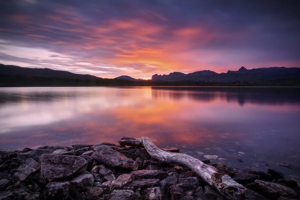
Jeju Island. Republic of Korea. CC BY-SA 2.0

South of the Republic of Korea lies Jeju Island, a volcanic island famous for its beautiful beaches, resorts and landscape. The volcano on the island is a shield volcano called Hallasan, and it is the largest mountain in South Korea, standing at 1950 meters tall. Its status is considered active, but there are some who disagree since the last time it erupted was in 1007 AD. Also, the volcano does not smoke, and there is no fire coming out, so it appears to be dormant, hence the disagreement. Jeju Island is both the largest and only island in South Korea that governs itself. It is home to the World Heritage Site Jeju Volcano Island and Lava Tubes, and it is one of the new 7 wonders of nature alongside areas like South America’s Amazon Rainforest, Indonesia’s Komodo Island, South Africa’s Table Mountain and others.

Beyond the volcano, the island also has a network of lava caves and tunnels. The beaches, too, are beautiful, and there are walking trails called Olle, which means “a winding path to your front door” in the local dialect. They cover almost the entire island, and along their route people can see the sea, rock formations, caves and more. There are interesting rock sculptures known as Dol Hareubang, which are statues carved from the volcanic rock all over the island. The name translates to “grandfather made of stone”, and they get this name because they all have elderly features. They are also considered to be guardians of the island that ward off evil spirits and demons.

Dol Hareubang. Charity Davenport. CC0 1.0

Beyond the natural beauty of the island and the stone statues, Jeju Island is home to a community of women, known as Haenyeo. They are all divers that gather food from the sea like oysters, sea urchins and abalone. The thing that makes them truly unique, however, is the fact that they don’t use oxygen masks. They free dive down to as deep as 30 feet below the surface and can hold their breath for minutes. Girls start learning how to swim, dive and help the women from as young as 8 years old, and there are women still diving who are in their 80s. The women have been the ones to do this for many years, in part because there were a lot more of them than men on the island. The Korean War also caused an increase in women being more economically engaged. 

Haenyeo are considered to be the first working mothers of South Korea and have made diving their profession. There are no men participating in the dives and harvesting of seafood. Like many places, South Korean society has been typically male dominated, so the women on Jeju Island are very different. They have been diving for the past 1700 years, but after an increase in the demand for seafood the haenyeo were doing well and they started  trying to provide better education and other career options. As a result, many women choose  to not follow the diver tradition and the number of haenyeo has decreased since then. A lot of them are also older women who have been doing it for their entire lives, while the younger and middle-aged women chose to follow career paths. The women’s work and contributions have led to them being mentioned in UNESCO’s list of Korea’s cultural heritage in 2016.


Katherine Lim

Katherine is an undergraduate student at Vassar College studying English literature and Italian. She loves both reading and writing, and she hopes to pursue both in the future. With a passion for travel and nature, she wants to experience more of the world and everything it has to offer.

7 Breathtaking Waterfalls Around The World

From the tropical jungles of the Philippines to the glacial mountains of Iceland, these seven waterfalls are some of the most beautiful out there.

The Cascadas de Agua Azul, located in southern Mexico, are a series of waterfalls on the Xanil River. Claudia Tavani. CC BY-NC 2.0.

Every year, countless travelers visit the world’s tallest waterfalls, with Niagara Falls receiving over 13 million visitors alone. However, it is only one of hundreds of waterfalls in North America, and one of thousands worldwide. Hidden away in corners of South America, Europe, Africa and Asia are a multitude of other falls that display nature’s power and beauty. Waterfalls are divided into ten categories depending on their geographic surroundings and how they descend through them.  These include punchbowl waterfalls like the Kawasan Falls at number three on our list, horsetail waterfalls, chutes, cataracts, cascades like the one found at Akchour at number seven on our list and block waterfalls formed by wide rivers falling in uninterrupted sheets, to name a few. Here are seven incredible highlights that may not be the tallest or widest in the world, but are absolutely unmissable simply for their sheer beauty.

1. Plitvice Waterfalls, Croatia

Croatia’s Plitvicka Jezera National Park is home to a beautiful network of lakes and waterfalls. Jack Brauer. CC BY-SA 2.0.

Located in central Croatia between the country’s capital of Zagreb and the coastal city of Zadar, Plitvice Lakes National Park has been a UNESCO World Heritage site since 1979. Its protected area spans 300 square kilometers (roughly 115 square miles) and comprises a network of lakes and caves, which are connected by a series of breathtaking waterfalls. These can be viewed from the various footpaths and wooden bridges that traverse the park, or visitors can also enjoy a boat ride included in the price of the entrance ticket. Because of its protected status, the park is also home to bears, wolves and eagles among a whole host of wild animals.

2. Iguazu Falls, Argentinian-Brazilian Border

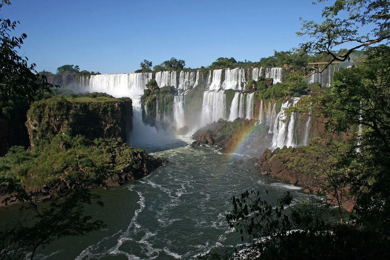
A birds eye view of one of the many waterfalls in Iguazu National Park, Argentina. Tomfriedel. CC BY 2.0.

The Iguazu Falls stretch for 2.7 kilometers (around 1.7 miles) along the border between the Misiones province in Western Argentina and the state of Paraná in Eastern Brazil. Altogether, the network makes up the largest system of waterfalls in the world, and was accordingly named a UNESCO World Heritage site in 1984. Thanks to a longstanding preservation effort in the two national parks on either side of the border that share custody of the falls, a network of walkways and viewing platforms can bring visitors very close to the falls, including near the bottom in an area called “Devil’s Throat”. You can travel to the falls by car from both the Brazilian and Argentinian sides, as well as from the Ciudad del Este in Paraguay. 

3. Kawasan Falls, Cebu Island, Philippines

Kawasan Falls is hidden away in the jungles of Cebu Island, Philippines. Vicky Flip Flop. CC BY-NC-ND 2.0.

The Instagram famous turquoise waters of Kawasan Falls are reachable by a three-hour bus ride southwest of Cebu City in the Philippines. The tropical waterfall is accompanied by limestone canyons and a dense jungle, all of which surround the pools often referred to as the “Gatorade Factory” due to their incredible color. Located in the coastal municipality of Badian, visitors can hike the kilometer and a half (just under a mile) long route uphill to reach the first and largest of many waterfalls that make up the series. Those interested in spending more time in the area can even book cottages available for overnight stays, though most opt to simply rent bamboo rafts to explore the pools.

 4. Gullfoss, Iceland

Iceland is home to numerous waterfalls with the Gullfoss Waterfall being a favorite among locals. O Palsson. CC BY 2.0.

The Icelandic name Gullfoss translates into “golden falls” in English, a reference to the sediment in the Hvita River from the nearby glacier that causes this spectacular waterfall to glow gold in the Nordic sunlight. Located a 90-minute drive west of the capital of Reykjavik, the two cascades that form Gullfoss are not actually that tall, falling for a total of only 31 meters (roughly 102 feet). However, seeing the waterfall up close can still be a deafening experience with floods of water going over the edge at a rate of around 109 cubic meters (just under 50,000 cubic feet) per second. There aren’t any railings or barriers either, so it is up to visitors to keep a safe distance from the cliff’s edge.

5. Weeping Wall, Hawai’i, USA

Travelers can visit Hawai’i’s Weeping Wall located in the heart of Kauai Island. Ahonui Bowman. CC BY-NC-ND 2.0.

Hawai’i is well-known for its incredible natural beauty, and the Weeping Wall is one of many spectacular sites on the island of Kauai. The network consists of a series of extremely narrow waterfalls winding across the centrally located Mount Waialeale, which stands 1,569 meters (about 5,066 feet) tall. The mountain’s name translates from Hawaiian to “overflowing water”, given that this location is in fact the second wettest area on the planet, and receives just under 11.5 meters (just under 37.5 feet) of rain every year. Given the mountain’s height, visitors rarely get a view of the upper part of the falls as it is often hidden in the clouds, but watching the water tumble down through the tropical greenery is still an incredible sight to see.

6. Ban Gioc Waterfall, Vietnam

A view of the Ban Gioc Waterfalls from Cao Bang, Vietnam. Applejuice. CC BY-SA 2.0.

Located on the border between the Cao Bang province in Northern Vietnam and the Guang Xi province in Western China, the Ban Gioc falls are the largest waterfall network in Asia. The waterfall stretches over 30 (about 98 feet) across on the Chinese side where it is known to locals as the De Tian Waterfall instead. Ban Gioc cascades down over three tiers of lush greenery, feeding directly into the Quay Son River, which in fact runs along the China-Vietnam border. Traveling to the falls from the Vietnamese capital of Hanoi normally takes visitors about two days to complete, with an overnight stop in Cao Bang City to split up the six and a half hour drive. 

7. Cascades D’akchour, Morocco

The higher of the two waterfalls that make up Cascades D’akchour near Chefchaouen, Morocco. Culture Trekking. CC BY-ND 2.0.

The Cascades D’akchour are tucked in amongst the Rif Mountains, the northernmost chain in Morocco. Reachable via a 45-minute drive from the famed “blue city” of Chefchaouen, visitors can enjoy a mountainous trek connecting several smaller waterfalls before arriving at the final cascade whose upper section tumbles down 100 meters of rock face (roughly 328 feet) into a collecting pool. The lower cascade, on the other hand, stands at a much smaller 20 meters tall (just under 66 feet) but also features a natural swimming pool just upstream of its descent over the cliff. For those interested in exploring even further, another hour and a half of hiking can bring you to the Pont de Dieu or Bridge of God, a naturally formed rock bridge carved out of the mountain by the Farda River.


Tanaya Vohra

Tanaya is an undergraduate student pursuing a major in Public Health at the University of Chicago. She's lived in Asia, Europe and North America and wants to share her love of travel and exploring new cultures through her writing.

All-Woman Rowing Team Takes On The Great Pacific Race

Four women compete in the Great Pacific Race, rowing from San Francisco to Hawaii.

For those who row competitively, completing the Great Pacific Race (GPR) is the pinnacle of a successful career. The race – which is a total of 2,080 miles (3,328 meters) – starts in San Francisco and ends in Hawaii. Teams of 3 or 4 are able to enter and are challenged to make it to Hawaii in as little time as possible. Though completely alone in their rowing efforts, every team is monitored from afar during all hours of the day by GPR crew in the instance of any emergencies.

Latitude 35, an all-female rowing team vetted with years of ocean rowing experience, has decided to challenge themselves in completing the Great Pacific Race. Among them are Adrienne Smith, Libby Castello, Sophia Denison-Johnson and Brooke Downes. They are not the first all-women’s team to compete, but they may be the fastest to ever finish the race if they maintain their pace on the last leg of their journey. The previous record that Latitude 35 wishes to crush is set by the Ocean Sheroes, who took on the challenge in 2021 and completed it in a little over 35 days. 

The first Great Pacific Race occured in 2014, and the organizers have held four subsequent “campaigns” since, with a total of 19 teams to ever complete the journey. Usually four or five teams will compete in the same race at a time, traveling from all over the globe to test their strength and willpower. Within the five sets of races that have taken place over the years, itvNews reports only “two four-person all female teams” have finished the race, making Latitude 35’s journey all the more special. 

Additionally, competitors are racing against the clock, not necessarily each other. To “win” the race, teams have to complete the journey the fastest, so the women of Latitude 35 are technically competing against teams – specifically the Ocean Sheroes – from a year ago who hold the current time record. Men and women may compete during the same campaign, but the race time records are separated by gender. However, it is important to note that just completing the challenge is a victory in itself; holding the world record for fastest time is just an additional win. 

Having left on June 21st, the Latitude 35 women have just about 495 miles (792 kilometers) left in their journey, and have done around 1590 miles (2,544 kilometers) in just over 28 days. They are on track to beat the pre-existing time record.

Besides the competitive nature of the race, it is also an incredible immersive experience with nature. Traveling on the open ocean for days allows participants to become up-close and personal with the ocean and all of its wonders. The Great Pacific Race describes the experience: “You will see shooting stars and the most incredible skies. You will experience nature in a way that few people can even imagine.” Latitude 35 has described their experiences with wildlife, including flying fish that have hopped around and into their boat.

The team has faced a few challenges along the way, including Tropical Estelle and Hurricane Darby, which threatened to hit the women’s route while they were on the open waters. Fortunately, neither the tropical storm nor the hurricane has found its way to the team, and the women are still safely continuing on.

The Great Pacific Race is a challenge of extraordinary athletic and physical strength. Calloused and blistered hands, sunburnt skin, hunger and fatigue all challenge the rowers. It is also a true test of emotional stamina and friendship. There is no reprieve from the rowing and physicality of the sport, just as there is no reprieve from your teammates. Latitude 35 has taken to Instagram to pass the time, and as they speak of their journey and the hardships they face – like rowing at night when all you want to do is sleep – they have gained a large following. 

Posting regular updates lets followers know where they are in their journey, as well as how they pass the time. Singing, laughing and making funny videos has helped the women stay motivated to finish their race. Additionally, Latitude 35 has started collecting donations for the Anxiety and Depression Association of America, raising money and awareness of the organization and what it has to offer athletes and those suffering with mental illness.


Ava Mamary

Ava is an undergraduate student at the University of Illinois, double majoring in English and Communications. At school, she Web Writes about music for a student-run radio station. She is also an avid backpacker, which is where her passion for travel and the outdoors comes from. She is very passionate about social justice issues, specifically those involving women’s rights, and is excited to write content about social action across the globe. 

7 Historical Sites That Could Be Underwater by 2050

Climate change is threatening these beautiful archaeological sites, and at this rate, it may not be long before they are completely submerged under water.

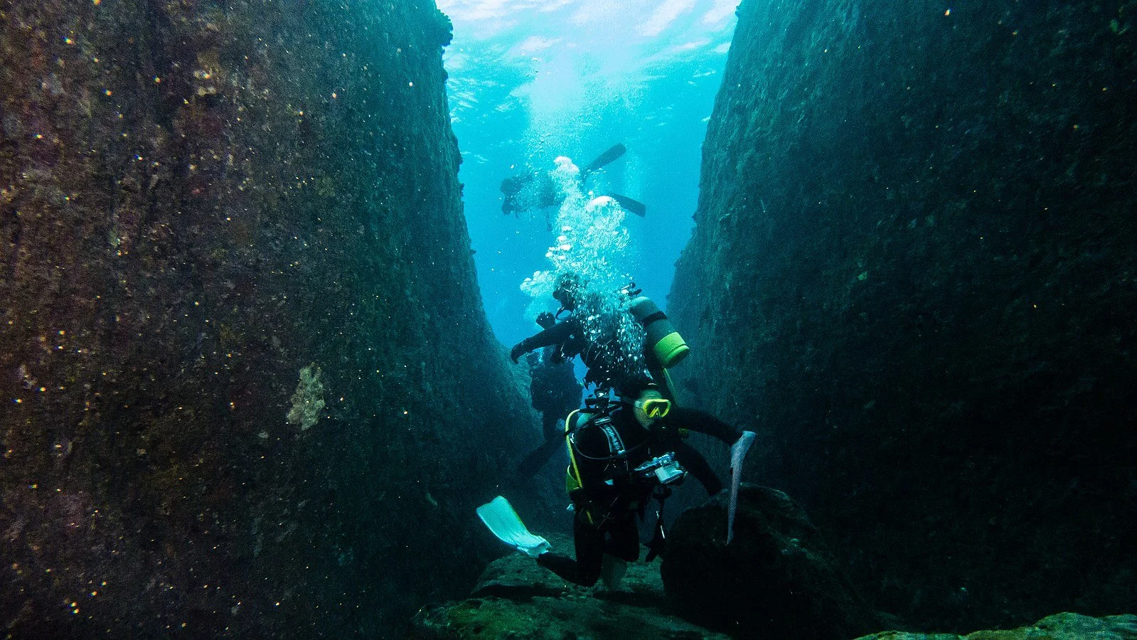
The Yonaguni Monument is submerged off the coast of Japan. Danapit. CC BY 2.0.

One of the most immediate consequences of global warming is the rise in sea levels that is threatening to turn many cities into a modern day Atlantis. However, it is not just the common tourist destinations of Venice and Bali that are at risk—there are a number of breathtaking historical sites that could also disappear under the tides. Many of these destinations are located at or below sea level and are also near bodies of water, which makes them extremely vulnerable to flooding and water damage.

1. Elephanta Caves – Gharapuri, India

Elephanta Caves. Ashwin Kumar. CC BY-SA 2.0.

In 2014, the Elephanta Caves were identified as being at long-term risk from rising sea levels in the Indian Ocean in a study conducted by researchers at the University of Innsbruck. Located on Elephantine Island in Mumbai Harbor, the caves include a number of man-made excavations and carvings into the various rock faces of the island in honor of the Hindu god Shiva. These archaeological remains date back to the mid-fifth century, making the site almost 1,500 years old. Many of the cave entrances are adorned with detailed sculptures of Shiva, the most famous being “Sadashiva,” a bust of the god carved into the side of the mountain measuring seven meters in height. Every year, the few hundred islanders and a large tribe of monkeys welcome over a million tourists, despite local protests about how the visitors are endangering their way of life.

2. Great Mosque – Kilwa Kisiwani, Tanzania

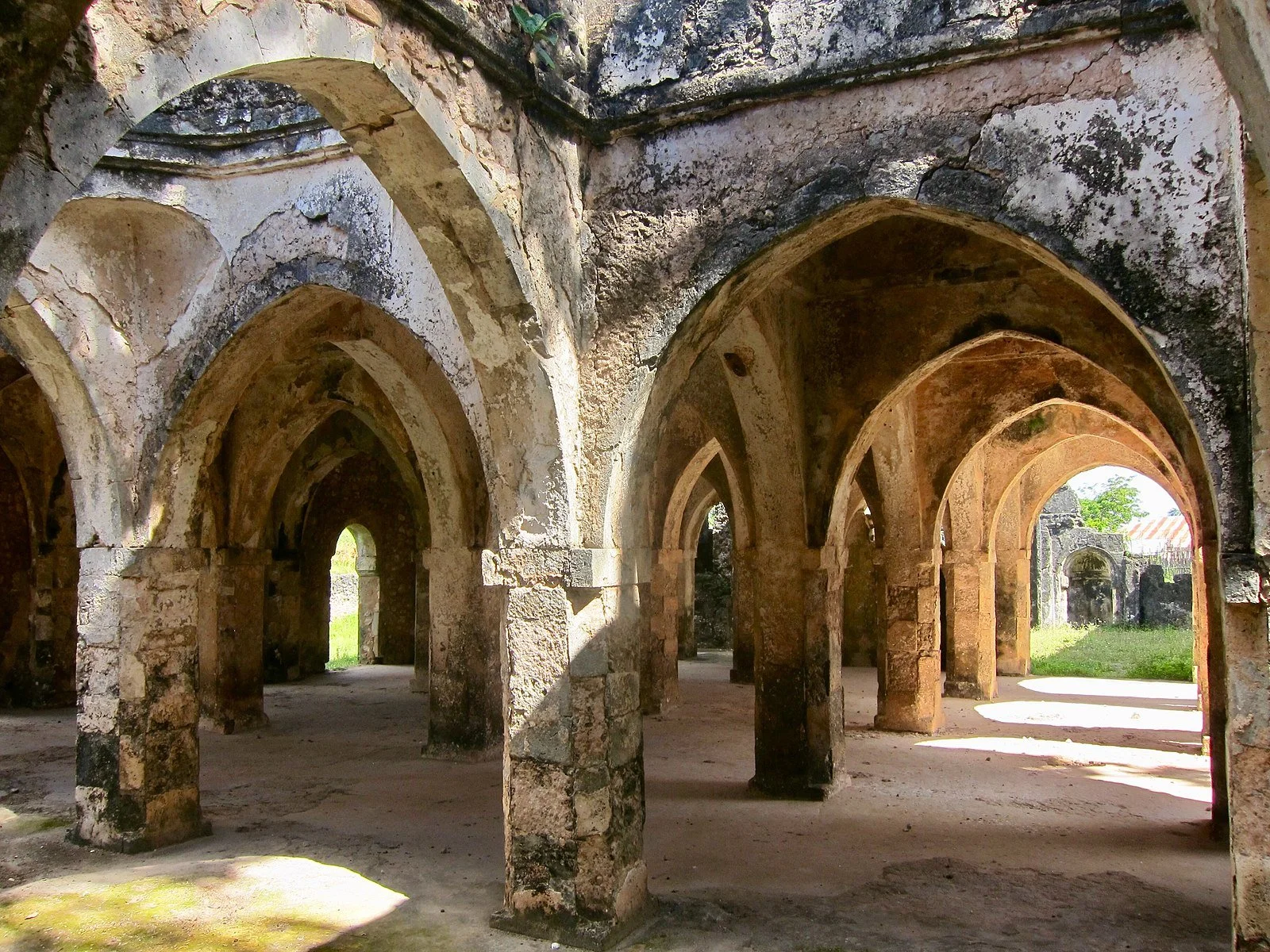
Inside the Great Mosque of Kilwa. Lazy-papaya. CC BY-SA 2.0.

As the oldest standing mosque on the east coast of Africa, the Great Mosque of Kilwa Kisiwani has been around since the 14th century. The island on which it is located was a key trading port in the Indian Ocean and saw shipments of ivory and gold as well as upwards of 20,000 African slaves pass through on their way to Europe and North America. Sailors stopping by on their journeys could enter the halls and worship under the 16 coral and timber domes, built specifically with such materials to withstand the elements. The local sultan added an extension to the south side of the mosque in the 14th century, including the “Great Dome” which also boasts an inscription by Ibn Battuta, an explorer known commonly as the Islamic Marco Polo.

Because Kilwa Kisiwani is a coastal city, local experts have long been expressing concerns about the dangers of coastal erosion to the integrity of the historical ruins. Rising water levels in the Indian Ocean are threatening the UNESCO heritage site as well as disrupt the locals’ way of life. 

3. Comalcalco – Tabasco, Mexico

Mayan ruins at Comalcalco, Tabasco. Dennis Jarvis. CC BY-SA 2.0.

The Mexican state of Tabasco sits on the coast of the Gulf of Mexico and experiences regular flooding. If sea levels continue to rise, the region and its incredible Mayan ruins could be completely submerged.

Aside from the temples, monuments and palaces typical of ancient Mayan ruins, the historical city of Comalcalco in Tabasco is also home to ancient cocoa farms and chocolate factories. Given its strategic location between the lush greenery that borders the Rio Seco, Comalcalco was an important trade center between the ports on the nearby coast and communities inland to the east. The city is also unique in that many of its buildings were constructed using kiln-fired bricks, which is why its name translates to “place of the clay griddles'' in Nahuatl. Many of these bricks are adorned with various glyphs and carvings of Mayan religious figures, making the site extremely valuable for archaeologists and a favorite of visiting tourists.

4. Gran Teatro Falla – Cadíz, Spain

The Gran Teatro Falla in the Old City of Cadíz, Spain. RG2. CC BY-SA 2.0.

The Gran Teatro Falla has stood as a prime example of neo-Mudejar architecture in the southwestern Spanish city of Cadíz since 1905. Named after famous Spanish composer Manuel de Falla, the red-brick building is affectionately known by locals as the “House of Colored Bricks” for its striking facade. The ceiling of the great hall is decorated with artist Felipe Abarzuza’s fresco of “El Paraíso” or Paradise, which was a new addition after the original Gran Teatro de Cádiz was destroyed in a fire in 1881. It took 21 years and three different architects for the new theater to be rebuilt, but it is still used to this day by various local groups throughout the year for theater, dance, music and film.

Unfortunately, Cadíz has also been identified as one of the Spanish cities that will be most negatively impacted by rising sea levels in the Mediterranean. This places the Gran Teatro, along with many other museums and historical monuments in the city, at risk of sinking.

5. Wat Mahathat – Ayutthaya, Thailand

Buddha statue at Wat Mahathat in Ayutthaya, Thailand. Uwe Schwarzbach. CC BY-NC-SA 2.0.

Thailand is among the many Southeast Asian countries that experiences a heavy monsoon season. Locals are used to seeing city streets completely submerged underwater between July and October every year. In 2011, the Buddhist University located at Wat Mahathat in the city of Ayutthaya experienced severe flooding as a result of the rains, and climate change’s effects on weather patterns continue to threaten the site.

This royal temple is believed to be one of the first built during the reign of the Ayutthaya Kingdom and includes various pagodas, a royal hall, numerous smaller temples for worship and a large sandstone bust of Buddha. It is a beautiful example of traditional Khmer architecture and also features ancient murals that extend across through the courtyards and chambers under groves of bodhi trees. The site is a popular destination for a large number of Buddhist pilgrims who journey across Southeast Asia each year to visit the oldest bell-shaped relic in the world, located in the center of the compound. At present, Wat Mahathat serves as the headquarters for Thailand’s largest monastic order, the Mahanikai school of Buddhism.

6. Roman Ruins – Tipaza, Algeria

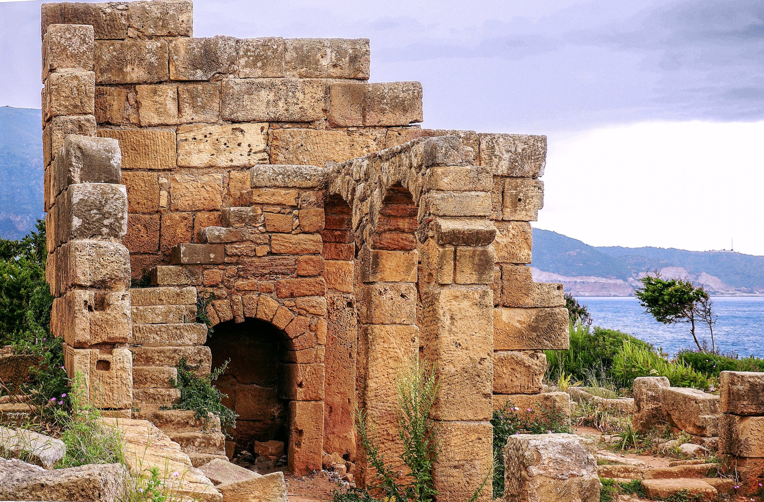
The remains of a Roman temple at Tipaza. Rachid Benabdellah. CC BY-SA 2.0.

The northern Algerian village of Tipaza is known for its scattering of Roman, Byzantine, Phoenician and early Christian ruins. Given its coastal location, it was prone to conquest by various sea-faring groups as early as the 6th century BCE. Nestled among golden beaches and pine tree forests, there are still remnants of a Punic necropolis, a Roman amphitheater once used for gladiator fights, various religious complexes and even thermal baths. The most notable monument is a royal mausoleum where the sole daughter of Cleopatra and Mark Antony is buried with her husband. The ancient town center was also surrounded by a defensive wall constructed by the Romans, most of which was deconstructed so that its materials could be reused for building Algiers.

UNESCO has already identified the ruins at Tipaza as being at heightened risk from flooding and erosion. The probability it estimated is also supposed to triple by 2050 if water levels in the Mediterranean continue to rise at present rates.

7. Iglesia Santo Domingo – Panama City, Panama

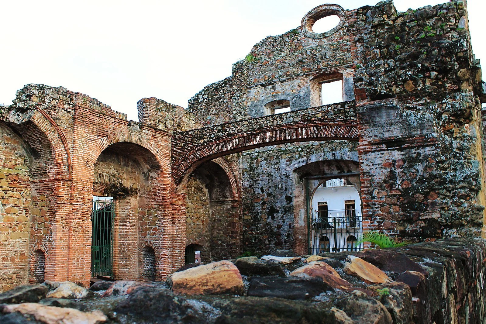
The Arco Chato in the Church of Santo Domingo. Darena. CC BY-SA 2.0.

Rising water levels in the South Pacific, in addition to the heavy rains experienced by Panama during their annual wet season, are threatening many older neighborhoods and the historical buildings within. This will only worsen as climate change continues.

The Iglesia Santo Domingo is one of the most iconic buildings in the Casco Viejo neighborhood of Panama City. The church is most well known for the flat arch—“Arco Chato”—that stretched across its interior courtyard with no support from its construction from 1678-2003 when it finally fell but was soon rebuilt. Because the arch was able to withstand two centuries worth of earthquakes, Governor Antonio Fernández de Córdoba selected Panama over Nicaragua to be the site of the interoceanic canal—the famous Panama Canal. Ravaged by fire in 1756, the church has stood as an empty brick shell ever since. It now houses the Museum of Religious Colonial Art, which exhibits various Panamanian artifacts from the 16th century onwards.


Tanaya Vohra

Tanaya is an undergraduate student pursuing a major in Public Health at the University of Chicago. She's lived in Asia, Europe and North America and wants to share her love of travel and exploring new cultures through her writing.

Rising Travel Fees in Bhutan

After two years of being closed off to visitors due to COVID-19, Bhutan is re-opening to tourism, but with an increased tourism fee.

Children and pigeons in Thimphu. Xiaojun Deng. CC BY 2.0

Bhutan is a beautiful Buddhist country located in Southeast Asia. It is located along the eastern edge of the Himalayas, and there is plenty of mountain and valley scenery, as well as Buddhist monasteries. There are a multitude of reasons to visit Bhutan, but there is one interesting reason that might stop some people from going: the “High Value, Low Impact” tourism fee. 

In the past, the government of Bhutan has charged the equivalent of $65 USD per night per traveler. This has been a system implemented for three decades, but after COVID-19 and the decrease in tourism everywhere, the Tourism Council of Bhutan will raise the fee to $200 during the low travel season when the country reopens on September 23, 2022. During high season, the fee will be $250 per day for every person. India, Bangladesh and Maldives have been exempt from the tourism fee thus far, but when the country reopens, the government has decided to charge visitors from these three nations $17, with a few exceptions for certain age groups. Bhutan has been closed to outsiders for the past few years due to strict COVID-19 guidelines. The money gained from the travel fee increase will be used to decrease the carbon footprint created by tourists visiting the country, as well as to help the Bhutanese who work in the tourism industry. Even with the fee, tourism in Bhutan does make up 6% of the country’s GDP. 

Keeping Bhutan’s rivers clean. United Nations Photo. CC BY-NC-ND 2.0

There is a misconception that the $200 is an extra expense in addition to the usual travel costs, but that is incorrect. These fees are actually all inclusive, meaning it covers the cost of typical travel expenses, such as food, accommodations (though choosing to stay at luxurious hotel will cost extra), tour guides, transportations and tourist site entrance fees. Souvenirs, tour guide tips and drinks are the most common travel expenses that are excluded from the tourism tax. Those people have to pay for themselves.

A large question about the existence of the travel fee is where the money goes. Part of it, of course, goes to the government (around 30%), but the rest does go to the tour guides, hotels, drivers and other staff mem bers in the tourism industry. The government also does work to improve education, infrastructure and healthcare systems for its citizens, so the money tourists pay does go to improving the country. Furthermore, whether flying or driving into Bhutan, carbon emissions are being produced, and the tour buses and other modes of transportation add to it. Offsetting people’s carbon footprint from all that is an area the government is devoted to. The promotion of carbon-neutral traveling and making the tourism industry more sustainable overall are what Bhutan is committed to achieveing  in order to improve the country.

Bhutan is not the only country with a tourism fee. There are other countries that have implemented it as a way to combat over tourism and protect the tourist industry in each country, such as Italy, Japan, Germany and Spain. There are many more countries that do this, and the tax ranges from less than $1 to over $50, depending on the country. The money goes back to it, from the workers to the upkeep of tourist attractions. Many countries have implemented it, and the fee is worked in as a tax for things like airline tickets or hotels. Bhutan does the highest tax, but with the money, the country has worked hard to preserve its culture and natural beauty.


Katherine Lim

Katherine Lim is an undergraduate student at Vassar College studying English literature and Italian. She loves both reading and writing, and she hopes to pursue both in the future. With a passion for travel and nature, she wants to experience more of the world and everything it has to offer.

5 Stunning Temples in Cambodia

From Hindu to Buddhist, Cambodia is home to some of the most architecturally rustic and traditional temples in the world. 

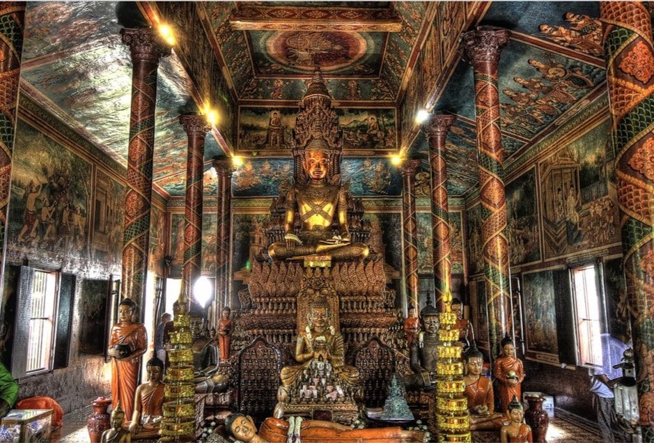
Inside of Wat Phnom. Daniel Mennerich. CC BY-NC-ND 2.0. 

While Angkor Wat is on most traveler’s lists when they visit Cambodia, the country also has many other extraordinary and one-of-a-kind temples which each hold immense historical, cultural, religious and artistic significance. 

1. Banteay Srei 

Banteay Srei. Uwe Schwarzbach. CC BY-NC-SA 2.0.

The temple Banteay Srei, located in Angkor, Cambodia, is believed to have been built in the tenth century by and for some sort of spiritual guru to a royal, though not much is known about the person themselves. In addition to its fascinating origin, Banteay Srei’s architecture is unique for the area, built almost entirely out of a shining pink sandstone and surrounded by a moat. In terms of the architeccture’s cultural significance, the temple features a large and ornate statue of the Hindu God Shiva. Nowadays, Banteay Srei is primarily known for its meaning to women. Banteay Srei directly translates to “the women’s temple”, and the statue of Shiva is surrounded by other statues of women including Hindu gods and saints. 

2. Ta Prohm

Tree growing in Ta Prohm. Daniel Mennerich. CC BY-NC-ND 2.0. 

The temple Ta Prohm, located in Krong Siem Reap, Cambodia, is one of few historical sites to have been left untouched by archaeologists and society in general. It was built around the 12th to 13th century, and it was a temple of enormous scale surrounded by a village of an estimated 79,000 people who worked to maintain it.  Unlike Banteay Srei, Ta Prohm was built by a Khmer king. Today, only the ruins of Ta Prohm remain, and its beauty and intrigue have only increased with growing trees surrounding the temple. Visitors can see a tree whose roots have grown over the roof of a corridor, and another stands tall in the middle of a courtyard. While visitors can walk through Ta Prohm, they are no longer permitted to climb on the stone walls, as the temple’s foundation is so old and precarious that damage can easily be done. 

3. Wat Phnom

Staircase to Wat Phnom. Daniel Mennerich. CC BY-NC-SA 2.0. 

In contrast to Ta Prohm, which has maintained a rustic look, temple Wat Phnom is located in the major city Phnom Penh, at the top of the only hill in the city. Unlike many other ancient temples, historians know Wat Phnom was built in 1372. A large and ornate staircase lined with animal sculptures such as lions and five-headed snakes leads the way to the temple. The temple is a place of worship, as people go to make wishes, requests and prayers for themselves and their loved ones. Wat Phnom is known to be a bustling and busy center, with vendors selling cold drinks and birds flying through the temple

4. Sambor Prei Kuk

Sambor Prei Kuk temple. Plb06. CC BY-NC-ND 2.0.

The Sambor Prei Kuk temples are unique from the other temples on this list primarily because of their age and striking architecture. Sambor Prei Kuk is a collection of temples built in the 6th to 7th century CE, in the Pre-Angkorean architectural style which favored more natural looking octagonal temple structures that were less outwardly ornate than later temples. Sambor Prei Kuk was named an UNESCO World Heritage Site in 2017 due largely to its architecture, which represents a significant period in the history of Cambodia. The religious symbols inside the temple also reflect the significance of the relatively new cross-continental trade that was emerging at the time in Asia. The inscriptions and statues feature a mix of Buddhist and Hindu figures and messages, as well as displaying the “God-kings” who ruled the region at the time by claiming divine connections

5. Angkor Wat

Angkor Wat. Pigalle. CC BY-NC-SA 2.0.

A Cambodian temples list wouldn’t be complete without Angkor Wat. The temple, located in Angkor, was built in the 12th century and is one of the most famous temples in the world, as well as one of Cambodia’s most famous sites. The compound contains hundreds of buildings, and is the largest religious structure globally. Originally, Angkor Wat was a Hindu temple, but in 1177 after losing a battle and thus losing faith in Hinduism, the king at the time (King Jayavarman VII) converted Angkor Wat into a Buddhist temple. In 1992, Angkor Wat became a UNESCO World Heritage Site, and an estimated 500,000 people per year travel to see the historic temple


Calliana Leff

Calliana is currently an undergraduate student at Boston University majoring in English and minoring in psychology. She is passionate about sustainability and traveling in an ethical and respectful way. She hopes to continue her writing career and see more of the world after she graduates. 

Avoiding the Crowds: 10 Alternatives to the Most Popular National Parks in the United States

There are many sites around the country to visit instead of the most popular national parks, helping to relieve their ecosystems.

Yosemite Valley, one of the highlights of America’s National Park Service. Jeff Krause Photography. CC BY-NC-ND 2.0.

U.S. national parks are more popular than ever. This may sound like a cliché, but it is actually a growing problem. In 2021, America’s national parks received almost 300 million visitors, up 25% from 2020. This increase in visitors is causing strain on the natural environment of those places. In addition, the overcrowding of some national park sites make for an unpleasant experience for visitors. However, many of the visitors to the U.S. National Park Service sites concentrate themselves in a few popular parks. It is possible to have similar experiences  at other sites with less crowds. Here are alternative sites to visit for the 10 most popular national parks in the United States. 

1. Instead of Great Smoky Mountains National Park, go to Grayson Highlands State Park in Virginia.

Great Smoky Mountains National Park. jody.claborn. Public Domain Mark 1.0.

Grayson Highlands State Park. vastateparkstaff. CC BY 2.0.

The Great Smoky Mountain National Park, which straddles the Tennessee-North Carolina border, is the one of the nation’s most popular national parks, receiving an all-time high of 14.1 million visitors in 2021. The park preserves towering mountains and hosts unique ecosystems. Similar landscapes can be found all over the Southern Appalachians, with the Grayson Highlands State Park in Virginia a similar alternative. Grayson Highlands State Park is the home of the state’s highest peak, Mount Rogers, as well as the home of wild ponies. The treeless mountaintops there also make for sweeping views.

2. Instead of Zion National Park, go to Red Rock Canyon National Conservation Area in Nevada.

Zion National Park. Joe Parks. CC BY-NC 2.0.

Red Rock Canyon National Conservation Area. andrew c mace. CC BY-NC-SA 2.0.

Zion National Park in Utah features deep, narrow canyons with colorful layers of rock. Famous hikes in the park include the Narrows, a trek through a narrow slot canyon, and Angel’s Landing, a hike up an exposed promontory leading to wide views of Zion Canyon. Visitors at the second most popular national park are concentrated at two small areas, Zion Canyon and the Kolob Canyons area, due to the rugged landscape. Similar canyon areas with colorful rock layers can be found in Red Rock Canyon National Conservation Area, just outside of Las Vegas. Visitors can explore the canyons and sandstone formations there. For the more adventurous, there are trails that take hikers to the peaks of nearby mountains.

3. Instead of Yellowstone National Park, go to Lassen Volcanic National Park in California.

Yellowstone National Park. James St. John. CC BY 2.0.

Lassen Volcanic National Park. Joe Parks. CC BY-NC 2.0.

Yellowstone, the world’s first national park, is full of unique geothermal features like hot springs and geysers and a variety of rare wildlife. However, it is not the only place in the United States where thermal features are found. In Northern California, Lassen Volcanic National Park also has geothermal features. The most pronounced of those are located in Bumpass Hell, a 3-mile hike from the main park road. As Lassen Peak most recently erupted in 1917, the remnants of that eruption can be seen in the Devastated Area. Volcanic activity has shaped the park, morphing it into an area teeming with geothermal activity.

4. Instead of Grand Canyon National Park, go to Palo Duro Canyon State Park in Texas.

Grand Canyon National Park. Grand Canyon NPS. CC BY 2.0.


Palo Duro Canyon State Park. Thomas Shahan 3. CC BY 2.0.

The Grand Canyon of Arizona is the largest canyon in the United States, where the Colorado River carves out the Kaibab Plateau. Each rim, the North and South, offers a different experience to visitors, with the North Rim being more remote and secluded. The second largest canyon in the United States is the Palo Duro Canyon in Texas, which is a less crowded alternative to the Grand Canyon. The Palo Duro Canyon is formed by the Red River eroding the land, forming colorful strips of rock. Visitors can take part in a glamping (luxury camping) experience at the state park, as well as horseback riding into the canyon.

5. Instead of Rocky Mountain National Park, go to San Juan National Forest in Colorado.

Rocky Mountain National Park. Dusty J. CC BY 2.0.

San Juan National Forest. stefanserena. CC0 1.0.

Rocky Mountain National Park in Colorado is regarded by some as the quintessential Rocky Mountain landscape. However, it only has one mountain higher than 14,000 feet: Longs Peak. The highest concentration of 14,000 feet peaks can be found in the southwest corner of the state in San Juan National Forest. In that wide span of mountains, hikers can seek solitude in the 2,399 miles of trails. There is also a scenic train ride between Durango and Silverton that allows riders to view the heart of the San Juan Mountains without much physical exertion.

6. Instead of Acadia National Park, go to White Mountain National Forest in New Hampshire.

Acadia National Park. moonjazz. CC BY-NC 2.0.


White Mountain National Forest. johncudw2399. CC BY-NC 2.0.

The convergence of mountains and the coast, along with its proximity to several northeastern cities, make Acadia National Park a popular place to visit. The crashing waves along the rocky shore makes for some chaotic scenes, and Cadillac Mountain is the first mountain in the United States to see the sunrise. But, the tallest mountains in the Northeast are located in White Mountain National Forest in New Hampshire. Mount Washington, the tallest mountain in the state, has famously unpredictable weather, being the site of the highest wind speed ever recorded. A cog railway takes visitors up the mountain.

7. Instead of Grand Teton National Park, go to the Wind River Range in Wyoming.

Grand Teton National Park. fortherock. CC BY-SA 2.0.

Wind River Range. LoneWolfMontana. CC BY-NC-ND 2.0.

Grand Teton National Park, located just south of Yellowstone, hosts a number of iconic views, from the rugged peak of Grand Teton itself to the T.A. Moulton Barn. Its lakes are a popular place for boating. While visitors crowd the viewpoints at Grand Teton, the nearby Wind River Range, which is shared by the Shoshone National Forest and the Bridger-Teton National Forest, offers much more solitude. Like Grand Teton, there are no roads in the interior of the Wind River Range, and adventurous travelers go on multi-day treks into the center of the mountain range. Gannett Peak, the tallest mountain in Wyoming, is located in the Wind River Range.

8. Instead of Yosemite National Park, go to the Alabama Hills in California.

Yosemite National Park. Eric Leslie. CC BY-NC-SA 2.0.

Alabama Hills. RS2Photography. CC BY-NC-ND 2.0.

Yosemite National Park offers majestic landscapes shaped by the remnants of glaciers in the Sierra Nevada mountains. Outside of Yosemite Valley, snowy peaks and bare mountains characteristic of the Sierra Nevadas abound. For a more quiet experience of the Sierras, visitors should consider the “other side” of the mountains, more specifically, the Alabama Hills. Located around the town of Lone Pine, those hills just below the highest peaks of the Sierras include unique geological formations. Hikers can also climb Mount Whitney, the tallest mountain in the contiguous United States. Mono Lake, by the town of Lee Vining, also offers a look at an endorheic salt lake.

9. Instead of Indiana Dunes National Park, go to Pictured Rocks National Lakeshore in Michigan.

Indiana Dunes National Park. toddwendy. CC BY 2.0.

Pictured Rocks National Lakeshore. kirsten.elise. CC BY-NC-SA 2.0. 

As one of the newest national parks, only gaining the status in 2019, Indiana Dunes National Park preserves a unique ecosystem in Northwest Indiana just an hour outside of Chicago and South Bend. The beaches along Lake Michigan are popular in the summer and the South Shore Line railroad provides added accessibility by having a few stations in the vicinity. However, Indiana Dunes can get overcrowded in the summer, and Pictured Rocks National Lakeshore on the Upper Peninsula of Michigan provides a more rustic experience. At Pictured Rocks, there are sand dunes like in Indiana Dunes, but also cliffs and waterfalls. While a multi-day hike along the North Country Trail will take intrepid travelers to all of the major sites, most of them are also accessible by car.

10. Instead of Glacier National Park, go to North Cascades National Park in Washington.

Glacier National Park. U.S. Geological Society. CC0 1.0.

North Cascades National Park. i8seattle. CC BY-NC 2.0.

In a place known for its namesake feature, Glacier National Park has relatively few of them. There are only 25 glaciers in the park and the last of them may be gone by 2030 due to climate change. However, there are 300 glaciers in North Cascades National Park, only a bit more than 2 hours away from Seattle. The main road through North Cascades goes through a deep valley with turquoise blue lakes, colored by the minerals carried by the glaciers. The end of the 23-mile unpaved Cascade River Road leads to a trail to Cascade Pass, which rewards visitors with scenic views of Forbidden Peak and Boston Mountain.


Bryan Fok

Bryan is currently a History and Global Affairs major at the University of Notre Dame. He aims to apply the notion of Integral Human Development as a framework for analyzing global issues. He enjoys hiking and visiting national parks.

Source: Avoiding the Crowds: 10 Alternatives to ...

The Camino de Santiago: Hiking a Medieval Pilgrimage

This pilgrimage has seen a modern revival and is now a popular hiking route for those seeking a spiritual or physical retreat.

A hiker on the Camino de Santiago trek through rolling hills. FreeCat. CC BY 2.0.

The apostle St. James had done considerable missionary work in Iberia when he was martyred in Rome in A.D. 44. After his death, his remains were transported to Galicia in modern-day northwest Spain, where they were discovered in the 9th century at the city of Santiago de Compostela. That discovery caused the site to become a pilgrimage destination, as many wanted to visit the relics of St. James for spiritual growth. A romanesque cathedral was built in the city, the destination of the pilgrimage that would be called the Camino de Santiago (Way of St. James in English, or just the Camino) in 1078, which further cemented the status of the pilgrimage as one of the most important in the Christian world.

The late Medieval period, roughly the 12th and 13th centuries, was the heyday for the pilgrimage. However, as the political situation in Europe got unstable, especially with the onset of the Protestant Reformation and religious wars, the Camino fell into decline. 

Starting in the late 20th century, the Camino experienced a resurgence, thanks to people like Father Don Elías who marked the path after centuries of disuse and promoting it to a wider audience. Today, it is a network of hiking paths across Portugal and Spain that converge at Santiago de Compostela. In 2019, almost 350,000 pilgrims arrived at Santiago de Compostela. 

The cathedral at Santiago de Compostela serves as the culmination of the trek. CC BY-SA 4.0.

The experience of hiking the Camino is different from most other long-distance hikes such as the Appalachian Trail or the Pacific Crest Trail. While there are sweeping wilderness views, they are not the focus of the Camino. Instead, the focus is cultural. Hikers experience all the history the region has to offer, like the intricate Gothic churches and Medieval ruins. People take the trek for a variety of reasons, including for a spiritual awakening, physical challenge, or cultural experience.

Similarly, unlike a traditional hiking trail, the Camino is actually a network of paths that converge at Santiago de Compostela. Hikers can start anywhere they like and make their way to Santiago. There are, however, several defined routes that modern hikers usually follow, with the most popular being the French Way, which starts in the town of St.-Jean-Pied-de-Port in France and winds nearly 500 miles along northern Spain to Santiago de Compostela. Other routes criss-cross Iberia; some start in Portugal, others start in southern Spain, and still others go across northern Spain.

There are other differences from traditional long-distance hikes as well. Instead of camping out in the open every night, pilgrims on the Camino stay in ‘albergues,’ which are hostels specifically for pilgrims. There, pilgrims stay in bunks with other pilgrims and get to know them. Camping is discouraged and widely prohibited outside of designated campsites in Spain. There are pricier options, such as hotels, for travelers who prefer a more luxurious experience.

Lastly, in order to gain all of the benefits of being a pilgrim, such as the completion certificate and access to some albergues, it is necessary to show a pilgrim’s passport. The passport can be stamped at various locations along the way to Santiago de Compostela, which is proof that one has walked or biked the required distance. At Santiago, pilgrims who have walked at least 100 kilometers or biked 200 kilometers can show their passport for a certificate of completion at the pilgrim’s office. 

While the Camino used to facilitate cultural exchange across Europe, today, it connects travelers from all over the world who wish to take part in this historic pilgrimage.


Byran Fok

Bryan is currently a History and Global Affairs major at the University of Notre Dame. He aims to apply the notion of Integral Human Development as a framework for analyzing global issues. He enjoys hiking and visiting national parks.

Belize: The World’s “Cradle of Chocolate”

Belize is home to some of the highest quality cacao farms in the world: meet some of the farmers and activists ensuring fair trade practices.

Cacao tree in Belize. Renee Johnson. CC BY-SA 2.0. 

Many scholars believe Belize is  the first place where cacao was cultivated. Cacao was very important to the Mayans who lived in Belize in ancient times, and artifacts have even been found in modern-day Belize to prove cacao’s historical significance. A “chocolate pot” used by the Mayans believed to be 2600 years old was found in Belize—a chocolate pot being a pot to serve a chocolate drink. Traces of cacao were found on the pot, and this drink is still common among some cacao farmers in Belize today.

In the 1980s, Hershey had a deal with the Belizean government to partner with cacao farmers to produce organic chocolate using the most up to date methods. Unfortunately, when the global price of chocolate dropped, Hershey abandoned the deal, as they were able to produce chocolate at a lower price elsewhere in the world. Belize’s chocolate production and exports essentially stopped for about ten years, leaving many farmers in dire financial situations. 

Green & Blacks, an organic chocolate company founded in 1991, eventually partnered with the Toledo Cacao Growers Association to source organic, high quality and most importantly, ethically sourced cacao from the Toledo district in Belize. Since this partnership, the cacao industry in Belize has slowly been strengthened. Below are two examples of family-owned farms in Belize, as well as ways to support Belizean and Mayan chocolate companies. 

Justino Peck is a cacao farmer from San Jose, Belize, and a chairman of the Toledo Cacao Growers Association. His farm is in partnership with Green & Blacks, and they produce a chocolate bar called Maya Gold which is marketed in Europe. Maya Gold chocolate was the first chocolate in the UK to be verified as Fair Trade in 1994. After being devastated by the decrease in price of cacao, Peck’s family was able to renovate their home and send one of their children to college after this deal. Peck also became a leader in his community: he lobbied the Belizean government on issues such as land rights and fair pay and working conditions for cacao farmers. Peck’s farm reflects the importance of being a mindful consumer: knowing where your goods come from can have a real, tangible impact on peoples’ lives. 

Cacao from Belize during the drying process. Renee Johnson. CC BY-SA 2.0.

Abelina Cho is the owner of a small chocolate company in San Felipe called Ixcacao. Cho is known as “Chocolate Queen”, and her farm is currently the only family-owned, Mayan chocolate producer today in Belize. Abelina Cho and her husband, Juan, are passionate about cacao’s cultural importance to Mayan people, and they produce dark chocolate the traditional Mayan way, without a recipe. Cho is shifting the credit for fine, high-quality chocolate back to the indigenous farmers who created these practices. Post colonization, high-quality chocolate was known as a European export, when really, it is Mayan farmers who created the practices used to cultivate cacao. Crediting the original creators of the chocolate we all enjoy, and paying them for their labor, is of the utmost importance.

TO GET INVOLVED

The best way to support small, Belizean-owned cacao producers is to be mindful of where you buy your chocolate from. Try to steer away from large corporations like Hershey, which are known to abuse and underpay their workers. Maya Gold chocolate—produced by both Justino Peck’s and Abelina Cho’s farms—is available throughout Europe and on many websites that ship to the U.S. and worldwide. Cho’s chocolate and other products are also available directly from the Ixcacao Mayan Belizean Chocolate website. If you ever find yourself traveling to Belize near the San Felipe area, Ixcacao farm also offers tours and chocolate making classes, where not only can you witness firsthand the historically rich and complex method of Mayan cacao production, but Abelina also cooks travelers a home cooked meal. Essentially, being a thoughtful consumer is the best way to get involved on this issue.  


Calliana Leff

Calliana is currently an undergraduate student at Boston University majoring in English and minoring in psychology. She is passionate about sustainability and traveling in an ethical and respectful way. She hopes to continue her writing career and see more of the world after she graduates. 

The Colonial Legacy of the Portuguese in Macau

Though Macau has been an autonomous region of China since 1998, its 400 years of Portuguese rule has given Macau a distinctive flair found nowhere else in Asia.

The pastel-colored buildings of Senado Square give off a European flair. Teen Wolf. CC BY-NC 2.0.

Macau, a Special Administrative Region (SAR) of China, located on the Pearl River Delta south of Guangdong province, was a Portuguese colony from 1557 to 1999. In its early years, the city quickly became a bustling commercial center, since it was at the crossroads of several notable trade routes. It was the gateway to China for the Portuguese. By the time Macau became a SAR of China  in 1999, ending the period of European colonization of Asia, the Portuguese had left their mark on the city. 

When the Portuguese first established Macau as a colony, settlement was limited to a small island that became the Macau Peninsula. As the original colony expanded, it incorporated the islands of Taipa and Coloane. Today, the land between Taipa and Coloane has been reclaimed, and the resulting strip of land, the Cotai Strip, is home to many casinos. Those casinos are one of the major economic drivers of Macau, generating even more revenue than Las Vegas, and they attract many tourists from around Asia. Macau is quickly becoming a cosmopolitan center, but the historic core of the region, on the Macau peninsula, is full of buildings constructed in the Portuguese style. Other influences remain of Portuguese rule, such as its cuisine, languages and legal system.

Architecture

The ruins of St. Paul’s Church. Christian Junker | Photography. CC BY-NC-ND 2.0. 

It is easy to spot the Portuguese influence on the buildings in Macau, because many of them have Ionic columns and baroque appearances. The Portuguese mainly left their mark on religious and administrative buildings in the city, such as the Ruins of St. Paul’s Church and the buildings of Senado Square. 

St. Paul’s Church was built between 1604 and 1640 by the Jesuits, and the church became their base of operations in Asia. It was the largest church in Asia at the time and was called the “Vatican of the Far East”. The baroque front of the church combines Eastern elements, as Japanese Christians who were fleeing persecution in their home country were involved with its construction. However, most of the church was made of wood, and much of it burned down during a typhoon in 1836. All that remains is its ornate façade, which has become a popular site in Macau.

The Holy House of Mercy is intricately linked with the early history of Macau. wiredtourist.com. CC BY 2.0.

The historic colonial administrative buildings are also preserved in Senado Square, which is full of pastel-colored, neo-classical buildings. It served as the main town square in centuries past and it contains a fountain. The square is flanked by the Leal Senado Building and the Holy House of Mercy. The Leal Senado Building, built in 1784 in a neoclassical style, was Macau’s first municipal chamber. Today, the building continues to host the city’s municipal council meets. There is also a Portuguese-styled courtyard behind the building.

Across Senado Square from the Leal Senado Building lies the Macau Holy House of Mercy. Built in 1569 shortly after the establishment of the colony, the Holy House of Mercy served as a medical institution originally and now serves a charitable institution. The Holy House of Mercy is also a present-day museum that holds a collection of Macau’s Catholic relics, telling the story of how Western culture entered Asia through the city.

Cuisine

Macau egg tart. foodnut.com. CC BY-NC-ND 2.0.

Portuguese influences also affect the food of Macau, which is “one of the best places in the world to sample Portuguese cuisine.” It is easy to find signature Portuguese dishes such as bacalhau, which is dried and salted cod, in local restaurants. 

Macau is also the home of the world’s first fusion cuisine, combining Chinese and Portuguese influences into local staples. Portuguese settlers in Macau added new spices and herbs to traditional Chinese foods and introduced new cooking methods like roasting, grilling and stewing to create a unique Macanese cuisine. Today, well-known Macanese dishes include minchi (considered Macau’s national dish and made from minced beef, soya sauce, onions and fried egg), tacho (a stew containing both Chinese and Western ingredients) and cappela (a meatloaf with cheese, black olives and breadcrumbs). Another popular dish, the Macau egg tart, has its origins in Portuguese pastries, but they are slightly different from similar dishes found in Portugal and neighboring Hong Kong.

Language

Street signs in Macau are still written in both Chinese and Portuguese. shankar s. CC BY 2.0.

The Portuguese language retained its official status in Macau after the handover, but only around 6,200 people speak it (based on the data from 2014). While its popularity dwindled in the years immediately following the handover, the Portuguese language has seen a resurgence in Macau due to the increase in Lusophone countries doing business with China, which is leading to a growing number of people learning it. 

Macau is also the home of the very unique creole language of Macanese Patois, also known as patuá to its native speakers, which is a combination of Cantonese and Portuguese with a few influences from Malay and Indian languages. There is no standard orthography in the language. The number of speakers is decreasing rapidly, and it is only spoken by around 50 people of Macanese ancestry. The Macanese people are a distinct group of people who are of mixed Portuguese and Chinese ancestry. However, there is a growing effort to preserve the language, with a drama group called Doci Papiaçam di Macau leading the revival by performing original plays in patuá.

Legal System

Macau government headquarters, which was also built in a Portuguese architectural style. Friscocali. CC BY-NC 2.0.

When Macau was returned to China in 1999, the Chinese government promised that Macau would be governed under the concept of “one country, two systems”. As part of that arrangement, Macau would be able to keep its existing political and economic systems for at least 50 years after becoming an SAR of China. Because of this, the legal code of Macau, though it is under Chinese sovereignty, is still based on the Portuguese legal code. However, recently, the Chinese government has undermined the agreements to keep the Portuguese legal code in place by removing Portuguese judges from presiding over sensitive cases. As China exerts more influences over Macau, which may have diminished some Portuguese influences, and the city could be in a much different place by 2049, when the agreement made in 1999 ends.


Bryan Fok

Bryan is currently a History and Global Affairs major at the University of Notre Dame. He aims to apply the notion of Integral Human Development as a framework for analyzing global issues. He enjoys hiking and visiting national parks.

Alaska: The Land of the Midnight Sun

In the summertime, Alaska experiences 24-hour long daylight for months at a time.

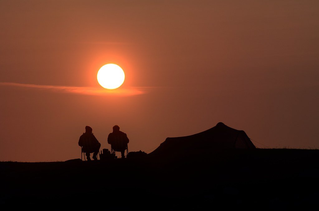
Two people watching the Midnight Sun. Aha24. CC BY-NC 2.0.

“The Land of the Midnight Sun” is the nickname given to the state of Alaska. In certain areas of the state, the sun does not fully set for months – typically between April and August – granting Alaskans and travelers roughly 24 hours of daylight. Additionally, this extra daylight allows for a unique phenomena that has given Alaska its greatest nickname; with daylight occurring even in the late hours of the evening, the sun can be seen even when the clock strikes midnight, donning Alaska the Land of the Midnight Sun. Alaskans and travelers alike visit locations in Alaska specifically for the pleasure to witness and experience this event.

The phenomena of the Midnight Sun occurs due to the relationship between the Earth’s axial tilt and how the planet rotates the sun. The rotation of the Earth around the sun is what allows our planet to experience seasons that cycle every year with the globe's movement. The northern hemisphere of the Earth experiences summer time in the months between April and August due to the fact that the North Pole points in the direction of the sun during these months. Alaska, being extremely close to the North Pole, experiences summer during these months as well.

In understanding how the rotation of the Earth allows for the seasons to change, we can then use the Earth’s axial tilt to explain why the Midnight Sun phenomena occurs in the summer. Already facing the sun due to the rotation of the Earth, the tilt of the globe – which is 23.5 degrees – places the North Pole directly into the sunlight coming from the star. This means that the North Pole - and surrounding areas like Alaska – face the sun continuously for around 4 months straight, causing the sun to rarely dip below the horizon. In this way, the Midnight Sun is a result of the combination between the Earth’s rotation and its axial tilt.

This long occurrence of sunlight also serves to explain and off put the two months of darkness Alaska experiences as well. When the North pole is not tilted towards the sun, and the earth has rotated around the sun into winter months, the North Pole – and subsequently Alaska – experiences what is called a Polar Night, where the sun doesn’t rise for nearly 60 days. That means Alaskans, especially those in more northern parts of the state, experience blackness during the winter months of November through January.

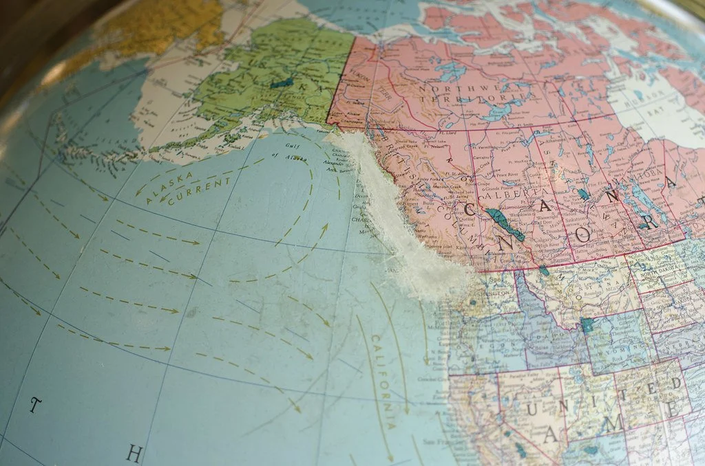
Alaska in green near the North Pole. Theron Trowbridge. CC BY-NC 2.0.

The further in Alaska you travel north during the summer, the longer the days become and the higher chances you will have of seeing the Midnight Sun. In Barrow, Alaska, the northernmost place in Alaska, the sun through the summer months does not set. That means that Barrow experiences 84 days of constant daylight straight, without a single sunset. In Fairbanks, which is at the lower center of the state and a few hundred miles south than Barrow, the sun can be seen for 21 hours a day. In Anchorage it is 19 hours and in Seward it is 18 hours.

For Alaskan’s that have been living in darkness during long winters, the Midnight Sun and long days of sunshine are a welcome occurrence. The thrill of enjoying the daylight for extended periods of time brings Alaskans out of a pseudo-hibernation. Climatologist Dr. Brian Brettschneider told the Weather Channel, “Not once have I heard an Alaskan say they don’t like long days. It isn’t uncommon to hear a lawnmower running or kids outside at 11 p.m.”

Midnight Sun behind clouds. PoetheusFotos. CC BY-NC-SA 2.0.

Brettschneider also mentioned that many who live in Alaska and work during the day use the extra hours of daylight to further enjoy their downtime. Outdoor activities like hiking are made possible after work because of the additional daylight during late hours.

For travelers visiting Alaska, the summer months are the most popular for the same reason. Able to really make the most of their time there, travelers can explore more areas of the beautiful wildlife found in the state, while witnessing once in a lifetime natural occurrences like the Midnight Sun.


Ava Mamary

Ava is an undergraduate student at the University of Illinois, double majoring in English and Communications. At school, she Web Writes about music for a student-run radio station. She is also an avid backpacker, which is where her passion for travel and the outdoors comes from. She is very passionate about social justice issues, specifically those involving women’s rights, and is excited to write content about social action across the globe. 

Unexpected Paradise: 6 Macaronesian Islands That You May Not Have Heard Of

Off the coast of Europe and Africa, the Macronesian islands offer unspoiled landscapes, quaint towns, and stunning coastlines.

The island of La Gomera is located in the Canary Islands, one of the island chains that make up Macaronesia. Jörg Bergmann. CC BY-NC-ND 2.0.

Macaronesia is a group of archipelagos in the North Atlantic Ocean. off the coast of Europe and Africa. It consists of the islands of the Azores and Madeira, (part of Portugal) the Canary Islands (part of Spain) and Cabo Verde  (an independent group of islands formerly controlled by Portugal). Some of these islands are only a short flight away from many major cities in Western Europe and becoming more popular, leading to more development on some of them, but unspoiled wilderness remains prevalent. 

1. São Miguel, Azores

The Lagoa das Sete Cidades features colorful lakes in the remnants of volcano calderas on São Miguel. energeticspell. CC BY-NC 2.0.

The largest island in the Azores, São Miguel features numerous beautiful natural sights for hikers and/or tourists. Due to minerals in the water, the lakes on the island come in various tints of green and blue. At a more temperate climate than many of the other Macaronesian islands, São Miguel receives more rain, resulting in many waterfalls on the island. Some companies lead rappelling excursions at the waterfalls. The seas around São Miguel are also prime for whale watching.

2. Flores, Azores

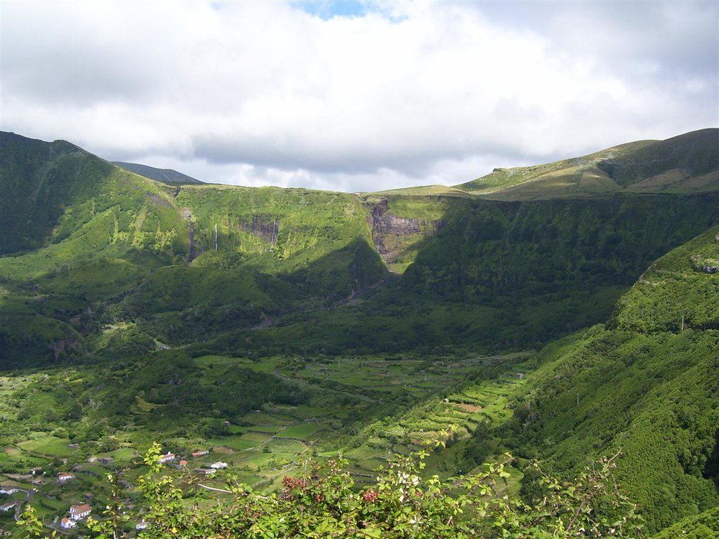
Lush, green cliffs characterize the island of Flores in the Azores archipelago. Paulo Corceiro. CC BY-ND 2.0.

One of the more remote islands in the Azores archipelago, Flores literally translates to “flowers” in English. Its stunning lush mountains are well-suited for hiking and canyoneering, with trails leading to some unique geological formations. Some places on the island to visit include the village of Fajã Grande, which is tucked in between cliffs and the Atlantic Ocean, and the 7 lagoons, the remnants of ancient volcanoes. 

3. Madeira

The cliffs of Madeira. Kacper Gunia. CC BY-NC 2.0.

After a thrilling landing at one of the most challenging airports for pilots in the world, visitors step into a green oasis with dramatic mountains and steep drop-offs. In the past, Madeira was a maritime center with Christopher Columbus and James Cook making stops there on their voyages. Later, rich landowners built ornate summer estates on the island, such as the Monte Palace Madeira, which is a present-day vast botanical garden. Hiking trails criss-cross the island, with many built on the remnants of levandas, irrigation canals used to feed water to drier areas of the island. A strenuous hike to Pico Ruivo, the highest point on the island, rewards intrepid hikers with vast views.

4. La Palma, Canary Islands

The volcanic landscape of the island of La Palma. weberpal. CC BY-NC-SA 2.0. 

The island of La Palma in the Canary Islands is fully operational again after the Cumbre Vieja volcano stopped erupting in December 2021. While it is still advisable to exercise caution around the eruption area, the rest of the island is free to be explored. Past volcanic eruptions have created unique rock formations underwater, making diving a popular activity off the coast of the island. Watersports such as kayaking and canoeing are also popular, especially along the sheltered coast of Fuencaliente. There is also an extensive network of hiking paths on the island, leading to a variety of unique landscapes.

5. Fuerteventura

Popular beaches and desert landscapes combine on the island of Fuerteventura. xavipat. CC BY-NC-ND 2.0.

The more southern islands of Macaronesia have a more arid climate, leading to more desert-like landscapes. Less than 100 kilometers from the coast of Africa, Fuerteventura consists of many popular beaches but also has quaint towns and rolling hills. As the first of the Canary Islands to be settled by Europeans, its first capital city of Betancuria was founded in 1404 and remains to this day and is a great place to learn about the island’s pre-Hispanic history. The island is also famous for its cuisine featuring majorero cheese and papas arugás with mojo (wrinkly potatoes with a local sauce).

6. Sal, Cabo Verde

The barren landscape of Sal is much more than what it seems. Phil Thirkell. CC BY-NC 2.0.

Another desert-like island, Sal is located in the northeast of the Cabo Verde archipelago and used to be the least populous island of the country until recent developments that have caused rapid growth. Like Fuerteventura, Sal has many beaches which are known as prime kiteboarding areas. Away from the beaches and resort areas lies what seems like a barren landscape, but tours on jeep and horseback can bring visitors to the remote interior to secluded areas. The island also has a legacy of salt mining, and it is possible to visit the Pedra de Lume area, which preserves the remnants of salt extraction operations.


Bryan Fok

Bryan is currently a History and Global Affairs major at the University of Notre Dame. He aims to apply the notion of Integral Human Development as a framework for analyzing global issues. He enjoys hiking and visiting national parks.

Indoor Skiing As Far Afield as Dubai

With massive, man made indoor ski resorts, skiing is no longer a winter-only sport. 

Ski Dubai. Neekoh.fi. CC BY 2.0

In 1927, Vienna, Austria opened up the first indoor ski slope called Schneepalast. The slope was 65.6 feet tall, and the building was eventually destroyed, but the idea has stayed around. People have improved on it by creating larger and larger indoor ski slopes for people to enjoy not just during the normal skiing season, but also in warm temperatures where and when snow doesn’t fall. Indoor ski resorts are all over the world, with at least one on every continent. Ski Dubai in Dubai, United Arab Emirates was voted the best indoor resort back in 2016 and 2017, and it used to be the biggest, though Harbin Wanda Indoor Resort in Harbin, China surpassed Ski Dubai in 2017. Wintastar Shanghai in Shanghai, China is currently on track to being the largest once it is completed in 2022. There are also indoor slopes that are meant only for practice in the summer. These are training centers for athletes, without man-made snow and more akin to treadmills.

Though an indoor resort will likely never be as large as an outdoor one, Ski Dubai is one of the largest indoor ski resorts in the world. It is the first indoor ski resort in the Middle East, featuring  a chairlift, a freestyle snowboarding area, an area for toboggans and snowball fights, an indoor zipline and five ski runs, including a black diamond run, the highest level of difficulty in skiing. Ski Dubai also has a penguin colony of Gentoo and King penguins that people can meet and interact with. Though not the only indoor ski resort with penguins, Ski Egypt has Gentoo and Chinstrap penguins, which is the most well-known. The entire area is extremely family friendly, which is why it continues to be one of the most popular attractions in Dubai.

King Penguins at Ski Dubai. Pranav Bhasin. CC BY-NC-ND 2.0

For an avid skier, indoor skiing might be a very interesting experience, but it doesn’t come close to skiing on an actual mountain. Having such a limited space can lose interest towards experienced skiers, but less experienced people tend to enjoy indoor resorts more. Another factor that could affect this is that skiing on fake snow is different than skiing on real snow. 

Fake snow is stickier than real snow, and it’s much harder and more packed. Skiing on it isn’t as smooth as on real snow. The composition of real snow is around 10% ice and 90% air, but man-made snow is closer to 30% ice and 70% air. Of course, indoor ski slopes can’t exactly use real snow, so these resorts are made entirely of this kind of snow. However, since it is still snow, it will melt in heat. Indoor ski resorts have to be cold to maintain it. Ski Dubai stays at a constant -4Celsius, or 24.8 Fahrenheit. Therefore,  despite being located in the desert, the inside of Ski Dubai is fairly cold and a stark contrast to the outside heat.


Katherine Lim

Katherine Lim is an undergraduate student at Vassar College studying English literature and Italian. She loves both reading and writing, and she hopes to pursue both in the future. With a passion for travel and nature, she wants to experience more of the world and everything it has to offer.

7 Sites of Mexico City’s Architectural Diversity, from Baroque to Brutalist

Mexico City is a flourishing metropolis with a plethora of historic and modernist architectural sites. Here are a few attractions scattered around the city.

A street at the center of Mexico City. Flickr user Franx’. CC BY-NC 2.0.

A Gothic cathedral sits next to a glassy business building. Brick houses with arabesque detailing overlook the noisy streets full of men in suits and street food vendors. Mexico City is growing every year; its multiplicity of neighborhoods hosts a variety of architectural styles and people from all over the globe. Often regarded as an oasis of modernity in the entirety of Latin America, this urban center has been labeled the “next Paris'' or as a new version of New York. Given its history of colonialism and its willful modernization under Porfirio Diaz, Mexico City’s compilation of architecture is oftentimes representative of its past and present. Here’s a cursory glance at a few of Mexico City’s sites of modernization, and the contradictions at play in these structures. 

The Central Library of the National Autonomous University on a gloomy day. Mark Hogan. CC BY-SA 2.0.

1. Central Library of the National Autonomous University

Juan O’Gorman’s Central Library of the National Autonomous University (UNAM) is a spectacle to behold. This behemoth holds the qualities of international modernist architecture: its 14-story frame sits above a glassy ground floor which looks over a neatly gridded yard. Yet, O’Gorman’s building doesn’t possess the stoicism of standard midcentury modern architecture; its distinctively Mexican-themed mural makes the building a historic storybook. Like a visual epic, the “Historical Representation of Culture” mural includes the expansive timeline of pre-conquest Mexico, the Spanish conquest, Mexican modernization and Mexico’s future. One can spot mosaics of the beginnings of Tenochtitlan, and the clash between pre-Hispanic Mexico and vehicles of Spanish colonialism. O’Gorman believed his mosaics of these cultural signifiers would make the library “different from the rest of the buildings within University City” by giving it a distinctly “Mexican character.” 

A corner of the exterior of Casa Luis Barragan. Forgemind Archimedia. CC BY 2.0.

2. Casa Luis Barragan

Casa Luis Barragan, which was built in 1948, looks as if it were suspended in time and space: colorful red walls jut into the placid blue sky, although they are immobile in detail and structure. Luis Barragan is a world-renowned architect whose eccentric architectural style can be recognized in his buildings’ solid colors, geometric shapes and sparsity of details. This vibrant house is a foil of O’Gorman’s direct homage to Mexico as a nation; it highlights formalist qualities over political values, which Barragan considered secondary to his architecture. Barragan is an expert at manipulating elements of nature. The play of shadows within the structure itself and the use of greenery turns an otherwise intimidating monument into a livable habitat. Although countless travel journals have attached Mexican modernist themes to Barragan’s home, it resists the supposed markers of “Mexican” aesthetics and remains a private site of great accomplishment.

Thousands visit the Basilica de Guadalupe daily. Alex Marduk. CC BY 2.0.

3. Basilica de Guadalupe 

Pedro Ramirez Vazquez’s seminal work, the Basilica de Guadalupe, is a sacred destination for thousands of Catholics around the world. The area it sits on, Tepeyac, was originally a place where Aztecs worshipped Tonantzin, or “the divine mother.” As a result of the suppression of Aztec religions during Spanish occupation, the Basilica de Guadalupe was built for Our Lady of Guadalupe who was said to have appeared before St. Juan Diego. The original colonial basilica was severely damaged in 1921 in a bomb attack, but Vazquez’s new Basilica de Guadalupe renovated the sacred site. This site was just one of Vazquez’s projects dedicated to industrializing Mexico, as shown in its modernist disk shape and the sheer mass of its structure.

Monumento a la Revolucion sitting at the city center. Ismael Villafranco. CC BY 2.0.

4. Monumento a la Revolucion

Located in the Cuauhtemoc borough of Mexico City, Monumento a la Revolucion is a stately memorial which celebrates the Mexican Revolution of 1910. Mirroring many of the United States’ federal buildings in Washington, the monument’s perfectly symmetrical Roman dome is fortified by brick pillars which meet at the four corners of the structure. Carlos Obregon Santacilia continued the project after it had been abandoned by both the state and the French architect they commissioned for the building, Emile Benard. Oliverio Martinez’s smooth sculptural representations of independence, reform, agrarian laws and labor laws protect the mausoleum on its four corners. In this marriage of neoclassical elements and Mexican nationalism, the Mexican government actively constructs its origin story via the conventions of Roman and French architecture.

Close-up shot of Martinez’s sculpture on Monumento a la Revolucion. Flickr user tchelseat. CC BY-NC 2.0.

A view of the facade of La Santisima Church. Wikimedia user Protoplasmakid. CC BY-SA 3.0.

5. La Santisima Church

La Santisima Church is covered in the Spanish churrigueresque style, which is the Baroque style that was dominant in Spain during the 18th century. Its facades are adorned with ornate carvings of the apostles, angels, Jesus and Mary placed in between its many columns. Although it appears relatively normal in a city full of extravagant churches, the distinctive religious iconography on its exterior deems La Santisima Church worthy of close attention.

Museo Soumaya shines brightly on sunny days. Flickr user Dan. CC BY 2.0.

6. Museo Soumaya

No piece of architecture screams “contemporary” like the Museo Soumaya. Museo Soumaya, which houses thousands of sculptures and paintings from pre-Hispanic Mesoamerica up to European impressionist works, is a piece of art itself. The Plaza Carso building in particular is an intriguing malformed shape dressed in millions of aluminum hexagons. Taking inspiration from Frank Lloyd Wright’s Guggenheim in New York, Fernando Romero designed the Plaza Carso as an enigma: the concept behind the work is intentionally vague, and the usefulness of its parabolic shape questionable. 

Front view of Museo Anahuacalli. Javier Castañón. CC BY-NC-ND 2.0.

7. Museo Anahuacalli

Although Diego Rivera is widely known for his painted murals, his exploration of three-dimensional design is just as noteworthy. Rivera’s Museo Anahuacalli was made of his own accord; Rivera wanted a space for his collection of over 50,000 relics of pre-Hispanic Mesoamerica. The style of the building is an amalgam of various Mesoamerican styles, taking inspiration from Teotihuacan and the temples of the Mayans and Aztecs. The exterior of the museum has the symmetry of neoclassical architecture, while its interior is heavily influenced by the Aztec pyramid. 

Many scholars speculate that the development of uniquely “Mexican” architecture, seen through Mexico City’s plethora of sites, stems from a desire for national representation. Mexico City’s postcolonial realities are found in its very infrastructure: one cannot ignore the presence of Catholicism, the reminders of a pre-Hispanic Mesoamerica, and the complications of deliberate industrialization. Juan O’Gorman’s library attempts to artfully marry the past, present and future. Casa Barragan is the work of a maverick who resists the narrative of a national architecture. The grandiose Basilica de Guadalupe is holy ground for millions of Catholics, yet it strays from the Gothic style of typical European cathedrals. 

The sheer amount of voices and styles in this sprawling metropolis is telling of its complicated relationship with modernization. There is no shortage of historic, formal, religious and artistic values in each of Mexico City’s buildings. 


Heather Lim

Heather recently earned her B.A. in Literatures in English from University of California, San Diego. She was editor of the Arts and Culture section of The Triton, a student-run newspaper. She plans on working in art criticism, which combines her love of visual art with her passion for journalism.  

6 Secret Spots in Greece You Should Know About

Greece’s natural beauty and history extends far beyond the well-traveled islands of Santorini and Mykonos.

The isolated Vlacherna Monastery off the coast of Corfu.. Daniel Solabarrieta. CC BY-SA 2.0.

Though Greece has 6,000 islands and islets, only 227 of them are inhabited. Many are famous for picturesque beaches and nightclubs that welcome more than 34 million tourists every year. It is no surprise that the country is a favorite for travelers looking to explore the natural beauty of the Mediterranean, to learn more about the ancient civilization that once called the islands home or just to escape the monotony of everyday life. However, there is much more to the country than its white stucco buildings and tzatziki including cliffside monasteries, man-made lakes, and hidden fishing villages just waiting to be discovered.

1. Monastery Republic of Mount Athos, Chalcidice

The holy monastery at Mount Athos. Maite Elorza. CC BY-NC-SA 2.0.

Located on the northern Greek peninsula of Chalcidice, Mount Athos is home to twenty ancient monasteries that date back to Byzantine times. Known to locals as the “Holy Mountain,” the recognized heritage site is off limits to women and children, but is home to approximately 1,400 monks. Its religious significance stems from legends that the rock face was once the location of a sanctuary of Zeus, but the mountain was also subjected to a number of attacks and attempted invasions over the years. The mountainous state officially became an autonomous region on October 3 ,1993and legally lies under the religious jurisdiction of the Patriarch of the Greek Orthodox Church from Constantinople.

2. Lake Doxa, Corinthia

Artificial Lake Doxa in western Corinthia. Ava Babili. CC BY-NC-ND 2.0.

Surrounded by fir-tree covered mountains, the man-made Lake Doxa was built about fifteen years ago to help counter the high water levels. These tides also caused the Monastery of Agios to relocate at the center of the lake, and now appears as though it is floating on the water’s surface. The lake is in the village of Archaia Feneos which is located at the base of Mount Cyllene, the supposed birthplace of the god Hermes. According to popular Greek myth, there is also a subterranean canal underneath the lake that was dug by Hercules as one of his Twelve Labors

3. Klima Fishing Village, Milos

The colorful fishing village of Klima. Ioana. CC BY-SA 2.0.

Located on the volcanic island of Milos, the tiny fishing village of Klima has an extensive history that stretches all the way back to around 3,000 BC. The island was occupied by Athenians, Macedonians and Romans over the next few centuries, each leaving their own architectural mark. Visitors can still see remnants of aqueducts, catacombs, theaters and even ancient gymnasiums. After its eventual liberation in the Greek Revolution, the population of Milos began focusing on agriculture and fishing, leveraging the unique volcanic soil and rocks to build garages and houses (known as “syrmatas”) that would protect them from bad weather. Many of the fishermen painted their doors and balconies with bright colors, giving the village its picturesque facade.

4. Voutoumi Beach, Antipaxos

The isolated Voutoumi beach on Antipaxos Island. Ari Bakker. CC BY 2.0.

As the smallest of the Ionian Islands, Antipaxos’ beaches are popular among locals from the neighboring islands of Paxi and Corfu but are relatively unknown to foreign tourists. Voutoumi beach is the largest of these and has some of the clearest waters in the Greek archipelago. It is also the preferred destination for private yachts because of its isolated location in a hidden cove on the north eastern side of the island. In fact, the pebble beach is so secluded that there aren’t any shops aside from a local tavern on a nearby hill that serves traditional Greek snacks. There are also a number of smaller coves that are easily reachable from Voutoumi by boat.

5. Melissani Cave, Kefalonia Island

An overhead view of the Melissani Cave. jordeangjelovik. CC BY 2.0.

Kefalonia is conversely the largest of the Ionian Islands and is home to an underground grotto located 20 meters (roughly 60 feet) below the surface of the Earth. The Melissani Cave is made up of two rooms, one of which is bright and sun-lit while the other is fully roofed with dark stone stalactites. The chambers are connected by a pool of water that runs about  30 meters (about 90 feet) deep. Legend has it that the cave is named after the nymph Melissanthi who perished in these waters after being rejected by the satyr god Pan. Excavations carried out in the 1950s and 1960s discovered small terracotta statues in the cave depicting the myth and commemorating her unrequited love. 

6. Ancient Greek Ruins, Delos

Ruins of the House of Cleopatra on the island of Delos. Bgag. CC BY-SA 2.0.

The island of Delos was once the religious epicenter of the Cyclades. It is now home to a large collection of archaeological ruins that commemorate Artemis and Apollo, the Olympian twins that are believed to have been born on the island. There are also beautifully preserved remnants of civilization from the archaic, classical and Hellenic periods in the form of ceramics, statues and mosaics. En route to the island’s highest point at the summit of Mount Cynthe is the ancient theater district and temples dedicated to the Egyptian deities Isis and Serapis. In fact, many foreign gods have dedicated shrines on Delos because it was a crucial trading port and hosted many sailors from overseas.


Tanaya Vohra

Tanaya is an undergraduate student pursuing a major in Public Health at the University of Chicago. She's lived in Asia, Europe and North America and wants to share her love of travel and exploring new cultures through her writing.